Los Padres National Forest covers 1.75 million acres in two disconnected blocks running along California's central coast, from the mountains above Monterey south through the Santa Lucia Range, across the Transverse Ranges, and into the mountains east of Ventura. It's a forest of extremes: wet redwood canyons along the Big Sur coast, bone-dry chaparral in the interior, granite peaks above 8,000 feet, and creek corridors that flow through wilderness so remote it takes two days on foot to reach. Established in 1898, it contains eight designated wilderness areas and one of the most important wildlife recovery programs in American conservation history.
Why Los Padres Stands Out
The California condor story alone sets this forest apart from every other public land in the country. By 1987, the wild condor population had collapsed to zero, with the last wild birds captured for a captive breeding program. Los Padres became central to the recovery: the Sespe Condor Sanctuary in the Sespe Wilderness and the Ventana Wildlife Society's Big Sur program have been primary release sites as the population climbed back toward 600 birds (captive and wild combined as of 2025). Hikers in the Sespe and Ventana Wilderness areas regularly spot these birds overhead. With a 9.5-foot wingspan, they're unmistakable.
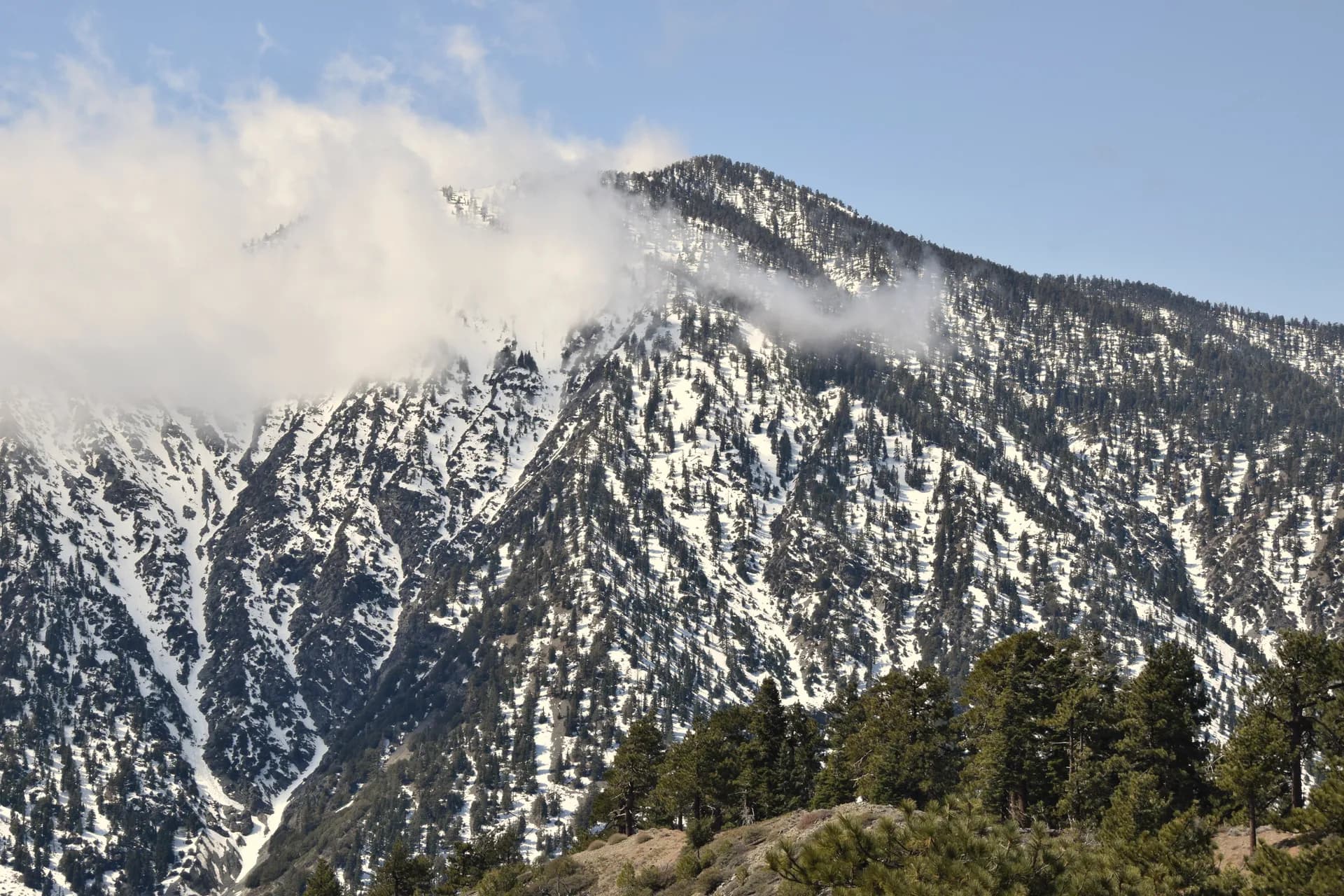
The Big Sur adjacency makes the northern unit of Los Padres one of the most scenically dramatic sections of any national forest in the country. The Santa Lucia Range rises steeply from the Pacific, and the trails that climb inland from the coast pass through redwood groves, cross creek drainages, and reach ridgeline camps with views that drop back to the ocean. The Vicente Flat Trail and the Pine Ridge Trail system offer genuine backcountry experience within a few miles of one of the most famous coastal highways in the world.
The interior of the forest tells a completely different story. East of the Santa Ynez Mountains above Santa Barbara, and east of Highway 33 above Ojai, the terrain transitions to dry chaparral, sandstone ridges, and ponderosa pine forest on the higher peaks. The San Rafael Wilderness, established in 1968 as the first wilderness area in California under the Wilderness Act, protects the Manzana Creek drainage and surrounding peaks. The Sespe Wilderness protects the condor corridor around Sespe Creek. The contrast between the damp, fern-draped creeks near Big Sur and the hot, dusty chaparral of the Sespe country is striking: they're technically the same forest, separated by about 100 miles of coastline.
Best Trails
With 1,500 miles of trails spanning eight wilderness areas and two mountain ranges, Los Padres offers hiking from gentle creek walks to serious multi-day backcountry routes. Here are four of the best starting points.
The Pine Mountain Loop via Reyes Peak is the best introduction to the Ojai backcountry. An 8-mile loop climbing through ponderosa pine forest to the summit ridge at 7,510 feet, it offers condor sightings, views into the Sespe Wilderness, and the rare experience of a cool, forested summit in Southern California's mountain terrain.
The Vicente Flat Trail is the gateway to the Big Sur backcountry. This 12-mile out-and-back from the Kirk Creek Campground trailhead on Highway 1 climbs through coastal scrub and redwood canyon to a wilderness camp on a high ridge above the ocean. It's one of the more demanding day hikes in the forest, and one of the most rewarding.
The Manzana Creek Trail to Potrero Camp takes you into the San Rafael Wilderness through creek-bottom terrain that feels genuinely remote. The 12-mile round trip follows the creek through willows and sycamores, with swimming holes in spring and regular condor sightings above the canyon walls.
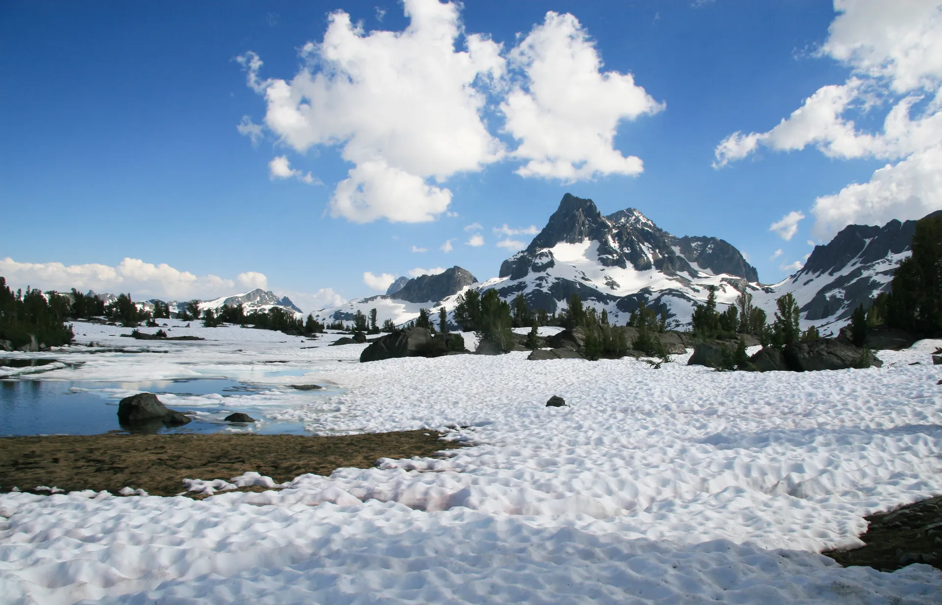
The Mount Pinos Summit Trail reaches the highest point in the forest at 8,831 feet, a site with deep cultural significance to the Chumash people. The 5-mile round trip is relatively gentle for a summit of this elevation, and the views on a clear day reach from the San Joaquin Valley to the Channel Islands.
Permits and Passes
California Campfire Permit: Required year-round for any open flame outside of a developed campground, including propane stoves. Free, available online at preventwildfireca.org. This requirement is enforced, and citations have been issued to backpackers who assumed a propane stove was exempt. During Red Flag Warning days and high fire danger periods, permits may be suspended entirely and fire of any kind prohibited.
Backcountry and Wilderness: No entry permit is required for day hiking or overnight backpacking in the wilderness areas. Self-registration at the trailhead is the standard practice, and the cards help the Forest Service track use and respond to emergencies. Fill one out even if it seems optional.
Fire Closures: This is the most important thing to know before visiting. Los Padres has some of the most frequent and extensive fire closures of any national forest in California. Large areas can close with little notice during high fire danger, and some closures last months. The LPNF website and the InciWeb incident tracking site are the best sources for current information. See our guide on checking conditions before you go for a full list of resources.
America the Beautiful Pass: The Interagency Pass ($80/year) covers day-use fees at developed recreation areas in Los Padres. Veterans may qualify for free passes. See veteran benefits for national forests for eligibility details.
Camping
Developed campgrounds in Los Padres range from the large county-operated Lake Cachuma facility near Santa Barbara to small primitive camps accessible only by trail. Most developed campgrounds are bookable through Recreation.gov.
The Cachuma Lake County Park on Highway 154 (Santa Barbara Canyon Road) is the largest car-camping facility in the area, with 450 sites and a full range of amenities. It's county-operated, not Forest Service, but it sits within the forest boundaries and serves as a base for exploring the Santa Ynez Recreation Area trails.
In the Ojai Ranger District, Reyes Creek Campground and Pine Mountain Campground on Highway 33 are the primary developed options for hikers targeting the Pine Mountain and Reyes Peak area. Sites are modest and first-come-first-served.
For the Mt. Pinos area, the Forest Service operates several small campgrounds along Mt. Pinos Road, open May through November depending on snow conditions.
Dispersed camping is permitted in most areas outside of designated campgrounds and day-use areas, with a campfire permit and standard Leave No Trace practices. For more on backcountry camping permits, see the guide on how to get a national forest camping permit.
When to Visit
Fall through spring (October through May) is the primary season for most of the forest. The chaparral country around Ojai and Santa Barbara is most comfortable in the 60s and 70s of winter and early spring. Big Sur trails are accessible year-round in mild weather, though Pacific storms from November through February can bring significant rain, making creek crossings more demanding and trail surfaces slippery.
Spring wildflowers (March through May) are exceptional in Los Padres. The chaparral slopes above Ojai and the Santa Ynez River corridor come alive with poppies, lupine, and native sage. Condor activity is highest during nesting season (roughly January through July), and sightings tend to cluster in the Sespe and Ventana areas.
Summer (June through September) brings high heat to the interior (above 100 degrees at lower elevations is common), fire restrictions that limit where you can legally build fires or use stoves, and elevated fire closure risk. The higher elevations above 6,000 feet on Pine Mountain and Mt. Pinos are more comfortable in summer, but the Ventana and San Rafael wilderness areas become genuinely dangerous in heat spikes. If you visit in summer, start before sunrise and plan to be back at the trailhead before noon.
Winter brings snow above 5,500 feet, which means the Mt. Pinos area may be inaccessible or require chains in December through February. The lower-elevation Big Sur trails are often at their most lush and green in winter.
Getting There
From Santa Barbara: The Santa Ynez Recreation Area is 25 miles north via Highway 154 (San Marcos Pass Road). The Ojai Ranger District is about 45 minutes via Highway 150 east to Highway 33 north. The Mt. Pinos area is roughly 90 minutes east via Highway 101 south and Frazier Mountain Park Road.
From Monterey: The northern Ventana Wilderness (Kirk Creek area) is about 60 miles south on Highway 1. Big Sur village is about 30 miles south of Monterey, and the Los Padres boundary begins just south of Carmel Valley. Allow extra time on Highway 1, as the road is narrow, winding, and subject to closures after slides.
From Los Angeles: The Ojai Ranger District is about 90 minutes northwest via US-101 to Highway 33. The Mt. Pinos area is roughly 90 minutes north via I-5 to Frazier Park. The San Rafael Wilderness near New Cuyama is about 2.5 hours, mostly on US-101 and Highway 166.
Practical Tips
Fire conditions change fast. The single most important step before any trip to Los Padres is checking for fire closures and fire restrictions. More trail plans get cancelled by fire closures in this forest than any other factor. Bookmark the LPNF alerts page and check it within 24 hours of departure.
Rattlesnakes and mountain lions are present throughout. Rattlesnakes (primarily the Southern Pacific rattlesnake and the Western diamondback in the inland areas) are most active April through October on rocky trails and creek banks. Stay on trail, watch where you place your hands and feet on boulder scrambles, and give any snake you encounter space. Mountain lions are present throughout the forest. The California Department of Fish and Wildlife publishes guidance on mountain lion encounters that is worth reviewing before backcountry trips.
Poison oak is pervasive at lower elevations, particularly in creek drainages and on north-facing slopes. Learn to identify the three-leaflet clusters. In winter, leafless stems are still oily and reactive. If you suspect contact, rinse with cold water as soon as possible.
Condor etiquette: If you see a condor, maintain at least 300 feet of distance. Never approach a nest site. Condors are curious and may land near you, especially in the Sespe area. Do not feed them or attempt to interact. The Ventana Wildlife Society requests that hikers report condor sightings with tag numbers at their website.
Water is essential. Interior trails in the Transverse Ranges are dry much of the year. Spring is the most reliable time to find flowing water at named creeks. Even in spring, verify current water source conditions before relying on natural water. Many hikers carry 3 or more liters for interior trails. Individual needs vary based on conditions, pace, and body weight.
For a broader look at public land categories and what makes this forest different from adjacent Pinnacles National Monument or Channel Islands National Park, see our guide on national forests vs. national parks. Los Padres rewards preparation. It's one of the least-visited large forests in California partly because the fire closure system can make trip planning frustrating. But on a clear spring morning on the Sespe Creek Trail with a condor soaring a hundred feet overhead, it's easy to understand why the people who know this forest tend to keep coming back.