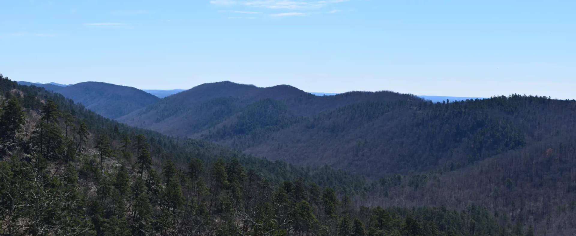
Ozark-St. Francis National Forest covers 1.2 million acres across the Ozark plateau and Boston Mountains of northwestern and north-central Arkansas. The forest sits atop a broad dome of sedimentary rock, primarily sandstone and limestone, that was lifted and then deeply dissected by streams over millions of years. The result is a landscape of dramatic bluffs, sheltered hollows, spring-fed streams, and the natural rock formations that make this forest visually distinct from any other national forest in the eastern half of the country.
The sandstone forms here in ways that surprise visitors from other parts of the country. Pedestal Rocks in the Scenic Area near Pelsor are sandstone caps balanced on eroded pedestals, standing 10 to 30 feet tall in a forest clearing. Sam's Throne is a freestanding sandstone bluff used by both hikers and rock climbers, with a view from its top that spans the entire Richland Creek watershed. Natural bridges, slot canyon sections, and alcoves carved into sandstone bluffs appear throughout the forest. This is central highlands geology at its most photogenic.
The forest is divided into six ranger districts covering the Ozark unit from the Oklahoma border east through the Boston Mountains and the Springfield Plateau, plus the small St. Francis unit in the Arkansas Delta near Helena. Three designated wilderness areas, Upper Buffalo, Richland Creek, and Leatherwood, protect substantial backcountry terrain within the Ozark unit. The Buffalo National River, managed by the National Park Service, is adjacent to the forest through much of its length and the two lands are functionally complementary for visitors to the region.
Why Ozark-St. Francis Stands Out
The rock formations. No other national forest in the Central United States offers the density of sandstone formations that Ozark NF does. The Pedestal Rocks Scenic Area alone is worth a dedicated visit. Sam's Throne, a 2,260-foot sandstone mesa with sheer drop-offs, is both a hiker's viewpoint and one of the premier trad climbing destinations in Arkansas. Natural bridges and rock shelters appear throughout the forest. This is a photographer's and geology enthusiast's landscape.
Blanchard Springs Caverns. The cave system at Blanchard Springs is among the most significant active cave formations in the Central US. Guided tours take visitors through two levels of formations, active speleothems, cave streams, and an impressive variety of cave formations. The cave is a major visitor attraction in the region and requires advance tour tickets in peak season.
Spring wildflowers and biodiversity. The Ozark highlands support a diverse forest of oak, hickory, and shortleaf pine with a rich understory that blooms extensively in spring. The moist hollows along stream drainages host communities of spring wildflowers, including trillium, bloodroot, spring beauty, and wild phlox, that rival any eastern forest in their display. The region's diverse geology produces diverse soils that support an unusual mix of plant communities.
Best Trails in Ozark-St. Francis National Forest
The Pedestal Rocks Loop is the signature 4.0-mile moderate loop of the forest. The loop passes directly through the Pedestal Rocks Scenic Area where balanced sandstone formations rise from the forest floor, with a canyon overlook that frames the eroded bluffs against the sky. This is the single most visually distinctive hike in the forest.
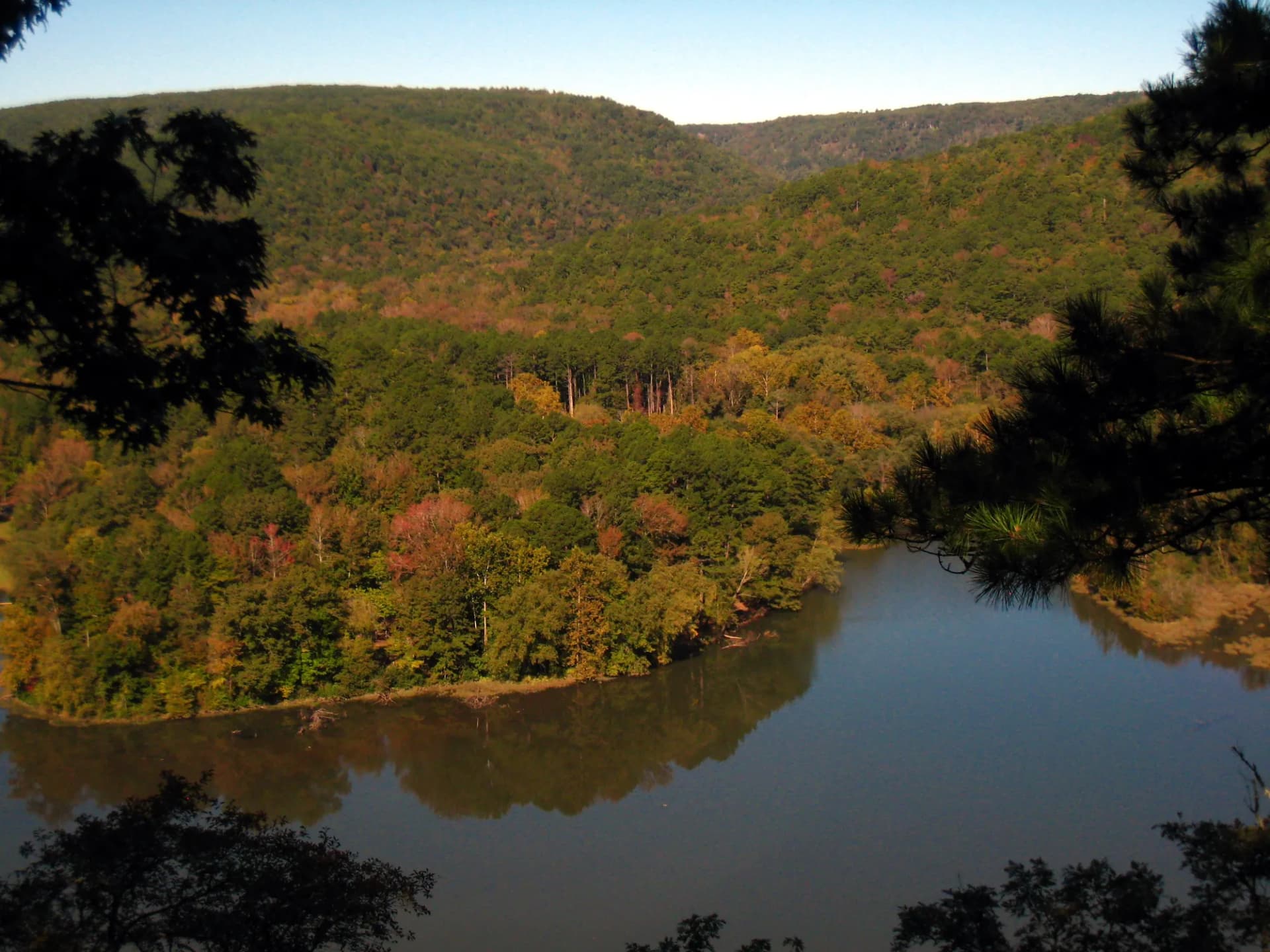
Sam's Throne Loop is a 4.0-mile circuit around the Sam's Throne bluff system near Mount Judea. The bluffs drop sharply on the southern and eastern sides, providing unobstructed views across the Richland Creek watershed and Buffalo River country to the north. The combination of bluff walking and forest circuit makes this a strong choice for a full morning hike.
The Richland Creek Wilderness Loop is an 8.0-mile backcountry loop through one of the three designated wilderness areas in the Ozark unit. The loop follows Richland Creek through a valley of bluffs and waterfalls before climbing through old-growth oak-hickory forest.
The Eagle Rock Loop Section is a 12.0-mile section of the 26-mile Eagle Rock Loop, the longest loop trail in the forest, covering some of the most diverse terrain in the Upper Buffalo Wilderness.
Permits and Passes
Most trail hiking requires no permit or fee as of 2026. Blanchard Springs Caverns tours require advance reservations; check Recreation.gov for current tour availability and pricing. The America the Beautiful annual pass is accepted at some developed recreation areas. See the Veterans Benefits guide for information on free passes for veterans.
Camping
Blanchard Springs Recreation Area provides the most developed camping in the forest, with sites close to the caverns and several hiking trails. Richland Creek Campground near the wilderness trailhead is a smaller, free campground popular with backpackers. Pedestal Rocks has a small free dispersed camping area near the scenic area trailhead.
Dispersed camping is permitted throughout most of the forest with no permit required as of 2026. Follow Leave No Trace principles and the LNT guide for camping on national forest land.
When to Visit
Spring (March through May): The premier season. Wildflowers peak from late March through April. Streams are running high and waterfalls are impressive. The forest transitions from brown to green through April.
Summer (June through August): Full access to all trails. The forest is lush. Temperatures in the Boston Mountains are moderated somewhat by the elevation but can be hot in June and July. Swimming holes in Richland Creek and other streams provide relief.
Fall (October through November): Excellent foliage in the hardwood forest from late October. The oak and hickory color is warm oranges and golds. One of the better fall color destinations in Arkansas.
Winter (December through February): The forest is quiet. Some roads may be impassable after ice storms. Lower-elevation routes are accessible in mild winter conditions. Ice climbers sometimes visit the frozen waterfalls in the Richland Creek area.
Getting There
From Harrison: Take US-65 south to AR-16, then west through Lurton and the forest. The Pedestal Rocks Scenic Area is accessible from AR-16 west of Pelsor.
From Russellville: Take I-40 west to AR-7 north, then AR-16 west into the forest. Blanchard Springs Caverns are accessible from AR-14 north of Mountain View.
From Fayetteville: Take US-71/AR-59 south to AR-16 east, or take AR-23 south through the Boston Mountains.
Practical Tips
- Black bears are present throughout the Ozark highlands. Store food properly at camp. See the bear canister requirements guide.
- Timber rattlesnakes and copperheads are present. Watch where you step and place your hands on rocks.
- Some forest roads are unpaved and can be muddy or impassable after heavy rain. Check road conditions before heading to remote trailheads.
- The Ozark plateau can have severe weather including tornado risk in spring. Check forecasts before multi-day trips and review conditions before departure.
Planning Your Trip
The USFS Ozark-St. Francis National Forests website at fs.usda.gov/osfnf has current ranger district contacts, campground reservation links, and road condition updates.
For trip planning guidance, see the camping permit guide and the conditions guide.