ForestMatters, LLC

The Tar Heel State

North Carolina

Blue Ridge waterfalls, the highest peaks east of the Mississippi, and the birthplace of American forestry.

1Forest Guide
8Trail Guides
512,758Acres Covered
6,684 ftHighest Peak

North Carolina at a Glance

Blue Ridge Parkway

The Blue Ridge Parkway runs 252 miles through North Carolina's mountains, connecting hundreds of trailheads and overlooks

Waterfall Capital

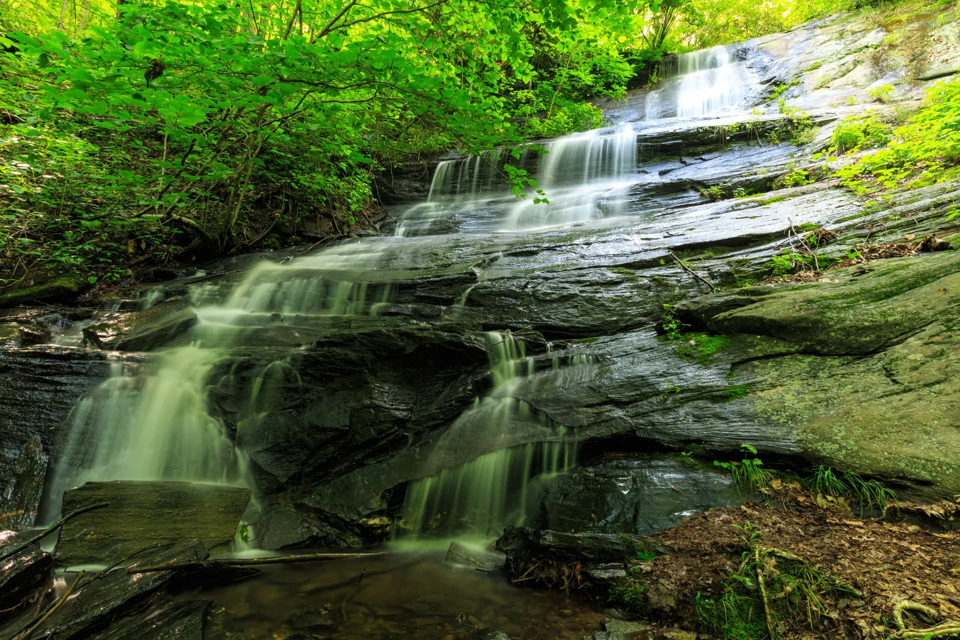
Western North Carolina has over 250 named waterfalls, earning Transylvania County the title of 'Land of Waterfalls'

Appalachian Trail

The AT crosses 96 miles through North Carolina, including its highest point at Clingmans Dome (6,643 ft)

Eastern Highpoint

Mount Mitchell (6,684 ft) in Pisgah National Forest is the highest peak east of the Mississippi River

Cradle of Forestry

America's first forestry school was established in Pisgah Forest in 1898, where modern forest management began

Biodiversity Hotspot

The southern Appalachians in North Carolina have more tree species than all of northern Europe combined

When to Visit

Year-round hiking is possible at lower elevations. Spring (April through May) brings wildflowers and waterfall season. October delivers peak fall color along the Blue Ridge Parkway. Winter above 5,000 ft can bring ice and snow.

National Forests in North Carolina

Trails in North Carolina

moderateout-and-back

Black Balsam Knob

3.5 mi1,100 ft gain
North CarolinaMay through October

Guide to Black Balsam Knob in Pisgah National Forest, North Carolina. A 3.5-mile out-and-back on the Art Loeb Trail to an open Appalachian bald at 6,214 feet with 360-degree views over the Southern Appalachian high country.

7 min read

moderateout-and-back

Courthouse Falls

4 mi600 ft gain
North CarolinaMarch through November

A 4.0-mile out-and-back through old-growth forest in Pisgah National Forest to a 45-foot waterfall on Courthouse Creek, one of the quieter cascades in western North Carolina.

7 min read

easy-moderateout-and-back

Devil's Courthouse

1 mi250 ft gain
North CarolinaApril through November

A short but dramatic 1.0-mile out-and-back to a quartzite summit at 5,462 ft in Pisgah National Forest, offering 360-degree views into North Carolina, South Carolina, Georgia, and Tennessee.

7 min read

easy-moderateloop

Graveyard Fields Loop

3.2 mi400 ft gain
North CarolinaApril through November

Guide to the Graveyard Fields Loop off the Blue Ridge Parkway in Pisgah National Forest. A 3.2-mile loop through a unique high-altitude valley with two waterfalls and exceptional fall color.

10 min read

moderate-hardout-and-back

Looking Glass Rock Trail

6.2 mi1,700 ft gain
North CarolinaApril through November

Guide to the Looking Glass Rock Trail in Pisgah National Forest. A challenging 6.2-mile out-and-back hike to the summit of one of the most iconic peaks in the southern Appalachians.

8 min read

easyloop

Max Patch

2.4 mi350 ft gain
North CarolinaApril through November

Guide to the Max Patch hike on the Appalachian Trail in Pisgah National Forest. A 2.4-mile loop to a grassy bald with 360-degree views of the Blue Ridge and Great Smoky Mountains.

9 min read

easyout-and-back

Moore Cove Falls

1.4 mi200 ft gain
North CarolinaYear-round

Guide to Moore Cove Falls in Pisgah National Forest, North Carolina. A 1.4-mile out-and-back through a flat forest cove to a 50-foot waterfall you can walk behind, near Brevard, NC.

8 min read

moderate-hardout-and-back

Shining Rock via Art Loeb Trail

7.6 mi1,600 ft gain
North CarolinaApril through November

Guide to the Shining Rock hike via the Art Loeb Trail in Pisgah National Forest, North Carolina. A 7.6-mile out-and-back to a white quartz outcropping at 5,940 feet.

6 min read

Trip Planning Guides

Did You Know?

1

Pisgah National Forest is where Gifford Pinchot first practiced scientific forestry in America, on land owned by George Vanderbilt's Biltmore Estate.

2

The Appalachian Trail's highest shelter, the Mount Collins Shelter at 5,870 ft, sits in the North Carolina mountains.

3

Nantahala National Forest's name comes from the Cherokee word meaning 'Land of the Noonday Sun' because the gorges are so deep sunlight only reaches the floor at midday.

4

Looking Glass Rock in Pisgah National Forest gets its name from ice that forms on the granite face in winter, reflecting sunlight like a mirror.

5

Linville Gorge in Pisgah National Forest is often called the 'Grand Canyon of the East,' dropping 2,000 ft over 12 miles.