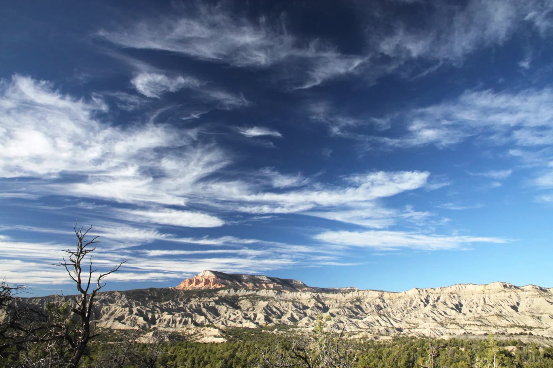
Ashley National Forest stretches across 1.37 million acres of northeastern Utah, from the Wyoming border south through the Uinta Mountains and east to the red-rock canyons above Flaming Gorge Reservoir. This is a forest of dramatic contrasts: glacier-carved alpine basins holding over a thousand lakes sit within a day's drive of high desert canyon country. The Uinta Range is the only major east-west trending mountain range in the contiguous United States, a geological anomaly that gives the forest its distinctive character.
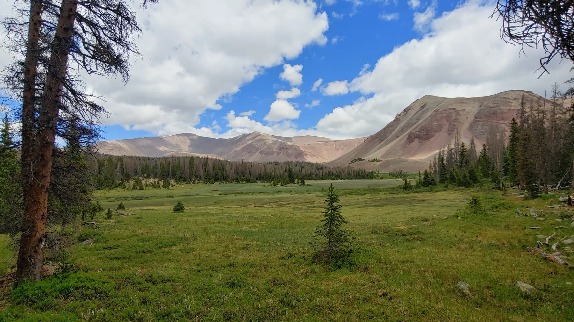
The centerpiece is the High Uintas Wilderness, a 460,000-acre protected area that holds Utah's highest summit, some of its most remote backcountry, and a density of alpine lakes that has no rival in the state. Hikers who make the long drive to the trailheads are rewarded with genuine wilderness: no maintained roads, limited cell service, and the kind of solitude that requires real effort to find elsewhere in the West. The forest draws hikers, anglers, horseback riders, and hunters from across the Intermountain region, though its distance from major urban centers keeps crowds manageable by Rocky Mountain standards.
Why Ashley Stands Out
Utah's Highest Summit. Kings Peak at 13,534 feet is the reason many hikers first come to Ashley National Forest. The standard route via Henry's Fork is a 28-mile round trip that gains over 5,200 feet, making it a serious multi-day undertaking. The summit sits at the edge of the Uintas' volcanic-influenced geology, offering 360-degree views across an alpine landscape that looks largely unchanged from photographs taken a century ago. See the Kings Peak trail guide for route details and planning information.
Alpine Lake Country. The High Uintas hold more high-altitude lakes per square mile than almost anywhere in the lower 48. Henry's Fork Basin alone contains dozens of named lakes set in a glaciated bowl below Kings Peak. The fishing is productive for cutthroat and brook trout, and the basin rewards non-anglers equally with wildflower meadows in late July and elk sightings in September. The Henry's Fork Basin trail gives access to this country without requiring a full summit attempt.
Flaming Gorge. The eastern edge of the forest holds a completely different landscape: red-rock canyon country above a 91-mile reservoir carved by the Green River. Flaming Gorge National Recreation Area offers canyon rim hiking, water recreation, and exceptional fishing for trout and smallmouth bass. The Flaming Gorge Rim Trail provides accessible views without the altitude demands of the Uintas. It's a useful pairing for families or groups with mixed hiking ability.
Best Trails in Ashley National Forest
Kings Peak via Henry's Fork is Utah's signature summit hike and the longest route in this guide at 28 miles round trip. Most hikers camp at Elkhorn Crossing or Dollar Lake and summit on day two. The route passes through Henry's Fork Basin before climbing to Gunsight Pass and the final ridge to the summit. See the full Kings Peak trail guide.
Henry's Fork Basin (13 miles round trip) delivers the alpine lake experience without the summit push. The trail ends at the upper basin near Elkhorn Crossing, surrounded by peaks above 13,000 feet and lakes that hold cutthroat trout. This is one of the best backpacking destinations in the Uintas for hikers who want high alpine scenery without the strenuous summit commitment. See the Henry's Fork Basin trail guide.
Uinta Highline Trail Section (10 miles round trip) samples one of the longest maintained wilderness trails in the country. The Highline runs 104 miles across the entire Uinta crest. Day hikers and overnighters can access a stretch from the West Fork Blacks Fork trailhead that showcases the tundra plateau above treeline. See the Uinta Highline trail guide.
Flaming Gorge Rim Trail (6 miles round trip) follows the canyon rim above the reservoir and offers the most accessible hiking in the forest. The views down into the red-walled canyon are dramatic, and the trail works well in shoulder seasons when the Uintas are still snowbound. See the Flaming Gorge Rim trail guide.
Permits and Passes
Ashley National Forest does not currently require wilderness permits for entry into the High Uintas Wilderness (as of 2026). There are no quota systems in place, though this can change. Check with the Vernal Ranger District or Roosevelt Ranger District before your trip, especially for large groups or horse parties which may face additional regulations.
Flaming Gorge National Recreation Area charges a day use fee of $5 per vehicle (as of 2026). The America the Beautiful Pass is accepted and covers this fee. Campground fees are separate from day use fees. Verify all current fees at recreation.gov before your visit.
Campfire restrictions and fire bans are common in the Uintas during dry summers. Check InciWeb and the forest's fire information page before any trip. The high elevations do not exempt you from fire restrictions.
Camping
The most popular backpacking camps in the High Uintas are dispersed sites near Henry's Fork Basin and along the Highline Trail corridor. There are no designated backcountry campsites; dispersed camping is permitted throughout the wilderness with a 200-foot buffer from water sources and trails. Group size limits apply in the wilderness. For dispersed camping guidance, see the national forest camping permit guide.
Developed campgrounds cluster around Flaming Gorge and at lower-elevation access points. Mustang Ridge Campground near Dutch John is the largest and most accessible, with 71 sites and reservations available through recreation.gov. Henrys Fork Campground near the main Kings Peak trailhead is small (8 sites), first-come first-served, and fills quickly on summer weekends.
Horse camps are available at China Meadows and at several trailhead staging areas on the north slope. Contact the Mountain View Ranger District in Wyoming for current horse camp information, as much of the Kings Peak approach crosses both states.
When to Visit
The High Uintas are a short-season destination. Snow typically closes high passes through June, and the window for reliable alpine conditions runs mid-July through late September. Wildflowers peak in late July and early August. September brings cooler temperatures, changing aspens, and fewer people.
Afternoon thunderstorms are frequent throughout July and August. Above treeline, lightning is a serious hazard. Plan to summit or cross exposed ridges before noon. Carry extra layers: temperatures can drop 30 degrees in an hour above 12,000 feet.
Flaming Gorge is accessible May through October and is at its best in spring and fall when summer crowds thin out and temperatures moderate. Summer heat in the canyon can be extreme, making early morning hikes or cooler-season visits more comfortable. See checking conditions before you go for resources on current fire, weather, and road conditions.
Getting There
The primary access for Kings Peak and Henry's Fork Basin is from Mountain View, Wyoming, via Wyoming Highway 410. Follow signs to Lonetree, then continue to Henry's Fork Road. The final 7 miles to the trailhead are unpaved and require a high-clearance vehicle. A passenger car can reach the lower staging area, but the last stretch to the main trailhead demands clearance.
For Flaming Gorge, take US-191 south from Vernal, Utah. The recreation area visitor center at Dutch John provides maps and current conditions. Cell service is limited throughout the forest; download offline maps and notify someone of your itinerary before heading into the backcountry.
Practical Tips
Many hikers underestimate the altitude in the Uintas. The trailheads themselves sit above 9,000 feet. If you are coming from low elevation, consider arriving a day early and sleeping at altitude before a long hike. Individual needs vary; pay attention to how your body responds.
Water is plentiful in the Uintas but all backcountry sources should be filtered or treated. Giardia is present. Many hikers carry a filter and a chemical backup. The high lakes and streams are clear but not safe to drink untreated.
Bears are present in Ashley National Forest. While black bear encounters are less common here than in other Intermountain forests, food storage best practices apply. Many hikers use bear canisters for multi-day trips in the wilderness. See the bear canister requirements guide for current regulations and recommendations.
The forest sits at high elevation with minimal tree cover above 11,000 feet. Sunscreen and UV-protective eyewear are strongly recommended. UV radiation increases significantly with altitude.
Planning Your Trip
Ashley National Forest is managed across three ranger districts: Vernal, Roosevelt, and Flaming Gorge/Duchesne. Each district has current trail and road condition information. The Vernal Ranger District covers the Kings Peak corridor; the Mountain View Ranger District in Wyoming (part of the Wasatch-Cache National Forest administration) co-manages the north-slope trailheads.
For a broader look at Utah's national forest offerings, compare with the Uinta-Wasatch-Cache National Forest to the west, which covers the Wasatch Front and much of the central Uinta Range. Serious Uinta high-country hikers often combine trips across both forests.
The Leave No Trace principles are especially important in the High Uintas, where fragile alpine soils and high-traffic routes combine to make cumulative impact a real concern. Camp on durable surfaces, pack out all waste, and give wildlife wide berth, particularly during fall hunting season.
Veterans and active military should note that the America the Beautiful Access Pass and Military Annual Pass cover entrance fees at Flaming Gorge and other federal recreation areas. See the veteran benefits guide for a full summary of available benefits.