Dixie National Forest covers 1.88 million acres of southern Utah's Colorado Plateau, a broad forest complex that stretches from the Nevada border east to the Escalante River canyon and encompasses everything from red-rock canyon country to high subalpine plateaus. The forest sits at the junction of two major geological provinces, the Colorado Plateau to the south and east, and the Basin and Range to the west, producing terrain of unusual variety and scale.
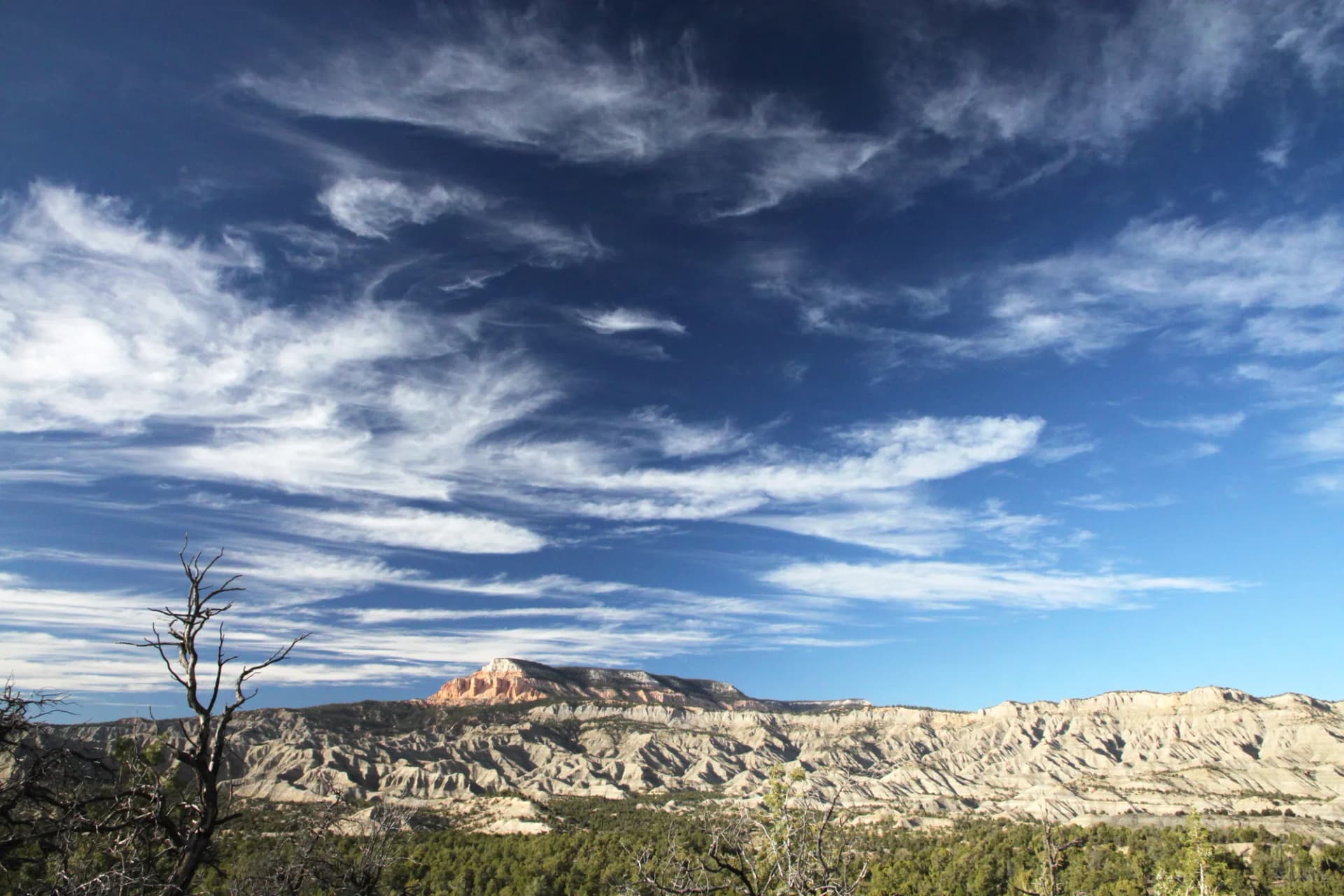
The Pink Cliffs, the uppermost step of the Grand Staircase, run through the northern edge of the forest. These white and pink limestone formations eroded by the same forces that created Bryce Canyon's hoodoos are among the most photogenic features accessible without a national park entrance fee. Red Canyon, just west of Bryce Canyon National Park, provides forest-land access to similar geology with its own hoodoo formations and deep red Claron limestone. Together they form the most visited section of the forest.
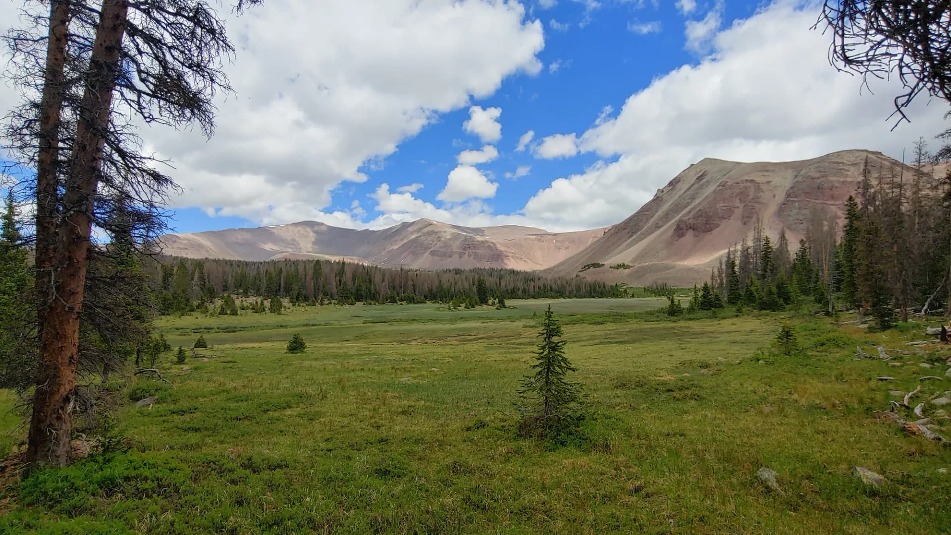
Boulder Mountain is the forest's most surprising feature to visitors who approach from the canyon country below. The broad volcanic plateau rises to over 11,000 feet and is covered in dense spruce-fir forest dotted with lakes. It looms above Capitol Reef and the Escalante canyon country, creating an abrupt vertical transition from desert to subalpine forest. Scenic Byway 12 crosses its flank, providing the most dramatic driving experience in the state.
Why Dixie Stands Out
Red Canyon is the accessible alternative to Bryce Canyon for visitors who either want to avoid the park entrance fee or who have already seen the park and want more canyon hiking without the crowds. The canyon's red and orange hoodoos, arches, and pinnacles differ slightly in color and character from Bryce but are equally photogenic. The Red Canyon Visitor Center sits just off US-89, and several short trails make the canyon accessible without a full-day commitment.
Boulder Mountain represents a dramatic reversal of what the surrounding landscape prepares you for. After driving through canyon country, arriving on this high, lake-dotted, forested plateau at 11,000 feet is unexpected and genuinely striking. The mountain has some of the best trout fishing in Utah (over 80 lakes and reservoirs), diverse hiking from short nature walks to multi-day wilderness traverses, and views from its summit that encompass a vast stretch of the Colorado Plateau.
The Grand Staircase context gives Dixie National Forest a geological significance beyond its individual features. The Pink Cliffs, White Cliffs, Vermillion Cliffs, Chocolate Cliffs, and Cinnabar Mesa visible from forest terrain represent the exposed edges of geological strata that read like a timeline of the Colorado Plateau's formation. Viewing this sequence from the Pink Cliffs Wilderness is a perspective that few wilderness areas anywhere in the country can match.
Best Trails in Dixie National Forest
Pink Cliffs Loop provides the most accessible introduction to the forest's signature geology. The 4-mile loop with 500 feet of gain is a good choice for visitors who want to experience the hoodoo and white limestone formations without committing to a longer route.
Red Canyon Rim Trail follows the rim above Red Canyon for 5.5 miles with consistent views into the canyon. This is the best sustained hiking experience in the Red Canyon area, with better views than the canyon-floor trails.
Boulder Mountain Summit Trail is the demanding option, climbing 2,300 feet over 9 miles to the highest accessible point on Boulder Mountain. The views from the summit extend across a vast section of the Colorado Plateau.
Bristlecone Pine Loop provides a 3-mile moderate walk to ancient bristlecone pine trees in the Cedar Breaks area, some of which may be over 3,000 years old.
Posy Lake Trail and Wide Hollow Reservoir Loop offer easy fishing and walking options in the Boulder Mountain area for visitors who prefer level terrain.
Permits and Passes
No day-use permit or entrance fee is currently required for most Dixie National Forest trailheads (as of 2026). Campfire permits are required and free. The America the Beautiful pass covers fees at adjacent national parks and any fee-based forest sites. Veterans may qualify for free passes; see veteran benefits for national forests.
Cedar Breaks National Monument (adjacent to the forest) charges a separate entrance fee. Bryce Canyon and Zion National Parks require reservations and entrance fees during peak season. Check conditions before your trip for current requirements at each site.
Camping
Red Canyon Campground near Panguitch Lake provides one of the best-situated campgrounds in the forest, with easy access to the canyon hiking. Posy Lake Campground on Boulder Mountain offers a high-altitude lake setting at about 8,600 feet. Both accept reservations through Recreation.gov.
Dispersed camping is permitted throughout most of the forest. The high elevations on Boulder Mountain and the terrain around the Escalante Canyons district offer excellent dispersed sites. For guidance on the procedures, see how to get a national forest camping permit.
When to Visit
May through October is the main season, with the timing varying by elevation. The lower canyon areas (Red Canyon, Pink Cliffs) are accessible from April through November. Boulder Mountain's upper trails are typically snow-free from June through October. The forest gets some winter visitation for cross-country skiing on Boulder Mountain and snowmobile access on certain roads.
Summer afternoons bring afternoon thunderstorms throughout the forest, particularly on Boulder Mountain and the high plateau terrain. Morning starts are recommended for any route above 9,000 feet. Flash flood risk in the canyon areas is real during storms, check forecasts and be aware of conditions upstream.
Fall is consistently excellent throughout the forest. Aspen color peaks from late September through mid-October and is spectacular on Boulder Mountain and in the canyons around Escalante.
Getting There
US-89 runs north-south through the heart of the forest, connecting Kanab to the south with Panguitch to the north. From Salt Lake City, take I-15 south to US-20 or US-89 south (about 250 miles, 3.5 hours). From Las Vegas, take I-15 north to Cedar City and then US-14 east to US-89 (about 175 miles from Las Vegas, 2.5 hours).
Cedar City serves as the main western gateway. Panguitch is the northern hub. Boulder serves the eastern section, accessible via Scenic Byway 12.
Practical Tips
Flash flood risk in the canyon areas is real. During afternoon thunderstorms, avoid canyon bottoms and narrows. Check NOAA forecasts for current conditions in the area. See checking conditions before you go for NOAA and NWS resources.
The Red Canyon Visitor Center on US-89 is the most accessible information point for canyon-area hiking. The Cedar City Ranger District and Powell Ranger District (Panguitch) offices can provide current conditions throughout the forest.
Cell service is limited or absent in most of the forest. Download maps before your visit. Boulder Mountain in particular is out of range for most carriers.
Planning Your Trip
For new visitors, national forest vs. national park explains why the forest lands adjacent to Bryce Canyon and Zion offer a different experience from the parks themselves. Leave No Trace principles apply throughout, and are particularly important in the high-use canyon areas near Red Canyon.