The Bitterroot National Forest
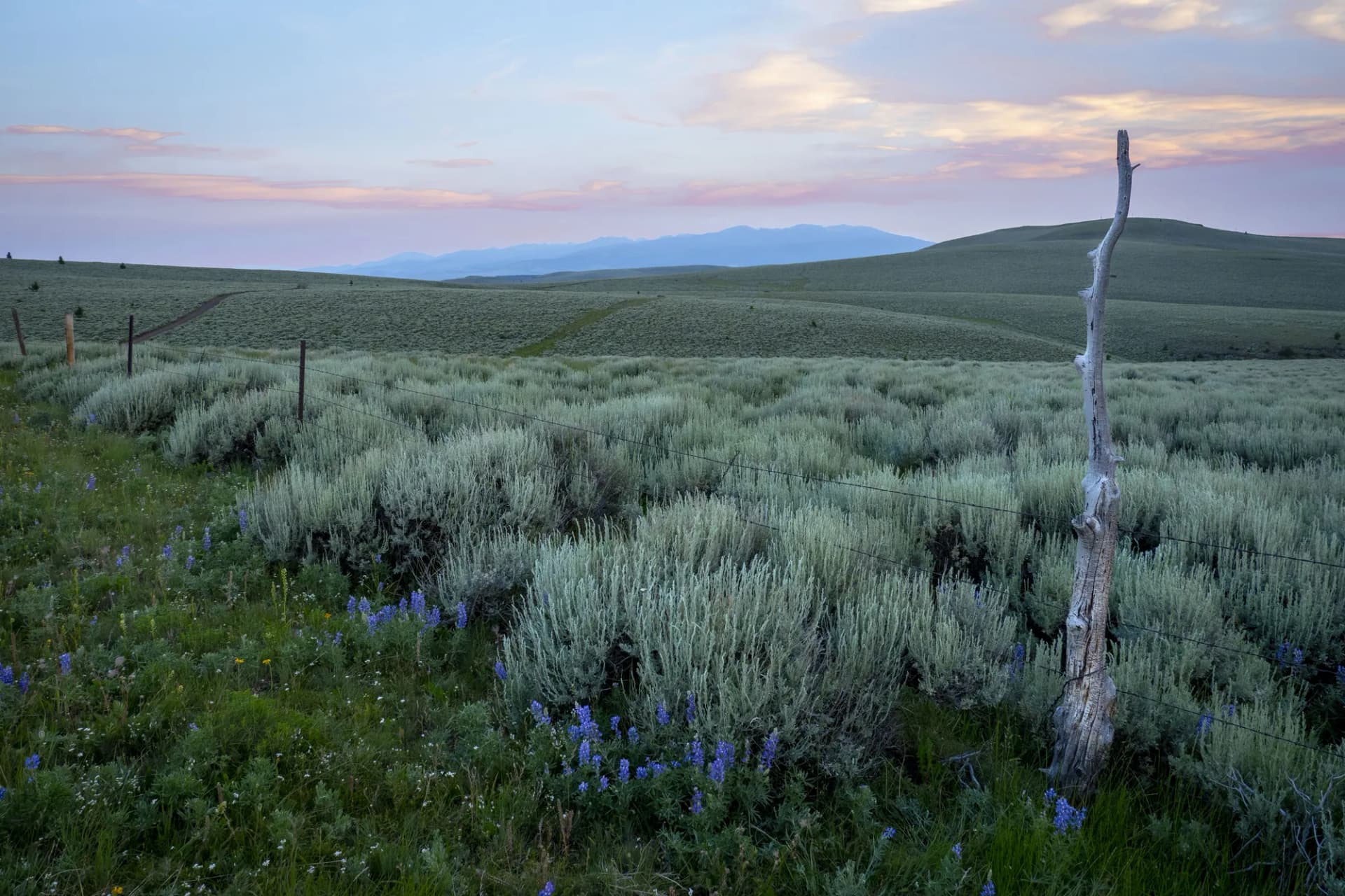
Carved by glaciers and shaped by the Bitterroot River, the Bitterroot National Forest stretches 120 miles along the Montana-Idaho border in a rugged spine of granite canyons and alpine ridges. Located in Montana, the forest covers 1.6 million acres and is best known for the Selway-Bitterroot Wilderness, one of the largest roadless areas in the contiguous United States. The Bitterroot Valley below is flanked by nine major drainages (Blodgett, Bass, Mill, Sweathouse, Tin Cup, Sleeping Child, Lost Horse, Chaffin, and Rye), each offering its own character.
The forest sits between two defining mountain ranges. The Bitterroot Range rises sharply to the west with dramatic canyon walls and jagged peaks, while the Sapphire Mountains form the gentler eastern boundary. This geography creates a landscape where valley floor fly fishing and technical mountain climbs coexist within a short drive. Wildlife is abundant: grizzly bears and wolves range through the wilderness interior, mountain goats traverse the high ridges, and elk populations support one of Montana's most significant hunting seasons.
Why Bitterroot National Forest Stands Out
The Selway-Bitterroot Wilderness
Designated in 1964 under the original Wilderness Act, the Selway-Bitterroot Wilderness covers 1.3 million acres spanning both Idaho and Montana. The Montana portion of the forest holds roughly half of that. Very few trails in the wilderness see organized maintenance, so expect downed timber, unmaintained routes, and creek crossings that run high through July. For experienced backcountry travelers, this is a feature: solitude is genuine here, not manufactured. The wilderness interior requires navigation skills and solid wilderness judgment. Check with the Hamilton Ranger District before entering.
Blodgett Canyon and the Western Canyons
The Bitterroot Range's western canyons are arguably the most dramatic canyon scenery in Montana. Blodgett Canyon's sheer quartzite walls rise more than 3,000 feet from the canyon floor. Rock climbers have established routes on these walls for decades, and hikers following the canyon trail see that vertical relief in every direction. Bass Creek, Mill Creek, and Lost Horse Creek offer similar canyon character with varying degrees of difficulty and solitude.
World-Class Fly Fishing
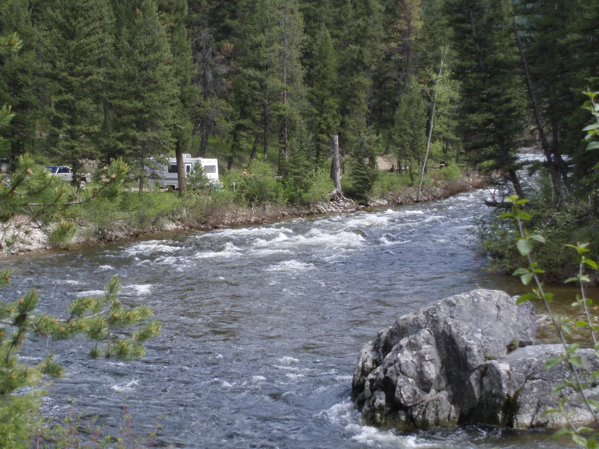
The Bitterroot River is a designated blue-ribbon trout fishery, and its tributaries add dozens more miles of quality water. Westslope cutthroat, brown trout, and rainbow trout all populate these streams. The upper forks (East Fork and West Fork Bitterroot) run through the forest and hold good populations even in late summer when valley sections warm. Access is straightforward at most USFS campgrounds and trailheads along the river corridor.
Best Trails
The eight trails below represent the range of what the Bitterroot offers, from accessible canyon walks to demanding wilderness routes.
Blodgett Canyon is the forest's signature hike: a 9-mile out-and-back through one of the most visually striking canyons in the Northern Rockies. The quartzite walls rise in tiers and the canyon floor follows a clear creek through old-growth ponderosa pine.
Saint Mary Peak climbs 9.4 miles round trip to a fire lookout at 9,351 feet with panoramic views of the Bitterroot Valley and the Sapphires. It is one of the few maintained trails offering summit-level views in this forest.
Bass Creek Trail follows Bass Creek through an 8.4-mile canyon route popular for its accessibility from Hamilton and its series of swimming holes in summer. The upper basin opens into alpine terrain for those continuing past the wilderness boundary.
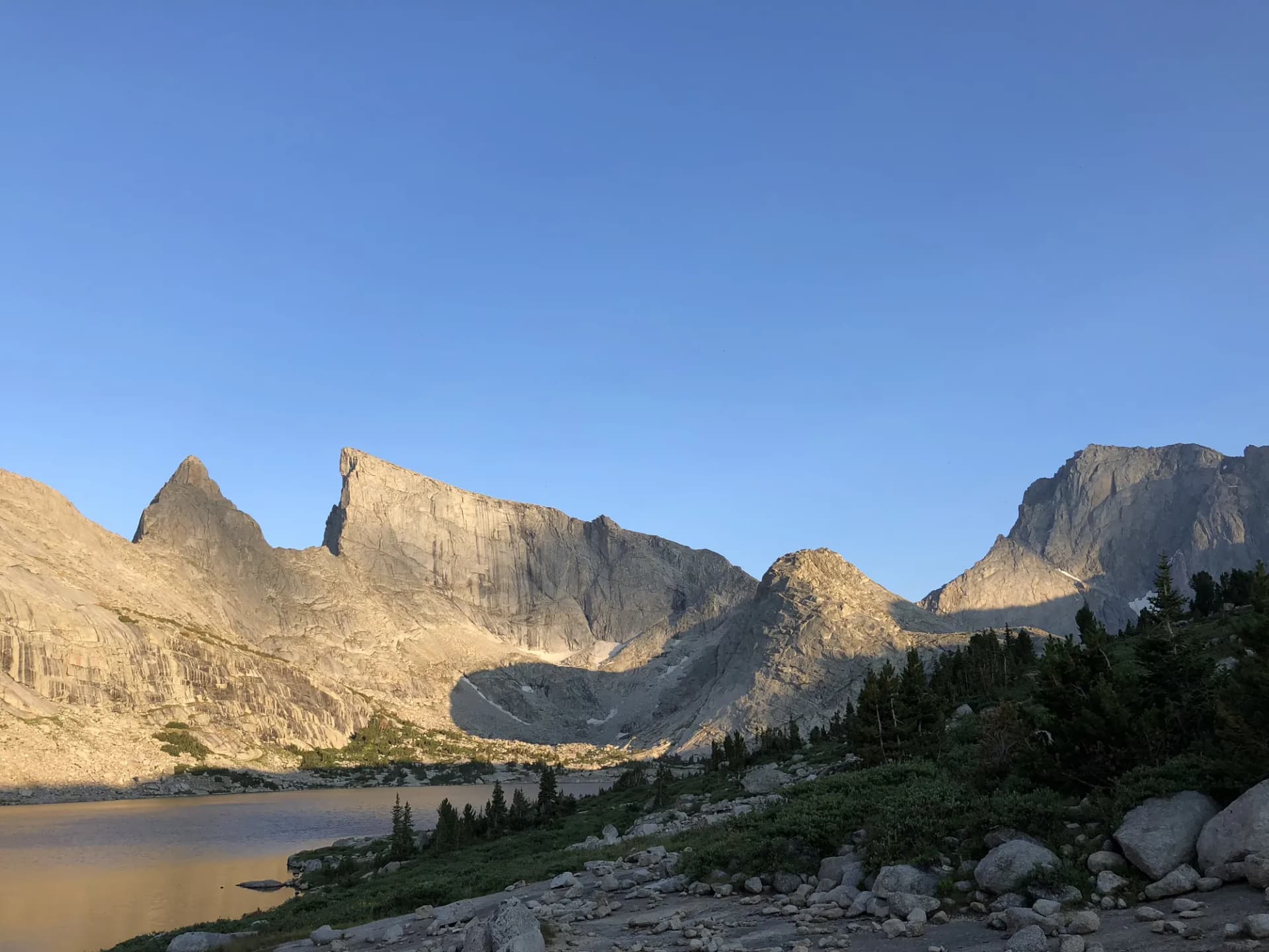
Mill Creek Lake is an 11.2-mile out-and-back to a high-elevation lake surrounded by the raw granite of the Bitterroot Range. The route climbs steadily through Mill Creek drainage and rewards with exceptional solitude.
Trapper Peak Trail ascends to the highest point in the Bitterroot Range at 10,157 feet. The 10-mile round trip is strenuous but non-technical, making it popular with hikers seeking the highest summit in the forest.
Sweathouse Creek Trail offers a gentler 5.6-mile walk through lower canyon terrain, well-suited to families and anglers. The creek supports good cutthroat fishing and the trail sees less foot traffic than the more famous canyons.
Lost Horse Creek Trail runs 7.2 miles into the Selway-Bitterroot Wilderness along a drainage less traveled than Blodgett or Bass. Old-growth larch and Douglas fir line the route and the upper basin holds a series of meadows excellent for wildlife observation.
Tin Cup Lake is a 6.8-mile out-and-back to a classic cirque lake tucked below the Bitterroot Divide. The approach follows Tin Cup Creek through stands of old-growth forest before climbing steeply to the lake basin.
Permits and Passes
No permit is required for day hiking or dispersed camping on the Bitterroot National Forest as of 2026. Developed campgrounds charge nightly fees ranging from $14 to $22 per night (as of 2026) and some sites are reservable through Recreation.gov.
The America the Beautiful Annual Pass covers day-use fees at many federal sites and is a strong value for regular visitors. See our guide to the America the Beautiful pass for veterans and the broader veteran benefits on national forests for information on free access programs.
Some trailheads in the forest require a Northwest Forest Pass or a Recreation.gov reservation during peak season. Verify current requirements with the Darby or Hamilton Ranger Districts before visiting, as fee structures change.
Camping
Lake Como Campground sits along Lake Como near Darby, offering 11 sites with access to swimming and fishing in the lake. Sites are reservable through Recreation.gov (as of 2026) and the season runs May through October, making it one of the longer-season campgrounds in the forest.
Black Bear Campground occupies a forested bench near Blodgett Creek and serves as a base for Blodgett Canyon hikes. Its 10 first-come, first-served sites fill quickly on summer weekends. The setting is classic Bitterroot ponderosa with creek access.
Rombo Campground sits along the West Fork Bitterroot River near Conner and provides excellent access to the upper West Fork drainage and wilderness trailheads. Fifteen sites accommodate both tents and smaller RVs.
Blodgett Canyon Campground is a small, primitive site at the canyon mouth with 6 sites ideal for backpackers staging a multi-day canyon trip. No reservations, first-come basis.
When to Visit
May through June brings snowmelt and running creeks. Canyon trails at lower elevations open in May, but high-elevation routes and wilderness crossings remain under snow well into June. Creek crossings are at their most challenging during peak runoff.
July through August is the prime season. Most trails are clear, wildflowers peak in alpine basins through mid-July, and the weather is generally stable. Afternoon thunderstorms are common on exposed ridges, so start early on summit routes. Mosquitoes are active near water in early July.
September through mid-October is arguably the best time for experienced hikers. Crowds thin, the larch turns gold (the Bitterroot has extensive western larch stands), elk bugling begins in late September, and stable weather windows are common. Snow can arrive on high routes by early October.
Winter closes most forest roads and buries high-elevation terrain. Cross-country skiing and snowshoeing on lower canyon floors are possible with appropriate gear, but avalanche risk on steep slopes warrants careful planning.
Getting There
From Hamilton: The Bitterroot's eastern gateway, Hamilton sits at the center of the forest road network. Most canyon trailheads are 5 to 15 miles west of town on paved forest roads. Hamilton has full services including fuel, groceries, and lodging.
From Missoula: Drive south on US-93 approximately 50 miles to Hamilton (about 1 hour). Missoula has the nearest major airport and serves as the regional hub for supplies and gear.
From Darby: Darby sits at the southern end of the main valley and provides the closest access to West Fork, Lost Horse, and Tin Cup trailheads. From Hamilton, Darby is 25 miles south on US-93.
Practical Tips
Bear awareness is essential throughout the Bitterroot. Grizzly bears have expanded their range into this forest and black bears are common throughout. Carry bear spray and know how to use it. Store food and scented items in bear canisters or hang them per USFS guidelines. Our guide on bear canister requirements covers current storage rules for wilderness travel.
Water sources are abundant in most drainages, but treat or filter all backcountry water. Giardia is present in many water sources. Creek levels are highest in May and June, and some crossings that are safe in August can be dangerous during early-season runoff.
Mountain weather changes rapidly. High-elevation routes see afternoon thunderstorms from July onward. Start summit attempts early and be below treeline by early afternoon if storms are building. Check the National Weather Service forecast for the Bitterroot Valley before any backcountry trip.
Cell service is limited to none throughout most of the forest. Download maps offline and carry a paper map and compass. Review the USFS checking conditions guide before any trip.
Follow Leave No Trace principles strictly: pack out all waste including human waste in high-use wilderness areas, stay on established trails where they exist, and respect wildlife corridors by maintaining distance from large animals.