Custer Gallatin National Forest is one of the most ecologically diverse and rugged national forests in the lower 48 states. Stretching nearly 3 million acres across southern Montana and a slice of northern Wyoming, it encompasses six distinct mountain ranges: the Beartooth, Absaroka, Gallatin, Crazy, Pryor, and Little Belt mountains. Each range has its own character, from the vast treeless plateau of the Beartooths (the largest high-elevation plateau in the contiguous United States) to the isolated granite spires of the Crazy Mountains rising out of the Great Plains with no foothills to warn you they're coming.
The forest takes its combined name from two historically separate forests merged in 2015: the Custer National Forest to the east and the Gallatin National Forest to the west. That merger created administrative efficiency but changed nothing about the terrain. You are still looking at two fundamentally different landscapes separated by more than a hundred miles of Montana. The Beartooth Plateau defines the eastern unit, while the Gallatin Range and Absaroka Mountains characterize the western portion, which shares its southern boundary with Yellowstone National Park.
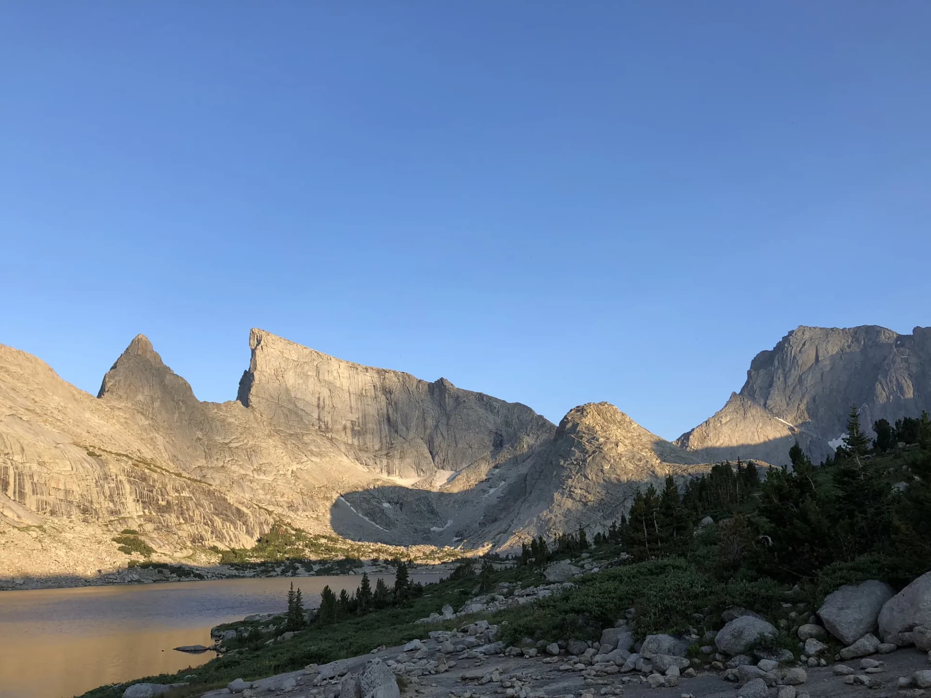
What draws serious hikers and climbers here above all else is Granite Peak. At 12,799 feet, it is the highest point in Montana and one of the more demanding state highpoints in the country. The standard approach from Mystic Lake involves nearly 7,000 feet of elevation gain over 22 miles round-trip, with a summit bid that requires negotiating exposed Class 4 rock and, depending on conditions, a glacier crossing. This is not a casual objective. But the forest also holds hundreds of miles of trails that are thoroughly accessible to anyone willing to spend a week at altitude.
Why Custer Gallatin Stands Out
The Beartooth Plateau
The plateau sits above 10,000 feet for miles in every direction, studded with more than 300 alpine lakes and ringed by peaks that top 12,000 feet. The Beartooth Highway (US-212) climbs to nearly 11,000 feet at Beartooth Pass and provides access to this high country without a multi-day backpacking commitment, though the best experiences come from leaving the road behind. Trails like the Lake Plateau via Fishtail Creek penetrate into areas where you can go an entire day without seeing another party. The area also contains critical grizzly bear habitat. These mountains hold one of the denser concentrations of grizzlies outside Glacier National Park.
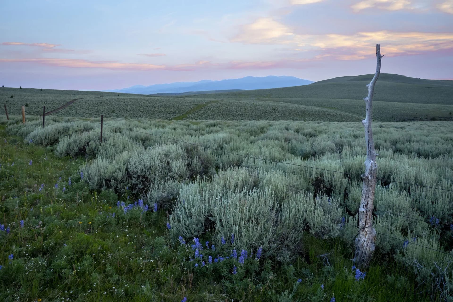
The Crazy Mountains
The Crazy Mountains are geological anomaly and visual spectacle. They rise abruptly from the plains between Billings and Bozeman, a compact range of granite peaks that top out near 11,000 feet. Because they are isolated from other ranges, they receive disproportionate rainfall and snowpack, supporting dense conifer forest and surprisingly lush subalpine meadows. The Crazy Mountains Trail is a serious hike by any measure, gaining 3,000 feet through varied terrain. Access is partly across private land, and hikers must stay on the established right-of-way. Check current land status with the Musselshell Ranger District before heading out.
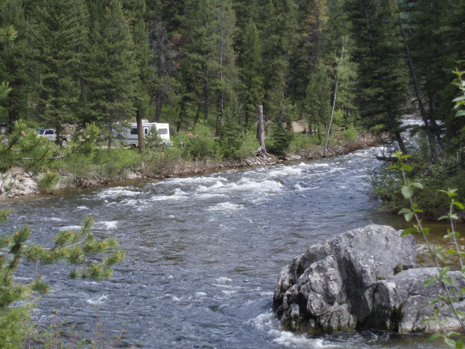
Stillwater River and Low-Elevation Corridors
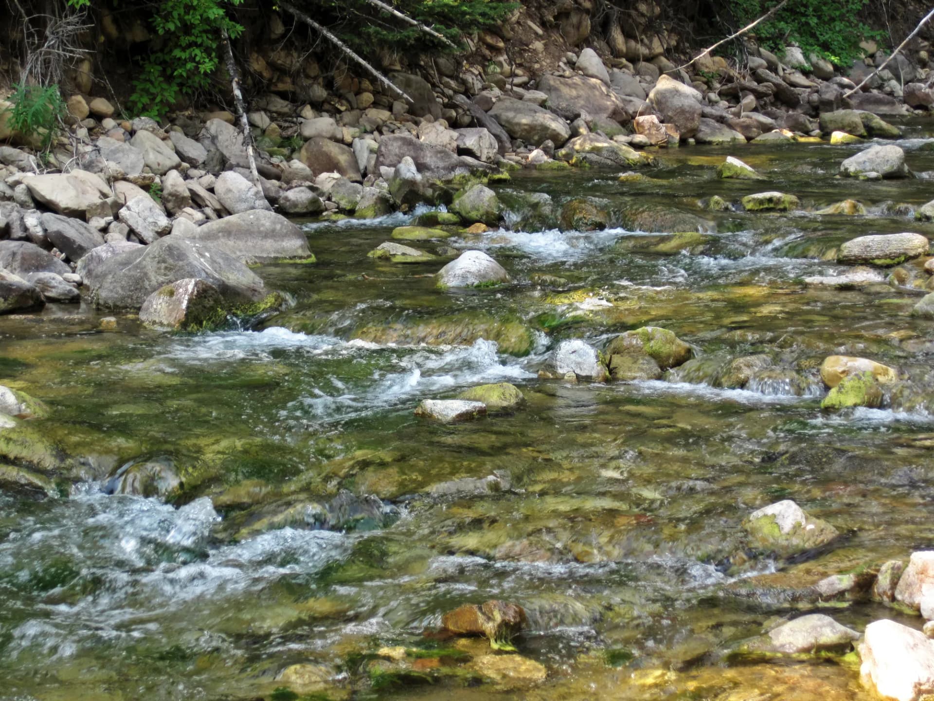
Not every visitor wants to contend with altitude. The Stillwater River Trail offers a genuinely pleasant low-elevation hike through a river corridor famed among fly fishers. The Stillwater is a blue-ribbon trout stream, and the trail follows it through stands of cottonwood and pine. Early summer wildflowers are exceptional here, and the creek provides a natural soundtrack that higher routes cannot match.
Best Trails in Custer Gallatin National Forest
The Granite Peak Summit Approach is the signature objective, a 22-mile round-trip with 7,000 feet of gain that should only be attempted by experienced hikers and climbers with proper gear and a weather window. Most parties camp at Froze-to-Death Plateau and summit on day two.
The Mystic Lake Trail is the most popular full-day hike in the forest, covering 11 miles with 1,700 feet of gain to reach a striking alpine lake at the base of the Beartooth escarpment. It also serves as the standard approach to Granite Peak.
For a more moderate outing with big alpine scenery, the Beartooth Lake Loop makes an 8-mile circuit around one of the most photogenic lakes on the plateau. The Lake Plateau via Fishtail Creek is a 12-mile out-and-back that rewards fit hikers with genuine solitude and a landscape of interconnected lakes above treeline.
Lower on the elevation spectrum, Slough Creek Trail provides easy access to a legendary fly fishing stream, and the Stillwater River Trail offers one of the most pleasant river walks in southern Montana.
Permits and Passes
No permit is required for most day hiking in Custer Gallatin National Forest as of 2026. The five designated wilderness areas (Absaroka-Beartooth, Crazy Mountains (proposed), and others) require self-registration at many trailheads, but there is no fee. Campsite reservations can be made through Recreation.gov for developed campgrounds. If you hold an America the Beautiful pass, it covers day-use fees at developed recreation sites. Veterans may qualify for reduced or waived fees. See our veteran benefits guide for details.
Verify current permit requirements with the appropriate ranger district before any trip. Requirements can change seasonally and year to year.
Camping
Developed campgrounds cluster along the Beartooth Highway corridor near Red Lodge and in the Stillwater drainage. Parkside and Greenough Lake campgrounds near Red Lodge offer convenient base camps for Beartooth access with vehicle sites and basic amenities. Island Lake Campground sits above 9,500 feet and provides direct access to the plateau's trail network, though it typically doesn't open until early July.
Dispersed camping is permitted throughout much of the forest outside developed areas, subject to standard Leave No Trace practices and any site-specific restrictions. See the Leave No Trace principles guide for practices that help maintain the quality of these remote sites. Campfires may be restricted during dry conditions. Check current fire restrictions before your trip.
When to Visit
July and August are the prime months for high-elevation hiking. Snow can linger on north-facing slopes above 10,000 feet well into late June, and the window before September storms can be narrow in the highest terrain. Lower-elevation trails in the Stillwater and Clarks Fork drainages open earlier (often by late May) and remain accessible into October.
Fall brings dramatic color change in the aspen groves and reduced crowds. The Beartooth Highway typically closes for the season by late October. Winter visitors use snowmobiles and cross-country skis to access the backcountry. Before any visit, check current conditions at fs.usda.gov/custer-gallatin and review our conditions-checking guide.
Afternoon thunderstorms are a near-daily occurrence on the plateau in July and August. Plan to be below treeline or off exposed ridges by early afternoon.
Getting There
Red Lodge, Montana, is the eastern gateway town and the most common base for Beartooth access. From Billings, take I-90 west to US-212 south. Red Lodge is about 80 miles from Billings. From Bozeman, access the western portions of the forest via US-191 south toward Big Sky and the Gallatin Canyon.
The Beartooth Highway (US-212) over Beartooth Pass connects Red Lodge to Cooke City and the northeast entrance of Yellowstone National Park. It is one of the more spectacular mountain roads in the country and is closed from approximately mid-October through late May. Check road status before planning a trip over the pass.
Practical Tips
Carry bear spray and know how to use it. Grizzly bear activity is common throughout the forest, particularly in the Absaroka-Beartooth Wilderness and near Yellowstone's northern border. Practice making noise on the trail. Store food and scented items in bear canisters when camping in the backcountry. See our bear canister requirements guide for what is required and recommended in this region.
Many hikers carry 3-4 liters of water capacity for full-day outings in the high country. Water is abundant from streams and lakes, and a filter or purification tablets are strongly recommended. Individual hydration needs vary based on effort, temperature, and acclimatization. At altitude, the effects of dehydration and sun exposure are amplified.
Cell service is absent throughout most of the backcountry. Carry a paper map and compass or a GPS device. The Absaroka-Beartooth Wilderness map published by the Beartooth Publishing Company covers the eastern high-elevation terrain in detail.
Planning Your Trip
The Beartooth Highway corridor near Red Lodge makes a strong base for first-time visitors. Two or three nights at a campground near Red Lodge gives you time for the Beartooth Lake Loop, a day on the Mystic Lake trail, and an afternoon exploring the plateau by car via the highway. For a more remote experience, the Stillwater drainage on the west side of the Beartooths requires more driving but delivers genuine backcountry solitude.
For information on trip planning from the nearest major city, check if a regional guide is available at forestmatters.com/guides. Review our national forest overview if you want to understand how national forests differ from national parks in terms of rules and access before your trip.