Willamette National Forest covers 1.67 million acres of Oregon's central Cascades, stretching roughly 110 miles along the range from the Columbia River tributaries in the north to Diamond Peak in the south. It is bounded on the west by the Willamette Valley, where Eugene and Salem sit within an hour's drive of the forest boundary, and on the east by the volcanic high country near the Three Sisters and Mount Jefferson. That proximity to two of Oregon's largest cities makes it one of the most visited national forests in the Pacific Northwest, second only to Mount Hood National Forest in terms of regional access. For visitors coming from Portland, the best hikes near Portland guide covers how Willamette fits alongside Mount Hood as a destination worth the longer drive south.
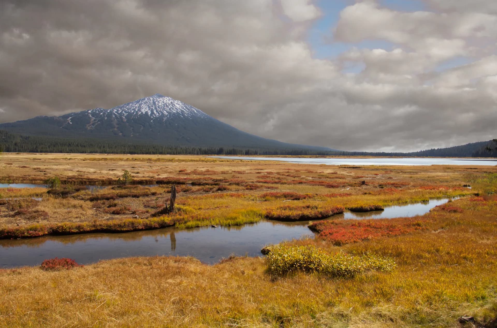
The forest holds eight designated wilderness areas, including a portion of the Three Sisters Wilderness, the largest in Oregon, which it shares with Deschutes National Forest to the east. Mount Jefferson Wilderness anchors the northern reaches of the forest, home to Oregon's second-tallest peak at 10,497 feet. Between those volcanic bookends, visitors find glacier-fed lakes, ancient old-growth Douglas fir stands, one of the Pacific Northwest's premier wildflower destinations on Iron Mountain, and the famous McKenzie River corridor with its impossibly blue water.
Getting There
The forest is accessible from two major corridors. Highway 126, the McKenzie Highway, runs east from Eugene through McKenzie Bridge and into the heart of the forest. This corridor provides access to the McKenzie River Trail, Proxy Falls, the Obsidian Trailhead, and the Three Sisters Wilderness western entry points. From Eugene, allow about an hour to reach McKenzie Bridge and 90 minutes to reach the higher-elevation trailheads near Highway 242 (which is seasonal and typically open from late May or June through October).
Highway 22 provides the northern approach from Salem, running southeast through Detroit and along the North Santiam River toward the Breitenbush area and the Mount Jefferson Wilderness. Salem to Detroit is about 55 miles (roughly one hour). The Detroit Ranger District, which manages the northern portion of the forest, handles permits and information for the Pamelia Lake and Marion Lake trailheads.
From Bend, Highway 242 (McKenzie Pass Highway) connects the east side of the Cascades to the forest's Highway 126 corridor, though this route closes seasonally. The Three Sisters Wilderness can also be accessed from the Deschutes NF side via Highway 46 (Cascade Lakes Highway), but the primary Willamette entry points are on the western side.
Gas up in Eugene, Salem, or Bend. Services are limited inside the forest, and many forest roads extend well beyond the last gas station.
Top Trails
Willamette National Forest offers a diverse spread of trail experiences, from short waterfall loops to multi-day wilderness traverses. Here are eight of the best.
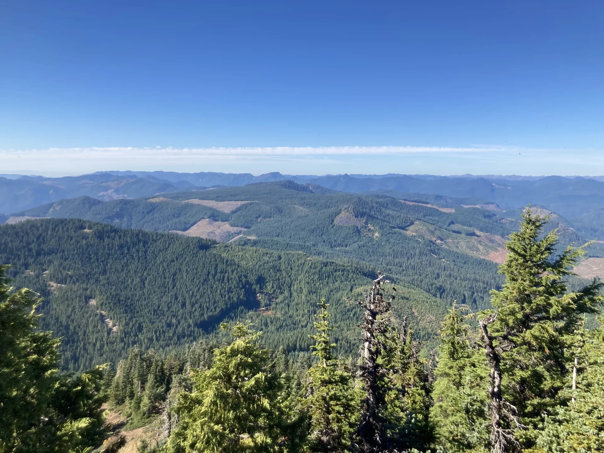
Iron Mountain is the undisputed wildflower destination of the Willamette. The 3.5-mile out-and-back climbs 1,368 feet to a summit observation platform at 5,440 feet on Highway 20 east of Sweet Home, passing through eleven distinct wildflower habitats with over 300 species. The bloom is considered best from mid-June through mid-July. The views from the summit platform take in the entire Cascade Range from Mount Jefferson south to the Three Sisters.
Pamelia Lake is the most scenic and popular approach into the Mount Jefferson Wilderness. The 4.4-mile out-and-back (800 feet gain) reaches a large, forest-ringed lake beneath the ice-draped flanks of Mount Jefferson at 4,086 feet. A Central Cascades Wilderness Permit is required between June 15 and October 15. Reserve through Recreation.gov well in advance, as this trailhead fills quickly.
Marion Lake offers a slightly more accessible route into the same wilderness area. The 5.2-mile loop gains 935 feet and passes Lake Ann before arriving at Marion Lake, one of the larger alpine lakes in the Oregon Cascades. The same Central Cascades permit applies. The loop format keeps the hike engaging in both directions.
Proxy Falls is a short but memorable waterfall loop near McKenzie Pass. The 1.6-mile circuit at 3,100 feet passes through open lava fields and dense old-growth forest, reaching two waterfalls: Upper Proxy Falls drops roughly 226 feet in a wide fan across a basalt cliff, and Lower Proxy Falls disappears into a porous lava field with no visible outlet. Highway 242 must be open (typically late May or June through October) to reach the trailhead.
The Obsidian Trail leads into the Three Sisters Wilderness through a landscape unlike anything else in the Willamette Valley's reach. The roughly 12-mile out-and-back route crosses recent lava flows, skirts Obsidian Falls, and reaches the icy moraines below North and Middle Sister. This is a Limited Entry Area with a daily permit quota enforced June 15 through October 15. Reserve through Recreation.gov well ahead of your trip.
The McKenzie River Trail is the forest's National Recreation Trail, running 26 miles from the headwaters of Clear Lake downstream through old-growth forest, volcanic formations, and past Tamolitch Falls (the famous "Blue Pool" that emerges from a lava tube). Most hikers do sections of the trail or arrange a shuttle for the full point-to-point. It is also popular for mountain biking.
Erma Bell Lakes in the Three Sisters Wilderness offers a gentler introduction to the wilderness, with a 5.3-mile out-and-back (800 feet gain) through lush forest to a series of mountain lakes stocked with trout. The trail passes Lower, Middle, and Upper Erma Bell Lakes along with several smaller tarns. Note that the mosquito season is intense through mid-July; plan accordingly or bring effective repellent.
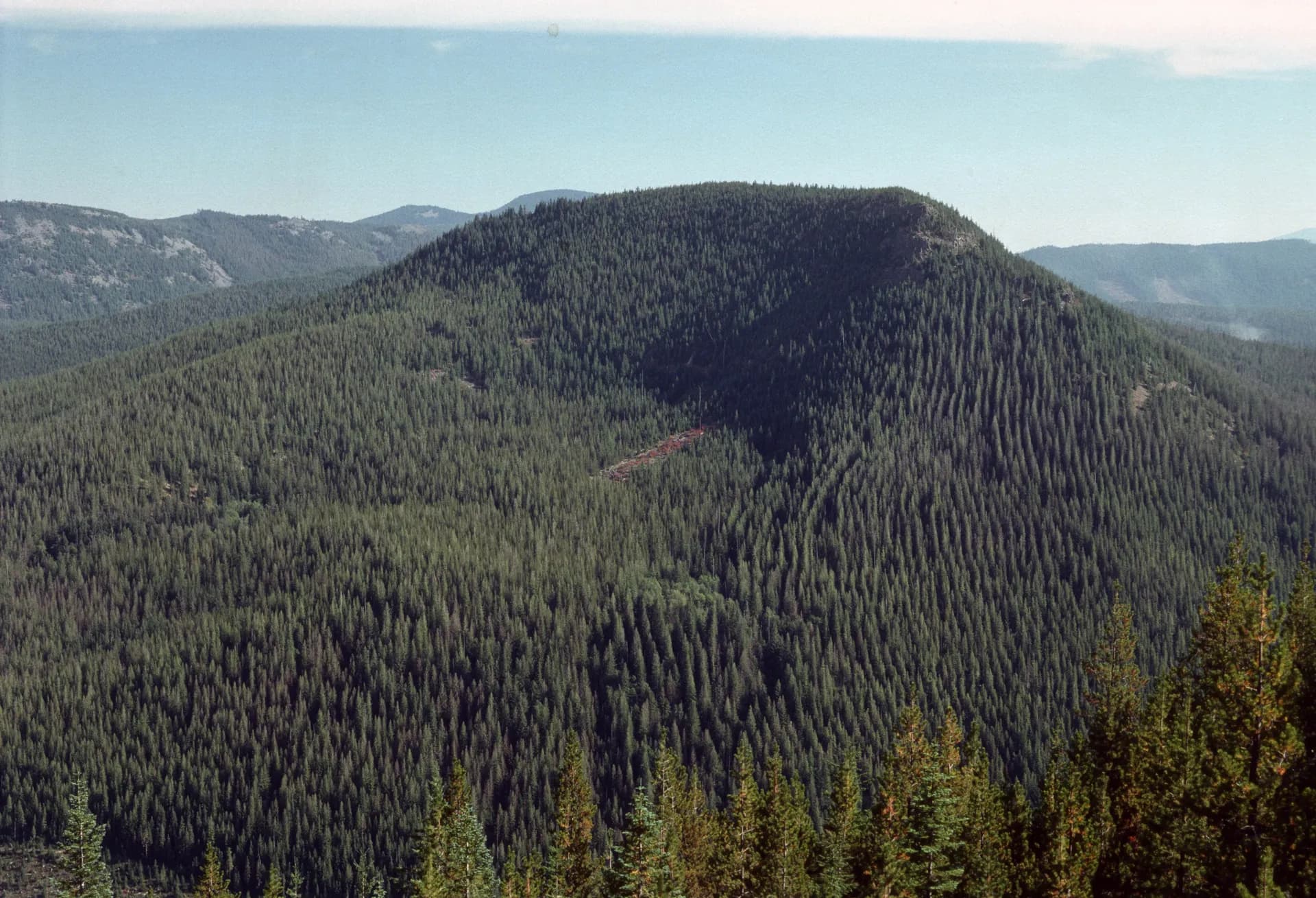
Chucksney Mountain is a demanding solitude hike that rewards with panoramic views across the South Fork McKenzie River drainage and toward the Three Sisters. The 10.7-mile out-and-back gains 2,381 feet and sees far fewer visitors than the permit-zone trailheads to the north. This is an excellent option when Central Cascades permit quotas are full.
Camping
Willamette National Forest has more than 70 developed campgrounds and extensive opportunities for dispersed camping in non-wilderness areas. Developed campground reservations are managed through Recreation.gov. Many popular campgrounds book out quickly for summer weekends, so reserve as early as possible.
Cold Water Cove Campground sits beside Clear Lake on the McKenzie Highway (Highway 126) at 3,040 feet. The 34 sites (including some reservable) accommodate RVs up to 50 feet. It is a logical base camp for the McKenzie River Trail or Proxy Falls. The campground typically opens in late May and runs through early October, with fees around $22 to $46 per night (verify current fees at Recreation.gov).
Breitenbush Campground is located about 10 miles east of Detroit on the Breitenbush River at 2,100 feet. The 29 sites (23 reservable) offer access to the Mount Jefferson Wilderness and the Pamelia Lake trailhead, both accessible within a 20-minute drive. Fees ran approximately $21 to $40 per night as of early 2026 — verify current fees at Recreation.gov before booking. Note that the campground has had intermittent closures due to flood and fire rehabilitation work; verify availability before making plans.
Marion Forks Campground is a small, first-come, first-served site near Highway 22 and Marion Creek Road, convenient for the Marion Lake trailhead. The 15 sites are rustic and low-cost (around $15 per night as of early 2026 — verify current fees before visiting). It is a practical option when developed campgrounds are full.
Dispersed camping is permitted throughout most of the forest outside wilderness areas, provided you camp at least 200 feet from water sources and trails. A Northwest Forest Pass is still required for any vehicle left at a developed trailhead. In wilderness areas, additional regulations apply, including no campfires within 100 feet of lakes and streams in some zones.
Permits and Fees
As of 2026, two passes cover most activities in Willamette National Forest.
Northwest Forest Pass: Required for parking at most developed trailheads throughout the forest. Day passes cost $5 per vehicle; an annual pass is $30. The Interagency Annual Pass ($80) and America the Beautiful Senior Pass also work at these trailheads. Passes are available at ranger stations, Recreation.gov, and many outdoor retailers.
Central Cascades Wilderness Permits: Required between June 15 and October 15 for day and overnight use at designated high-use trailheads in the Two Sisters and Mount Jefferson area. Affected trailheads include Pamelia Lake, Marion Lake, and the Obsidian Limited Entry Area, among others. Day-use permits cost $1 per person; overnight permits are $6 per permit. Permits are released on a rolling window through Recreation.gov. Verify current quota numbers and release dates with the ranger district, as the system has evolved in recent seasons.
Fire restrictions: During periods of high fire danger (typically July through October), campfire restrictions frequently limit or ban wood fires and sometimes camp stoves throughout the forest and wilderness areas. Check the forest website or call a ranger district before any trip that involves a stove or fire.
Wildlife and Ecology
The forest spans an extraordinary elevation range, from about 1,000 feet in the lower McKenzie River valley to over 10,000 feet on Mount Jefferson's flanks. That vertical range creates a sequence of ecological zones: valley Douglas fir and western red cedar forest at lower elevations, Pacific silver fir and mountain hemlock in the mid-elevation zone, subalpine parkland and meadows above 5,500 feet, and bare rock and glaciers on the high volcanic peaks.
Mammals: Black bears are present throughout the forest. Practice proper food storage at all camps. Roosevelt elk range the lower valleys, particularly in the North Santiam and McKenzie drainages. Mountain lions are present but rarely seen. Pikas, marmots, and black-tailed deer are common at higher elevations.
Birds: The old-growth forest supports spotted owls and marbled murrelets. Northern goshawks and osprey are regularly observed along the McKenzie and Santiam rivers. Gray jays appear at virtually every backcountry camp. The high wilderness meadows host white-tailed ptarmigan and rosy finches.
Fish: The McKenzie River is one of Oregon's premier wild trout streams, with populations of native cutthroat and steelhead. The North Santiam drainage supports runs of Chinook salmon and winter steelhead. Many high-country lakes, including Marion Lake and the Erma Bell Lakes, are stocked with brook and rainbow trout.
Old-growth forest: The western portions of the forest, particularly in the lower McKenzie drainage and areas that escaped recent fires, contain impressive stands of old-growth Douglas fir, western red cedar, and bigleaf maple. Some of the ancient trees along the McKenzie River Trail exceed 500 years in age.
Best Time to Visit
Summer (June through September): The primary season. High-elevation trails typically clear of snow by late June in average snowpack years, though heavy snow years may push that window into mid-July. The Leave No Trace principles are particularly important here: fragile alpine meadows can take decades to recover from off-trail foot traffic. Expect full trailhead parking lots on weekend mornings at popular destinations. Arrive early or plan weekday trips.
Fall (October through November): An underrated season. Crowds diminish sharply after Labor Day, and vine maple and huckleberry turn brilliant red and orange through the lower forests in October. Overnight temperatures drop quickly, and the first snowfall on higher terrain can arrive by mid-October. Many campgrounds close by early October.
Winter (December through March): Lower-elevation trails such as the McKenzie River corridor remain accessible much of the winter, though conditions are often wet and muddy. Highway 242 (McKenzie Pass Highway) closes seasonally and is typically not passable until late May or June. Snowshoeing and cross-country skiing are possible in the higher-elevation zones.
Spring (April through May): A transitional window. Lower-elevation trails open progressively, and waterfalls run at full power from snowmelt. Higher routes remain closed under snow. Spring is the best season for solitude and river fishing.
Tips for Your Visit
Plan permits early. Central Cascades Wilderness Permits for the Pamelia Lake, Marion Lake, and Obsidian trailheads sell out weeks or months in advance during peak season. Check the Recreation.gov release calendar each year and set reminders.
Download maps before you go. Cell service is limited to none throughout most of the forest, including in the McKenzie River corridor. Download offline maps via Gaia GPS, AllTrails, or USFS Motor Vehicle Use Maps before leaving town.
Carry water treatment gear. Giardia is present in many backcountry water sources. Treat or filter all water from streams and lakes. A lightweight filter or UV purifier is strongly recommended for multi-day trips.
Consider alternatives when permits are full. When Central Cascades permit quotas are taken, Chucksney Mountain, the McKenzie River Trail below Trail Bridge Reservoir, and the Diamond Peak Wilderness on the forest's southern end offer excellent hiking with no permit requirement. Deschutes National Forest to the east also provides nearby alternatives.
Bear safety. Black bears are active throughout the forest, especially in late summer when huckleberries ripen. Use bear canisters or hang food when camping in the backcountry. The USFS recommends reviewing bear safety guidelines before any overnight trip. See our guide to bear canister requirements for planning specifics.
Check for fire restrictions before using any stove or fire. As Oregon's fire seasons have become more severe in recent years, restrictions often take effect by mid-July. Violations carry significant fines and put firefighting resources at risk.
Road conditions. Many forest roads are unpaved and seasonally gated. High-clearance vehicles are recommended for some trailheads, particularly those accessed via Forest Service roads off Highway 242. Check the Willamette National Forest road conditions page and verify that your target road is open before driving a long distance to reach a trailhead.