Rising from the Wyoming Plains
Bighorn National Forest rises abruptly from the sagebrush and grass plains of north-central Wyoming, the Bighorn Mountains appearing almost as a wall from the east as travelers approach on US-14 from Sheridan. The forest covers 1,115,000 acres of this isolated mountain range, which stands separate from the main Rocky Mountain chain to the west. The Bighorns were glaciated during the last ice age, and the evidence is everywhere in the high country: polished granite, more than 200 alpine lakes in glacially carved basins, and the classic U-shaped profile of the main valley corridors.
The forest is divided between its dramatic alpine core (the Cloud Peak Wilderness) and the canyon lands on both flanks. The eastern approach via US-14 climbs through Tensleep Canyon, a limestone gorge of exceptional geology that makes the drive itself worth the trip. The western approach via US-14A drops down through switchbacks past Medicine Wheel National Historic Landmark and the Bighorn Canyon overlook country. Between these bookend entries lies a forest of considerable variety and genuine high-country wilderness.
Why Bighorn National Forest Stands Out
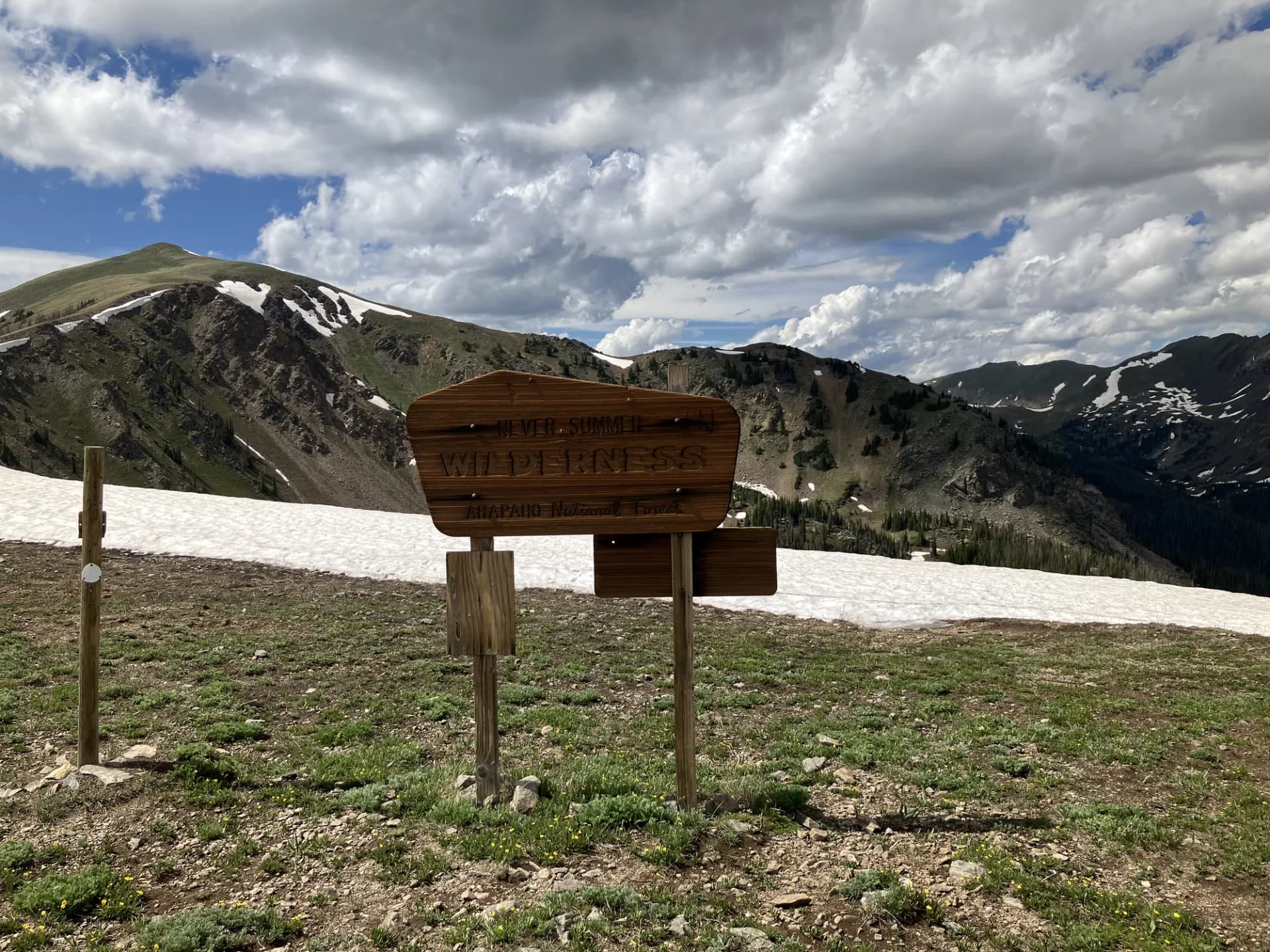
Cloud Peak Wilderness and the Alpine Lakes
The Cloud Peak Wilderness covers 189,000 acres of the highest Bighorn terrain, centered on Cloud Peak at 13,175 feet. The wilderness contains more than 200 named and unnamed alpine lakes, most of them accessible by trails that fan out from trailheads along US-16. The lakes range from small tarns above 11,000 feet to larger basins holding good populations of cutthroat trout. The wilderness interior is traversed by the Cloud Peak Skyway and by dozens of connecting routes that allow multi-day travel through the high country.
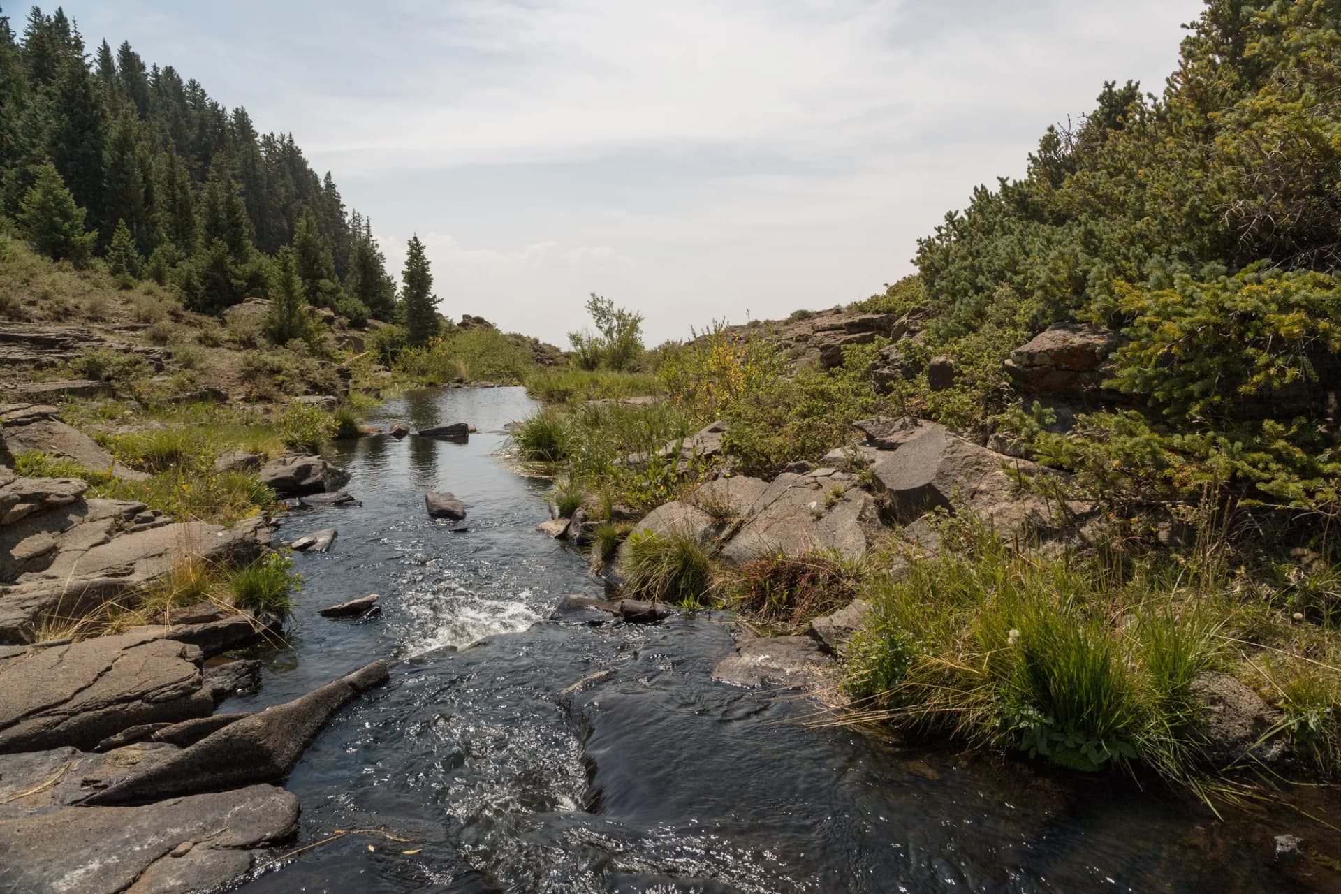
Tensleep Canyon and the Limestone Escarpment
Tensleep Canyon on the western flank of the Bighorns is one of the most geologically striking limestone canyons in the northern Rockies. Tensleep Creek has carved a gorge through Permian limestone layers over millions of years, and the canyon walls are textured with solution features, caves, and color banding that tells the story of ancient sea beds now elevated to 6,000 feet. The canyon is also known for sport rock climbing on its limestone faces.
Medicine Wheel and Native American Heritage
Medicine Wheel National Historic Landmark sits at 9,642 feet on Medicine Mountain, one of Wyoming's most significant pre-European cultural sites. The stone structure is estimated at 5,000 years old and is considered sacred by the Crow, Lakota, Arapaho, and many other tribes. Access is by a 1.5-mile road walk from a seasonal gate; the forest manages a consulting process with affiliated tribes for interpretive programs.
Best Trails
Cloud Peak Summit Trail (22.0 miles, out-and-back) is the multi-day classic of the forest, traversing the Cloud Peak Wilderness to the highest summit in the Bighorns. A technical mountaineering objective.
Tensleep Canyon Trail (5.0 miles, out-and-back) follows Tensleep Creek through the canyon walls for a geological tour of the western escarpment.
Solitude Loop (8.0 miles, loop) traverses the mid-elevation forest near Sheridan with ridge views and meadow sections popular as a day hike from the eastern approach.
Hunter Corrals Trail (4.5 miles, out-and-back) accesses the Cloud Peak Wilderness lake country from the eastern trailhead area, visiting the first of the high alpine lakes.
Mistymoon Lake Trail (7.6 miles, out-and-back) is one of the most popular lake hikes in the wilderness, reaching a striking high-alpine lake below the Cloud Peak massif.
Edelman Pass Trail (9.0 miles, out-and-back) crosses the high divide of the Bighorns to a saddle with views into the western canyon country.
Bucking Mule Falls Trail (2.0 miles, out-and-back) visits a spectacular 600-foot waterfall on the eastern escarpment of the Bighorns near the Tongue River canyon.
Medicine Wheel Trail (3.0 miles, out-and-back) walks the gated road to the Medicine Wheel National Historic Landmark on Medicine Mountain.
Permits and Passes
No permit is required for day hiking or dispersed camping in Bighorn National Forest or the Cloud Peak Wilderness (as of 2026). Developed campground sites range from $10 to $22 per night and most are first-come, first-served, with Sibley Lake Campground reservable through Recreation.gov (as of 2026).
The America the Beautiful Pass covers day-use fees at developed recreation areas. Veterans may qualify for additional benefits. See America the Beautiful Pass for Veterans and Veteran Benefits in National Forests for current details.
Camping
Tensleep Canyon Campground on the western approach off US-16 provides 38 sites in the canyon environment. First-come, first-served. Water and pit toilets.
Sibley Lake Campground north of US-14 near Burgess Junction offers 25 sites with a small lake nearby. Reservable through Recreation.gov. This is the most developed and popular campground in the northern section.
Circle Park Campground is a small, high-elevation campground in the Cloud Peak area providing a base camp for wilderness access. Ten sites, first-come, first-served.
Dispersed camping is available throughout most of the forest and in the Cloud Peak Wilderness with standard setback rules.
When to Visit
Late June through July is when the high country opens. Snow typically melts from major trail corridors by early July, though passes can hold drifts into late July in heavy snow years. Wildflowers peak in July and early August in alpine meadows.
August is the most stable high-country weather window. Afternoon thunderstorms are possible but mornings are typically clear and cool. The wilderness lakes are at their best accessibility and the fishing is excellent.
September brings early fall conditions. The first autumn storms can drop snow above 10,000 feet. Elk begin bugling in the meadows. The wilderness crowds thin dramatically after Labor Day.
October through May the high country is snowbound. The canyon trails on the flanks remain accessible through October. The Bighorn plateau receives heavy snowfall from November through May, making cross-country skiing and snowmobile access the primary winter activity.
Getting There
From Sheridan: US-14 climbs the eastern escarpment from Sheridan into the heart of the forest. The switchback section above Burgess Junction is one of the most dramatic mountain road climbs in Wyoming. Approximately 28 miles from Sheridan to Burgess Junction, about 45 minutes.
From Buffalo: US-16 crosses the forest from east to west via Ten Sleep Canyon. The 35-mile drive from Buffalo to Tensleep provides access to the southern and western portions of the forest. About 40 minutes.
From Worland: US-16 east from Worland climbs through Tensleep Canyon to the forest interior. Approximately 55 miles to Burgess Junction, about one hour.
Practical Tips
The Cloud Peak Wilderness is true alpine terrain above treeline. Weather can change rapidly, and afternoon thunderstorms are a daily occurrence in summer. Always start summit and ridge hikes early, aiming to be below exposed terrain before 1 PM. Lightning strikes above treeline are a significant hazard.
Grizzly bears do not inhabit the Bighorns, but black bears are present. Store food properly and follow best practices for the area. Mountain lions also inhabit the forest. Moose frequent the willow-lined drainages at all elevations.
Fishing the alpine lakes requires a Wyoming fishing license. Cutthroat trout are native to many high lakes and provide excellent fly fishing. Bait fishing regulations vary; check current Wyoming Game and Fish regulations before fishing.
Check current road and trail conditions at checking conditions before you go before visiting the high country, as seasonal road openings vary by snow year. Practice Leave No Trace principles throughout, particularly around the heavily used alpine lake trailheads where concentrated camping has historically impacted fragile soils.