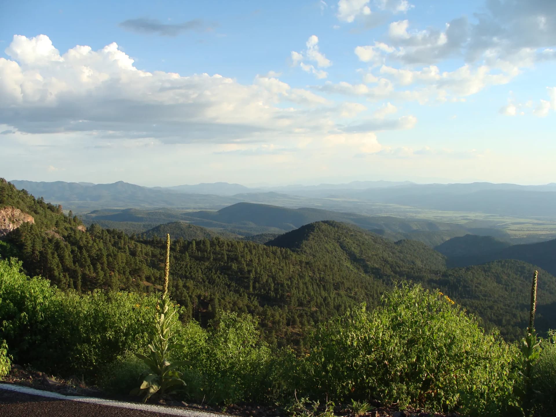
Cibola National Forest wraps around central New Mexico in four separate mountain blocks, the most prominent being the Sandia Mountains that form the dramatic eastern escarpment above Albuquerque. The Sandias rise over 5,400 feet in horizontal distance from the city grid to Sandia Crest at 10,678 feet, one of the steepest urban mountain fronts in North America. This proximity to Albuquerque, home to nearly one million people, makes Cibola one of the most used urban-adjacent national forests in the Mountain West.
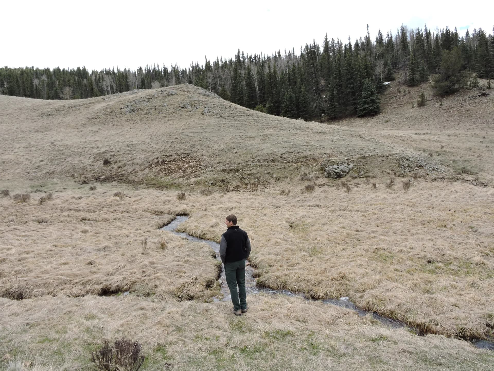
The forest's second major mountain is Mount Taylor at 11,301 feet near Grants, New Mexico. Mount Taylor is culturally significant to multiple Indigenous nations and is the dominant summit of the San Mateo Mountains west of Albuquerque. The Manzano Mountains to the south of the Sandias complete the main highland areas, offering cooler, less-visited hiking with strong fall color. Across these ranges, Cibola's 700 miles of trail serve a wide range of hikers from urban day-trippers to serious wilderness seekers.
Why Cibola Stands Out
Urban Wilderness at Its Best. The Sandia Mountains are the most-visited portion of the forest and exemplify what urban wilderness access means at its highest level. The La Luz Trail climbs the sheer west face of the Sandias from the foothills to the crest in 7.5 miles, gaining over 3,600 feet through limestone cliffs and dense Douglas fir forest. The South Crest Trail traverses the gentle ridgeline from Sandia Crest southward with views on both sides. Both trails are a 25-minute drive from downtown Albuquerque, and neither feels urban once the trailhead is left behind.
Mount Taylor's Cultural and Physical Significance. Mount Taylor is not just a high peak. For the Navajo Nation, Acoma Pueblo, Laguna Pueblo, and other Indigenous peoples, it is one of the four sacred mountains defining the boundaries of their traditional homeland. The mountain's significance predates European contact by centuries. Hikers who visit should approach it with awareness of this context. The peak itself is a substantial summit at 11,301 feet, requiring a 13-mile round trip through ponderosa and spruce-fir forest.
Year-Round Accessibility. The Sandia Mountains' orientation and Albuquerque's mild climate make Cibola hiking practical in every month. The foothills trails are open in January; the crest trails accumulate snow but remain popular for winter hiking with microspikes. This extended seasonal window is unusual for a forest with summits above 11,000 feet.
Best Trails in Cibola National Forest
La Luz Trail (7.5 miles one-way or 15 miles round trip) is the classic Sandia challenge: the west face route from the La Luz Trailhead to Sandia Crest through limestone formations, ponderosa, and spruce-fir. The route gains 3,600 feet in a direct, sustained climb. Many hikers descend by tram rather than retracing. See the La Luz Trail guide.
Mount Taylor Summit Trail (13 miles round trip) climbs New Mexico's sacred mountain from the southeast through ponderosa pine and mixed conifer to the summit at 11,301 feet. See the Mount Taylor trail guide.
South Crest Trail (8 miles round trip) traverses the southern Sandia ridgeline from Sandia Crest with views of both the Albuquerque basin and the Estancia Valley. Less demanding than La Luz but still a rewarding high-altitude ridge walk. See the South Crest Trail guide.
Tree Spring Trail (4 miles round trip) offers a shorter access route to the Sandia crest area from the east side, suitable for hikers wanting a taste of the upper Sandias without the full La Luz commitment. See the Tree Spring Trail guide.
Permits and Passes
No permits are required for day hiking or wilderness access in Cibola National Forest as of 2026. Developed campground fees apply at sites requiring payment. Verify current requirements with the applicable ranger district before any trip.
The America the Beautiful Pass is accepted at applicable fee areas in the forest.
Camping
Developed campgrounds serve the major hiking areas. Fourth of July Campground in the Manzano Mountains is the most scenic developed option, with 25 sites in a beautiful aspen-and-spruce setting. Sulphur Canyon Campground near the Juan Tabo area provides 8 sites close to the Sandia west face trailheads.
Dispersed camping is permitted in designated areas following Leave No Trace guidelines. The Sandia Mountain Wilderness prohibits overnight camping within a quarter-mile of Sandia Crest. Review the national forest camping guide for current regulations.
When to Visit
The Sandia foothills and lower mountain trails are accessible year-round, though winter conditions require appropriate footwear. The upper Sandias (La Luz, South Crest, Tree Spring) are best from April through November; winter hiking is possible but requires microspikes or crampons in icy conditions. Mount Taylor is best from May through October.
Summer monsoon season brings afternoon thunderstorms from mid-July through September. The Sandia Crest and ridgelines are lightning hazards. Plan summit and ridgeline hikes for morning completion.
Getting There
The Sandia Mountains are reached from Albuquerque via Tramway Road (for west-face trailheads) or NM Highway 536 (Crest Road) from Tijeras east of the city for east-face and crest trailheads. The drive to Sandia Crest via Crest Road takes approximately 35 minutes from Albuquerque.
For Mount Taylor, take I-40 west from Albuquerque toward Grants, approximately 75 miles. From Grants, follow forest road signs toward the Mount Taylor trailhead east of town.
Practical Tips
The Sandias rise 5,400 feet above Albuquerque, and the weather on the crest is genuinely different from the city. Temperature differences of 20 to 30 degrees between the city and the crest are common. Carry layers even on warm Albuquerque days when heading to the upper mountain.
Rock climbing is popular on the Sandia west face limestone formations. Climbers should check with the Sandia Ranger District for current access and any seasonal restrictions for raptor nesting areas.
Bears are present in the Sandia and Manzano mountains. Store food properly and follow bear canister guidelines for overnight trips.
Planning Your Trip
Cibola National Forest is managed by the Sandia, Mountainair, Mount Taylor, and Magdalena Ranger Districts. The Sandia Ranger District covers the primary hiking areas around Albuquerque.
Compare Cibola with neighboring Santa Fe National Forest to the north (Jemez Mountains and Sangre de Cristo) and Carson National Forest farther north near Taos for a full picture of New Mexico's national forest hiking options. The three forests together cover the highlands of central and northern New Mexico.
Veterans and active military can use the Military Annual Pass and America the Beautiful Access Pass at applicable fee areas throughout Cibola National Forest. See the veteran benefits guide for a full summary.