The Wild Lochsa Corridor
Clearwater National Forest protects approximately 1,800,000 acres of the most remote forest land in northern Idaho, anchored by the wild Lochsa River canyon and the southern reaches of the vast Selway-Bitterroot Wilderness. It forms the southern portion of the combined Nez Perce-Clearwater National Forest administrative unit, sharing resources with the Nez Perce section to the north while maintaining a distinct character defined by river canyons, old-growth forests, and some of the largest roadless country in the lower 48 states.
US-12, the Lolo Motorway, follows the Lochsa River through the forest from the Lochsa-Selway confluence to Lolo Pass on the Montana border. This highway is one of the most dramatic mountain drives in the Pacific Northwest, traversing river canyon and passing through country that Lewis and Clark crossed in 1805 on the most difficult section of their entire expedition. The highway provides access to most of the forest's trailheads, campgrounds, and visitor infrastructure. Beyond the highway corridor, Clearwater is genuinely wild: vast roadless drainages, minimal maintained trails, and the kind of silence that has become uncommon in the American West.
Selway-Bitterroot Wilderness
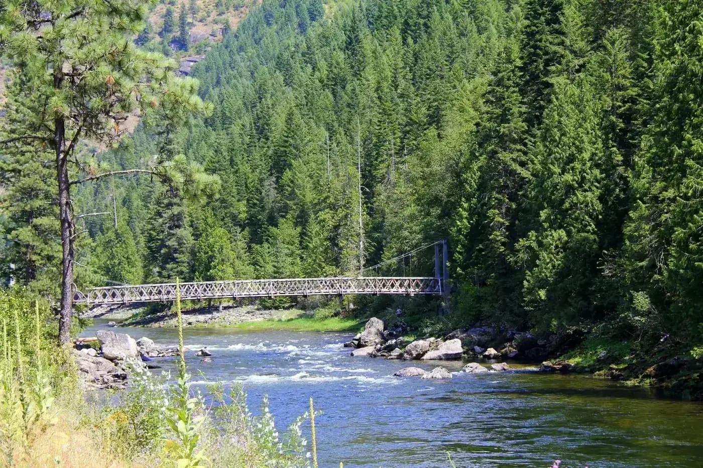
The Selway-Bitterroot Wilderness spans portions of Idaho and Montana and ranks among the largest wilderness areas in the contiguous United States at 1.3 million acres. The Clearwater section contains significant portions of this wilderness, including the upper Selway River drainage. The Selway is one of the premier wilderness rivers in North America, a Class III-V canyon accessible only by trail or permitted river launch. The lottery-based permit system for the Selway River protects the wilderness character of this corridor, which sees far fewer visitors than its quality would suggest possible.
The Selway-Bitterroot backcountry is primarily the domain of experienced backpackers comfortable with cross-country travel, high water crossings in early season, and navigation in terrain where maintained trails are sparse. Elk hunters fill the backcountry in September and October, representing the bulk of human presence through much of the wilderness each year.
Lochsa Historical Trail
The Lochsa Historical Trail follows the ridge system above the river canyon through country that the Nez Perce people used for centuries as a travel corridor between the Columbia Plateau and the bison grounds of Montana. Lewis and Clark struggled across this same ridge in September 1805, near starvation and thoroughly lost without their Nez Perce guides. The trail provides a different perspective on the river canyon than the highway corridor below, with long views into the Selway drainage and across to the Montana border ridges.
The full trail runs approximately 28 miles one-way, typically done as a shuttle trip over two to three days. Shorter day hike segments are accessible from several highway pullouts.
Best Trails
Lochsa Historical Trail (28.0 miles, point-to-point) follows the historic Nez Perce travel route along the ridge above the Lochsa River. The trail is best done as a multi-day shuttle with a vehicle at each end. Views across the river canyon and into the Selway drainage are exceptional.
Selway River Trail (19.0 miles, out-and-back from trailhead at Selway Falls) follows the river deep into the Selway-Bitterroot Wilderness. The trail provides access to one of the most intact river ecosystems in Idaho without requiring a raft permit.
Canyon Creek Trail (8.0 miles, out-and-back) climbs a tributary drainage off the Lochsa with old-growth western redcedar at lower elevations and open subalpine terrain above. One of the better day hikes accessible directly from US-12.
Meadow Lake Trail (6.0 miles, out-and-back) reaches a high lake in the Bitterroot divide country with views into both Idaho and Montana. A moderate approach with significant elevation gain in the final mile.
Bald Mountain Summit (9.0 miles, out-and-back) is a ridge-walk route with panoramic views across the Lochsa and Selway drainages. Popular as a day hike for visitors camped along US-12.
Permits and Passes
Day hiking and dispersed camping require no permit in Clearwater National Forest (as of 2026). The Selway River requires a permit for river launches during the peak season (May 15 through July 31), allocated by a Recreation.gov lottery system. Apply well in advance if planning a river trip.
Review bear canister requirements for overnight trips in the Selway-Bitterroot Wilderness. The dispersed camping guide covers general rules applicable throughout the forest.
Camping
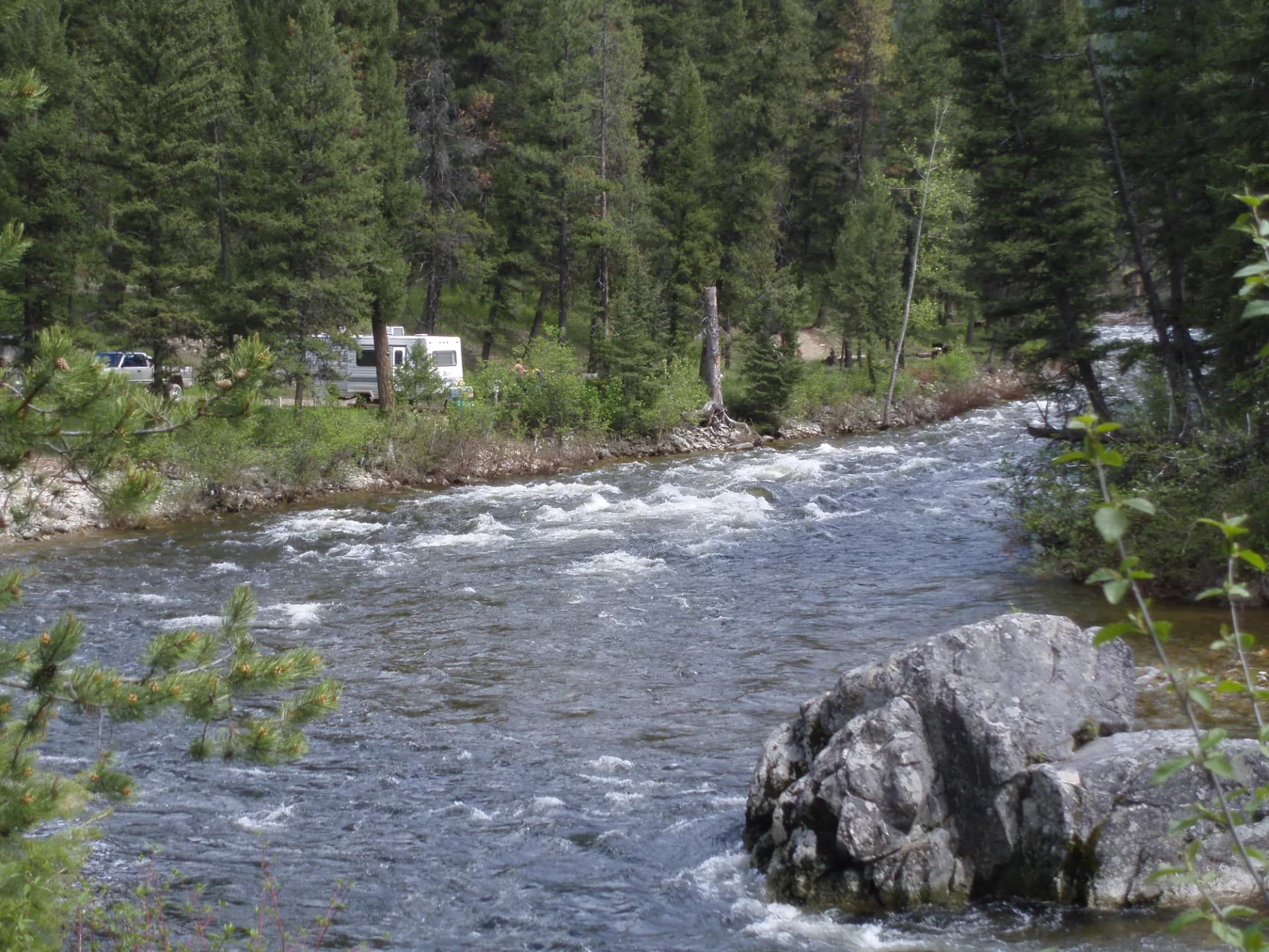
Powell Campground and Wilderness Gateway Campground are the primary developed facilities along US-12, serving as bases for both river recreation and hiking. Wilderness Gateway (89 sites) is the largest and most popular, sitting at the Selway River junction. Most smaller campgrounds along the highway are first-come, first-served.
Dispersed camping is available throughout the forest along forest roads and away from developed areas. The river corridor campgrounds fill on summer holiday weekends; arrive midweek for reliable site availability.
When to Visit
June through October is the general hiking season. The Lochsa River peaks in May and June, making that period best for river recreation. High-country trails in the Selway-Bitterroot are snow-free by late July. September brings elk hunting season and spectacular fall color in the canyon's deciduous trees.
Check current conditions at checking conditions before you go before any visit, particularly river levels in spring and fire conditions in late summer. Practice Leave No Trace principles throughout, especially in the low-traffic wilderness areas where impact recovery is slow.
Getting There
From Missoula, Montana, take US-12 west over Lolo Pass. The highway enters the Clearwater section immediately after the pass and follows the Lochsa River for about 70 miles to the Selway River junction at Lowell, then continues west to Kooskia. Most trailheads are accessed directly from highway pullouts along this route.