Davy Crockett National Forest covers 162,000 acres of East Texas Pineywoods in Houston and Trinity Counties, protecting the longleaf and loblolly pine uplands and Neches River bottomland of the historic Texas timber belt. Named for the frontiersman and Alamo defender who traveled through this region in 1836, the forest is a working public land that balances timber management with recreation, wildlife habitat, and longleaf pine restoration. The Four C National Recreation Trail, one of the better backpacking routes in the Texas national forests, runs 20 miles through the forest's core from Ratcliff Lake to the Neches River.
The town of Crockett, Texas sits 12 miles from the forest boundary, making it the natural gateway and supply point for visitors. The forest is far enough from Houston (130 miles) and Dallas (200 miles) to feel genuinely remote during the week, though spring and fall weekends can see traffic at Ratcliff Lake and the Four C trailheads. The surrounding landscape is quintessential East Texas: rolling sandy hills, dense pine and hardwood, and the Neches River corridor that forms the eastern edge of the forest.
Why Davy Crockett Stands Out
Four C Trail. The 20-mile trail is the forest's signature achievement. The route passes through diverse habitats from the pine uplands around Ratcliff Lake to the Neches River bottomland in the south, with creek crossings, longleaf restoration zones, and mature hardwood groves along the way. Most backpackers take 2 days, camping at one of the primitive sites near the midpoint.
Ratcliff Lake. The 45-acre lake and adjacent campground are the recreational heart of the forest. The swimming beach, campground, and trail access make Ratcliff Lake a complete family recreation destination. The lake was originally constructed in the 1930s as part of the same era of public works that built the Boykin Springs facilities in Angelina National Forest.
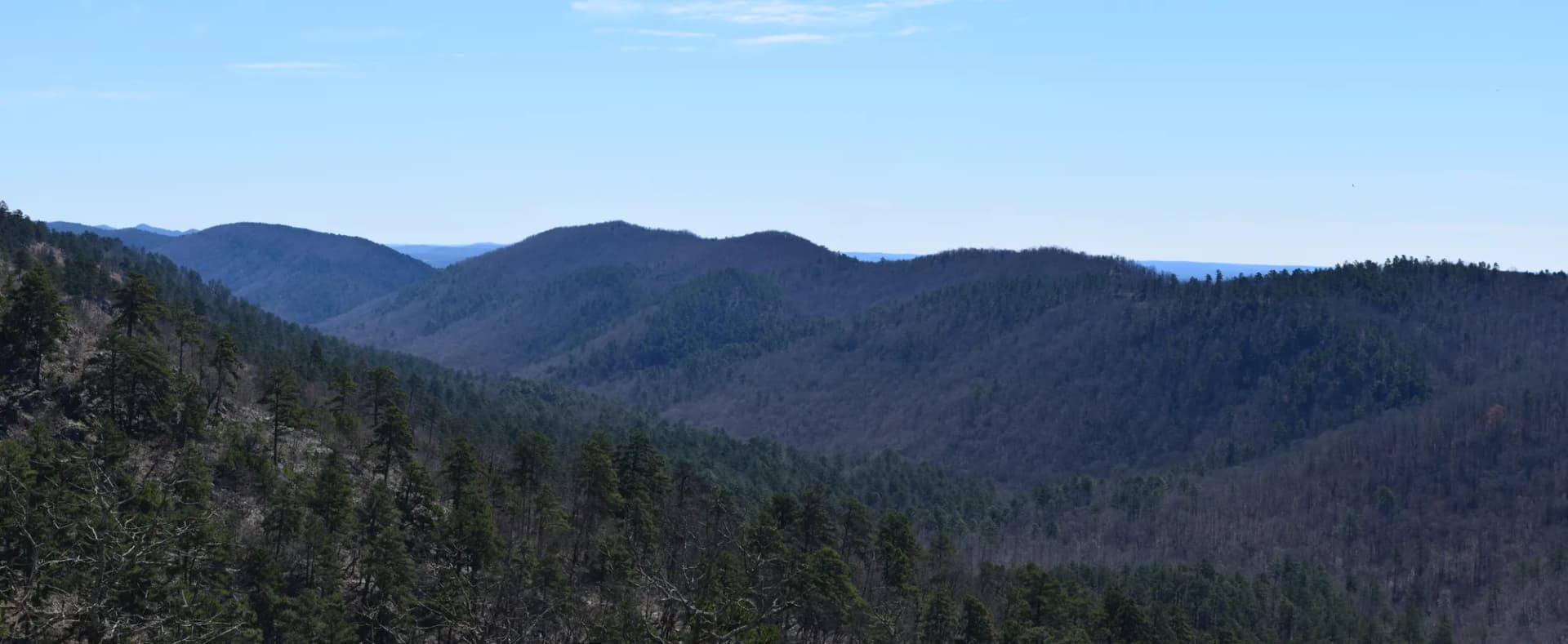
Neches River bottomland. The Neches River forms the eastern boundary of the forest, with old-growth bottomland cypress and hardwood in the corridor between the upland forest and the river. The bluffs above the river provide elevated views over the bottomland that are unusual in this otherwise-flat landscape.
Best Trails
The Four C National Recreation Trail (20 miles, moderate) is the forest's signature backpacking route. The Ratcliff Lake Loop (4.5 miles, easy) circles the lake from the campground. The Neches Bluff Overlook Trail (3.5 miles, easy-moderate) reaches elevated views above the Neches River.
The Piney Creek Horse Trail (16 miles, moderate) is the primary equestrian route in the forest. The Longleaf Ridge Trail (5.0 miles, moderate) traverses the longleaf restoration ridge system. The Walnut Creek Loop (3.5 miles, easy) is a short family-friendly loop near the forest's central unit. The Four C South Section (8.0 miles, moderate) covers the most scenic southern portion of the Four C Trail. The Ratcliff Campground Nature Walk (1.5 miles, easy) is the shortest accessible trail in the forest.
Permits and Passes
No permit is required for day hiking or dispersed camping. Ratcliff Lake Campground requires fees through Recreation.gov (as of 2026). The America the Beautiful pass covers day use fees at developed recreation areas. Veterans have additional options in our veteran benefits guide.
Fire restrictions may be in effect during dry periods. See our checking conditions guide for current USFS resources before your trip.
Camping
Ratcliff Lake Campground (46 sites) is the main developed campground, adjacent to the swimming beach and lake. The campground is the standard base for Four C Trail through-hikers starting from the north. Reservations strongly recommended for spring and fall weekends.
Hickory Creek Campground (10 sites) is a free primitive camp in the forest interior, used primarily by backpackers on the Four C Trail and hunters. No reservation required; first-come, first-served.
Dispersed camping is permitted on national forest land throughout Davy Crockett National Forest at least 200 feet from water, trails, and roads. No permit required for dispersed camping (as of 2026).
When to Visit
October through April is most comfortable. East Texas summers are hot and humid. March and April bring spring wildflowers to the forest understory and peak warbler migration through the Pineywoods. November through January is prime hunting season; blaze orange is strongly recommended. Summer is hot but Ratcliff Lake swimming is at its peak for families.
Getting There
From Crockett: Take TX-7 east approximately 12 miles to the forest boundary. The ranger district office is in Crockett on TX-7 and has maps and current conditions.
From Lufkin: Take US-69 south to TX-7 west. Allow 50 minutes.
From Houston: Take US-59 north to Lufkin, then follow the Lufkin directions. Allow about 2.5 hours from central Houston.
Practical Tips
Alligators are present in Ratcliff Lake and the Neches River corridor. Maintain distance from any alligator and keep pets on leash near water.
Ticks are active year-round in East Texas. Check after every outing in brush or tall grass. Cottonmouth snakes are common near water; give any snake space. The Leave No Trace seven principles apply throughout the forest.