ForestMatters, LLC

Deerlodge National Forest

Montana · 5 min read

State: Montana
Acres: 1,096,000
Established: 1906
Best Season: July through September
Trail Miles: 600 mi
Wilderness Areas: 1
Google MapsApple Maps
HikingBackpackingCampingFishingWildlife ViewingSnowshoeingSkiingPhotography

At a Glance

  • Anaconda-Pintler Wilderness with rugged peaks above 10,000 feet
  • Mount Haggin State Wildlife Management Area bordering the forest
  • Warm Springs Creek flowing through ranch country below the Pintlers
  • Granite Mountain and the surrounding copper-mining heritage landscape
  • Pintler Pass connecting the Anaconda Range to Rock Creek
  • Storm Lake and upper Flint Creek alpine country

Permits & Passes

Day Hiking and Dispersed CampingOptional

Free (as of 2026)

Developed Campground FeesRequired

$12-16/night (as of 2026)

Details

Federal Discount Passes

  • Military Annual PassFree — active duty & veterans
  • Senior Pass$20 lifetime — ages 62+
  • Access PassFree lifetime — permanent disability
Learn more →

Anaconda Range and Mining Country

Deerlodge National Forest covers the western Montana mountain ranges above the historic mining towns of Anaconda and Butte, encompassing roughly 1,096,000 acres of the Anaconda Range and the Flint Creek Range. It forms the western portion of the combined Beaverhead-Deerlodge National Forest administrative unit, the largest national forest in Montana by area. The two sections share a supervisor's office in Dillon, but the Deerlodge section has a character shaped by copper and silver mining history that sets it apart from the Beaverhead's ranch-and-river landscape to the east.

The community of Anaconda, sitting at the forest's western edge, is defined by the giant Anaconda Smelter Stack, a 585-foot brick smokestack visible for miles across the valley and now preserved as a state park. The smelter processed copper ore from Butte's mines for nearly a century, and the environmental legacy of that operation shapes much of the valley floor. The forest itself, at higher elevations and in the mountain drainage upstream, has recovered substantially, and the Anaconda-Pintler Wilderness represents some of the finest high-country hiking in Montana.

Anaconda-Pintler Wilderness

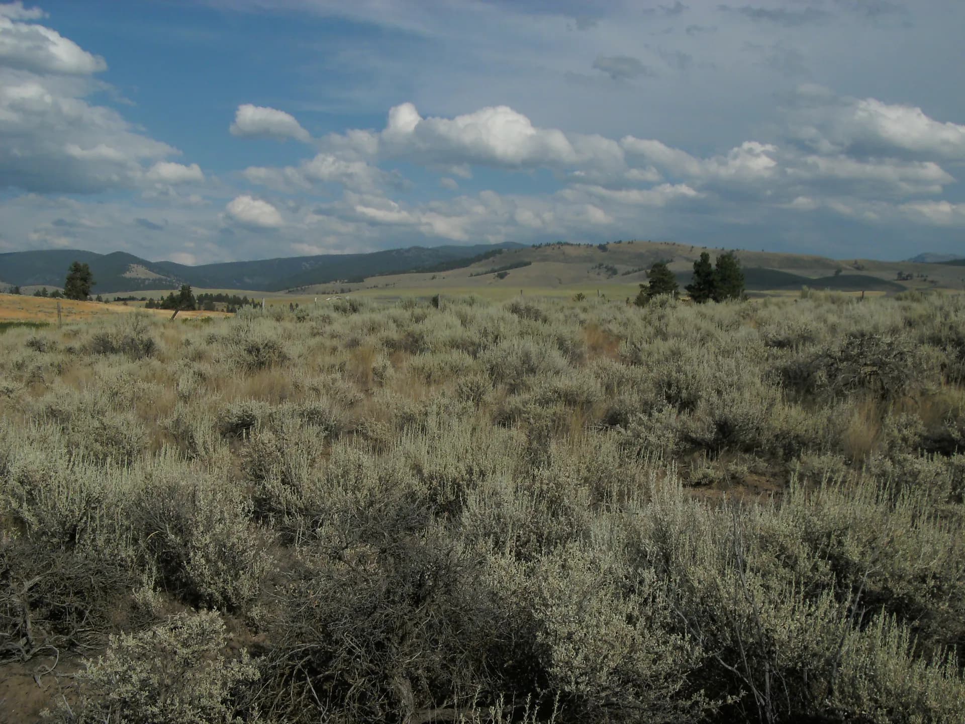
The Anaconda-Pintler Wilderness stretches across the Anaconda Range in a 70-mile arc from the Bitterroot Valley to the Pioneer Mountains, with its core in the Deerlodge section. The wilderness contains rugged peaks above 10,000 feet, numerous alpine lakes, and the Continental Divide Trail, which traverses the crest of the range. This is genuine high-country terrain: short summers, frequent afternoon lightning, and trails that require navigation skills in the upper basins.

The wilderness is far less visited than better-known Montana ranges like the Mission or Beartooth. That relative solitude is its primary draw for experienced backpackers. Trails into the interior basins typically require two to three days minimum to explore thoroughly. Mule deer, elk, black bears, and mountain goats are all present in the wilderness.

Granite Mountain and Mining Heritage

The Granite Mining District east of Phillipsburg was one of the most productive silver producers in Montana history during the 1880s boom. Ghost town ruins at Granite, Montana sit on forest land and are accessible via forest roads. The surrounding terrain, scarred by historical mining activity, has largely revegetated with lodgepole pine and subalpine fir. The Flint Creek Range above Phillipsburg is a quieter corner of the forest with good fishing in Flint Creek and several accessible lakes.

Best Trails

Anaconda-Pintler Wilderness Loop (24.0 miles, multi-day loop) traverses the core of the wilderness, crossing the Continental Divide twice and visiting several remote lake basins. Most hikers take three to four days. Snow on passes can persist through mid-July.

Pintler Pass Trail (12.0 miles, out-and-back) climbs to the Continental Divide at Pintler Pass, with views into both the Deerlodge and Bitterroot sides of the range. This is the most direct route into the wilderness interior from the Anaconda side.

Storm Lake Trail (7.0 miles, out-and-back) reaches an alpine lake in the Pintler highlands, offering a manageable day trip to lake scenery without the full commitment of the wilderness loop.

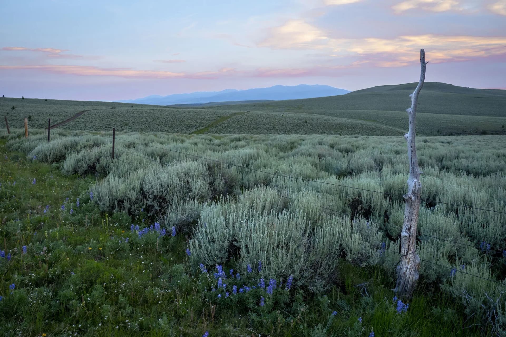
Warm Springs Creek Trail (8.0 miles, out-and-back) follows the Warm Springs Creek drainage from the valley floor into the mountain interior, passing through ranch-and-aspen country before entering the conifer forest above.

Upper Flint Creek Trail (9.0 miles, out-and-back) explores the headwaters of Flint Creek in the eastern section of the forest, a quieter alternative to the Pintler high country.

Permits and Passes

No permit is required for day hiking or dispersed camping in Deerlodge National Forest (as of 2026). Developed campground fees apply where noted. America the Beautiful passes are accepted at fee sites. Veterans and permanently disabled individuals may qualify for the federal discount passes.

Bear activity is documented throughout the Anaconda-Pintler high country. Review bear canister requirements before any overnight wilderness trip.

Camping

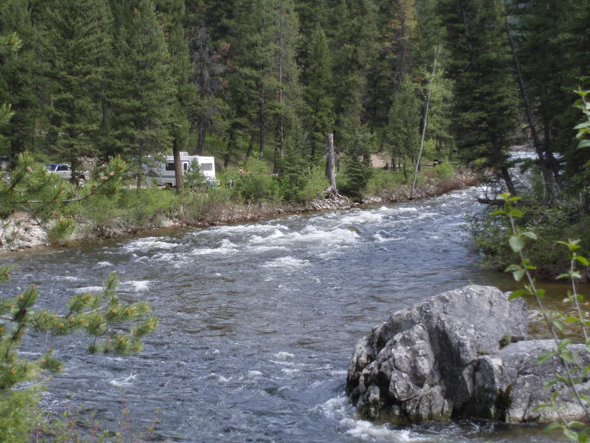
Developed campgrounds are modest and primarily first-come, first-served. Warm Springs Campground and Spring Hill Campground sit near the main access corridors at reasonable elevations. Lodgepole Campground in the Flint Creek drainage is the largest reservable option. Dispersed camping is widely available throughout the forest along forest roads; review current fire restrictions with the ranger district, as late summer fire danger can restrict campfire use.

When to Visit

July through September is the hiking season for the high country. The Anaconda-Pintler Wilderness is typically accessible from late July after snow clears from the high passes. September is excellent for elk viewing and reduced crowds. Fall colors in the aspens below the high country peak in late September.

Check conditions at checking conditions before you go and practice Leave No Trace principles throughout the forest, particularly in the wilderness areas.

Getting There

From Anaconda, take MT-1 east or take forest roads south directly into the Anaconda-Pintler high country. From Butte, MT-1 west to Anaconda takes about 25 miles. Missoula is approximately 75 miles northwest via I-90.

Trail Guides

strenuousloop

Pintler Pass Trail

14 mi3,200 ft gain
July through September

Hike the Pintler Pass Trail in Deerlodge National Forest, Montana. This strenuous 14-mile loop crosses the Anaconda-Pintler Wilderness with alpine lakes, wildflowers, and mountain views.

3 min read

strenuousout-and-back

Granite Mountain Trail

10.4 mi3,800 ft gain
July through September

Climb Granite Mountain in Deerlodge National Forest, Montana. This strenuous 10.4-mile out-and-back gains 3,800 feet to one of the highest summits in the Flint Creek Range with panoramic views.

3 min read

moderate-hardloop

Mount Haggin Loop

8 mi1,600 ft gain
June through October

Hike the Mount Haggin Loop in Deerlodge National Forest, Montana. This moderate-hard 8.0-mile loop traverses the Mount Haggin Wildlife Management Area with views, wildflowers, and wildlife.

3 min read

strenuousloop

Pintler Pass Loop

17 mi4,200 ft gain
July through September

Backpack the Pintler Pass Loop in Deerlodge National Forest, Montana. This strenuous 17-mile loop is a premier multi-day route through the Anaconda-Pintler Wilderness with alpine lakes and wildflowers.

3 min read

moderateloop

Racetrack Trail

7 mi1,200 ft gain
May through October

Hike the Racetrack Trail in Deerlodge National Forest, Montana. This moderate 7.0-mile loop traverses a scenic valley with views of the surrounding mountains and frequent wildlife sightings.

3 min read

strenuousout-and-back

Storm Lake Trail

9.6 mi2,400 ft gain
July through September

Hike to Storm Lake in Deerlodge National Forest, Montana. This strenuous 9.6-mile out-and-back climbs through the Flint Creek Range to a remote alpine lake with mountain views.

3 min read

moderateout-and-back

Upper Flint Creek Canyon

5.8 mi1,000 ft gain
May through October

Hike Upper Flint Creek Canyon in Deerlodge National Forest, Montana. This moderate 5.8-mile out-and-back follows a scenic canyon creek with mountain views and wildflowers.

3 min read

moderateout-and-back

Warm Springs Creek Trail

6.2 mi800 ft gain
May through October

Hike the Warm Springs Creek Trail in Deerlodge National Forest, Montana. This moderate 6.2-mile out-and-back follows a scenic creek past a natural hot springs area with wildlife.

3 min read

Campgrounds

Warm Springs Campground

12 sitesFirst-come$12/night (as of 2026)June through September

Spring Hill Campground

15 sitesFirst-come$12/night (as of 2026)June through September

Lodgepole Campground

31 sitesReservable$16/night (as of 2026)June through September

Getting There

Anaconda
8 miles15 minutes
Butte
25 miles30 minutes
Missoula
75 miles1 hour 20 minutes

More in the Northern Rockies

Frequently Asked Questions

Is Deerlodge National Forest part of Beaverhead-Deerlodge National Forest?
Yes. Deerlodge National Forest is one of two proclaimed units that form the combined Beaverhead-Deerlodge National Forest administrative unit, the largest national forest in Montana. The Deerlodge section covers the Anaconda Range and Flint Creek Range in the western portion of this combined unit.
What is the Anaconda-Pintler Wilderness?
The Anaconda-Pintler Wilderness covers about 158,000 acres across the Beaverhead-Deerlodge and Bitterroot National Forests. The Deerlodge section contains the western approaches to this wilderness, with peaks reaching above 10,000 feet and remote lake basins requiring multi-day trips to reach fully.
What is the significance of the Granite Mountain area?
Granite, Montana was one of the richest silver-mining towns in the American West during the 1880s and 1890s. The surrounding mountain terrain is riddled with historical mine ruins, tailings, and remnants of the mining infrastructure from that era. The Miners Union Hall ruins are a notable historical site.
When is the best season to hike in Deerlodge National Forest?
July through September is the primary hiking season. The Anaconda-Pintler high country holds snow through late June in most years. Elk hunting season in September and October brings significant activity to the backcountry.
Federal Discount Passes

Free and Discounted Entry for Qualified Visitors

Military Annual Pass

Active duty & veterans (any discharge except dishonorable)

Free · Annual

Senior Pass

U.S. citizens or permanent residents age 62+

$20 · Lifetime

Access Pass

Permanent disability (includes 50% off many camping fees)

Free · Lifetime
Get passes at any ranger station or store.usgs.gov/passLearn more →