Lake Tahoe sits in a granite and glacial basin on the border of California and Nevada at 6,225 feet, and the Lake Tahoe Basin Management Unit encompasses the 154,000 acres of USDA Forest Service land ringing the lake. The basin is one of the most visited outdoor recreation areas in the western United States, drawing visitors from the Bay Area and Sacramento year-round for hiking, skiing, kayaking, and one of the purest large bodies of water in the world. Tahoe's legendary clarity, its deep blue through turquoise color, comes from the granite bedrock and the basin's position above the surrounding Central Valley haze.
The Basin Management Unit is not a typical national forest. Created in 1973 specifically to address the environmental pressures on the Tahoe basin from rapid post-war development, it operates under a regional plan that coordinates land use across both states, five counties, and multiple agencies. For visitors, the practical difference is minor: the unit maintains campgrounds, trails, and wilderness areas just as any national forest would. The recreational assets, Desolation Wilderness, the Tahoe Rim Trail, and miles of lakeshore trail, are genuinely world-class.
Why Lake Tahoe Basin Stands Out
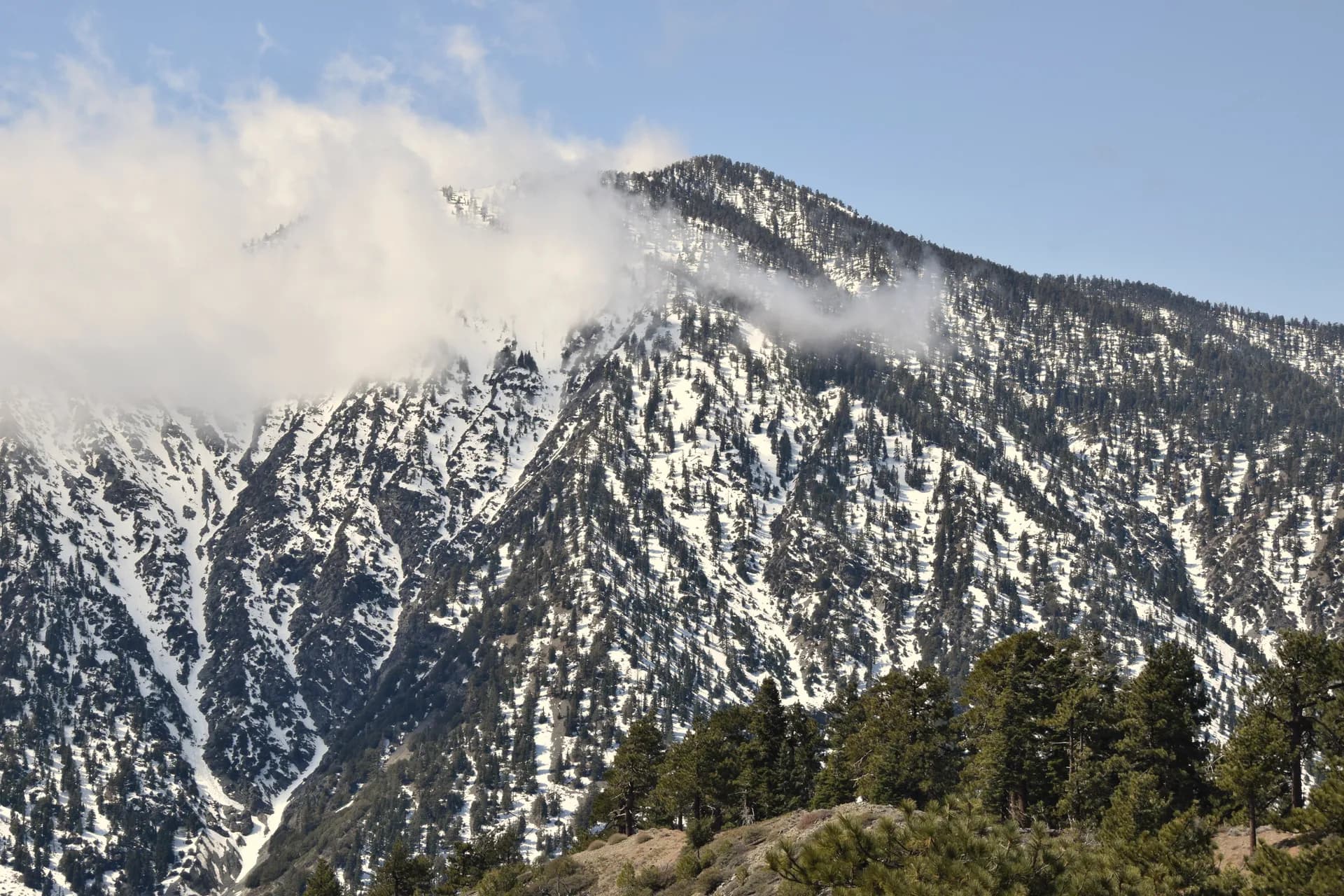
Desolation Wilderness. The 63,960-acre Desolation Wilderness southwest of the lake is the most heavily used wilderness area in the United States by some measures, and for good reason. Granite domes and glacially carved bowls hold more than 100 lakes above 6,500 feet, surrounded by lodgepole and western white pine. The wilderness is accessible via multiple trailheads from the South Lake Tahoe side and from the Eldorado National Forest to the west. Day use requires a free self-issue permit; overnight stays require a reservation permit (as of 2026) through Recreation.gov. The Mount Tallac Trail climbs through the wilderness fringe to one of the lake basin's signature summits.
Tahoe Rim Trail. The 165-mile Tahoe Rim Trail circles the entire lake basin, traversing ridgelines on both the California and Nevada sides, passing through Desolation Wilderness, and offering lake views from elevations up to 10,000 feet. Most hikers do sections as day hikes or multi-day loops. The Tahoe Meadows section near Mount Rose on the Nevada side is among the most accessible and scenic. The trail passes through both national forest land and Nevada state land; no through-hike permit is required.
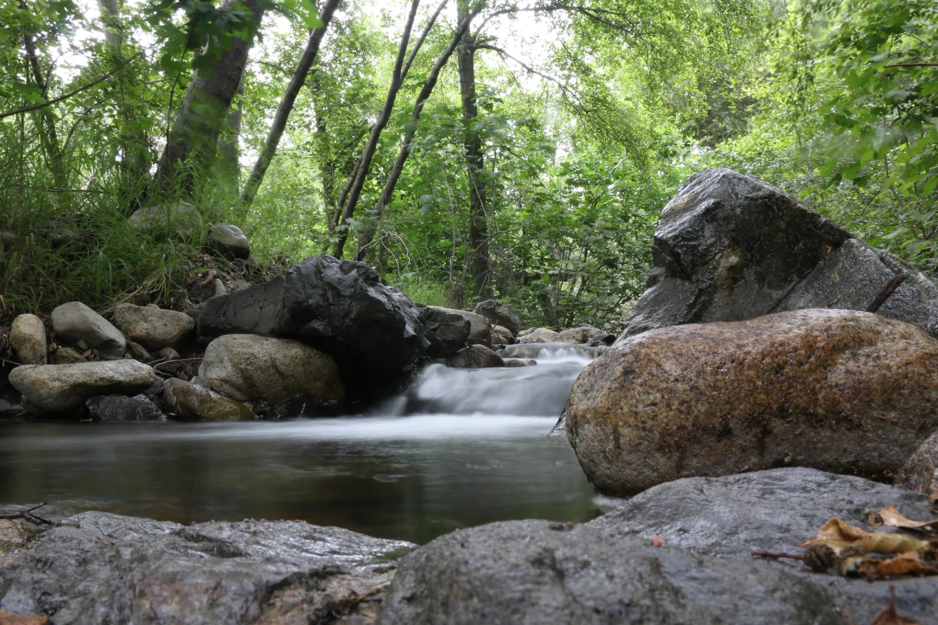
Lake clarity and shoreline access. Lake Tahoe is 1,645 feet deep at its maximum, the second deepest lake in the United States, and its water visibility historically reached 100 feet below the surface. The national forest unit maintains several shoreline access points and beach areas, including the stretch near William Kent Campground. Swimming, kayaking from Emerald Bay, and sunrise views from the East Shore are the kinds of experiences that justify the drive regardless of crowd levels.
Best Trails
The Tahoe Rim Trail: Tahoe Meadows (5.0 miles, easy-moderate) is the most accessible stretch of the Tahoe Rim Trail, traversing a subalpine meadow above 8,700 feet near Mount Rose with expansive lake views. The Mount Tallac Trail (9.4 miles, strenuous) climbs 3,300 feet to the 9,735-foot summit with one of the finest panoramic views in the Sierra Nevada.
The Eagle Lake Trail (2.0 miles, easy) is the most popular short hike in the basin, ending at a clear cirque lake above Emerald Bay. The Fallen Leaf Lake Loop (6.5 miles, moderate) circles one of the basin's most beautiful secondary lakes through old-growth forest. The Velma Lakes Trail (10.0 miles, moderate-hard) enters the Desolation Wilderness to reach a series of granite-rimmed lakes with good fishing and camping.
The Emerald Bay Overlook Trail (1.5 miles, easy) reaches the most photographed view of Lake Tahoe from a ridgeline above the bay. The Glen Alpine Trail (6.5 miles, moderate) follows a historic wagon road through Glen Alpine Springs into the Desolation Wilderness fringe. The Tahoe Rim Trail: Big Meadow (7.0 miles, moderate) traverses the South Lake Tahoe ridgeline with consistent lake views.
Permits and Passes
Desolation Wilderness requires a free self-issue permit for day use, obtained at the trailhead. Overnight permits require an advance reservation through Recreation.gov and cost $5 to $10 per night (as of 2026), with group size limits and a quota system during peak summer months. Outside the wilderness, no permit is required for day hiking. A California campfire permit is required for all open fires and gas stoves on national forest land (free at readyforwildfire.org, as of 2026). The America the Beautiful pass covers day use fees at developed recreation areas. Veterans and active military have additional pass options covered in our veteran benefits guide. Review how to get a national forest camping permit for the Desolation Wilderness reservation process.
Camping
Fallen Leaf Campground (206 sites) is the largest campground in the basin, on the shore of Fallen Leaf Lake south of South Lake Tahoe. Sites range from standard tent to full hookup RV. Reservations through Recreation.gov are strongly recommended for any weekend from June through September.
William Kent Campground (95 sites) is on the west shore of Lake Tahoe north of South Lake Tahoe on US-50/89. The location provides easy access to both lakeshore and Desolation Wilderness trailheads. Reservable in summer.
Bayview Campground (10 sites) is a small walk-in tent campground near Emerald Bay, popular as a base for Eagle Lake and Desolation Wilderness day hikes. First-come, first-served.
Kaspian Campground (10 sites) is a small campground on the west shore north of Tahoe City, first-come, first-served. Good for smaller parties wanting a quieter option than Fallen Leaf.
When to Visit
June marks the opening of most lake-level campgrounds and trails. Snow lingers on the upper Desolation Wilderness routes into early July in normal years. Wildflowers in subalpine meadows peak in late June and early July.
July and August are peak season. Campgrounds fill weeks in advance and popular trailhead parking areas overflow by mid-morning on weekends. The lake is warmest for swimming in August. Early morning starts are important at busy trailheads.
September and October are excellent months. Crowds thin after Labor Day, temperatures are comfortable (50s to 70s), and the aspens and other deciduous trees add fall color to the granite and blue-sky backdrop. Desolation Wilderness permits are easier to secure in September.
November through May brings snow, ski season at nearby resorts, and quieter cross-country skiing and snowshoeing conditions on the basin trails. The Tahoe Meadows section of the TRT is a popular winter snowshoe destination.
Getting There
From Sacramento (most common): Take US-50 east over Echo Summit and into South Lake Tahoe. The drive is about 100 miles and 2 hours in good weather. Chain controls apply in winter.
From San Francisco: Take I-80 east over Donner Summit to Truckee, then CA-89 south along the west shore to South Lake Tahoe. About 200 miles and 3.5 hours. Truckee is the gateway for the north and west shore trailheads.
From Reno, NV: Take US-395 south to CA-267 west over Brockway Summit into Kings Beach, or US-395 to NV-341 to US-50 west to South Lake Tahoe. About 65 miles and 1.25 hours.
Practical Tips
Crowding is real at popular trailheads from July through Labor Day. Eagle Falls, the Emerald Bay pullouts, and the Mount Tallac trailhead regularly overflow onto the highway. Arriving by 7:00 a.m. on summer weekends is the practical solution. Midweek visits in July and August are much more manageable.
Altitude is a consideration for visitors coming from sea level. The lake sits at 6,225 feet; the Desolation Wilderness climbs above 9,000 feet. Many visitors from low elevations experience mild altitude symptoms (headache, reduced energy) on the first day. Rest, hydration, and a gradual pace help most people adjust. Consult the CDC's altitude illness resources for guidance on symptoms and management.
Wildfire and smoke affect the basin most years from July through September. Air quality from regional wildfires can vary dramatically. Check AirNow.gov and the InciWeb fire map before visiting. The California campfire permit is required year-round on national forest land in the basin (as of 2026). See our guide on checking conditions before you go for official links.
Black bears are active throughout the basin and have learned to associate cars and campgrounds with food. Store all food, coolers, and scented items in bear boxes (provided at most campgrounds) or a certified bear canister when backpacking. The USFS recommends treating any bear encounter by making yourself large, making noise, and giving the bear space. See our bear canister guide for specifics. Follow Leave No Trace principles throughout the basin to preserve the lake clarity and wilderness character that make Tahoe worth visiting.