Overview
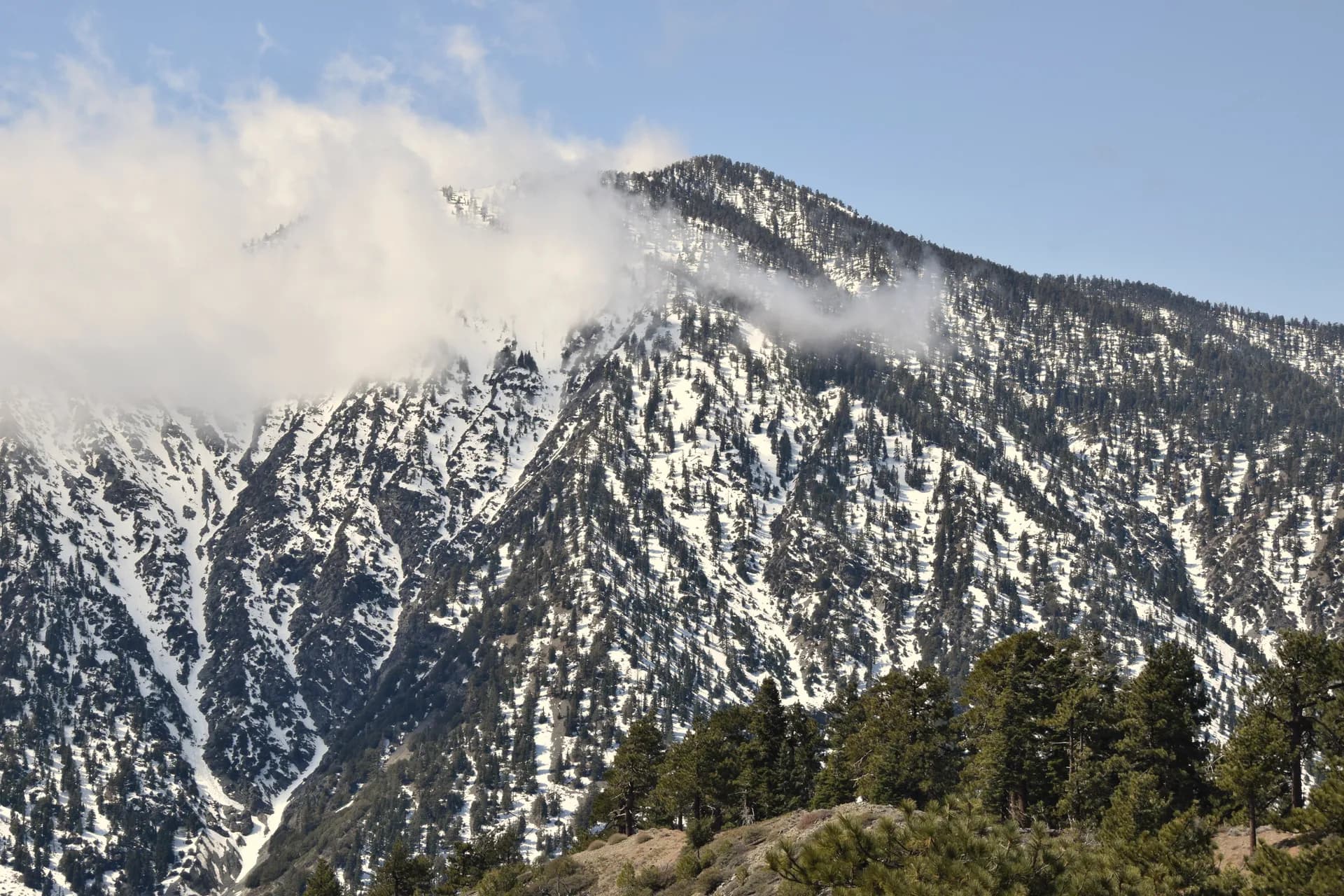
Lassen National Forest covers 1.2 million acres in northeastern California, wrapping around the southern and eastern flanks of Lassen Volcanic National Park. The forest is defined by its volcanic origins: cinder cones, lava tubes, pumice flats, and crater lakes all testify to the region's geological restlessness. Mount Lassen last erupted in 1915, making this one of the most recently active volcanic areas in the contiguous United States.
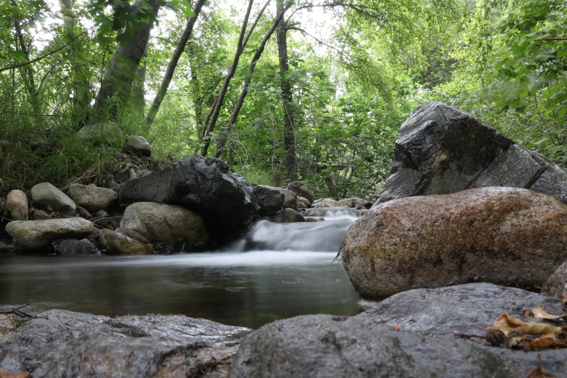
Beyond the volcanic drama, Lassen NF offers a quieter counterpart to the national park next door. Visitors find old-growth red firs, pristine alpine lakes, and over 400 miles of trails with far lighter foot traffic than the park. Eagle Lake, one of California's largest natural lakes, sits entirely within the forest and draws anglers, paddlers, and campers each summer.
Why Lassen National Forest Stands Out
Volcanic Terrain Unlike Anywhere in California
The Caribou Wilderness and Ishi Wilderness together protect some of the most distinctive volcanic landscapes in the Sierra Nevada. The Caribou Wilderness holds dozens of shallow lakes in basalt basins, remnants of lava flows that cooled and collected snowmelt over millennia. Walking through here feels fundamentally different from hiking in granite Sierra terrain. Pumice and basalt underfoot, lodgepole and red fir above, and still water everywhere.
Eagle Lake and Hat Creek
Eagle Lake sits at 5,100 feet and spans nearly 30 square miles, making it one of the more unusual fishing destinations in California. Its endemic Eagle Lake rainbow trout, which evolved in isolation, draws fly anglers from across the state. Hat Creek, running through the forest's western side, is designated a wild trout section and managed under special regulations that make it a respected destination for serious fly fishing.
Quiet Wilderness Close to Population Centers
Lassen National Forest sits roughly two hours from Sacramento and the Bay Area, yet it remains one of the least-visited forests in California. The lack of a major interstate nearby, combined with Lassen Volcanic NP drawing most of the regional attention, keeps trail counts manageable and dispersed camping genuinely available. This is a forest where solitude is still accessible on summer weekends.
Best Trails
Lassen National Forest offers a full range of hiking from short waterfall walks to multi-day wilderness loops. Here are all eight trails covered in this guide:
The Caribou Lake Trail is a 4.6-mile out-and-back into the heart of the Caribou Wilderness, reaching a clear alpine lake set in a basalt bowl. Moderate elevation gain and excellent scenery make it a favorite day hike.
The Burney Falls Loop is a short 1.3-mile circuit around the base of Burney Falls, a 129-foot waterfall fed by underground springs. One of the most accessible hikes in the region and popular with families.
The Twin Lakes Trail covers 8.2 miles through the Caribou Wilderness to a pair of lakes surrounded by forest and volcanic rock. Plan for a full day; the terrain is varied and rewarding.
The Thousand Lakes Wilderness Loop is a 12.4-mile circuit through one of the forest's most scenic wilderness areas, passing multiple lakes and gaining significant elevation to reach volcanic ridge viewpoints.
The Magee Peak Trail is an 11.8-mile out-and-back to the summit of Magee Peak (8,550 ft), offering panoramic views of Lassen Peak, Mount Shasta, and the Sacramento Valley.
The Black Cinder Rock Trail is a 4.2-mile loop across a striking basalt and cinder landscape near Hat Creek, passing through young lava flows and volcanic formations.
The Feather Falls Trail is a 9.4-mile loop to one of the tallest waterfalls in the United States, dropping 640 feet into the Middle Fork Feather River canyon.
The Domingo Springs Trail is a 5.6-mile out-and-back through dense forest to a natural mineral spring and meadow complex along the North Fork Feather River.
Permits and Passes
Most activities in Lassen National Forest are free. Day hiking and dispersed camping require no permit (as of 2026). Developed campsite reservations at Almanor, Hat Creek, and other campgrounds can be made through recreation.gov, with fees running $18-25/night (as of 2026).
The Caribou Wilderness and Ishi Wilderness require no permit as of 2026, though group size limits and fire restrictions apply in summer. Check the Almanor Ranger District office or USFS website before heading out.
Holders of an America the Beautiful Annual Pass (available to veterans at a significant discount) receive free access to developed day-use areas and fee campgrounds across the national forest system. See America the Beautiful Pass for Veterans and Veteran Benefits at National Forests for full details.
Camping
Almanor Campground sits on the western shore of Lake Almanor, one of the largest lakes in the region, with 104 sites reservable through recreation.gov. Fee is approximately $20/night (as of 2026), open May through September. The campground is close to the town of Chester, providing easy resupply access.
Hat Creek Campground offers 73 sites along the wild trout section of Hat Creek, making it the top choice for fly anglers visiting the forest. Sites are reservable through recreation.gov at $18/night (as of 2026), open May through October.
Caribou Lake Campground is a small, first-come-first-served facility with 11 sites at the edge of the Caribou Wilderness. No hookups, vault toilets only, fee approximately $10/night (as of 2026). The short walk to Caribou Lake from camp makes this a worthwhile destination for those who arrive early in the season.
Dispersed camping is allowed throughout most of the national forest outside designated campgrounds, free of charge (as of 2026). Sites must be at least 100 feet from water sources, trails, and roads.
When to Visit
June through mid-July opens most trails as snow melts from higher elevations. Wildflowers peak in late June and July in alpine meadows and on north-facing slopes. Expect some muddy trail sections through late June.
Mid-July through August is prime season: all trails accessible, lakes warm enough for swimming, and long daylight hours. This is when Eagle Lake and Almanor campgrounds fill on weekends; arrive Thursday or reserve well in advance.
September through October brings quieter trails, cooler temperatures, and fall foliage in the mixed conifer zones. Aspens along creek drainages turn gold in late September. Many campgrounds remain open through October, though services thin out.
November through May, higher elevations receive heavy snow. Cross-country skiing and snowshoeing are popular on the Hat Creek Rim and around Caribou Wilderness trailheads when conditions allow.
Getting There
From Redding (58 miles, 1 hour): Head east on Highway 44 from Redding directly into the national forest. This is the main western approach, passing Hat Creek and the Lassen National Forest Visitor Center at Highway 44 and Highway 89. Most trailheads are accessible from this corridor.
From Chico (75 miles, 1 hour 20 minutes): Take Highway 32 north through Chico to Highway 36, then east into the forest. This route provides access to the Almanor and Feather River districts. Highway 32 through Deer Creek canyon is a scenic drive worth the time.
From Sacramento (175 miles, 2 hours 45 minutes): Take I-5 north to Red Bluff, then Highway 36 east directly to Chester and the southern forest boundary. This is the primary route for Bay Area and Sacramento visitors, reaching Lake Almanor and the forest's southern campgrounds first.
Practical Tips
Check fire restrictions before every trip. Lassen National Forest sits in a high fire risk zone, and Stage 1 and Stage 2 fire restrictions can prohibit campfires and stoves at any time during summer. Current conditions and restrictions are posted at the USFS website and the Almanor Ranger District office. See Checking Conditions Before You Go for a full rundown of what to check.
Black bears are present throughout the forest. Store all food in bear canisters or the provided bear boxes at campgrounds. Never leave food in vehicles overnight. Review Bear Canister Requirements for specifics.
Hat Creek Rim receives strong afternoon winds and intense sun at elevation. Bring wind layers even in summer. Water sources are available at most campgrounds and along creek drainages, but always treat or filter backcountry water before drinking.
For wilderness travel, review Leave No Trace 7 Principles before your trip. Lassen's fragile volcanic soils and alpine lake margins are particularly sensitive to off-trail foot traffic.
Compared to neighboring Lassen Volcanic National Park, the national forest offers more flexible camping and free trailhead access. For a full comparison of what to expect in each, see National Forest vs. National Park.