ForestMatters, LLC

Modoc National Forest

California · 5 min read

State: California
Acres: 1,654,000
Established: 1904
Best Season: June through October
Trail Miles: 400 mi
Wilderness Areas: 1
Google MapsApple Maps
HikingBackpackingHuntingFishingFly fishingWildlife viewingBirdingOff-road drivingCross-country skiingSnowshoeingPhotographyHorseback ridingScenic driving

At a Glance

  • South Warner Wilderness, 70,000 acres of glacially carved Warner Mountains peaks
  • Modoc Plateau: ancient lava flows, cinder cones, and volcanic terrain
  • Tule Lake National Wildlife Refuge adjacent to the forest, with massive migratory bird concentrations
  • Pronghorn antelope habitat, one of California's most accessible antelope viewing areas
  • Medicine Lake Highland, a volcanic complex with cinder cones and lava tubes

Permits & Passes

Day Hiking and Dispersed CampingOptional

Free (as of 2026)

Campfire PermitRequired

Free (as of 2026)

Details
Developed Campground SitesRequired

$10-18/night (as of 2026)

Details

Federal Discount Passes

  • Military Annual PassFree — active duty & veterans
  • Senior Pass$20 lifetime — ages 62+
  • Access PassFree lifetime — permanent disability
Learn more →

Modoc National Forest covers 1.6 million acres of California's northeastern corner, a vast and largely overlooked landscape of ancient lava flows, fault-block mountain ranges, and Great Basin sagebrush that bears almost no resemblance to the California of popular imagination. In California's northeastern corner, the Cascade volcanic landscape gives way to the Basin and Range geology of the Great Basin, and Modoc sits at that transition. The Warner Mountains rise abruptly from the arid plateau to over 9,000 feet, supporting forests of aspen and fir that feel more like Idaho than California.

The forest is genuinely remote. Alturas, the only city of any size in Modoc County, has a population of under 3,000. The pronghorn antelope in the sagebrush flats outside Alturas outnumber the humans. The Tule Lake and Lower Klamath National Wildlife Refuges adjacent to the north forest boundary attract millions of migratory birds each fall. And the South Warner Wilderness provides high-country backpacking with virtually no crowds.

Why Modoc Stands Out

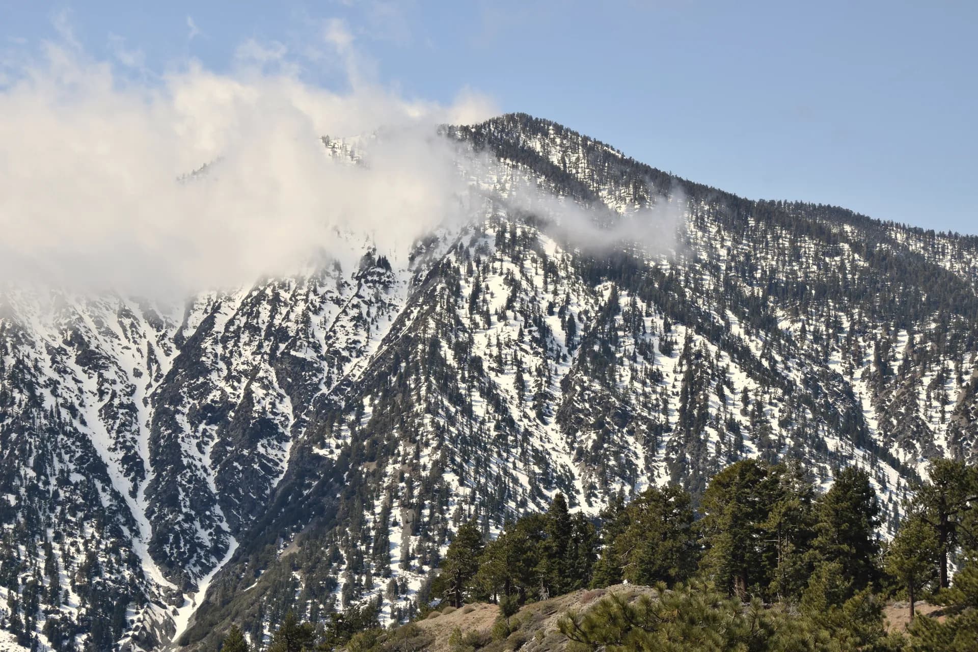
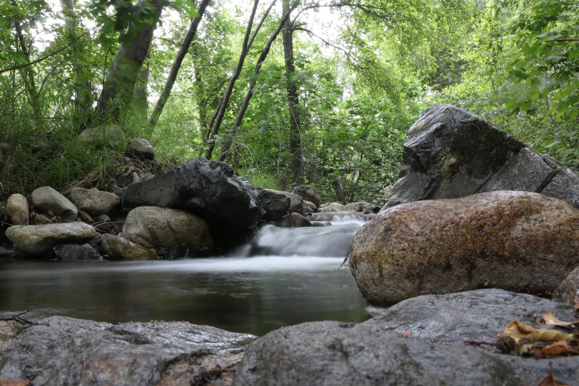
South Warner Wilderness and the Warner Mountains. The Warner Mountains are a fault-block range, one of the few such ranges in California and geologically distinct from the volcanic landscape around them. The Warner ridgeline runs north-south at elevations of 7,000 to 9,000 feet, with glacially carved cirques, permanent streams, and aspen-mixed conifer forests. The Summit Trail traverses the spine of the range through the 70,000-acre wilderness.

Medicine Lake Highland. Medicine Lake sits in a volcanic caldera at 6,700 feet, the largest shield volcano in the United States by area. The Medicine Lake Highland includes cinder cones, obsidian flows, lava tube caves, and the lake itself. The Medicine Lake Rim Trail circles the caldera rim. The Glass Mountain obsidian flow to the east is one of the largest obsidian outcrops in North America.

Wildlife: pronghorn, sage grouse, and migratory birds. The open sagebrush landscape of the Modoc Plateau supports pronghorn antelope in significant numbers, one of the easiest places in California to see North America's fastest land animal in its natural habitat. Fall migration at the adjacent Tule Lake and Klamath refuges brings concentrations of ducks and geese that can number in the hundreds of thousands.

Best Trails

The Summit Trail: South Warner Wilderness (10.0 miles, strenuous) traverses the Warner Mountain spine through the wilderness. The Patterson Meadow Trail (6.0 miles, moderate) accesses a large high-mountain meadow in the Warner Mountains with pronghorn and bald eagle viewing. The Medicine Lake Rim Trail (5.5 miles, easy-moderate) circles the volcanic caldera. The Pepperdine Trail (4.0 miles, easy-moderate) is an accessible Warner Mountains approach.

The Lava Beds National Monument Loop (3.5 miles, easy) is adjacent to the forest boundary and explores lava tube caves. The Lassen Creek Trail (5.0 miles, moderate) follows Lassen Creek through the southern forest. The Clear Lake Wildlife Trail (3.0 miles, easy) circles a wetland complex with excellent birding. The Slide Creek Trail (7.5 miles, moderate-hard) provides deep Warner Mountains access from the east.

Permits and Passes

A campfire permit is required for any fire or stove use outside developed campground fire rings (as of 2026), available free at readyforwildfire.org. No hiking or dispersed camping permit is required anywhere in Modoc National Forest or the South Warner Wilderness. The America the Beautiful pass covers day use fees. Veterans should review our veteran benefits guide.

Check current fire restrictions and road conditions at fs.usda.gov/modoc and review our checking conditions guide.

Camping

Medicine Lake Campground (22 sites) is the primary campground for the volcanic highland area, set near the lake at 6,700 feet. First-come, first-served. The access road typically opens in mid-June.

Plum Valley Campground (15 sites) is near the southern Warner Mountains, a good base for the Pepperdine and Patterson Meadow trails. First-come, first-served.

Soup Spring Campground (14 sites) is in the Warner Mountains area, positioned near good high-country hiking access. First-come, first-served.

Pepperdine Campground (12 sites) is a small campground at the Pepperdine Trailhead, very small and very remote. Good for those who want to walk out of camp.

When to Visit

June through August are the primary months when the Medicine Lake road and the high Warner Mountains trails are accessible after snowmelt. July is when the Warner Mountains wildflowers are at peak.

September and October offer the best wildlife viewing with the beginning of fall waterfowl migration at the adjacent refuges. The Warner Mountains show fall color (aspen) in late September. Hunting season begins; blaze orange is strongly recommended.

November through May: Most high roads are closed. The lower-elevation areas around Alturas are accessible year-round.

Getting There

From Redding: Take State Route 299 east to Alturas, about 110 miles and 2 hours. This is the primary route from the Sacramento Valley.

From Reno: US-395 north to Alturas, about 90 miles and 1.5 hours. The route provides good pronghorn viewing on the Nevada side of the border.

From Klamath Falls, OR: US-97 south then SR-299 east to Alturas. About 90 miles.

Practical Tips

Isolation means preparation. Modoc is genuinely remote. Cell service is absent throughout most of the forest. Fuel is limited; top off in Alturas before any extended forest road exploration. Download offline maps. Carry extra water; the volcanic plateau has limited surface water.

Summer lightning is a hazard on the Warner Mountains ridgelines. The South Warner Wilderness experiences afternoon thunderstorms in July and August; plan to be off ridgelines by early afternoon.

Rattlesnakes are present in the lower-elevation sagebrush and rocky areas. Watch where you step and place your hands, particularly in warm weather. Give any rattlesnake encountered plenty of space and do not attempt to move or handle it.

Leave no trace principles matter especially in the rarely visited backcountry of the South Warner Wilderness and the Medicine Lake Highland. Follow the Leave No Trace seven principles.

Trail Guides

easyloop

Clear Lake Wildlife Trail

3 mi100 ft gain
March through November

A 3-mile loop around a wetland complex near Clear Lake in the northern Modoc National Forest, with exceptional birding for migratory waterfowl, sandhill crane, and shorebirds.

3 min read

moderateout-and-back

Lassen Creek Trail

5 mi500 ft gain
May through October

A 5-mile out-and-back along Lassen Creek through the southern Modoc National Forest, with fishing access, aspen forest, and the quiet character of the Modoc Plateau drainages.

3 min read

easyloop

Lava Beds Cave Loop

3.5 mi200 ft gain
May through October

A 3.5-mile loop on the Modoc National Forest / Lava Beds National Monument boundary area, exploring volcanic surface terrain and accessing the entrance area of the lava tube cave system.

3 min read

easy-moderateloop

Medicine Lake Rim Trail

5.5 mi600 ft gain
June through October

A 5.5-mile loop around the rim of the Medicine Lake volcanic caldera in Modoc National Forest, with views into the caldera, across the Modoc Plateau, and over the Medicine Lake volcanic highland.

3 min read

moderateout-and-back

Patterson Meadow Trail

6 mi900 ft gain
June through October

A 6-mile out-and-back to Patterson Meadow in the Warner Mountains of Modoc National Forest, through aspen forest and open meadow with excellent wildlife viewing and wildflowers.

3 min read

easy-moderateout-and-back

Pepperdine Trail

4 mi800 ft gain
May through October

A 4-mile out-and-back through the lower Warner Mountains in Modoc National Forest, through ponderosa pine and aspen with views of the sagebrush plateau below.

3 min read

moderate-hardout-and-back

Slide Creek Trail

7.5 mi2,200 ft gain
July through September

A 7.5-mile out-and-back from the east side of the Warner Mountains into the South Warner Wilderness in Modoc National Forest, through pinyon-juniper woodland to glacially carved alpine terrain.

3 min read

strenuousout-and-back

Summit Trail: South Warner Wilderness

10 mi3,000 ft gain
July through September

A strenuous 10-mile out-and-back along the spine of the Warner Mountains in Modoc National Forest, through the 70,000-acre South Warner Wilderness with 360-degree views and total solitude.

3 min read

Campgrounds

Medicine Lake Campground

22 sitesFirst-come$10/night (as of 2026)June through October

Plum Valley Campground

15 sitesFirst-come$10/night (as of 2026)June through October

Soup Spring Campground

14 sitesFirst-come$10/night (as of 2026)June through September

Pepperdine Campground

12 sitesFirst-come$10/night (as of 2026)June through September

Getting There

Alturas
10 miles15 minutes
Cedarville
35 miles50 minutes
Redding
110 miles2 hours

More in the Pacific Southwest

Frequently Asked Questions

Where exactly is the Modoc National Forest?
Modoc National Forest is in the extreme northeastern corner of California, in Modoc and Lassen Counties. It is bordered by Oregon to the north, Nevada to the east, and the Lassen National Forest to the west. Alturas is the closest city and the administrative headquarters. The forest is the most geographically isolated national forest in California, roughly 200 miles from Sacramento and similarly distant from Portland and Reno.
What is the South Warner Wilderness?
The South Warner Wilderness is a 70,000-acre wilderness area in the Warner Mountains in the eastern portion of Modoc National Forest. The Warner Mountains are a fault-block range rather than a volcanic range, rising abruptly from the Great Basin to peaks above 9,000 feet. The wilderness contains glacially carved cirques, permanent streams, and forests of aspen and mixed conifer that are unusual in this otherwise arid corner of California. The Summit Trail is the primary access route.
Is Modoc National Forest good for birding?
Modoc National Forest and the adjacent Tule Lake and Lower Klamath National Wildlife Refuges are among the most significant migratory bird destinations in the Pacific Flyway. Millions of ducks, geese, and shorebirds use the refuges during fall migration (September through November). The forest itself supports sage grouse, prairie falcon, sandhill crane, and numerous raptors. The combination of the forest and the adjacent refuges makes this one of the best birding destinations in California.
Can I see pronghorn antelope near Modoc National Forest?
Yes. Pronghorn antelope range throughout the Modoc Plateau adjacent to the national forest and are commonly seen along the highway corridors and on the open grassland areas of the forest itself. The sagebrush flats on the western portion of the forest between Alturas and the California-Oregon border have reliable antelope populations. Early morning is the best time for sightings.
Federal Discount Passes

Free and Discounted Entry for Qualified Visitors

Military Annual Pass

Active duty & veterans (any discharge except dishonorable)

Free · Annual

Senior Pass

U.S. citizens or permanent residents age 62+

$20 · Lifetime

Access Pass

Permanent disability (includes 50% off many camping fees)

Free · Lifetime
Get passes at any ranger station or store.usgs.gov/passLearn more →