The Payette National Forest
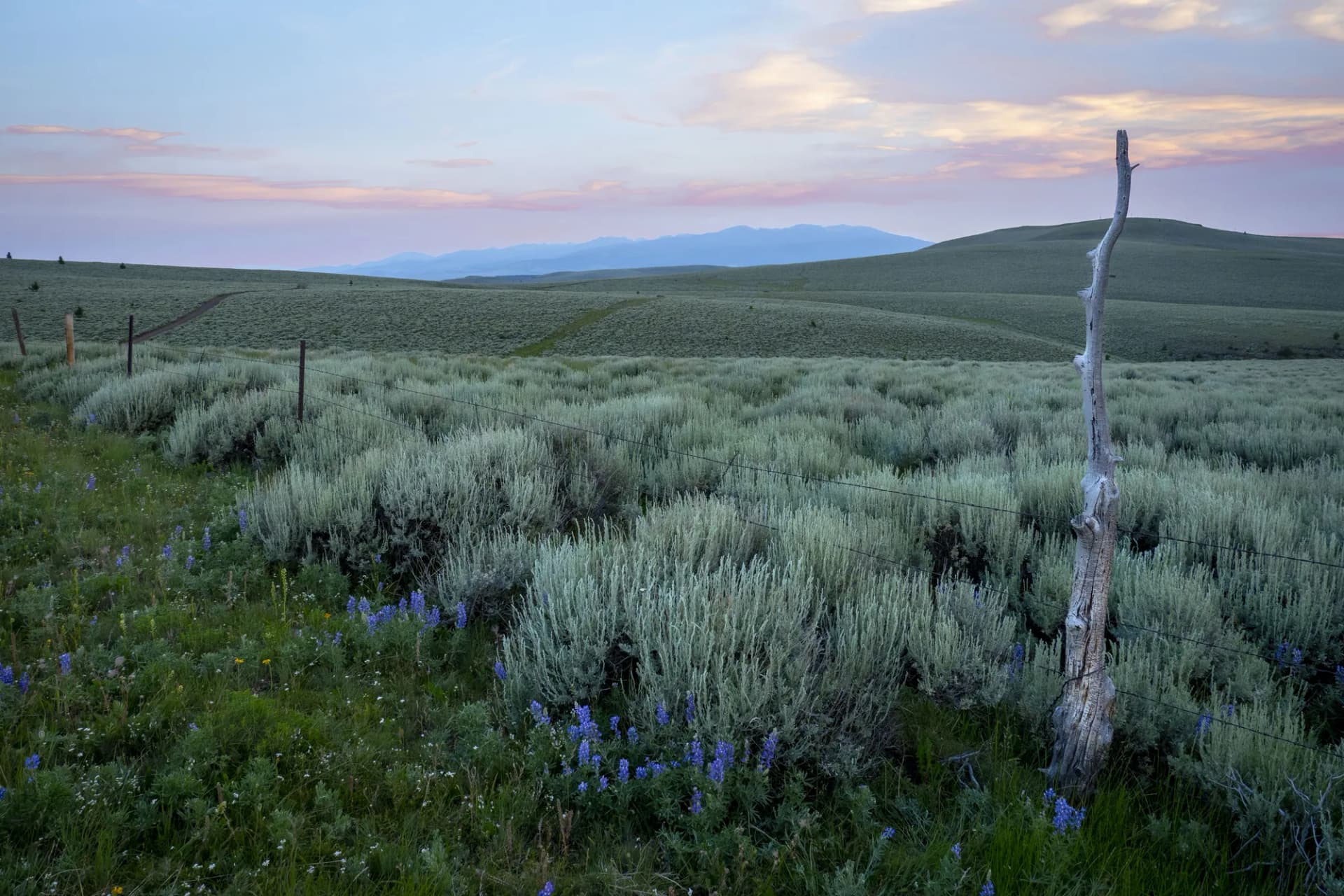
The Payette National Forest spreads across 2.3 million acres of central Idaho, from the McCall resort community at its center to the dramatic rim of Hells Canyon on its western boundary. This is a forest of contrasts: lakeside resort towns and roadless wilderness, beginner hiking trails and the most demanding whitewater in the Pacific Northwest, ski resorts and primitive dispersed camping. McCall, a town of about 3,000 on the shore of Payette Lake, serves as the primary gateway and is one of Idaho's most complete year-round outdoor destinations.
The forest is anchored by two defining features. To the north and east, the Frank Church-River of No Return Wilderness extends into the Salmon-Challis forest in an unbroken roadless expanse. To the west, the Seven Devils Mountains rise from the Snake River plateau in volcanic peaks that overlook Hells Canyon, North America's deepest river gorge. Between these anchors, the McCall area provides accessible lakes, river corridors, and mountain trails that draw visitors from Boise and beyond throughout the year.
Why Payette National Forest Stands Out
The Seven Devils and Hells Canyon Rim
The Seven Devils Mountains are visually unlike anything else in Idaho. The volcanic peaks rise to nearly 9,400 feet and drop precipitously to the Snake River in Hells Canyon, which reaches 7,993 feet in depth at its deepest point, deeper than the Grand Canyon. The Seven Devils Loop trail system accesses the high terrain above the canyon and provides views that are genuinely rare: snow-capped volcanic peaks in the foreground and a gorge of extraordinary depth below.
McCall and Payette Lake
McCall is one of the most livable small outdoor towns in the Northwest. Payette Lake provides swimming, boating, and paddling within walking distance of the town center. The surrounding forest offers accessible hiking, mountain biking, and cross-country skiing from the McCall area without requiring long drives to trailheads. The town's infrastructure supports both families and experienced outdoor recreationists.
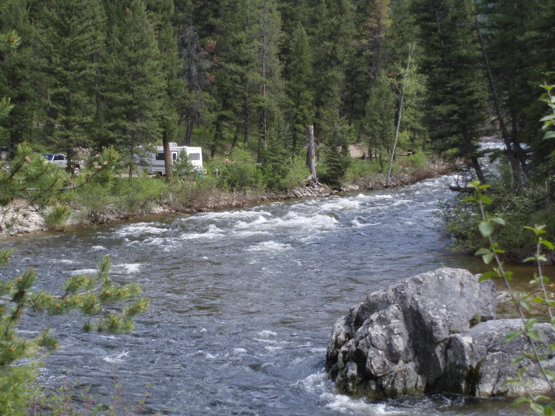
The North Fork Payette River
The North Fork Payette is a benchmark for expert kayakers and one of the most technically demanding commercially rafted rivers in the region. The Cabarton section is a Class IV introduction; the sections upstream escalate to Class V and above. The river corridor through the forest creates a dramatic approach from Cascade to McCall on Highway 55.
Best Trails
Eight trails span the Payette's geography from the accessible McCall lakes to the remote Seven Devils wilderness rim.
Seven Devils Loop is the forest's signature multi-day trip, a 27-mile loop through the Seven Devils wilderness with Hells Canyon views and multiple alpine lakes. The route is commonly done as a 3-day backpack.
Rapid River Trail follows an 8-mile out-and-back along Rapid River, a wild and scenic tributary of the Little Salmon River, through old-growth canyon forest with excellent steelhead habitat.
Loon Lake Trail provides a moderate 6.2-mile hike to a remote lake in the McCall backcountry with good fishing and solitude without the demands of the wilderness interior.
Smith Lake Trail is a 5-mile moderate hike to a scenic lake southwest of McCall, popular with McCall-area visitors for its accessibility and good swimming.
Goose Lake Trail climbs 7.8 miles round trip to a high-elevation lake in the Seven Devils, providing a day-hike taste of the volcanic peak terrain above Hells Canyon.
Box Lake Trail accesses a remote lake basin in the Frank Church wilderness on the Payette's eastern border with a 10-mile round trip through dense conifer forest.
Lake Fork Meadows Trail runs 6.5 miles from the McCall area through open mountain meadows to a scenic viewpoint above the Lake Fork drainage, popular with mountain bikers in summer.
Brundage Mountain Trail climbs 5.8 miles round trip to the summit of Brundage Mountain above McCall, sharing terrain with the winter ski area and offering panoramic views of Payette Lake and the surrounding peaks.
Permits and Passes
No permit is required for day hiking or dispersed camping on the Payette National Forest as of 2026. Campground fees range from $12 to $20 per night (as of 2026). River permits are required for certain sections of the Payette and Little Salmon rivers during peak season.
The America the Beautiful Annual Pass covers day-use fees at federal sites. For information on veterans' access programs, see our guides on the America the Beautiful pass for veterans and veteran benefits on national forests.
Camping
French Creek Campground provides 23 sites near the Salmon River corridor with direct access to float and fishing put-ins. First-come, first-served, with a season running May through October.
Lake Fork Campground sits near the Lake Fork of the Payette River with 10 first-come sites and hiking trail access from the camp.
Lick Creek Campground provides 15 sites near the Lick Creek Road corridor with access to multiple trailheads in the McCall backcountry.
Sheep Rock Campground is a small primitive site with 8 sites near the Seven Devils area, serving as a base camp for the loop trail and day hikes to the volcanic peaks.
When to Visit
July through August is peak season. Most high-elevation trails are clear by mid-July and the McCall area is at its most active. Payette Lake warms to swimmable temperatures in July.
June opens the McCall-area lower-elevation trails and lake access while the Seven Devils remain under snow at higher elevations.
September through October provides the best fall hiking conditions in the forest. Crowds thin dramatically after Labor Day and the larch forest on the higher slopes turns gold in October. Weather is stable and predictable.
Winter brings skiers to Brundage Mountain Ski Resort and cross-country skiers to the Ponderosa State Park trail system near McCall. The town's services stay open year-round.
Getting There
From Boise: Drive north on Highway 55, following the Payette River canyon for approximately 110 miles (2 hours). This scenic drive along the North Fork Payette is itself a destination.
From McCall: The forest boundary begins at the edge of town. Most major trailheads are 10 to 45 minutes from McCall on paved or well-maintained gravel roads.
From Lewiston: Drive southeast on US-95 to Riggins and then south on Highway 95 or east into the forest from the Hells Canyon rim side, approximately 130 miles (2.5 hours).
Practical Tips
Bear spray is standard equipment throughout the Payette. Black bears are common and mountain lions are present. Wildlife encounters are more likely in the Seven Devils area and in the Frank Church wilderness drainages. Our guide on bear canister requirements covers overnight storage.
The Hells Canyon rim and Seven Devils terrain involves significant elevation changes and exposed ridge sections. Check weather carefully before summit or rim hikes: afternoon thunderstorms are common in July and August.
Water is abundant in the forest's many lakes and streams but requires treatment or filtering. Cell service is limited to none in most of the forest's interior.
Check current conditions and fire restrictions before any trip using the USFS guide. Follow Leave No Trace principles throughout, particularly in the Seven Devils wilderness where concentrated summer use can impact the lake basins.