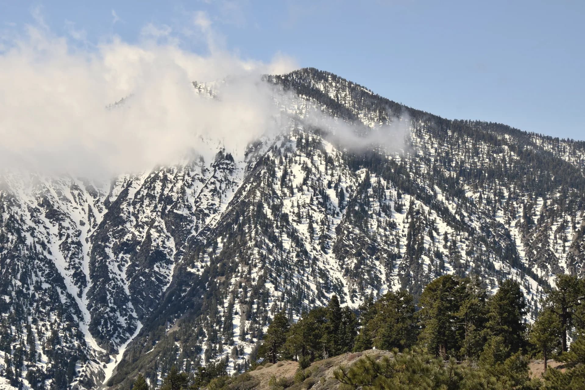
Plumas National Forest stretches across 1.1 million acres of the northern Sierra Nevada and southern Cascades in northeastern California, from the deep V of the Feather River canyon at 1,000 feet elevation to volcanic peaks and glacially polished ridges above 8,000 feet. The forest's unusual geographic position, where the Sierra and Cascades ranges meet and overlap, creates a diversity of terrain and plant communities unusual even by California standards. The Feather River, which drains the entire northern Sierra watershed, carved the most dramatic canyon in the region: a 3,000-foot gorge of volcanic rock, metamorphic ridges, and Class IV whitewater.
Plumas is less crowded than the more famous California mountain forests to the south. Tahoe gets the ski resort traffic, Yosemite gets the summer hordes, and Lassen handles its own volcanic fame. Plumas sits in between, well-known to northern Californians who know their forests but largely overlooked by visitors who came specifically to see something named and famous. That gap creates real opportunity for the visitor who values scenery over status.
Why Plumas Stands Out
Gold Lake Basin. The high country above Graeagle centers on a glacially carved basin studded with more than 30 lakes between 6,000 and 7,800 feet. The Sierra Buttes, volcanic plugs rising 8,591 feet, anchor the southeast corner of this basin and are visible from trails throughout the area. The Gold Lake Loop accesses the heart of this basin with views of multiple lakes from the ridgeline. This is the most scenic high-country terrain in the forest.
Feather Falls. At 410 feet, Feather Falls is the sixth-tallest waterfall in the United States and among the most impressive in California. The Feather Falls National Recreation Trail approaches the falls from the Featherfalls Recreation Area near Oroville, a 9.5-mile round trip through mixed conifer forest with dramatic final views of the fall plunging into the Middle Fork Feather River canyon.
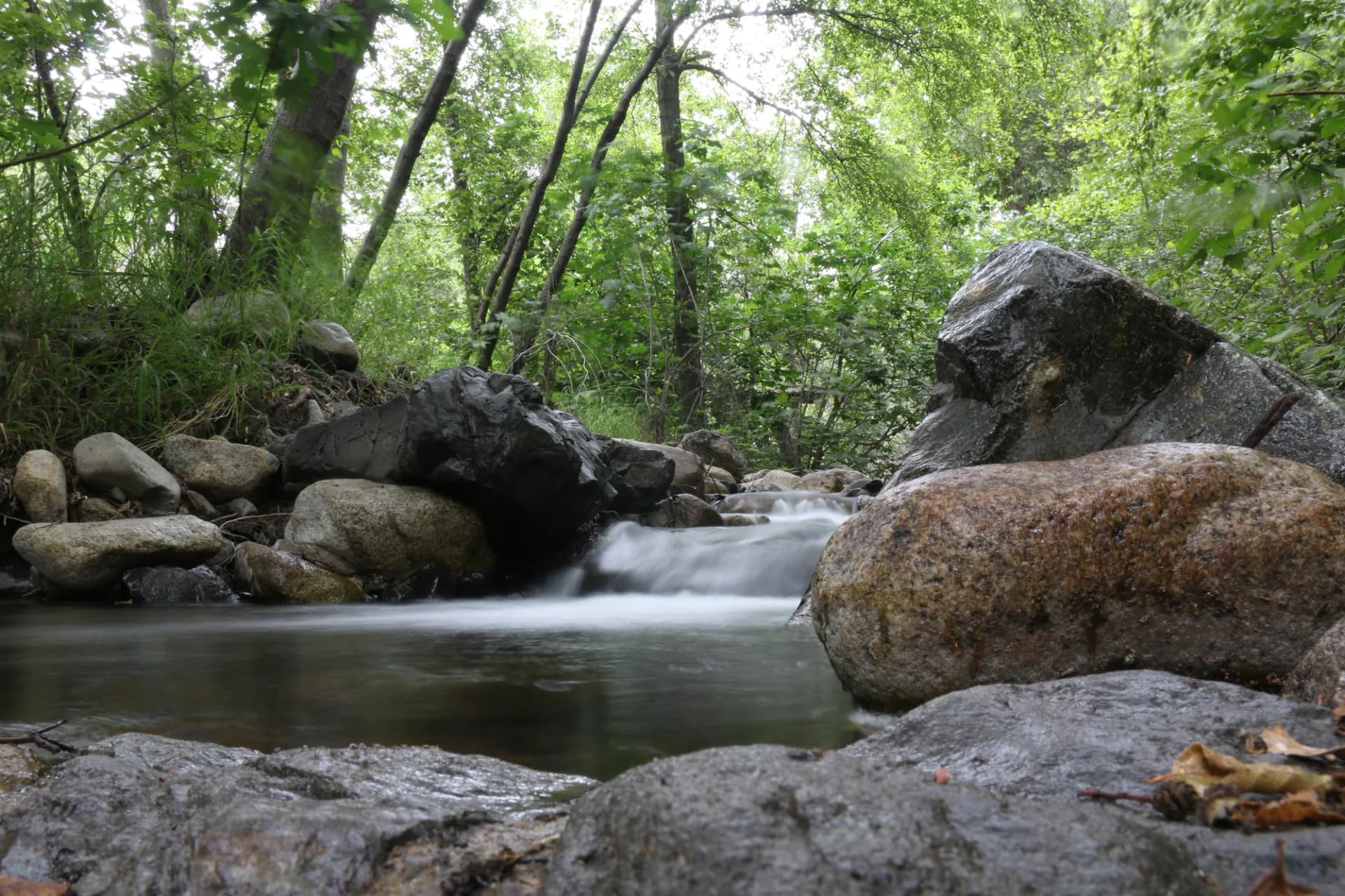
The Feather River canyon. US Highway 70 follows the North Fork Feather River through a canyon that rivals the Feather Falls section for drama, with vertical walls of basalt and metamorphic rock rising thousands of feet from the river. The railroad grades along the canyon were engineering achievements that took decades to complete. The canyon is cooler and shadier than surrounding terrain and provides excellent fishing for wild trout and steelhead.
Best Trails
The Gold Lake Loop (6.5 miles, moderate) connects multiple glacial lakes in the high basin southeast of Graeagle. The Mount Elwell Trail (7.0 miles, strenuous) climbs to the highest point in the Sierra Buttes area with panoramic views. The Bucks Lake Wilderness Loop (11.0 miles, moderate-hard) is the signature backcountry route in the wilderness area.
The Feather Falls National Recreation Trail (9.5 miles, moderate) visits one of California's great waterfalls. The Long Valley Trail (4.5 miles, easy-moderate) provides accessible meadow hiking near Quincy. The Hartman Bar National Recreation Trail (6.0 miles, moderate-hard) descends into the Middle Fork Feather River canyon. The Butterfly Valley Trail (2.5 miles, easy) is a botanical reserve trail known for its carnivorous plants and wildflower diversity. The Haskell Peak Trail (4.0 miles, moderate) accesses the volcanic summit northeast of Gold Lake.
Permits and Passes
A campfire permit is required for any open fire or camp stove use on national forest land outside of developed campground fire rings (as of 2026). Obtain the free permit at readyforwildfire.org before your trip. No hiking or dispersed camping permit is required. Developed campground sites require a fee through Recreation.gov. The America the Beautiful pass covers day use fees. Veterans and active military should review our veteran benefits guide.
Wildfire risk is significant in Plumas National Forest; check current fire restrictions at fs.usda.gov/plumas and review our checking conditions guide.
Camping
Bucks Lake Campground (68 sites) is near the dam and lake shore on the west side of Bucks Lake, with fishing and boating access. Reservable through Recreation.gov in summer.
Gold Lake Campground (47 sites) is the primary base for the Gold Lake Basin high country, near the Lakes Basin Recreation Area. Popular with families and anglers.
Feather River Canyon Campground (33 sites) is in the canyon near Quincy, cooler and shadier than lake-area campgrounds. Good for fishing-focused visitors.
Grizzly Campground (55 sites) is near Graeagle in the Gold Lake Basin area, the best-situated campground for exploring the basin trails.
When to Visit
July and August are peak season for the high-country lake basin and Bucks Lake fishing. Snowmelt clears most trails by early July.
June offers wildflowers in the high country and the highest waterfall flows at Feather Falls. Some passes and high roads may still be snow-covered in early June.
September and October are excellent for hiking without the summer crowds. Fall color begins in the aspens along the creeks in late September.
November through May: Snow closes most high-country roads and trails. The lower Feather River canyon remains accessible.
Getting There
From Sacramento: Take I-80 east to Truckee, then north on State Route 89 to Sierraville and Graeagle. Allow 2.5 hours. Alternatively, US-395 north then west on State Route 70 through the Feather River canyon.
From Reno: US-395 north to Hallelujah Junction, then State Route 70 west. About 1.5 hours to the Portola area.
From the Bay Area: I-80 east to Sacramento, then as above. About 3.5 hours total.
Practical Tips
Black bears are present, particularly near developed campgrounds. California requires bear-proof food storage containers or food storage boxes at all Forest Service campgrounds. Bear boxes are provided at many developed sites. See our bear canister requirements guide for backcountry camping specifics.
Wildfire: The northern Sierra is a fire-prone landscape. The Plumas complex was heavily affected by recent fire seasons. Check current closure status and fire restrictions before any trip. Air quality from smoke can be poor during fire season.
Water: Many hikers carry 2 liters for the longer high-country routes. Streams and lakes are water sources in the backcountry but require treatment due to giardia risk. Water is scarce on south-facing ridges in late summer.
Leave no trace is especially important around the Gold Lake Basin lakes, which see significant summer use. Follow the Leave No Trace seven principles.