Front Range Wilderness Above Fort Collins
Roosevelt National Forest protects approximately 788,000 acres of Colorado's Front Range above Fort Collins, Estes Park, and the Cache la Poudre corridor. It forms the northern portion of the combined Arapaho and Roosevelt National Forests administrative unit, sharing a supervisor's office in Fort Collins with the Arapaho section to the west. The Roosevelt section is the more heavily used portion of the combined forest, sitting adjacent to Colorado's Front Range population corridor and providing the closest wilderness access for Fort Collins and the northern suburbs of Denver.
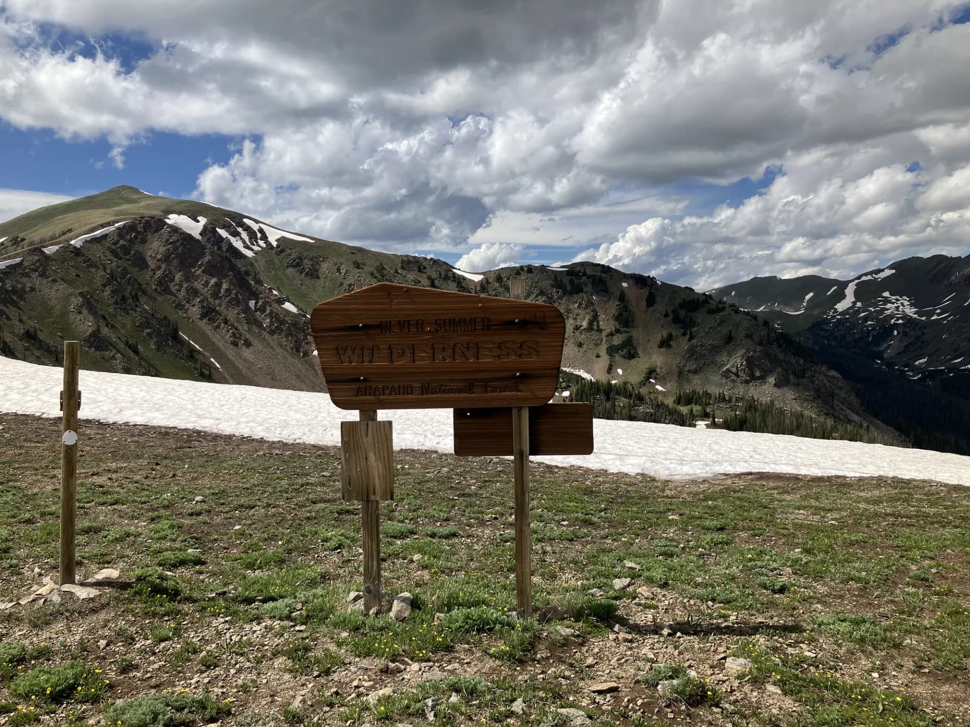
The forest contains three federally designated wilderness areas: the Rawah Wilderness in the northwest, the Indian Peaks Wilderness along the Continental Divide in the south, and the Cache la Poudre Wilderness protecting a segment of Colorado's only Wild and Scenic River. These three distinct landscapes give the Roosevelt section considerable variety for a mountain forest of its size.
The proximity to Fort Collins (population 170,000) and the heavy summer use of the Indian Peaks Wilderness have pushed trail management here toward a more intensive model than most Rocky Mountain national forests. Trailhead parking is competitive, Indian Peaks requires day-use permits in summer, and the most popular trails see weekend crowds comparable to the busiest parks in the state.
Rawah Wilderness
The Rawah Wilderness, in the northwestern portion of the Roosevelt section near Laramie River Road, offers the best combination of scenery and solitude in the forest. The name comes from an Arapaho word meaning "wilderness" or "it is wild." The wilderness contains numerous remote lake basins, a crest trail with long views into Wyoming, and trails that see a fraction of the use that hammers the Indian Peaks. Rawah Lakes, Twin Crater Lakes, and the high ridge country approaching the Continental Divide are the primary destinations.
Cache la Poudre Canyon
Poudre Canyon (CO-14) runs west from Fort Collins into the national forest, following the Cache la Poudre River through a narrow canyon with dramatic granite walls. This is Colorado's designated Wild and Scenic River corridor: the river is a Class III-IV whitewater run popular with commercial rafters in May and June, and the canyon provides excellent fishing for wild trout. Multiple campgrounds along the highway make Poudre Canyon a popular base for Roosevelt section recreation. The Big South Trail at the upper end of the canyon provides access to the Big South Fork of the Poudre, a quieter and more remote drainage than the main canyon.
Indian Peaks Wilderness
The Indian Peaks Wilderness along the Continental Divide is one of the most visited wilderness areas in Colorado, and its permit system reflects that reality. Trails from the Brainard Lake Recreation Area on the eastern approach are exceptional: high tundra, alpine lakes, and Continental Divide views within a few miles of the trailhead. The permits fill well in advance for summer weekends. Visiting midweek or in September, when the permit requirement ends and crowds thin dramatically, is strongly recommended.
Best Trails
Rawah Lakes Trail (8.4 miles, out-and-back) reaches the premier lake group in the Rawah Wilderness, with excellent overnight camping and views across the Continental Divide. One of the best day hike or overnight options in the Roosevelt section for hikers seeking solitude.
Cache la Poudre Canyon Trail (11 miles, out-and-back) follows the Wild and Scenic River corridor through the canyon, combining river scenery with good fishing access.
Mount Richthofen Trail (9 miles, out-and-back) is the signature summit hike of the northern forest, reaching the prominent peak above the Neota Wilderness.
Mummy Range Loop (14 miles) traverses the high ridge country of the Mummy Range with Continental Divide views and genuine backcountry solitude.
Mirror Lake (Roosevelt) (6 miles, out-and-back) accesses a high lake in the Cache la Poudre headwaters region, north of the Indian Peaks and quieter than the Brainard Lake area trailheads.
Twin Crater Lakes (7.4 miles, out-and-back) reaches two alpine lakes in the Rawah Wilderness, a strong alternative to the longer Rawah Lakes route.
Permits and Passes
Indian Peaks Wilderness day hiking requires a permit from the last Friday in June through Labor Day ($5/person as of 2026). Overnight permits for the Indian Peaks are separate and also require advance reservation. The Rawah Wilderness and Cache la Poudre Wilderness require no permit for day hiking or dispersed camping (as of 2026).
The Brainard Lake Recreation Area charges a day-use fee for vehicle entry ($12/vehicle as of 2026, covered by America the Beautiful pass). The how to get a national forest camping permit guide covers reservation procedures for developed campgrounds.
Veterans and permanently disabled individuals may qualify for federal discount passes.
Camping
Chambers Lake Campground in the Laramie River corridor is the best base for Rawah Wilderness access (52 sites, reservable). Long Draw Campground near the Continental Divide provides access to both the Indian Peaks and the Rawah high country. Multiple campgrounds along Poudre Canyon serve river recreation visitors.
When to Visit
July through September is the core hiking season. The Indian Peaks and Rawah high country is typically snow-free by mid-July. September is the best month: permit requirements for Indian Peaks end after Labor Day, crowds drop sharply, fall color in the aspens peaks mid-month, and weather is generally stable before October snows arrive. Check conditions at checking conditions before you go. Practice Leave No Trace principles throughout, particularly in the heavily used Indian Peaks.
Getting There
From Fort Collins, take CO-14 (Poudre Canyon Highway) west into the forest, approximately 30 miles to the Rustic area and 45 miles to Chambers Lake. For Indian Peaks trailheads from the east, take US-36 south from Estes Park or US-72 from Boulder to Ward, Colorado. The best hikes near Denver guide includes several Roosevelt section destinations.