The Salmon-Challis National Forest
The Salmon-Challis National Forest is the wildest national forest in the contiguous United States, a 4.3-million-acre expanse of central Idaho built around the Frank Church-River of No Return Wilderness, the largest roadless wilderness in the lower 48 states. The forest takes its name from two of Idaho's most significant communities: Salmon, gateway to the Salmon River canyon and the wilderness interior, and Challis, the county seat of Custer County perched in the Lost River Valley beneath Idaho's highest mountains.
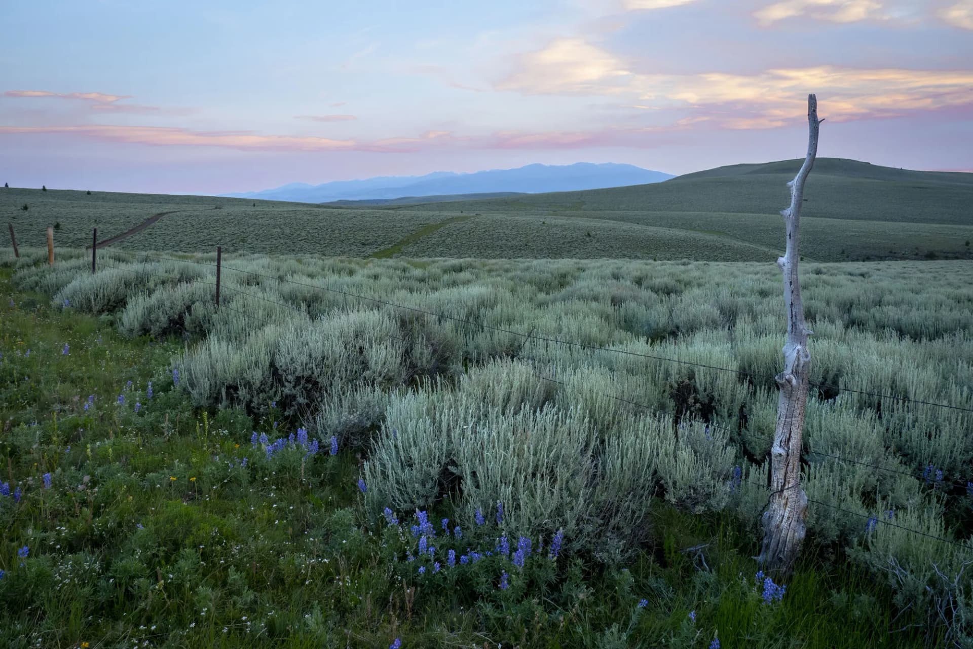
The geography here is extraordinary. The Salmon River, the longest undammed river in the contiguous United States, runs through the heart of the wilderness in a canyon that rivals the Snake River canyon in depth. The Lost River Range to the east holds Idaho's only peaks above 12,000 feet, including Mount Borah at 12,662 feet. Between these anchors lies a landscape of immense scale: roadless basins, remote lakes, and trail systems that see a fraction of the use of comparable terrain in Glacier or the Tetons.
Why Salmon-Challis National Forest Stands Out
The Frank Church Wilderness
Designated in 1980 and named for Idaho Senator Frank Church, the Frank Church-River of No Return Wilderness covers 2.4 million acres, larger than the state of Delaware. The wilderness is bisected by the Main Salmon River and its Middle Fork, both classified as Wild and Scenic Rivers. Entry into the wilderness requires genuine planning: distances are enormous, trail maintenance is irregular, and the primary aerial gateway (the airstrip at Chamberlain Basin) adds a transportation layer unlike anything in the lower 48.
Mount Borah and the Lost River Range
The Lost River Range forms the eastern boundary of the forest, rising abruptly from the sagebrush flats of the Lost River Valley in fault-scarp ridges that created Idaho's highest terrain. Mount Borah, at 12,662 feet, is the state high point and a legitimate mountaineering objective with Class 3 terrain on Chicken Out Ridge. Seven other peaks in the range exceed 11,000 feet. The 1983 Borah Peak earthquake, centered directly beneath the mountain, was the largest earthquake in Idaho history and is responsible for the fault scarp visible from the trailhead.
World-Class River Recreation
The Main Salmon and Middle Fork Salmon rivers are benchmarks for western whitewater. The Middle Fork in particular is consistently rated among the top river expeditions in North America, a multi-day float through a roadless canyon with hot springs, Class IV rapids, and wildlife-rich basins. Permits are required and competitive (as of 2026). The Main Salmon provides a more accessible alternative with sections ranging from Class II to Class IV.
Best Trails
Eight trails represent the range of this enormous forest, from the challenging summit of Idaho's highest peak to the remote alpine lakes of the Bighorn Crags.
Mount Borah Trail is the definitive Salmon-Challis hike, a 7-mile round trip to the 12,662-foot state high point requiring Class 3 scrambling on the notorious Chicken Out Ridge section.
Bighorn Crags accesses an extraordinary landscape of granite spires and alpine lakes in the Frank Church Wilderness, with a 12-mile route to the heart of the crags from the Cape Horn trailhead.
Williams Lake Trail is a moderate 4.4-mile round trip to a scenic lake in the Salmon area that serves as one of the most accessible lake destinations in the forest.
Sacajawea Peak Trail climbs 11 miles round trip to the 10,303-foot summit of the dominant peak above the town of Salmon, offering views down the Salmon River canyon.
Herd Lake Trail runs 6.0 miles to a high-elevation lake in the White Cloud country, providing remote alpine access without the extreme commitment of the Frank Church interior.
Patterson Creek Trail follows a remote central Idaho drainage for 8.2 miles through prime elk and mule deer habitat on the western side of the Lost River Range.
Salmon River Trail traces the river corridor for 7.6 miles through canyon terrain accessible from Salmon, combining river views with canyon geology.
East Fork Salmon Trail runs 9.0 miles into the headwaters of the East Fork Salmon River, entering the Frank Church Wilderness through one of its less-traveled entry corridors.
Permits and Passes
Day hiking and dispersed camping on the Salmon-Challis National Forest require no permit as of 2026. River floating permits are required for the Main Salmon and Middle Fork Salmon during peak season: verify current requirements through Recreation.gov (as of 2026), as the lottery systems and fee structures change year to year.
The America the Beautiful Annual Pass covers day-use fees at federal sites across the country. See our guides on the America the Beautiful pass for veterans and veteran benefits on national forests for details on access programs for qualifying visitors.
Camping
Challis Hot Springs Campground provides one of the most distinctive camping experiences in the forest: 50 sites adjacent to geothermal hot springs near Challis, reservable through Recreation.gov (as of 2026) and accessible year-round.
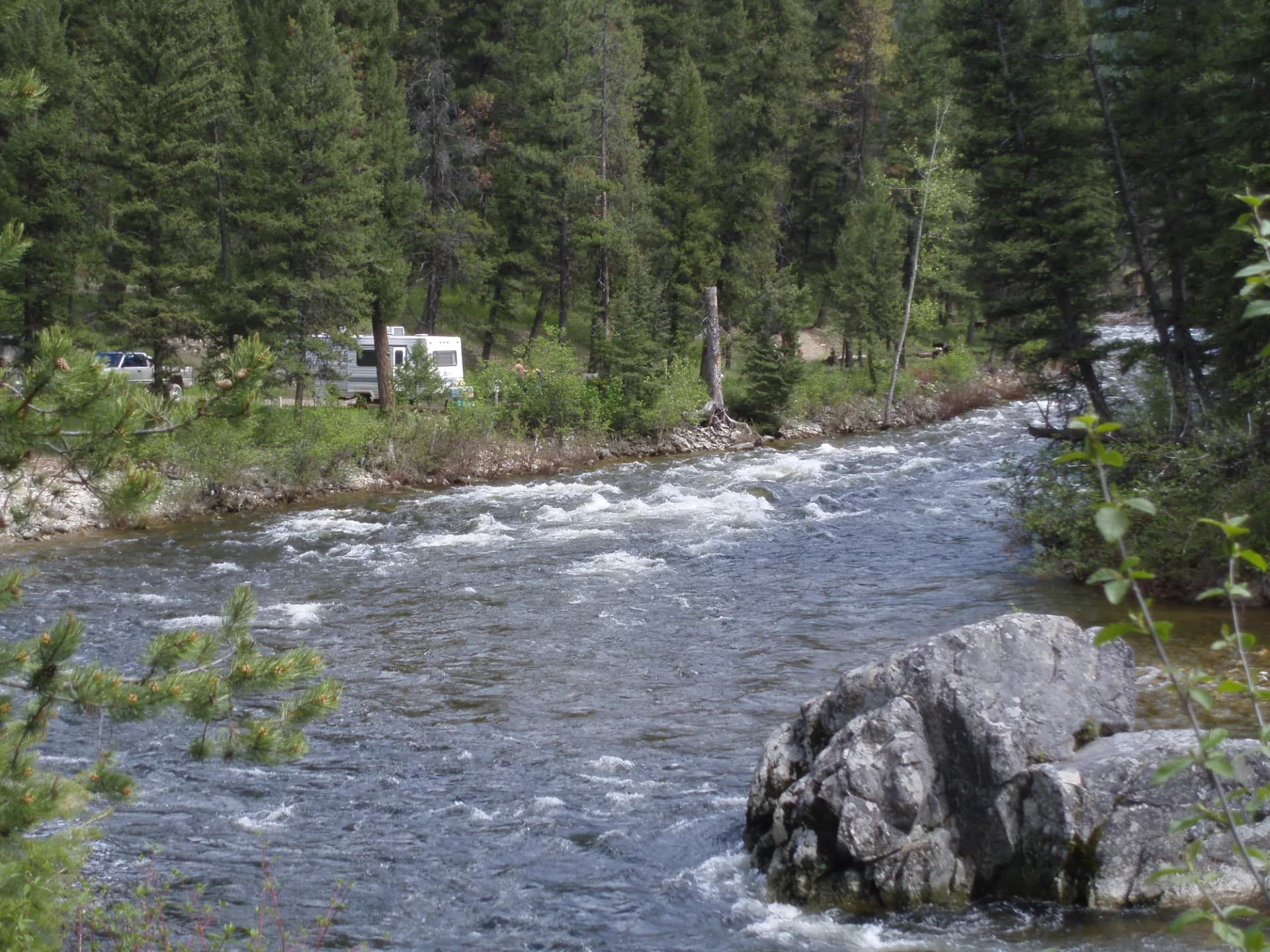
Salmon River Campground sits along the Salmon River near the town of Salmon with 30 first-come sites providing river access and a base for exploring the northern forest and wilderness entry trails.
Morgan Creek Campground is a small, primitive site in the central forest near Morgan Creek with 12 sites suited to backpackers and anglers accessing the Morgan Creek drainage.
Mackay Reservoir Campground serves as a base for Borah Peak hikers in the Lost River Valley, with 20 sites near the reservoir and easy access to the Borah Peak Trailhead road.
When to Visit
July through August is peak season in this high-elevation forest. Most trails above 7,000 feet are clear by mid-July in most years, and the long summer days allow for ambitious objectives. Afternoon thunderstorms are common on the exposed Lost River peaks.
September through mid-October is prime for experienced hikers. Crowds are minimal (few enough that many trail registers go unsigned for days), wildlife activity increases with the onset of elk rut, and the weather is typically stable with cool mornings.
June opens the lower-elevation river corridors and valley trails while the high country remains under snow. The Salmon River and lower drainages are at their most dynamic in June with peak flows.
Winter closes nearly all forest roads. The remote nature of the forest makes winter access challenging even for experienced parties. Snowmobiling is popular in some areas of the forest.
Getting There
From Salmon: The northern gateway, Salmon sits at the junction of US-93 and the Salmon River. Most northern forest trailheads are accessible within 30 to 90 minutes from town. Salmon has limited services including fuel and a small grocery, with a regional airport served by small regional carriers.
From Challis: Challis provides the central gateway to the Lost River Range and the southern sections of the forest. The Borah Peak Trailhead is approximately 55 miles south on US-93. From Challis, Twin Falls is 175 miles south (3 hours) via US-93.
From Twin Falls: Drive north on US-93 approximately 175 miles (3 hours) to Challis. Twin Falls has the nearest major commercial airport serving the southern gateway.
Practical Tips
The remoteness of the Salmon-Challis is not a marketing point: it is a genuine characteristic that demands preparation. Cell service is nonexistent in most of the forest. Carry a satellite communicator. Download maps and trail data offline. Identify the nearest point of help before entering any wilderness drainage.
Water is abundant in most drainages but must be filtered or treated. Giardia is present. Creek levels vary significantly from May to September.
Wildlife is abundant and diverse. Black bears, mountain lions, wolves, and elk are present throughout. Take appropriate precautions: carry bear spray, know how to use it, and store food properly. Our guide on bear canister requirements covers wilderness storage standards.
Check current conditions, fire restrictions, and road status before departing using the USFS checking guide. Forest roads in the Salmon-Challis are often rough and require high clearance vehicles. Know your vehicle's limitations before committing to a remote road.
Follow Leave No Trace principles particularly in the wilderness interior, where the combination of low-use and high impact potential from any individual party is significant.