Six Rivers National Forest occupies the wild river canyons and Klamath Mountain ridges of far northwestern California, a 957,000-acre forest named for the six Wild and Scenic Rivers that cut through it: the Klamath, Trinity, Eel, Van Duzen, Smith, and Mad. The forest is one of the wettest in California's national forest system, receiving 60 to 100 inches of rain annually in the higher elevations, which feeds those rivers, supports towering Douglas fir and Port Orford cedar forests, and creates the salmon and steelhead fisheries that have sustained indigenous communities in this region for thousands of years.
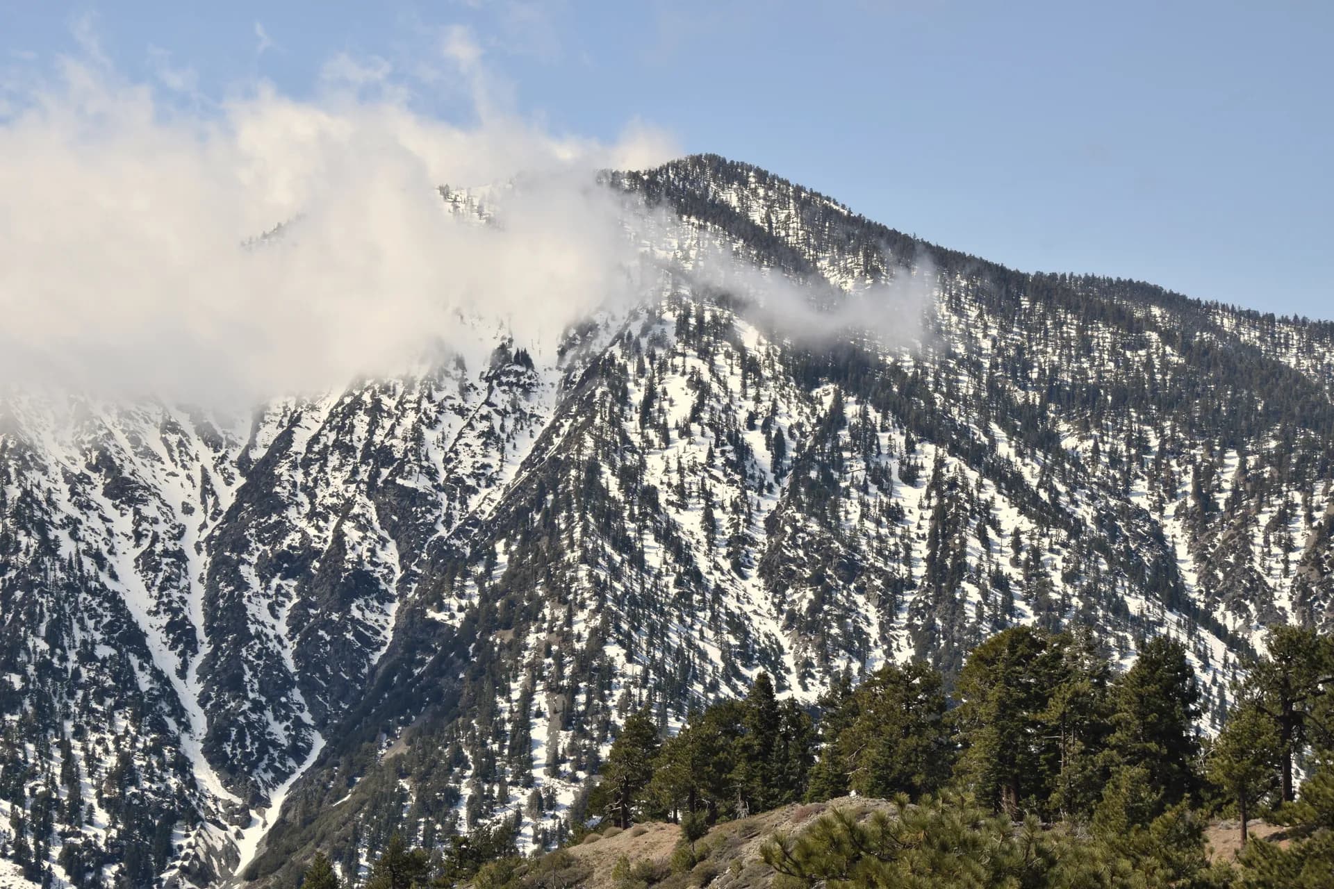
The Klamath Mountains, which form the backbone of the forest, are geologically distinct from either the Sierra Nevada or the Cascades, a complex mix of ancient oceanic crust, serpentine, and metamorphic rock that produces unusual soils and unusual plant communities. The forest's position between the maritime climate of the northern California coast and the drier interior creates a botanical diversity that supports rare plant species found nowhere else. It is also, by persistent legend and some genuine popular mythology, the heart of Bigfoot country.
Why Six Rivers Stands Out
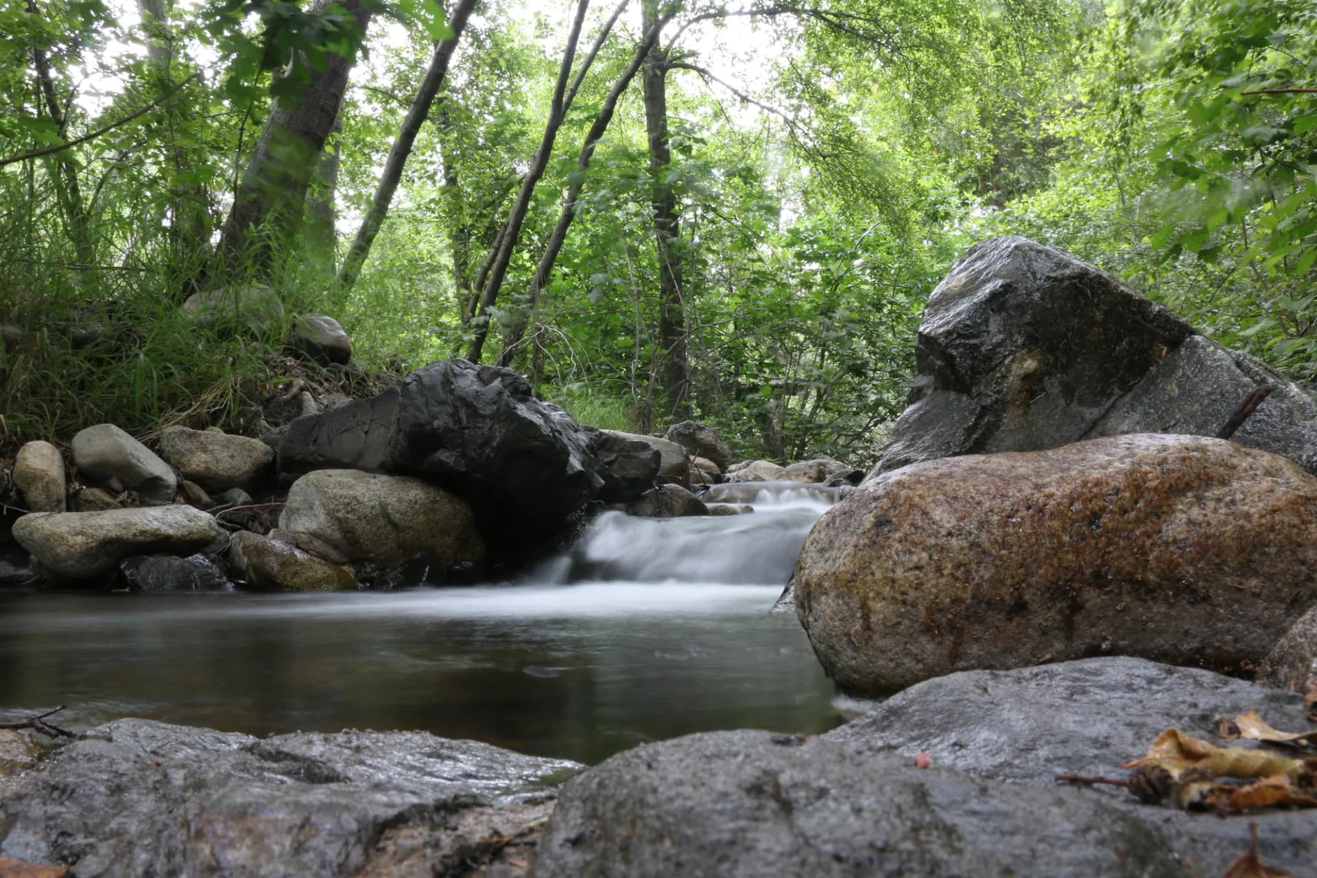
Wild and Scenic Rivers. All six of the forest's namesake rivers have federal Wild and Scenic River designations, and the Klamath and Trinity in particular are internationally recognized for their wild salmon and steelhead runs. The Trinity River below Lewiston Dam was partially restored to natural flow in the 1990s after decades of diversion, and the salmon and steelhead runs have responded. The Bluff Creek Trail follows the Klamath's tributary Bluff Creek through the forest that inspired the most famous Bigfoot sighting.
The Siskiyou Wilderness. The Siskiyou Wilderness in the northern Six Rivers and adjacent Klamath National Forest protects a portion of the Klamath Mountains' most botanically diverse terrain. The serpentine soils in the wilderness support an extraordinary endemic plant community including the rare Brewer spruce and Port Orford cedar. The Twin Sisters Trail accesses the most remote section of this wilderness.
Old-growth adjacency. The northern portion of Six Rivers borders Redwood National and State Parks, and the forest itself contains old-growth Douglas fir stands comparable to anything in the state parks. The boundary is invisible to the ecology: the trees don't stop at the park line.
Best Trails
The Bluff Creek Trail (7.0 miles, moderate) follows Bluff Creek through the forest famous as the Patterson-Gimlin film location and a genuinely beautiful canyon. The South Fork Mountain Trail (8.0 miles, moderate-hard) traverses the long South Fork Mountain ridgeline above the Trinity watershed. The Twin Sisters Trail (6.5 miles, strenuous) climbs to the twin peaks of the Siskiyou Wilderness.
The Grizzly Creek Trail (4.5 miles, moderate) is a river corridor hike near Willow Creek. The Buck Creek Trail (5.5 miles, moderate) accesses the Yolla Bolly wilderness boundary. The Smith River National Recreation Trail (6.0 miles, easy-moderate) follows the pristine Smith River in the northern forest. The Pearch Creek Trail (3.5 miles, easy) is an accessible creek hike near the Orleans area. The Red Cap Lake Trail (8.5 miles, moderate-hard) accesses a remote lake in the interior forest.
Permits and Passes
A campfire permit is required for any fire or stove use outside developed campground fire rings (as of 2026), available free at readyforwildfire.org. No hiking or dispersed camping permit is required anywhere in Six Rivers National Forest. The America the Beautiful pass covers day use at developed areas. Veterans should review our veteran benefits guide.
Check current fire restrictions and road conditions at fs.usda.gov/srnf and review our checking conditions guide. The forest is subject to wildfire, earthquake, and flash flooding hazards.
Camping
Patrick Creek Campground (17 sites) is one of the most popular campgrounds in the northern forest, near the Smith River in Del Norte County. Reservable through Recreation.gov in summer.
Bluff Creek Campground (8 sites) is a small, remote campground near the Bluff Creek area. First-come, first-served.
Sanger Lake Campground (9 sites) is at a high-elevation lake in the Siskiyou area. First-come, first-served; accessible only after snow clears in late June.
Oak Bottom Campground (26 sites) is on the Trinity River near Willow Creek, popular with river anglers. Reservable in summer.
When to Visit
May through June offer the highest river flows, best waterfall displays, and spring wildflowers. The Klamath and Trinity spring fishing season is excellent.
July and August are the warmest months for swimming in the rivers. Wildfire risk peaks in August; check conditions before traveling.
September through November bring fall salmon and steelhead runs to the rivers, which is the primary draw for many visitors. Fall color from the bigleaf maple and alder along the river corridors is vivid in October.
November through April: Heavy rain and winter storms make forest access challenging. The rivers are at their highest and most powerful in late winter.
Getting There
From Eureka: State Route 299 east through Blue Lake to Willow Creek and the Klamath-Trinity watershed. About 50 miles and 1 hour to the central forest.
From Redding: State Route 299 west through Weaverville to the forest. About 90 miles and 1.5 hours.
From the Oregon border: US-101 south into Del Norte County, then east to the Smith River area. About 20 miles from Crescent City to the northern forest.
Practical Tips
Flash flooding is a real risk in the Klamath Mountains. The canyon terrain concentrates rainfall rapidly, and rivers can rise several feet in hours during winter and spring storms. Check weather forecasts before any canyon or creek hiking.
Wildfire: The Six Rivers has experienced significant fire in recent years. Check InciWeb and USFS closure orders before traveling in summer and fall.
Rattlesnakes and ticks are present in the lower-elevation river canyon areas throughout the hiking season. Wear appropriate clothing and check for ticks after brushy hikes.
Bears: Black bears are present. Store food properly in camp and review our bear canister guide.
Leave no trace principles are particularly important along the Wild and Scenic River corridors. Follow the Leave No Trace seven principles.