Stanislaus National Forest spans nearly 900,000 acres of the central Sierra Nevada, stretching from the pine-oak foothills west of Sonora to the volcanic and granite high country along the Sierra crest above Sonora Pass. The forest takes its name from the Stanislaus River, whose tributaries drain the western Sierra in three forks that cut through dramatic canyons before reaching the Central Valley. This is the Sierra Nevada that most Bay Area and Sacramento Valley residents drive through without quite realizing what they are bypassing on their way to Yosemite.
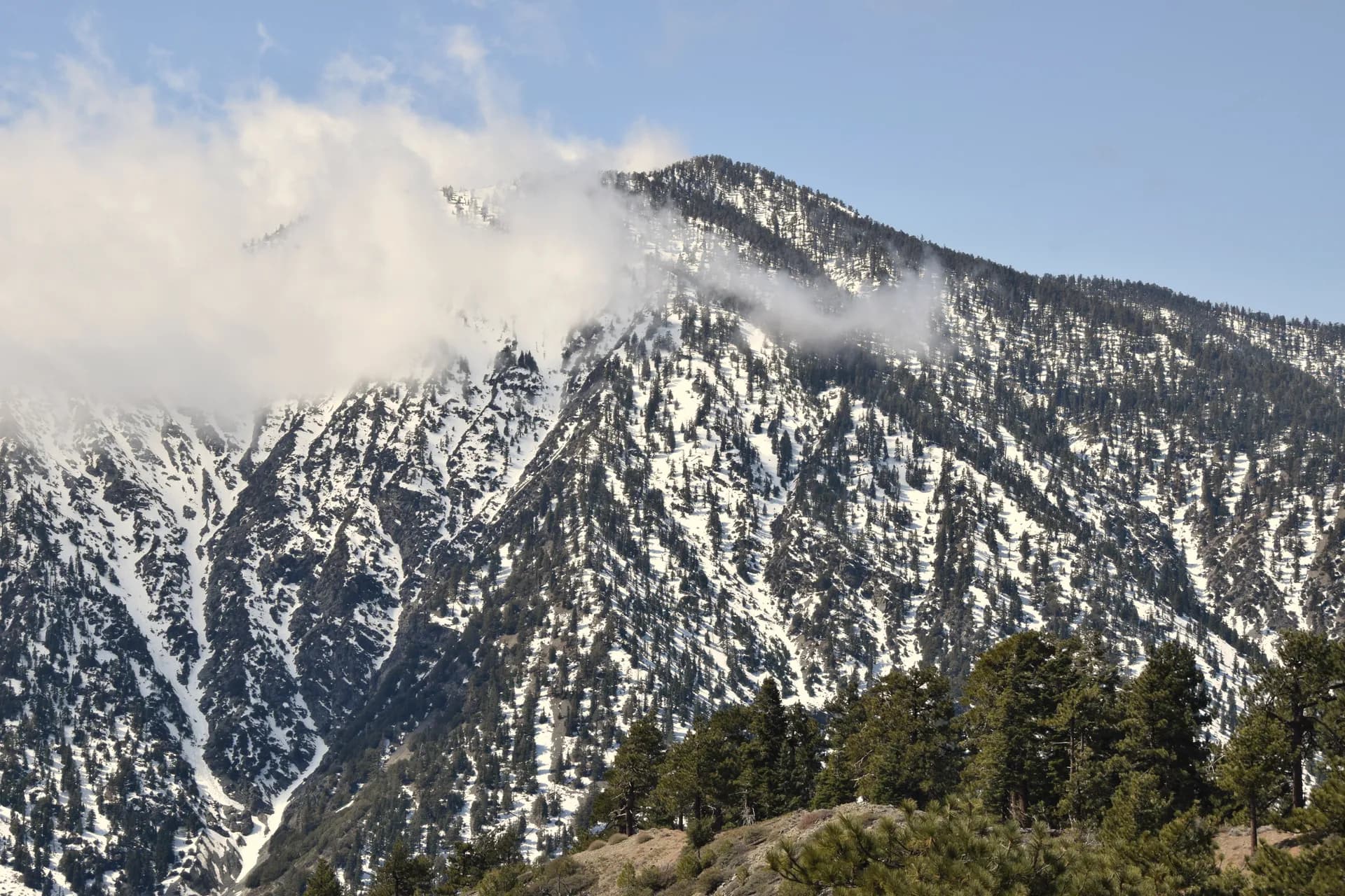
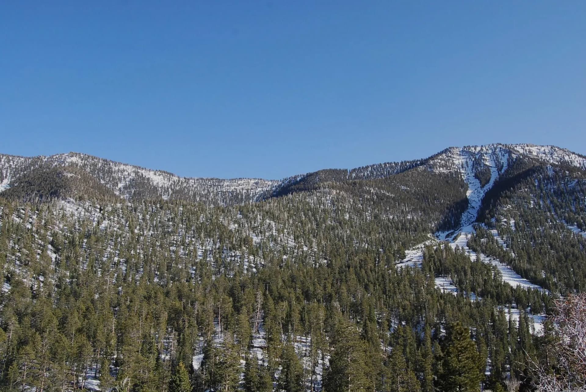
The forest contains four wilderness areas totaling roughly 300,000 acres, with the Emigrant Wilderness (112,000 acres) as the centerpiece. Emigrant sits just north of Yosemite National Park's boundary and shares its high-country character: volcanic peaks and domes from the region's ancient eruptions mixed with Sierra granite, dozens of alpine lakes, and a network of cross-country routes that reward experienced navigators. The key difference from Yosemite is the permit system. Emigrant Wilderness uses a free self-issue permit rather than a competitive quota system, which means the wilderness experience available here is genuinely accessible without a lottery win.
Sonora Pass, at 9,624 feet, is the highest paved road crossing in the northern Sierra Nevada and one of the most scenic. The drive over Highway 108 connects the Central Valley to the Bridgeport Valley in Nevada via a route that passes through some of the best roadside high Sierra scenery accessible by a standard vehicle. Trailheads near the pass access both the Emigrant Wilderness to the north and the Hoover Wilderness (adjacent Carson-Iceberg Wilderness) to the east. See the national forest vs. national park guide for context on how Stanislaus's management compares to neighboring Yosemite.
Why Stanislaus Stands Out
Emigrant Wilderness Without the Yosemite Lottery
The Emigrant Wilderness shares the Sierra Nevada's high-country geology and scenery with Yosemite but without the competitive permit system. Volcanic peaks like Leavitt Peak (11,570 feet) and Relief Peak (10,720 feet) rise above dozens of named lakes in a landscape that rewards multi-day exploration. Most trailheads require only a free self-issue permit, which means a spontaneous mid-week backpacking trip is possible without months of advance planning. The western Emigrant trails from Pinecrest get the most use; the eastern corridors from Kennedy Meadows are significantly quieter.
The Clark Fork and Kennedy Meadows
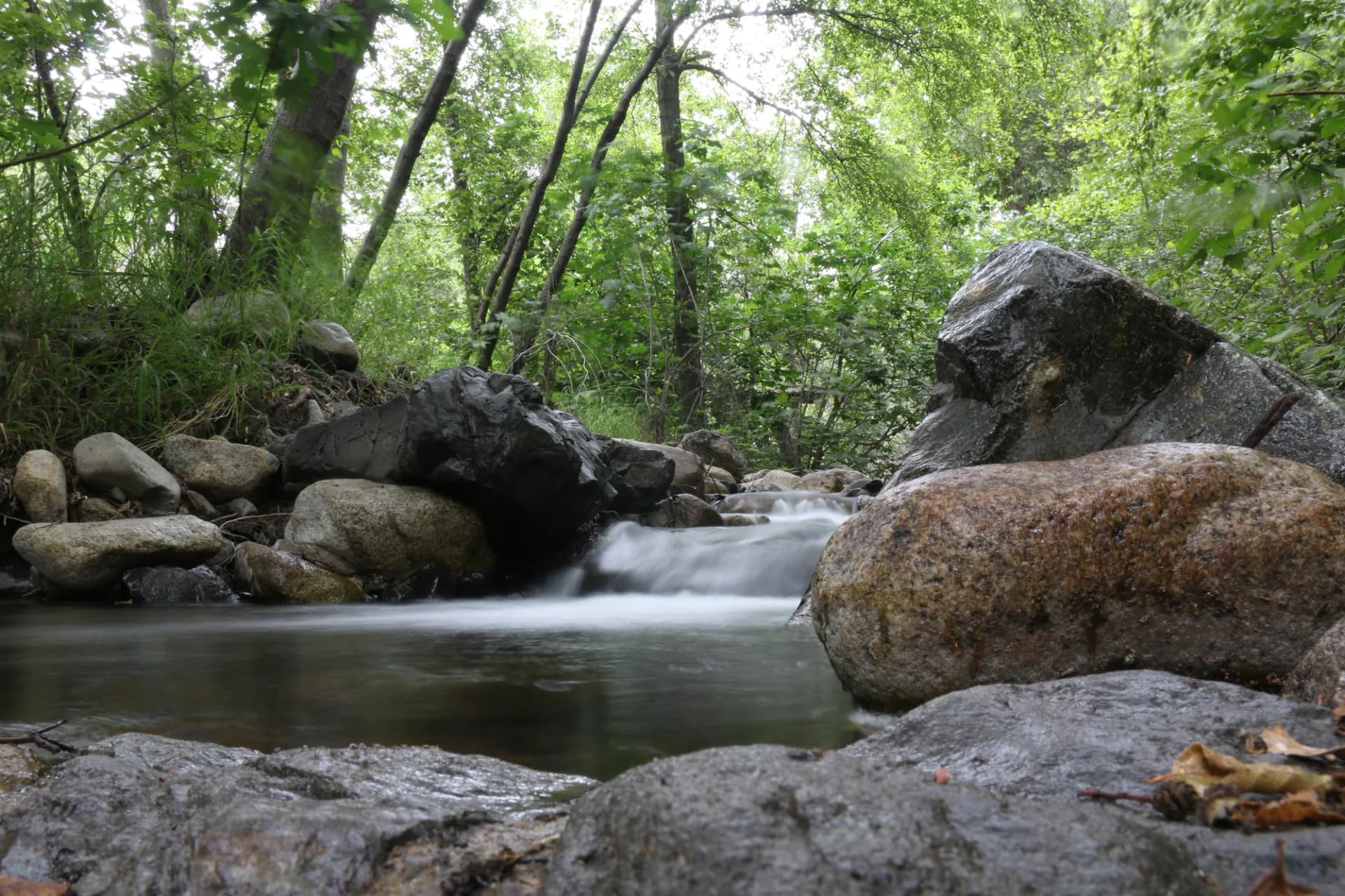
The Clark Fork of the Stanislaus River drains a broad valley below Sonora Pass that contains one of the finest subalpine meadow systems in the Sierra Nevada at Kennedy Meadows. The Clark Fork campground area is popular with families for summer camping, fishing, and swimming in the clear river pools. The meadow at Kennedy Meadows proper, reachable by an easy walk from the campground, is the kind of place that Sierra Nevada regulars describe as a favorite spot they are vaguely reluctant to mention publicly. Wide, flat, flower-filled in July, and surrounded by volcanic peaks.
Columns of the Giants
The Columns of the Giants interpretive loop provides a 0.5-mile walk to a basalt column formation that rivals Devils Postpile National Monument in quality but sees a small fraction of the visitors. The columns formed when a volcanic lava flow cooled and cracked into hexagonal basalt prisms. The geology here is distinct from the granite that characterizes most of the Sierra, reflecting the volcanic history of the region north of Yosemite.
Best Trails in Stanislaus National Forest
Burst Rock Trail
The Burst Rock Trail climbs from the Pinecrest Lake area to a granite viewpoint above the western Emigrant Wilderness with views across the high country. The 7-mile round trip gains 1,400 feet through red fir forest and open granite slabs, finishing at a distinctive split boulder that frames the view.
Relief Reservoir Trail
The Relief Reservoir route follows the main Emigrant Wilderness access trail from Kennedy Meadows to a large backcountry reservoir at 7,226 feet. The 9-mile round trip is the most direct approach to the high Emigrant country and one of the best day hikes in the forest for seeing the volcanic landscape character.
Buck Lakes Loop
The Buck Lakes Loop in the Emigrant Wilderness connects two alpine lakes on a 10-mile circuit, one of the few true loop options in the wilderness without significant cross-country travel.
Clark Fork Meadows Trail
The Clark Fork Meadows Trail is a 5-mile out-and-back from the popular Clark Fork campground area to the upper meadows of Kennedy Meadows, making it the most accessible subalpine meadow walk in the forest.
Permits and Passes
Emigrant Wilderness requires a free self-issue permit for overnight camping, available at trailhead kiosks as of 2026. No permit is needed for day hiking. A free California campfire permit is required outside developed campgrounds throughout the forest. The America the Beautiful Pass covers day-use parking fees. Veterans and active military may access this pass at no cost; see the veteran benefits guide for details.
Camping
The forest has both developed campgrounds and dispersed backcountry camping. Herring Creek Campground near Pinecrest is the largest and most popular. Clark Fork Campground in the Donnells area fills on summer weekends and provides direct access to the Clark Fork swimming holes. Dispersed camping in the wilderness requires the free permit and adherence to 200-foot setbacks from water. Bear boxes are recommended but bear canisters are a more practical solution for backpackers. See bear canister requirements for current USFS guidance.
When to Visit
June through October is the main season. Sonora Pass (Highway 108) typically opens in late May or June; check CalTrans road conditions before planning early-season high-country trips. July and August are peak season with reliable warm temperatures at elevation. September is excellent for hiking with quieter trails and early fall color. October brings the first snow to the high country but low-elevation trails remain open.
Fire conditions affect camping and campfire rules from August onward. Always check current restrictions at fs.usda.gov/stanislaus before departing.
Getting There
Highway 108 (Sonora Pass Road) is the primary access corridor, connecting Sonora to the east side of the Sierra via the 9,624-foot pass. From Sonora, the main forest recreation areas (Pinecrest, Donnells, Clark Fork) are 30-60 miles east. Highway 120 (Tioga Road) borders the southern forest near the Yosemite boundary. Most trailheads require paved road drives from Highway 108.
From the Bay Area, Highway 580 to Interstate 205 to Highway 120 or Interstate 5 to Highway 99 to Highway 108 are the standard approaches, with 3-4 hour drives typical from the Bay Area or Sacramento.
Practical Tips
- Pinecrest Lake area roads are congested on summer holiday weekends. Midweek visits or early morning arrivals improve the experience significantly.
- Weather at Sonora Pass is alpine: snow is possible at any time, and afternoon thunderstorms are frequent in July and August. Start high-country hikes early.
- The forest shares management boundaries with Yosemite National Park to the south. If your route crosses into the park, Yosemite wilderness permit requirements apply.
- Cell service is limited throughout the high country. Download maps before leaving the Sonora area.
Planning Your Trip
The Summit Ranger District (based in Pinecrest) and the Calaveras Ranger District (based in Hathaway Pines) cover the main recreation areas. Contact the relevant office for current conditions, road status, and permit information. Check conditions before any trip using InciWeb for fire information and the USFS Stanislaus website for permit and road updates. For backcountry planning, the Leave No Trace principles guide and how to get a national forest camping permit guide are useful references.