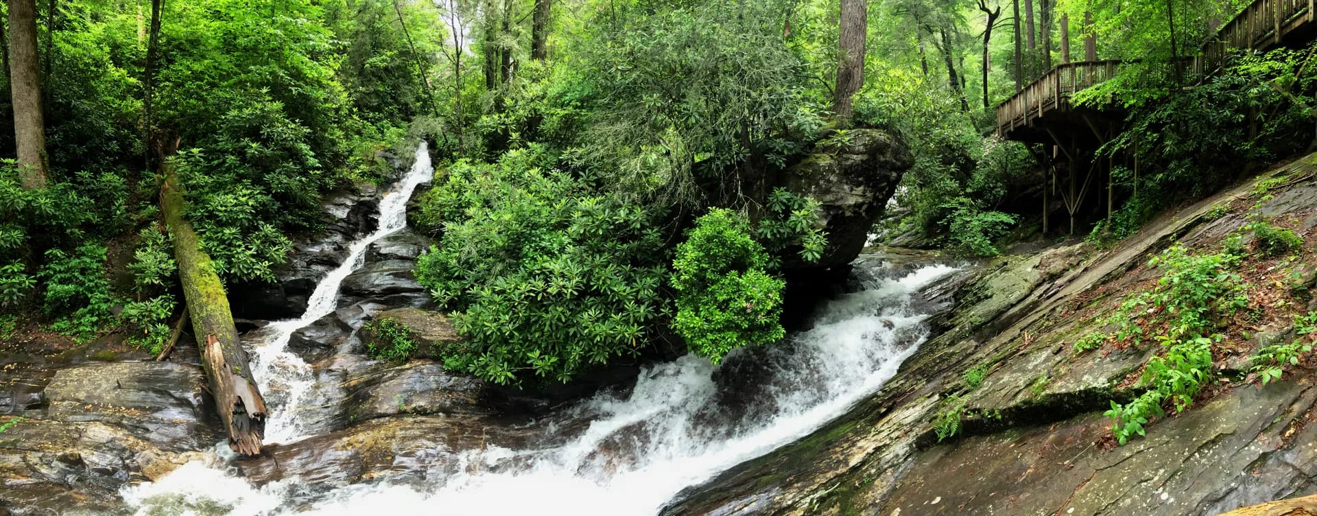
Pisgah National Forest
~22 mi from AshevilleNorth Carolina
Complete guide to Pisgah National Forest in western North Carolina. Trail recommendations, campgrounds, waterfalls, Blue Ridge Parkway access, and trip planning resources.
13 min read
NC · Southeast
8 forest guides within driving distance
Planning a trip near Asheville? Our curated guide has the top picks.
Read the guide →Complete guide to Pisgah National Forest in western North Carolina. Trail recommendations, campgrounds, waterfalls, Blue Ridge Parkway access, and trip planning resources.
13 min read
Cherokee National Forest flanks Great Smoky Mountains National Park across 655,000 acres of Tennessee's Blue Ridge and Unaka Mountains, offering waterfalls, high-country meadows, and some of the best trout fishing in the South.
7 min read
North Carolina's Nantahala National Forest is the most visited national forest in the Eastern United States. Over 531,000 acres of Southern Appalachian terrain host the Appalachian Trail, old-growth Joyce Kilmer Memorial Forest, and some of the highest waterfalls in the East.
7 min read
371,000 acres across three South Carolina districts, from the Piedmont hills of the Andrew Pickens District to the coastal plain Long Cane and Enoree Districts, with Chattooga Wild and Scenic River, waterfalls, and Appalachian foothills hiking.
7 min read
Complete guide to Chattahoochee-Oconee National Forests in Georgia. Trail recommendations, campgrounds, waterfalls, Appalachian Trail access, and trip planning resources.
15 min read
North Carolina's smallest national forest: 51,000 acres of ancient Uwharrie Mountains, the oldest mountain range in North America, with gold rush history, lake recreation, and a designated wilderness.
7 min read

Daniel Boone National Forest spans 708,000 acres of rugged Kentucky hill country, offering sandstone arches, deep gorges, and the largest concentration of natural arches east of the Rockies.
8 min read
Jefferson National Forest spans the Virginia and West Virginia Appalachians, anchored by Mount Rogers, Virginia's highest peak, and the Appalachian Trail's finest southern Virginia miles.
5 min read
Guide to the Shining Rock hike via the Art Loeb Trail in Pisgah National Forest, North Carolina. A 7.6-mile out-and-back to a white quartz outcropping at 5,940 feet.
6 min read
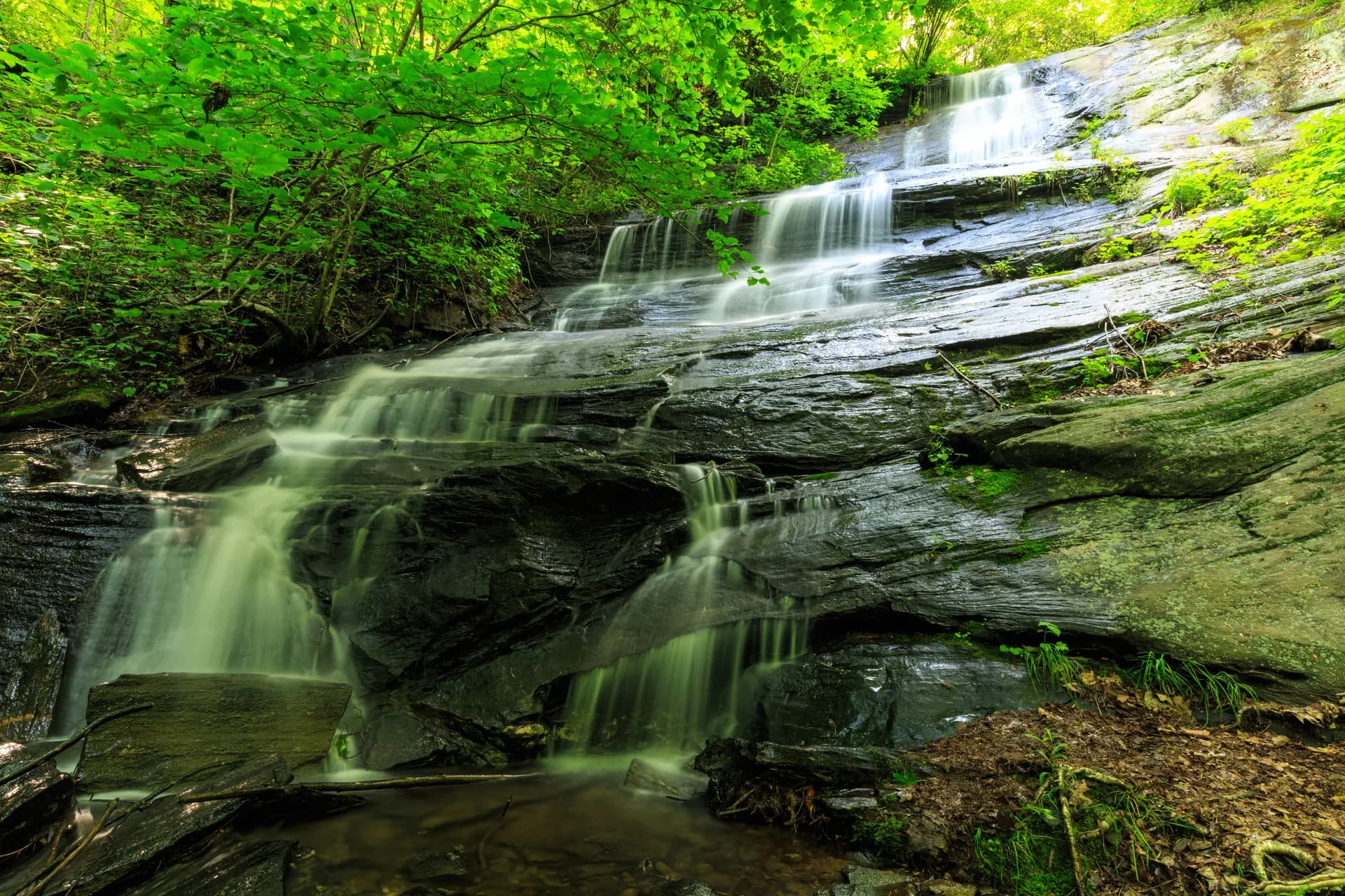
Guide to Moore Cove Falls in Pisgah National Forest, North Carolina. A 1.4-mile out-and-back through a flat forest cove to a 50-foot waterfall you can walk behind, near Brevard, NC.
8 min read
Guide to the Looking Glass Rock Trail in Pisgah National Forest. A challenging 6.2-mile out-and-back hike to the summit of one of the most iconic peaks in the southern Appalachians.
8 min read
Guide to the Graveyard Fields Loop off the Blue Ridge Parkway in Pisgah National Forest. A 3.2-mile loop through a unique high-altitude valley with two waterfalls and exceptional fall color.
10 min read
Guide to Black Balsam Knob in Pisgah National Forest, North Carolina. A 3.5-mile out-and-back on the Art Loeb Trail to an open Appalachian bald at 6,214 feet with 360-degree views over the Southern Appalachian high country.
7 min read
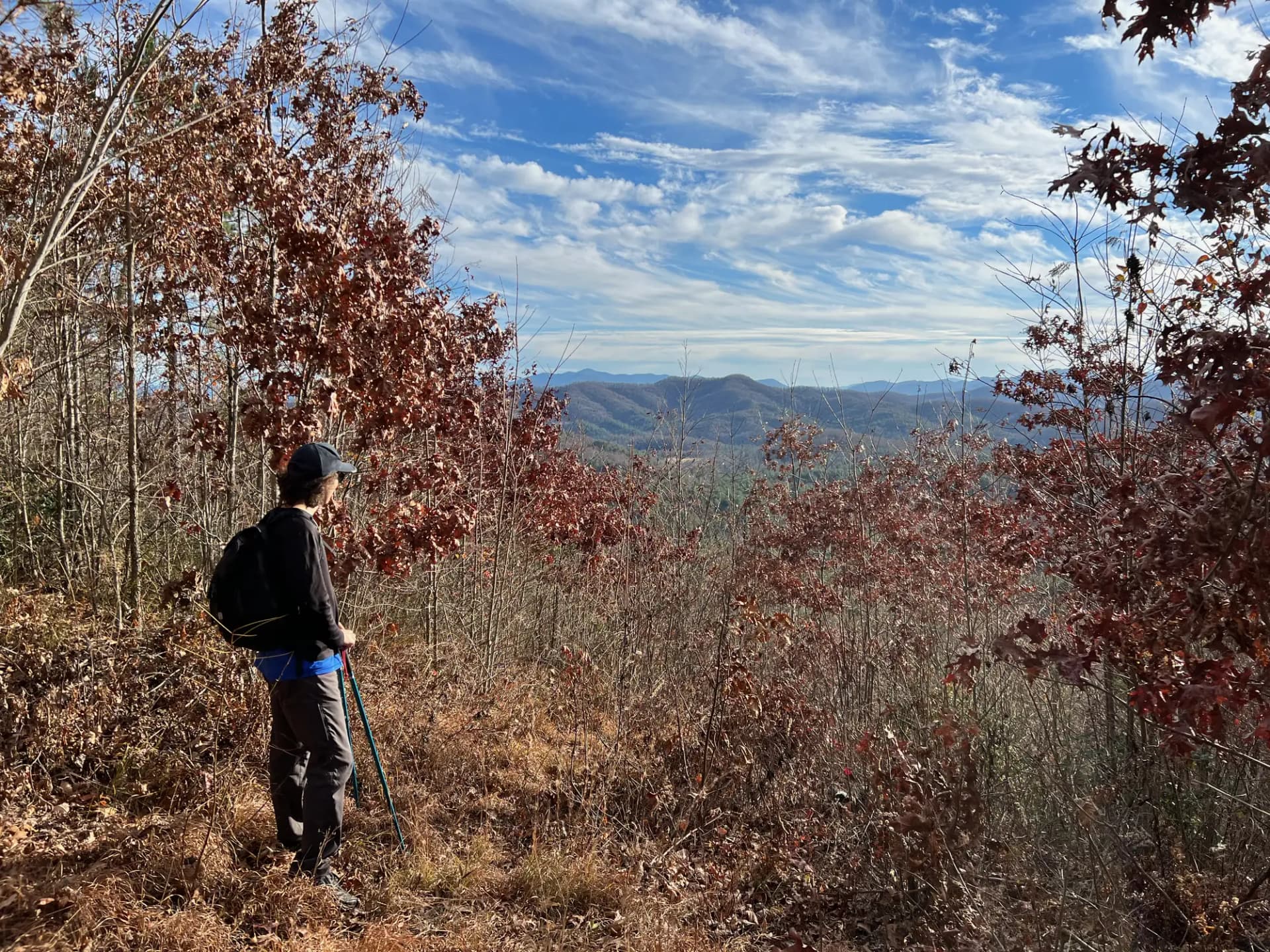
Guide to the Max Patch hike on the Appalachian Trail in Pisgah National Forest. A 2.4-mile loop to a grassy bald with 360-degree views of the Blue Ridge and Great Smoky Mountains.
9 min read
A short but dramatic 1.0-mile out-and-back to a quartzite summit at 5,462 ft in Pisgah National Forest, offering 360-degree views into North Carolina, South Carolina, Georgia, and Tennessee.
7 min read
A 4.0-mile out-and-back through old-growth forest in Pisgah National Forest to a 45-foot waterfall on Courthouse Creek, one of the quieter cascades in western North Carolina.
7 min read
The Roan Mountain Highlands Trail follows the Appalachian Trail across the open balds and rhododendron gardens of the Roan Mountain massif for 8.0 miles out and back, with expansive views into multiple states.
4 min read
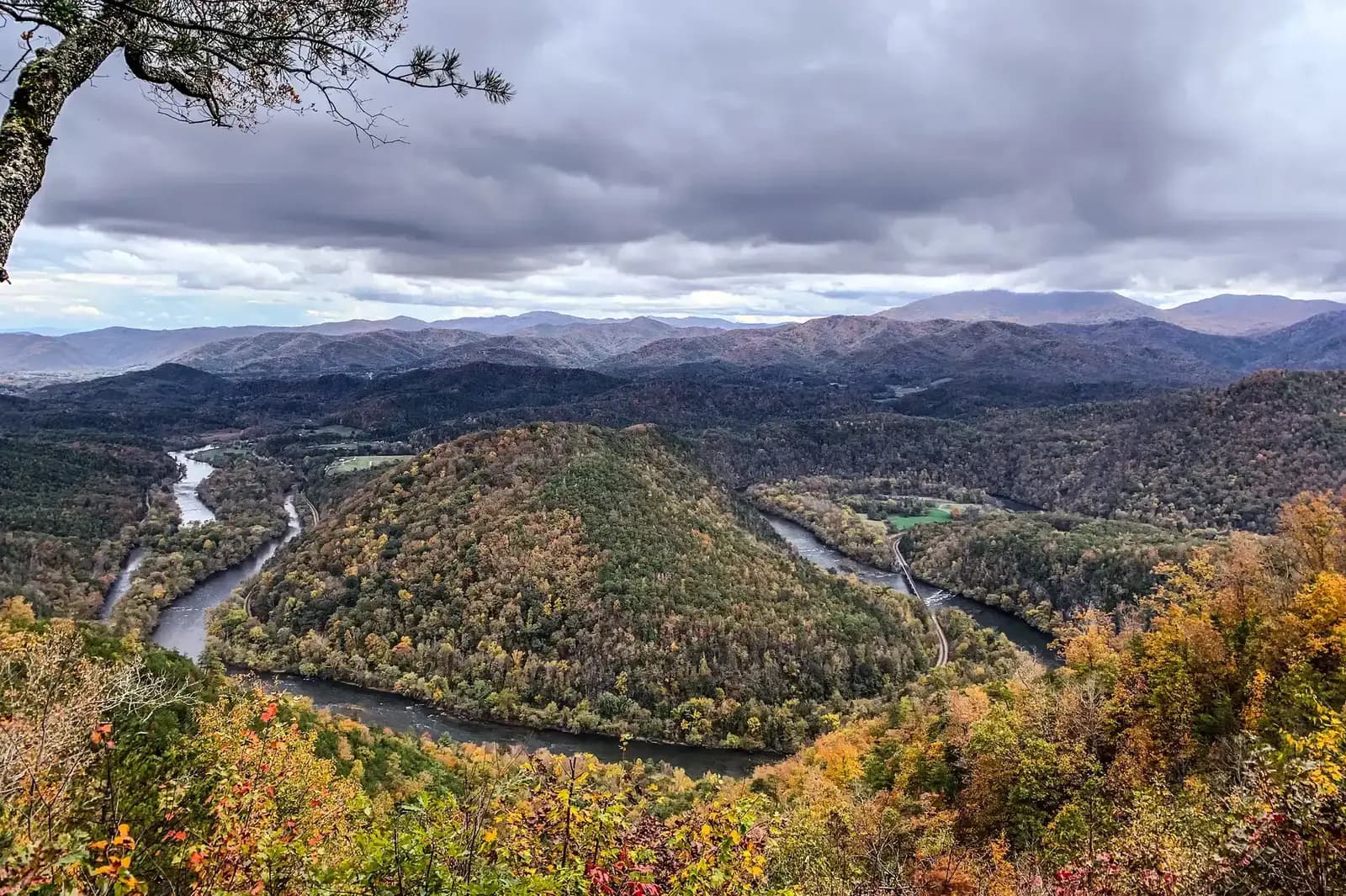
A 1.0-mile out-and-back to the upper overlook of Whitewater Falls, one of the highest waterfalls in the Eastern United States. The cascade drops over 400 feet on the Whitewater River near the North Carolina-South Carolina border.
4 min read
The Pond Mountain Wilderness Loop is a 7.0-mile circuit through one of Cherokee National Forest's two designated wilderness areas, combining ridge walking and creek drainages in the northern unit.
3 min read
This 6.8-mile out-and-back section of the Appalachian Trail through Laurel Fork Gorge passes Laurel Fork Falls before climbing into old-growth forest, one of the most dramatic AT sections in Tennessee.
3 min read
A 4-mile round trip to the tri-state boundary marker of South Carolina, North Carolina, and Georgia in the Ellicott Rock Wilderness of Sumter National Forest, through old-growth cove hardwood forest.
3 min read
A 1.5-mile out-and-back to the 50-foot Spoonauger Falls in Sumter National Forest, a lesser-visited waterfall near Burrells Ford with a beautiful two-tiered cascade.
3 min read
A 5.0-mile out-and-back to the historic Ellicott Rock, the boundary marker of North Carolina, South Carolina, and Georgia, through the federally designated Ellicott Rock Wilderness on the Chattooga River.
4 min read
A 14-mile challenging section of South Carolina's Foothills Trail through Sumter National Forest's Andrew Pickens District, with ridge traverses, waterfalls, and the most demanding terrain in the forest.
3 min read
An easy 2-mile out-and-back to the 70-foot King Creek Falls in Sumter National Forest's Andrew Pickens District, the most visited waterfall hike in the South Carolina national forest.
3 min read
A 5-mile out-and-back climbing a steep ridge in Sumter National Forest's Andrew Pickens District, with views into the Chattooga watershed and one of the most demanding ascents in the forest.
3 min read
An 11-mile one-way route along the Chattooga Wild and Scenic River in Sumter National Forest, through old-growth cove forest and river canyon with one of the Southeast's most storied whitewater rivers.
4 min read
An 8.0-mile out-and-back along the Bartram Trail in Nantahala National Forest, following the historic route of naturalist William Bartram through the Southern Appalachians. Ridgeline walking, mountain views, and rich wildflower corridors.
4 min read
A 4.0-mile out-and-back to the 4,627-foot Wayah Bald summit and its historic stone observation tower. The hike follows the Appalachian Trail and offers some of the best 360-degree views in the southern Appalachians.
4 min read
The 9.0-mile out-and-back to Standing Indian Mountain follows the Appalachian Trail to the highest point in the Georgia-North Carolina area south of the Smokies. The 5,499-foot summit delivers 360-degree views across the Southern Appalachians.
4 min read
An 8.0-mile out-and-back on the Appalachian Trail through the Nantahala National Forest section near Wayah Bald. The route traverses high-elevation ridgelines with views, rhododendron tunnels, and classic Southern Appalachian AT character.
4 min read
A 2.0-mile figure-eight loop through one of the last remaining old-growth cove hardwood forests in the Eastern United States. Yellow poplars exceeding 20 feet in circumference grow here, making this short walk one of the most striking forest experiences in the Southeast.
5 min read