Virginia's Mountain Highlands
Jefferson National Forest occupies the mountain backbone of southwest Virginia, running from the New River Valley in Roanoke County south and west to the Tennessee and North Carolina borders, with extensions into West Virginia and Kentucky. Covering approximately 723,000 acres, it forms the southern half of the combined George Washington and Jefferson National Forests administrative unit. Where the George Washington section is characterized by the gentler ridges of the northern and central Shenandoah Valley country, the Jefferson section rises to genuine highlands: Mount Rogers at 5,729 feet, the tallest mountain in Virginia, sits here, and the surrounding plateau terrain feels more like the Southern Appalachian highlands than the ridge-and-valley country further north.
The Appalachian Trail is the thread that connects the Jefferson section's major destinations, running for more than 300 miles through the forest across ridges that shift from forested corridors to open highland meadows as the trail moves through the Mount Rogers National Recreation Area. This is some of the best walking on the entire AT: broad views, rare spruce-fir forest, highland meadows grazed by feral ponies, and a landscape that feels more remote than its proximity to Roanoke and Blacksburg would suggest.
Mount Rogers National Recreation Area
The Mount Rogers National Recreation Area, centered on Virginia's highest peak, is the most visited section of Jefferson National Forest. The 115,000-acre area contains Mount Rogers itself (summit in a dark spruce-fir forest that blocks the view, but the highland approach is spectacular), Wilburn Ridge, and the high meadows that host the feral pony herd. The ponies, descendants of domestic horses released here decades ago, are the signature wildlife encounter of this forest. They appear unannounced, grazing the open meadows along the Appalachian Trail, and they're accustomed to human presence. Keep distance and do not approach to feed.
Cascades and the New River Country
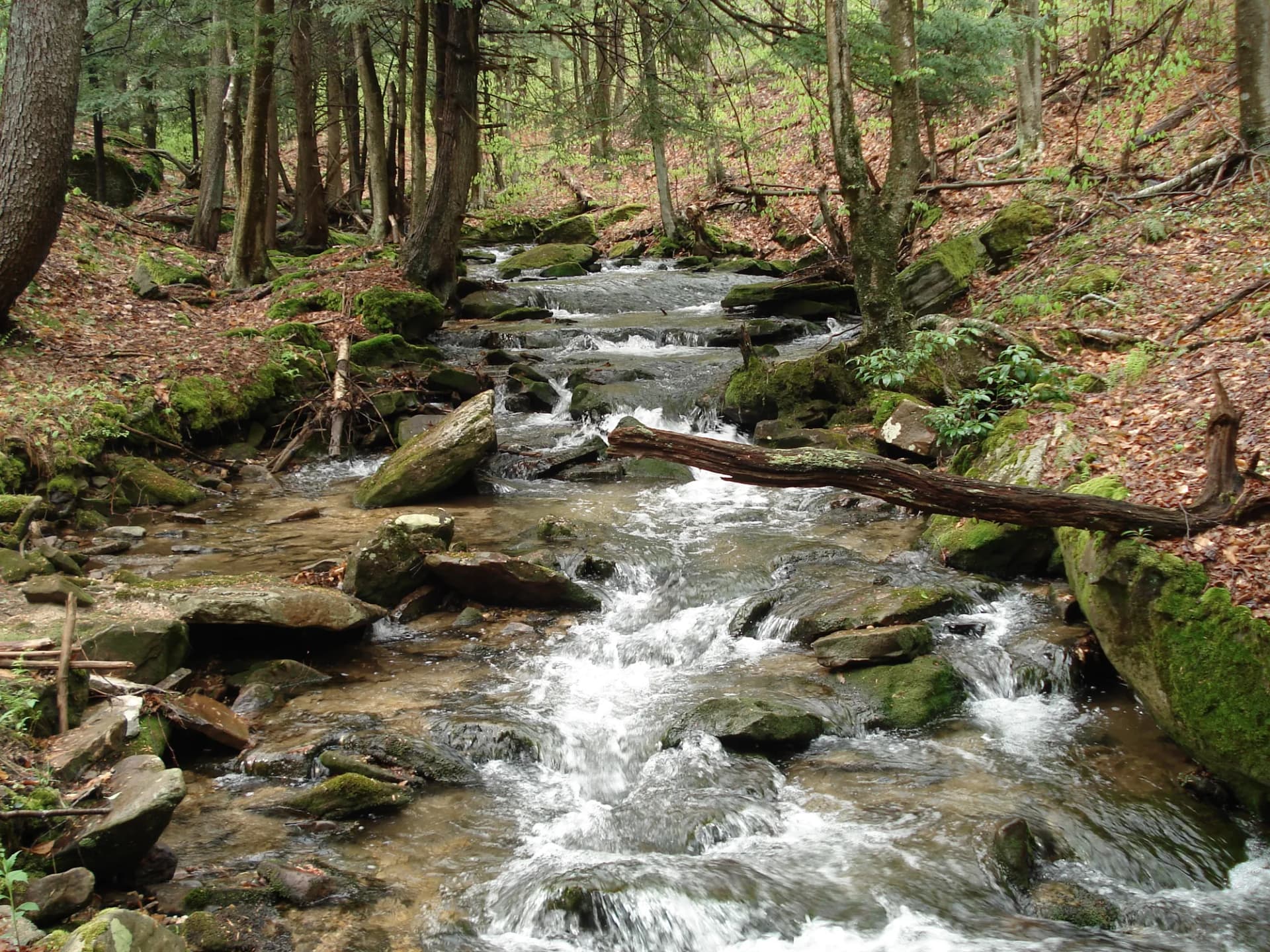
On the forest's northern edge, the New River forms a western boundary with West Virginia. The Cascades National Recreation Trail near Blacksburg and Virginia Tech is the forest's most popular single day hike, following Little Stony Creek to a 66-foot plunge waterfall. Spring runoff in March and April brings the falls to peak flow, and the creek canyon is pleasant year-round for its hemlock and hardwood forest.
The Peters Mountain Wilderness and the adjacent Kimberling Creek Wilderness protect two pockets of roadless country in the forest's northeastern section, offering quieter backpacking alternatives to the busier Mount Rogers area.
Best Trails
Mount Rogers via Appalachian Trail (9.0 miles, out-and-back from Massie Gap) traverses the highland meadows and spruce-fir forests of the Mount Rogers NRA to Virginia's highest point. The summit is wooded, but Wilburn Ridge and the meadow approach offer the best views. Wild ponies are commonly encountered on this route.
Grayson Highlands Loop (7.5 miles, loop) combines the Appalachian Trail with side trails through the open highland country of Grayson Highlands State Park adjacent to the NF boundary, including the best pony-viewing terrain in the area.
Cascades National Recreation Trail (4.0 miles, out-and-back) is the most accessible waterfall hike in the forest, following Little Stony Creek north of Blacksburg to a 66-foot waterfall. Heavily visited in spring and fall.
Appalachian Trail Virginia Section (12.0 miles, selected section) through the Jefferson section delivers the best combination of highland meadow walking, spruce-fir forest, and long ridge views available anywhere in Virginia.
Beartown Trail (3.5 miles, loop) explores a jumbled boulder field and rock labyrinth near Burkes Garden in Tazewell County, one of the geological curiosities of the forest.
Devils Fork Loop (6.2 miles, loop) traverses ridge and creek terrain in the southern section with good options for fishing and forest solitude.
Permits and Passes
No permit is required for day hiking or dispersed camping in Jefferson National Forest (as of 2026). Developed campground fees apply. America the Beautiful passes are accepted at fee sites.
The America the Beautiful pass for veterans and veteran benefits in national forests cover current programs for veterans and active military.
Camping
Grindstone Campground (99 sites, reservable) in the Mount Rogers NRA is the largest and most popular facility, providing a good base for the pony highlands. Hurricane Campground is a smaller alternative also near Mount Rogers. Couch Branch Campground is first-come and more primitive.
When to Visit
April through November is the primary season. Spring brings wildflowers along creek bottoms and the AT corridor. Summer is warm with occasional afternoon thunderstorms on the high ridges. October delivers outstanding fall color throughout the ridges and valleys. Winter can bring snow and ice to the higher terrain; the highland meadows at Mount Rogers can be blustery and cold even in early spring.
Check conditions at checking conditions before you go and practice Leave No Trace principles throughout.
Getting There
From Roanoke, take I-81 south to Marion, then US-16 south to the Mount Rogers NRA entrance. From Blacksburg, take US-460 west toward Radford, then south on I-81 to the Marion area. For the Cascades trailhead, take US-460 northwest from Blacksburg approximately 15 miles to the marked turn.