Remote Heart of Central Idaho
Challis National Forest encompasses the upper Salmon River basin and the rugged White Cloud Peaks in central Idaho, covering approximately 2,468,000 acres of some of the most remote terrain in the lower 48 states. It forms one half of the combined Salmon-Challis National Forest administrative unit, sharing a supervisor's office with the Salmon section to the north but occupying a distinctly different landscape: high limestone peaks, sage-covered valley floors, and a river system that has sustained human life in this remote country for thousands of years.
The forest is not built for easy tourism. Paved roads are scarce, cell service is essentially absent, and many of the best destinations require high-clearance vehicles just to reach the trailhead. That remoteness is the point. Challis National Forest offers the kind of backcountry experience that has become genuinely rare: days on trail without seeing another person, pristine alpine lakes that require real effort to reach, and a landscape that operates on its own terms.
White Cloud Peaks and the Boulder Chain Lakes
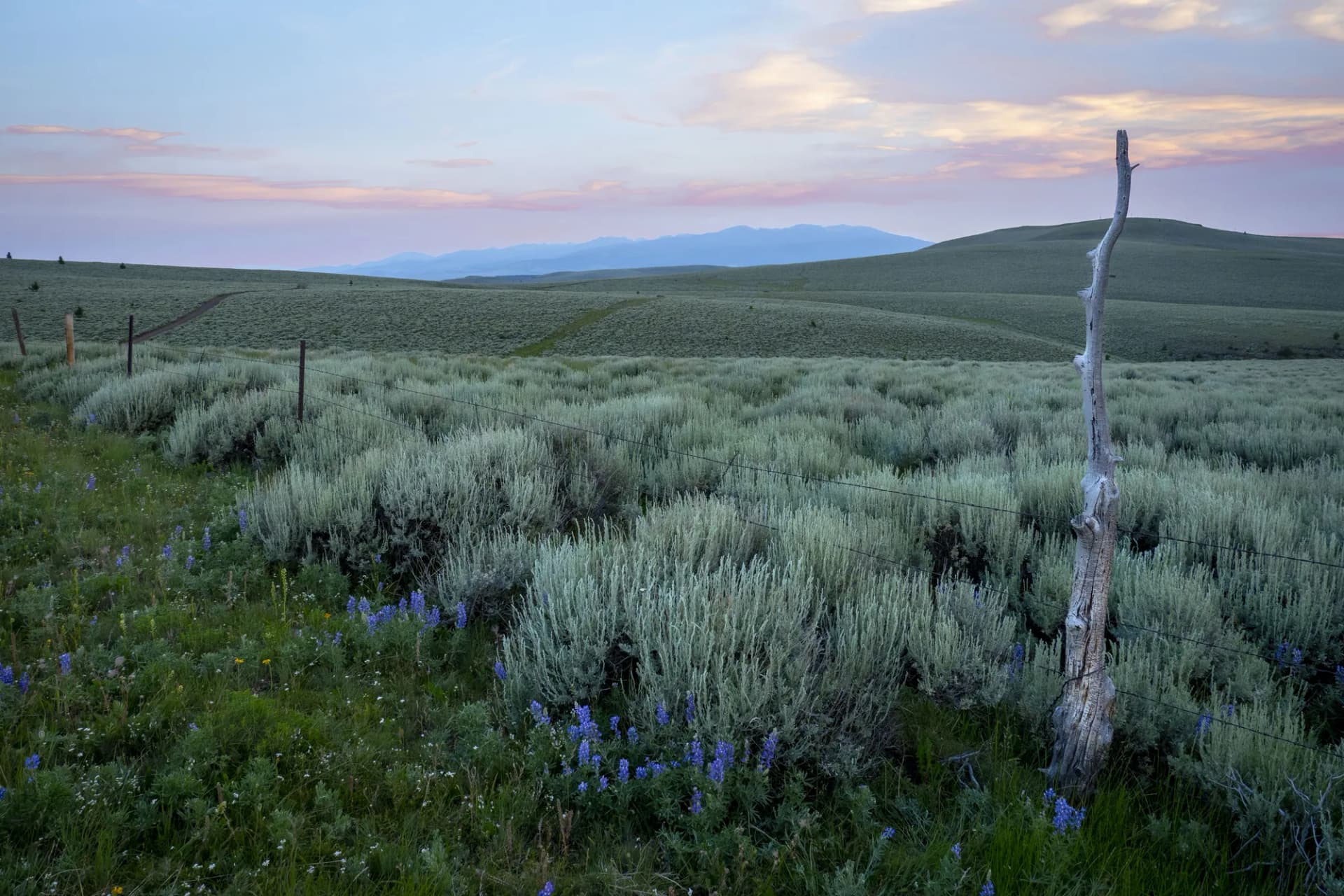
The White Cloud Peaks form the western edge of the Challis section, rising abruptly above the East Fork of the Salmon River. These pale limestone summits reach elevations above 11,000 feet and contain the Boulder Chain Lakes, a series of connected alpine lakes that ranks among the finest backcountry destinations in Idaho. The combination of dramatic peaks, multiple water sources, and excellent cross-country travel terrain draws serious backpackers willing to make the long approach.
The White Clouds were the subject of a contested mining proposal in the late 1960s that galvanized Idaho's conservation movement and ultimately led to expanded wilderness protection across the state. The area now sits within the White Clouds Wilderness, designated in 2015 as part of the Boulder-White Clouds Wilderness complex.
Borah Peak and the Lost River Range
On the forest's eastern edge, the Lost River Range rises abruptly from sage flats to produce Borah Peak at 12,662 feet, Idaho's highest point. The standard Chicken-Out Ridge route gains 5,500 feet in 3.5 miles, with Class 3 scrambling near the summit on a narrow exposed ridge that gives the route its name. This is a genuine mountaineering objective, not a hiking trail, and it demands solid footing, no fear of exposure, and an early start to avoid afternoon lightning.
The Lost River Valley below Borah sustained significant damage in the 1983 Borah Peak Earthquake (magnitude 6.9), which raised the mountain by several feet and opened a visible fault scarp visible from the highway that has become a geological landmark.
Best Trails
White Cloud Peaks Loop (28.0 miles, multi-day) is the premier wilderness circuit in the forest, connecting high passes, alpine lakes, and the crest of the White Cloud Peaks. Most hikers take three to four days. Snow can persist on passes through mid-July.
Boulder Chain Lakes (22.0 miles, out-and-back) follows the East Fork of the Salmon River before climbing into the most concentrated lake basin in the White Clouds. The string of seven connected lakes offers camping at multiple points and exceptional fishing for cutthroat trout.
Borah Peak Approach (7.0 miles, out-and-back) is the standard route to Idaho's highest summit. The trail is well-marked to the base of Chicken-Out Ridge, where the route transitions to scrambling terrain. Many hikers turn around at this point and still gain extraordinary views across the Lost River Range.
Yankee Fork Trail (12.0 miles, out-and-back) follows the historic Yankee Fork of the Salmon River past remnants of the gold rush-era Custer ghost town and an impressive gold dredge from the 1940s still sitting in the river. The valley floor trail is relatively gentle and combines history with scenery.
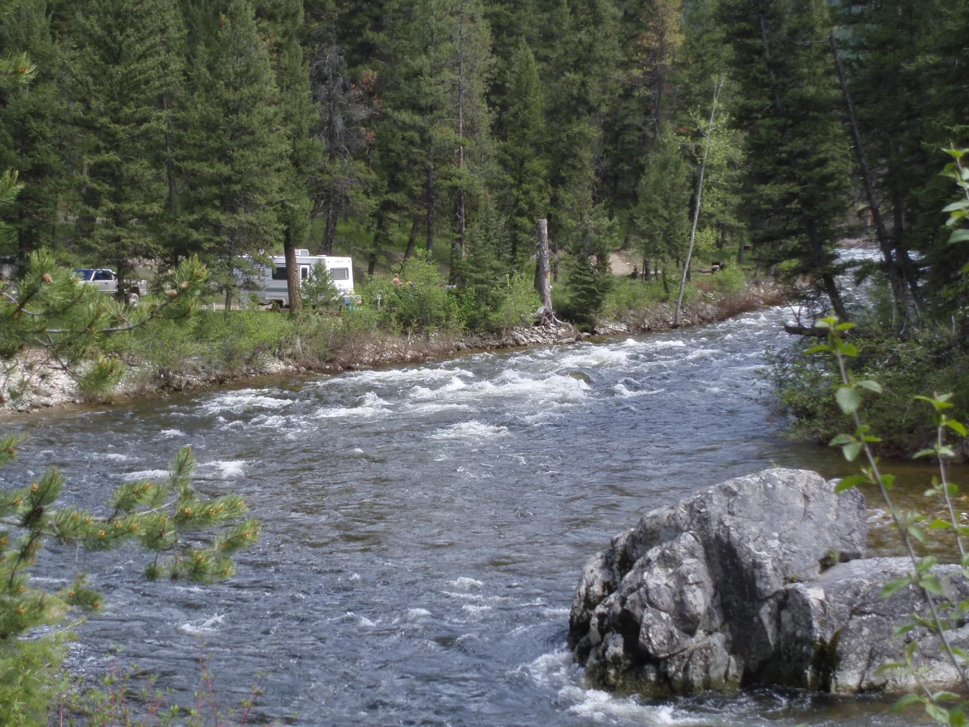
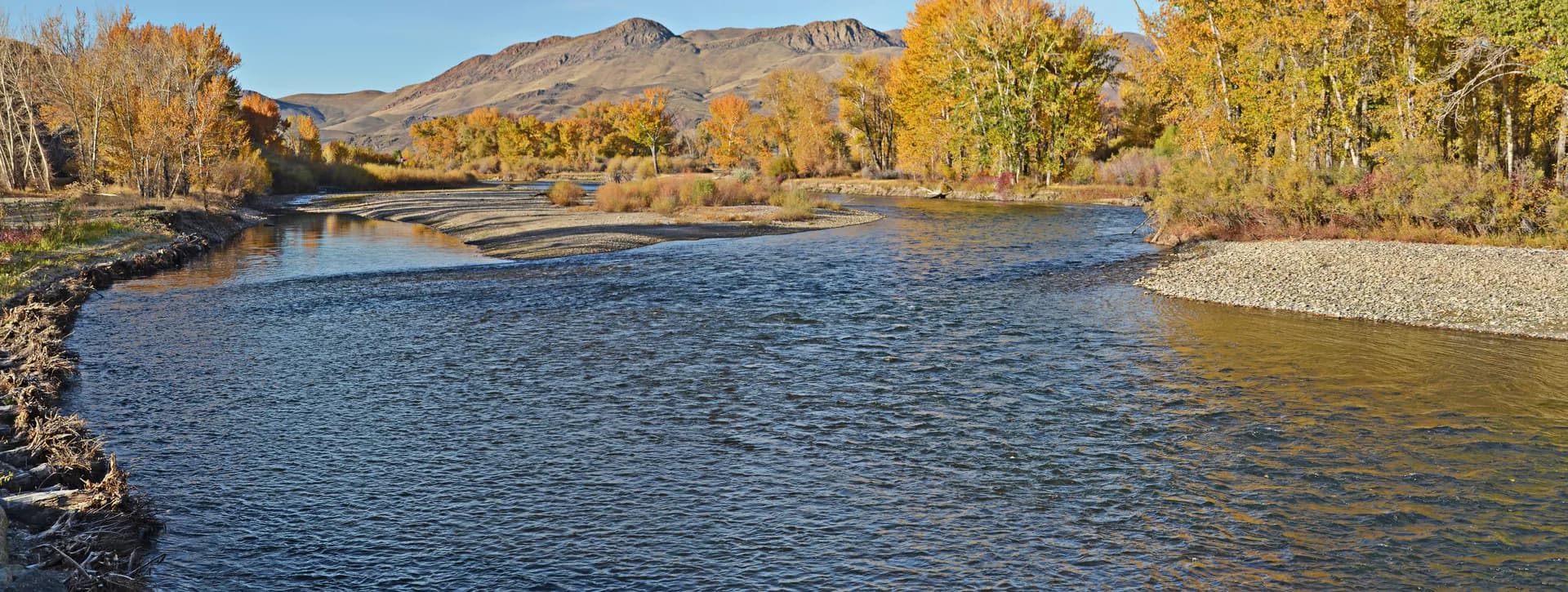
Salmon River Trail follows the Wild and Scenic Salmon River through the forest, connecting access points along the main river canyon. This route is particularly popular with fishing and with visitors who want to experience the river corridor without a raft.
Permits and Passes
No permit is required for day hiking or dispersed camping in Challis National Forest (as of 2026). The forest operates under dispersed camping rules typical of remote Idaho forests. Read through the dispersed camping guide for general USFS rules. Bear canisters are strongly recommended for overnight trips in the White Clouds, where bear activity is documented. Review bear canister requirements before any multi-day trip.
Veterans and individuals with qualifying disabilities may access the federal discount passes for reduced fees at developed recreation sites.
Camping
Developed campgrounds in the Challis section are small, primitive, and first-come first-served. Challis Creek, Yankee Fork, and Bayhorse campgrounds offer basic facilities with vault toilets but limited water. Fees are modest (as of 2026). For the best camping in the forest, dispersed sites throughout the river corridors and along forest roads offer privacy and scenery that developed campgrounds cannot match.
When to Visit
July through September is the reliable hiking window. Higher passes in the White Clouds hold snow through mid-July in heavy snow years. By August, conditions are typically excellent throughout the forest. September brings cooler temperatures, the Salmon River tributaries begin their fall transition, and elk bugling fills the valleys in the evenings.
Spring (May through June) in the lower Salmon River corridor is excellent for fishing and wildlife viewing, but high-country access remains limited.
Check current conditions at checking conditions before you go, and practice Leave No Trace principles throughout this sensitive and low-traffic wilderness landscape.
Getting There
Challis is the primary gateway town, sitting on US-93 in the Salmon River Valley. From Twin Falls, take US-93 north approximately 140 miles through the Lost River Valley to Challis. The drive passes the Borah Peak trailhead about 20 miles south of town. For the White Cloud Peaks trailheads, take the East Fork Road south from Challis into the upper basin.