Where Desert Meets Alpine: Arizona's Sky Island Forest
Coronado National Forest is unlike any other national forest in the United States. Its 1,780,000 acres are not a single continuous block but rather a scattered archipelago of ten separate mountain ranges rising from the Sonoran Desert floor of Arizona, each functioning as an ecological island supporting plant and animal communities more associated with Mexico's Sierra Madre than with the surrounding desert. Named for the Spanish explorer Francisco Vásquez de Coronado who crossed this region in 1540, the forest encompasses ranges from the Santa Catalinas above Tucson to the Chiricahuas on the New Mexico border, with the Huachucas, Pinalenos, and several other ranges in between.
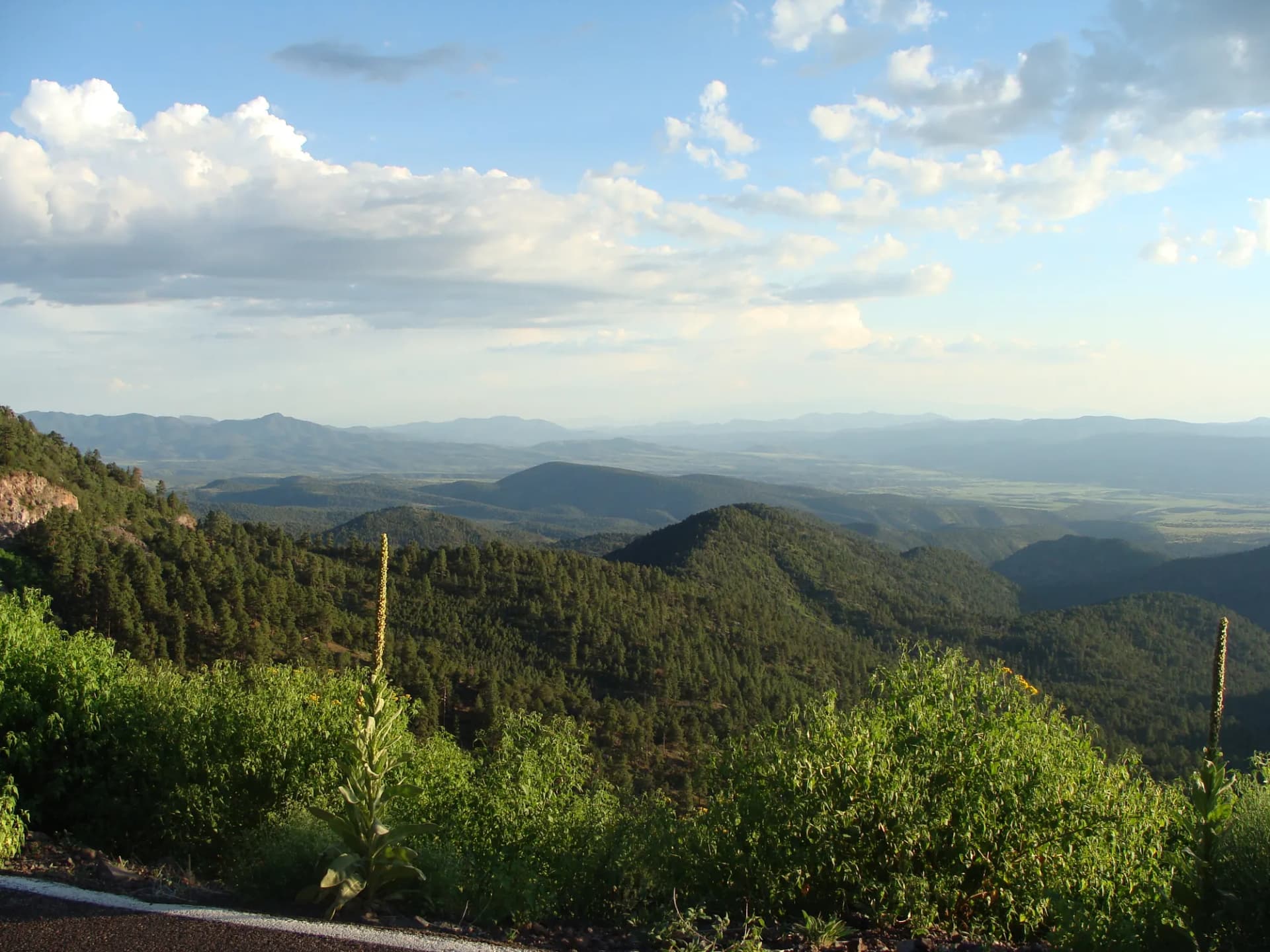
The concept of the "sky island" defines this forest. A hiker can start a morning walk through Sonoran Desert saguaro cactus at 2,800 feet and arrive six hours later in Canadian Zone spruce-fir forest at 9,000 feet, having passed through the equivalent of a north-to-south transect from Mexico to Canada. This compression of life zones into short horizontal distances makes Coronado one of the most biologically diverse land areas in North America, with over 900 species of vascular plants, 300 species of birds, and the highest butterfly diversity of any national forest in the country.
Why Coronado National Forest Stands Out
The Santa Catalinas and Sabino Canyon
The Santa Catalina Mountains rise directly from the northern edge of Tucson to 9,157-foot Mt. Lemmon, the southernmost ski area in the United States. The Catalina Highway (also called the Mt. Lemmon Highway or Sky Island Scenic Byway) climbs 5,000 feet in 27 miles, passing through seven distinct life zones visible through the car window before reaching the small ski resort and the mountain community of Summerhaven. Sabino Canyon Recreation Area, at the mountain's southern base, receives approximately 1.5 million visitors per year and offers access to dramatic canyon hiking through riparian corridors and up to the Seven Falls.
Chiricahua Mountains and World-Class Birding
The Chiricahua Mountains in the far southeast corner of the forest are considered one of the premier birding destinations in North America, sitting on the migration flyway between the Sierra Madre and the Rocky Mountain ranges. Species including the elegant trogon, painted redstart, and numerous hummingbird species make the Chiricahuas a destination for birders from around the world. The adjacent Chiricahua National Monument manages dramatic rhyolite spire formations, while the national forest wilderness surrounding it provides the undisturbed habitat that makes the birding so exceptional.
Six Wilderness Areas and Genuine Backcountry
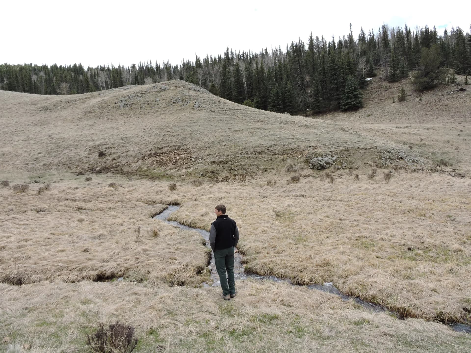
Coronado's six designated wilderness areas protect the most remote and biologically sensitive terrain in the forest. The Pusch Ridge Wilderness in the Santa Catalinas, the Chiricahua Wilderness, the Pinaleño Mountains' highest terrain, and the Mount Wrightson Wilderness in the Santa Ritas all offer backcountry travel well away from roads. The relative dryness of the region and the compact nature of the sky islands means that day hikers can access genuine wilderness terrain with comparatively short approaches.
Best Trails
Mt. Lemmon Via Wilderness of Rocks (12.0 miles, out-and-back) traverses the Wilderness of Rocks, a chaotic granite landscape below the summit of Mt. Lemmon, before reaching the forested summit area. The most demanding full-day route in the Santa Catalinas.
Sabino Canyon to Seven Falls (9.0 miles, out-and-back) follows Bear Canyon into the Santa Catalinas to reach Seven Falls, a series of cascades in a narrow canyon. The most popular hike in the Coronado NF.
Bear Canyon Trail (7.8 miles, out-and-back) follows the Bear Canyon tram road on foot to a series of pools and canyon scenery, a shorter alternative to the Seven Falls route.
Chiricahua Wilderness Loop (8.5 miles, loop) traverses the heart of the Chiricahua Wilderness through pine forest and canyon terrain in one of the most remote sky island settings in the forest.
Mt. Wrightson Trail (9.0 miles, out-and-back) climbs to the 9,453-foot summit of Mt. Wrightson in the Santa Rita Mountains south of Tucson, the highest point in the Santa Ritas and the best summit hike in the forest.
Carr Peak Trail (5.4 miles, out-and-back) climbs through the Huachuca Mountains to Carr Peak, with views across the San Pedro River Valley and into Mexico from 9,223 feet.
Butterfly Trail (5.0 miles, out-and-back) traverses the high country of the Santa Catalinas near Mt. Bigelow through meadows and mixed conifer forest above 8,000 feet.
Cochise Stronghold Trail (4.5 miles, out-and-back) visits the rocky canyon terrain in the Dragoon Mountains used as a stronghold by Cochise and the Chiricahua Apache in the 1860s and 1870s.
Permits and Passes
The Mt. Lemmon/Catalina Highway area requires a per-vehicle fee of $10 for entry to the Santa Catalina's front-country recreation areas (as of 2026). Day hiking on most other forest trails is free. Developed campground sites require reservations and fees ranging from $20 to $30 per night (as of 2026).
The America the Beautiful Annual Pass covers the Santa Catalina recreation area fee. Veterans and permanently disabled individuals may qualify for the Access Pass. See America the Beautiful Pass for Veterans and Veteran Benefits in National Forests for details.
Camping
Rose Canyon Lake Campground at 7,000 feet in the Santa Catalinas is the premier developed campground in the forest. Seventy-four sites near a small trout lake. Reservable through Recreation.gov; very popular from May through September (as of 2026).
Peppersauce Campground at the base of the Santa Catalinas on the Oracle Ridge side provides 19 lower-elevation sites with year-round access. A good winter camping option when higher sites are snow-covered.
Rustler Park Campground in the Chiricahua Mountains at 8,500 feet provides 25 dispersed-style sites in a cool, forested setting. First-come, first-served. Outstanding birding from camp during spring and fall migration.
Dispersed camping is available throughout most of the forest away from developed areas, though fire restrictions during Arizona's dry season (typically May through July) may limit campfire use. Check current restrictions before arriving.
When to Visit
March through May is the most comfortable season across most of the forest. Temperatures in the desert foothills range from 60 to 85 degrees, and higher elevations stay in the 40s-60s. Spring wildflowers in the desert transitions near lower trailheads can be spectacular after a wet winter.
June through early July brings Arizona's dry pre-monsoon heat. Lower elevation trails become uncomfortably hot; focus on high-elevation routes above 7,000 feet.
July through September marks monsoon season. Afternoon thunderstorms develop daily, typically between noon and 6 PM. Mornings are excellent for hiking at all elevations. Lightning risk on exposed ridges is genuine and requires early starts. The monsoon greens the landscape and triggers late-summer wildflower blooms.
October through November brings the second spring: cooling temperatures across all elevations, clear skies, and excellent hiking conditions. Fall migration at the Chiricahuas makes October one of the best birding months.
December through February brings snow to elevations above 7,000 feet. Mt. Lemmon typically has skiable snow; lower trails stay open and uncrowded. The Chiricahuas and Santa Ritas offer mild winter hiking.
Getting There
From Tucson: The Santa Catalinas are directly accessible via the Catalina Highway (Mt. Lemmon Road) northeast of the city. Sabino Canyon Recreation Area is approximately 30 miles from downtown Tucson via Tanque Verde Road, about 45 minutes.
From Sierra Vista: The Huachuca Mountains and Ramsey Canyon area are 15 miles west of Sierra Vista via AZ-92. The Chiricahua Mountains are approximately 90 miles east on US-80 and AZ-181.
From Nogales: The Santa Rita Mountains and Mt. Wrightson area are approximately 65 miles north via I-19 and the Madera Canyon Road, about 1 hour 15 minutes.
Practical Tips
Flash floods are a serious hazard in desert canyons during monsoon season, particularly in Sabino Canyon and other narrow washes. Never enter a canyon if storms are visible upstream. See checking conditions before you go for current weather and flash flood warnings.
Water is the critical planning variable in Coronado. Many trails have no reliable water source. Many hikers carry 3 to 4 liters on longer desert-adjacent routes, particularly in spring and summer. Individual needs vary significantly with temperature and exertion. Springs marked on maps may run dry in drought conditions.
Rattlesnakes (particularly western diamondbacks and black-tailed rattlesnakes) are active from spring through fall across all elevations. Watch your step on rocky trails and around ledges. Black bears are present in the higher elevations and are active particularly in the Chiricahuas and Santa Ritas.
Border proximity in the southernmost units means visitors may encounter Border Patrol activity. Remain on established trails and contact the ranger district for current public land access information in units near the international border. Practice Leave No Trace principles throughout.