Crested Butte's Backyard Wilderness
Gunnison National Forest wraps around the historic mining-turned-ski town of Crested Butte and the agricultural center of Gunnison in central Colorado, covering approximately 1,664,878 acres of Elk Mountain terrain, ranch country basins, and the volcanic West Elk Range. It forms one of three units within the combined Grand Mesa-Uncompahgre-Gunnison National Forest administrative unit (GMUG), which also includes the Uncompahgre and Grand Mesa sections. The Gunnison section is most closely associated with the communities it serves and with a wildflower season that earns repeated mentions as Colorado's finest.
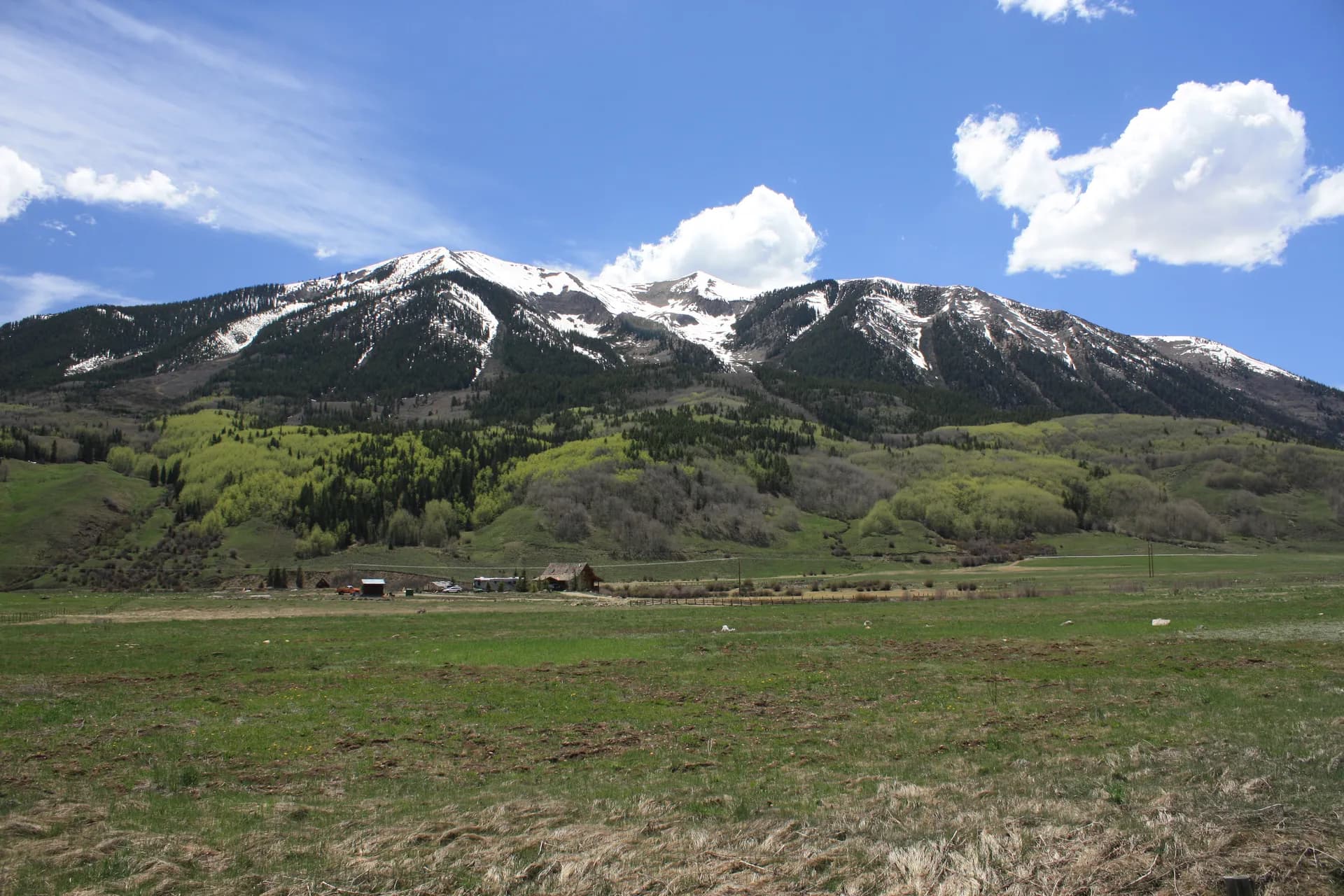
Crested Butte sits at 8,909 feet in a high valley formed by the Slate and East rivers, with the forest beginning essentially at the edge of town. The ski resort dominates winter, but summer hikers, mountain bikers, and backpackers find a landscape transformed by flowers and green meadows that make the ski-area view seem like a different planet. The Gothic Natural Area and Rocky Mountain Biological Laboratory occupy the old ghost town of Gothic just north of Crested Butte, and the surrounding terrain offers some of the finest wildflower hiking in Colorado.
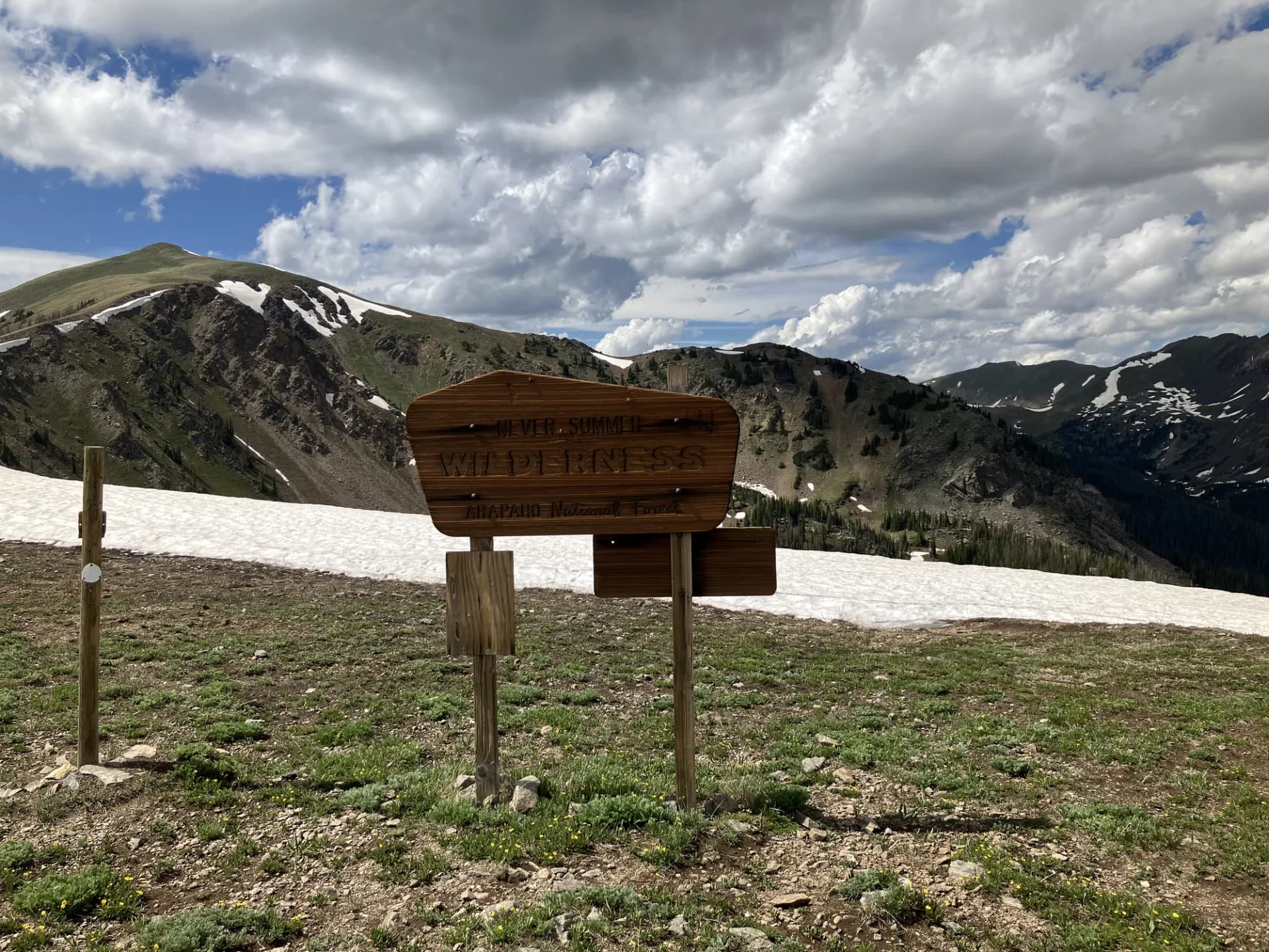
West Elk Wilderness
The West Elk Wilderness, west of Gunnison and south of the main Elk Mountains, occupies a landscape shaped by volcanic activity rather than the granitic intrusion that formed most of Colorado's high peaks. The result is a terrain of dark basalt columns, eroded badlands, and remote forested ridges that lacks the dramatic peaks of the nearby Maroon Bells but offers a quieter, equally rewarding backcountry experience. The West Elk wilderness is substantially less visited than comparable Colorado wilderness areas, making it a strong choice for hikers seeking solitude on multi-day trips.
The centerpiece landscape in the wilderness is the Castles area, an eroded volcanic badland with spires and towers rising above the surrounding forest. Most visitors approach via Ohio Creek Basin, a classic ranching valley that provides the gateway to the wilderness on the north.
Fossil Ridge and Taylor Park
Fossil Ridge Recreation Area, east of Gunnison above the Taylor River, is a de-facto wilderness corridor offering exceptional backcountry travel without the formal wilderness designation. The Taylor Park Reservoir and surrounding terrain provide fishing, dispersed camping, and OHV access in the lower areas, while the high ridges above offer trail hiking with good solitude and views across the Sawatch Range to the east.
The Colorado Trail passes through the Gunnison section, providing a long-distance through-hiking corridor connecting Denver and Durango with some excellent mileage in this section.
Best Trails
West Elk Wilderness Loop (30.0 miles, multi-day) circumnavigates the core of the West Elk Wilderness, visiting the Castles volcanic formations, multiple remote drainages, and the high ridge country above Ohio Creek. Most hikers take four to five days.
Ohio Creek Basin Trail (14.0 miles, out-and-back) follows a classic Colorado ranch valley north from Gunnison into the foothills of the West Elks, passing working ranches and climbing into the mountain country above. A moderate approach with excellent scenery.
Fossil Ridge Trail (16.0 miles, out-and-back) explores the high ridge country east of Taylor Park, offering views across the Sawatch Range and access to a quiet backcountry that sees less traffic than the Crested Butte trails.
Spring Creek Pass Trail (10.0 miles, out-and-back) follows the Continental Divide through the forest's southern section, accessing the high plateau where the Gunnison, Rio Grande, and San Juan drainages converge.
Copper Creek Trail (12.0 miles, out-and-back) climbs out of Crested Butte into the Elk Mountains high country, passing through some of the finest wildflower meadows in the region in late July.
Crystal Creek Trail (8.0 miles, out-and-back) offers a less-crowded alternative to the popular Crested Butte hiking corridors, climbing a side drainage with good views and wildflowers.
Permits and Passes
No permit is required for day hiking or dispersed camping in Gunnison National Forest (as of 2026). Developed campground fees apply. The how to get a national forest camping permit guide covers general USFS camping procedures.
Lightning is the primary hazard in July and August. The high ridges and open meadows around Crested Butte see frequent afternoon thunderstorms. Plan to be below treeline by early afternoon on days with storm potential. Check conditions at checking conditions before you go.
Camping
Taylor Park Reservoir campgrounds offer the most developed facilities and reservable sites. Gothic Campground near the old ghost town of Gothic is tiny but dramatically located. Pitchfork and Almont campgrounds provide highway corridor access with fewer amenities.
For the best camping, dispersed sites along Taylor River and in the Ohio Creek drainage offer fishing access and mountain scenery. Practice Leave No Trace principles throughout, especially in the Crested Butte area where summer trail traffic is heavy.
Getting There
Crested Butte is accessible via CO-135 from Gunnison. From Denver, take I-70 west to Gunnison on US-50, approximately 200 miles, then CO-135 north to Crested Butte. The drive takes about three to four hours depending on pass conditions.