ForestMatters, LLC

Lewis and Clark National Forest

Montana · 5 min read

State: Montana
Acres: 1,860,000
Established: 1897
Best Season: June through October
Trail Miles: 700 mi
Wilderness Areas: 2
Google MapsApple Maps
HikingBackpackingCampingFishingWildlife ViewingPhotographyKayakingHorseback Riding

At a Glance

  • Rocky Mountain Front, one of the most dramatic prairie-to-mountain transitions in North America
  • Bob Marshall Wilderness complex on the forest's western boundary
  • Little Belt Mountains with Kings Hill Scenic Byway
  • Tenderfoot Creek Experimental Forest and ecological research corridor
  • Smith River State Water Trail running through the heart of the forest
  • Outstanding elk and grizzly bear habitat on the Rocky Mountain Front

Permits & Passes

Day Hiking and Dispersed CampingOptional

Free (as of 2026)

Smith River Float PermitRequired

$15/person (as of 2026), lottery required

Details

Federal Discount Passes

  • Military Annual PassFree — active duty & veterans
  • Senior Pass$20 lifetime — ages 62+
  • Access PassFree lifetime — permanent disability
Learn more →

The Rocky Mountain Front and the Little Belts

Lewis and Clark National Forest covers approximately 1,860,000 acres of central Montana terrain anchored by two very different landscapes: the Rocky Mountain Front Range, where the Rockies rise abruptly from the High Plains, and the Little Belt Mountains, a limestone uplift rising from the agricultural flatlands of central Montana. Together they form the Lewis and Clark section of the combined Helena-Lewis and Clark National Forest, sharing a supervisor's office in Helena with the Helena section to the south.

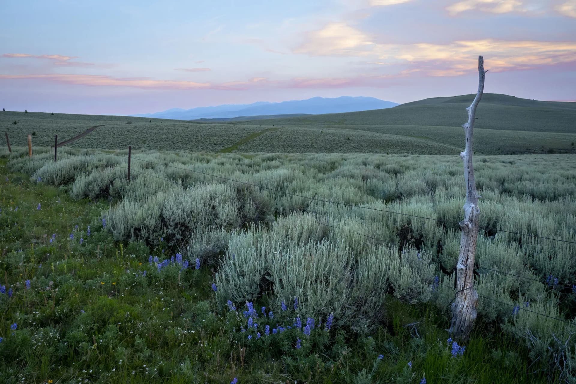
The Rocky Mountain Front is the forest's most dramatic and ecologically significant terrain. Here, along a narrow band from Browning south through Choteau and Augusta, the mountains rise thousands of feet within a few horizontal miles from the open Great Plains. Grizzly bears move freely between the mountains and the adjacent private ranchlands. Elk winter on the prairie and summer on the high slopes. This interface between the Rocky Mountain ecosystem and the Great Plains grasslands is one of the most biodiverse and ecologically intact landscapes in the contiguous United States, and the Forest Service manages much of the mountain side of that boundary.

Bob Marshall Wilderness Gateway

The western edge of the Lewis and Clark section borders the Bob Marshall Wilderness, one of the largest and most celebrated wilderness areas in the lower 48. The Bob Marshall complex (including the adjacent Scapegoat and Great Bear Wilderness areas) covers approximately 1.5 million acres and represents one of the finest remaining examples of a complete Rocky Mountain ecosystem. The Lewis and Clark section provides eastern approaches to the Bob via trails that descend from the Front Range into the wilderness interior.

Little Belt Mountains

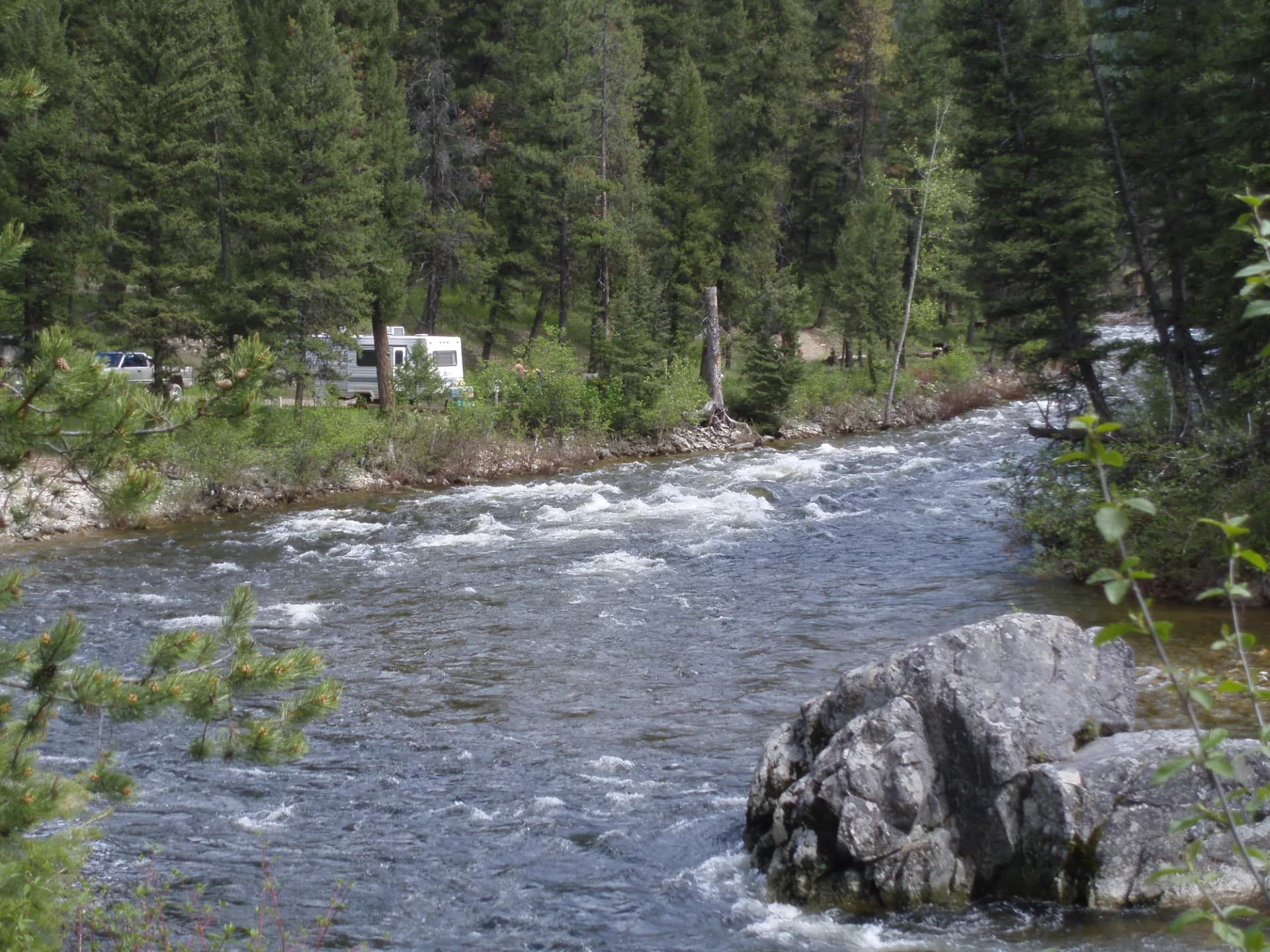
The Little Belt Mountains section is a separate unit of the Lewis and Clark Forest, sitting east of Helena and roughly 40 miles south of Great Falls. US-89 (Kings Hill Scenic Byway) crosses the range at Kings Hill Pass (7,393 feet), providing excellent access to hiking, camping, and fishing throughout the Little Belts. The Tenderfoot Creek Experimental Forest, a research corridor used by Montana State University and USFS scientists, sits within this section and contains some of the best-documented old-growth ponderosa pine stands in central Montana.

Smith River

The Smith River flows through a 59-mile limestone canyon between Camp Baker and Eden Bridge, entirely within or adjacent to the Lewis and Clark Forest. This remote float is accessible only by raft or kayak during peak season, and a permit lottery restricts access to preserve the wilderness character of the corridor. The canyon walls rise 1,000 feet above the river in places, and the trip takes four to seven days. For those who secure a permit, the Smith River is one of the finest multi-day river journeys in Montana.

Best Trails

Rocky Mountain Front Trail (15.0 miles, out-and-back) traverses the eastern face of the Front Range above Augusta, following ridges with views east across the Great Plains and west into the Bob Marshall Wilderness. Grizzly bear country throughout.

Kings Hill Trail (8.0 miles, out-and-back) climbs from the highway to views across the Little Belt Mountains, passing through lodgepole pine and open meadows with good wildflower displays in July.

Tenderfoot Creek Trail (12.0 miles, out-and-back) explores the research forest corridor along Tenderfoot Creek, passing through documented old-growth ponderosa pine stands and following a clear-water creek excellent for fishing.

Meagher Ridge Trail (10.0 miles, out-and-back) climbs to a high ridge in the Little Belt section with panoramic views across central Montana's agricultural valleys and the surrounding mountain ranges.

Smith River Access Trail (6.0 miles, out-and-back) provides a hiking approach to Smith River canyon viewpoints for visitors without a float permit, offering canyon rim views of this remarkable limestone gorge.

Highwood Mountains Trail (9.0 miles, out-and-back) accesses the Highwood Mountains, a small isolated range northeast of Great Falls that represents a detached portion of the Lewis and Clark Forest with good wildlife viewing and limited visitors.

Permits and Passes

Day hiking and dispersed camping require no permit in Lewis and Clark National Forest (as of 2026). The Smith River float requires a lottery permit (approximately $15/person as of 2026). Developed campground fees apply at maintained sites.

Bear spray is strongly recommended for all travel in the Rocky Mountain Front section, where grizzly bears are an active presence. Review guidance from checking conditions before you go before any Front Range visit. Veterans and permanently disabled individuals may qualify for federal discount passes.

Camping

Kings Hill Campground and Many Pines Campground along the Kings Hill Scenic Byway are the primary developed options in the Little Belt section. Primitive and dispersed camping is widely available throughout both sections of the forest along forest roads.

When to Visit

June through October is the primary hiking season. The Little Belt Mountains are accessible from late May after snowmelt. The Rocky Mountain Front is accessible year-round on lower terrain, but high trails require July or later. October brings excellent elk rut viewing along the Front.

Practice Leave No Trace principles throughout, and give wildlife the space they require, particularly along the Rocky Mountain Front where grizzlies and large ungulates frequently cross the landscape.

Getting There

From Great Falls, take US-89 south approximately 35 miles to the Kings Hill section of the Little Belts. For Rocky Mountain Front trailheads near Augusta, take US-287 south from I-15 at Wolf Creek, then west to Augusta. Most Front Range trailheads are accessed via paved county roads and gravel forest roads.

Trail Guides

moderateout-and-back

Falls Creek Trail

4 mi900 ft gain
May through October

Hike the Falls Creek Trail in Lewis and Clark National Forest, Montana. This moderate 4-mile out-and-back gains 900 feet to a scenic waterfall through the Little Belt Mountain foothills.

3 min read

moderateout-and-back

Highwood Mountains Trail

5 mi1,200 ft gain
May through October

Hike the Highwood Mountains in Lewis and Clark National Forest, Montana. This moderate 5-mile out-and-back gains 1,200 feet through isolated volcanic peaks rising above the central Montana plains with wildflower views.

3 min read

moderateloop

Kings Hill Summit Loop

6.4 mi1,200 ft gain
June through October

Hike the Kings Hill Summit Loop in Lewis and Clark National Forest, Montana. This moderate 6.4-mile loop circles the Kings Hill area with views, wildflowers, and wildlife in the Little Belt Mountains.

3 min read

moderate-hardout-and-back

Meagher Ridge Trail

6 mi1,400 ft gain
June through October

Climb Meagher Ridge in Lewis and Clark National Forest, Montana. This moderate-hard 6-mile out-and-back gains 1,400 feet through the Little Belt Mountains with ridge views and wildflower meadows.

3 min read

easyloop

Nilan Reservoir Trail

4.5 mi500 ft gain
May through October

Walk the Nilan Reservoir Trail in Lewis and Clark National Forest, Montana. This easy 4.5-mile loop gains 500 feet around a scenic mountain reservoir with excellent wildlife and waterfowl viewing.

3 min read

strenuousout-and-back

Rocky Mountain Front Trail

11.4 mi2,800 ft gain
June through October

Hike the Rocky Mountain Front Trail in Lewis and Clark National Forest, Montana. This strenuous 11.4-mile out-and-back follows the dramatic Front Range escarpment with views, wildlife, and wildflowers.

3 min read

easyout-and-back

Smith River Access Trail

3.5 mi400 ft gain
April through October

Walk the Smith River Access Trail in Lewis and Clark National Forest, Montana. This easy 3.5-mile out-and-back gains just 400 feet along the scenic Smith River corridor with excellent wildlife habitat.

3 min read

moderate-hardout-and-back

Tenderfoot Creek Trail

7.6 mi1,600 ft gain
May through October

Hike the Tenderfoot Creek Trail in Lewis and Clark National Forest, Montana. This moderate-hard 7.6-mile out-and-back follows a scenic creek with wildflowers and riparian wildlife.

3 min read

Campgrounds

Kings Hill Campground

19 sitesFirst-come$12/night (as of 2026)June through September

Many Pines Campground

23 sitesFirst-come$12/night (as of 2026)June through September

Big Spring Creek Campground

15 sitesFirst-come$10/night (as of 2026)June through September

Getting There

Great Falls
35 miles45 minutes
Lewistown
40 miles50 minutes
Helena
60 miles1 hour

More in the Northern Rockies

Frequently Asked Questions

Is Lewis and Clark National Forest part of Helena-Lewis and Clark National Forest?
Yes. Lewis and Clark National Forest is one of two proclaimed units that form the combined Helena-Lewis and Clark National Forest administrative unit. The Lewis and Clark section covers the Rocky Mountain Front and the Little Belt Mountains in central Montana, west and south of Great Falls.
What is the Rocky Mountain Front?
The Rocky Mountain Front is the abrupt geological boundary where the Rocky Mountains rise out of the Great Plains, creating one of the most visually dramatic landscape transitions in North America. Along the Front between Browning and Augusta, Montana, the mountains rise several thousand feet within a few miles from the open prairie. This area supports grizzly bears, wolves, elk, and pronghorn that move between the plains and mountain habitats seasonally.
How does the Smith River float permit work?
The Smith River is a 59-mile float through a remote canyon accessible only by river. A permit lottery determines who can launch during the peak season (roughly May through July). The lottery opens in early January (as of 2026). Apply through Recreation.gov. This is one of the most sought-after float permits in Montana.
Where is Kings Hill Scenic Byway?
Kings Hill Scenic Byway (US-89) runs through the Little Belt Mountains section of the Lewis and Clark National Forest between White Sulphur Springs and Belt, Montana. The byway climbs to Kings Hill Pass at 7,393 feet and passes through forests, meadows, and limestone canyon terrain that is accessible from the highway.
Federal Discount Passes

Free and Discounted Entry for Qualified Visitors

Military Annual Pass

Active duty & veterans (any discharge except dishonorable)

Free · Annual

Senior Pass

U.S. citizens or permanent residents age 62+

$20 · Lifetime

Access Pass

Permanent disability (includes 50% off many camping fees)

Free · Lifetime
Get passes at any ranger station or store.usgs.gov/passLearn more →