Mendocino National Forest covers 913,000 acres of California's inner Coast Range, a remote and largely overlooked mountain system between the Sacramento Valley and the Mendocino County coast. This is the only national forest in California without a paved road through its interior, a distinction that effectively filters out the casual visitor and rewards those willing to drive miles of forest roads to find one of the state's most undiscovered outdoor destinations. The landscape is rugged, diverse, and uncharacteristically wild by California standards: volcanic peaks, chaparral-covered ridges, oak woodlands, and the Pacific Crest-level summit of Snow Mountain.
The forest is well known to the hunters and off-roaders who use it regularly and almost unknown to the hiking and backpacking community, which tends to gravitate toward the more famous Sierra Nevada and coast forests. That imbalance creates genuine opportunity: trails in the Snow Mountain Wilderness and the forest interior are virtually unvisited by hikers even in peak season, and the spring wildflower displays can be extraordinary in good rain years.
Why Mendocino Stands Out
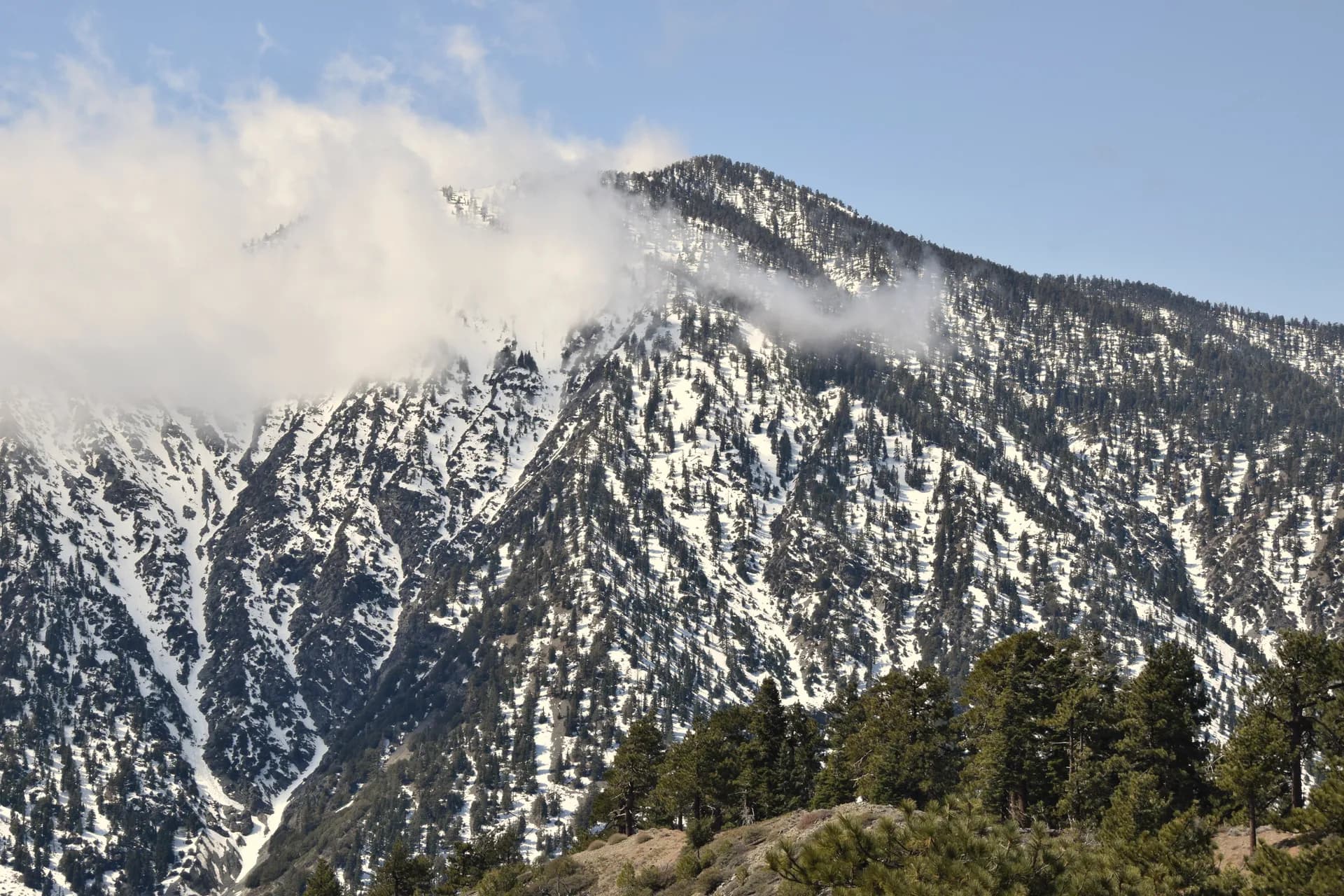
Snow Mountain Wilderness. The 37,000-acre Snow Mountain Wilderness contains the highest terrain in the Coast Range south of the Trinity Alps, with Snow Mountain's east and west summits reaching 7,038 and 7,056 feet respectively. The views from the summit encompass the Sacramento Valley, the Sierra Nevada, the Coast Range, and on clear days the Cascades. The Snow Mountain Summit Trail is a strenuous climb through chaparral and subalpine forest.
Spring wildflowers. Mendocino's position in the inner Coast Range, with its pattern of wet winters and dry summers, produces some of California's most spectacular spring wildflower displays in good rain years. Lupine, California poppy, owl's clover, and many other species bloom on the hillsides from March through May. The Plaskett Meadows area and the hillsides above Lake Pillsbury are particularly productive.
Hunting and wildlife. Mendocino National Forest is one of California's premier hunting destinations. Black-tailed deer, wild turkey, and black bear are all present in significant numbers. Tule elk range along the southern forest boundary in the Cache Creek area. The forest draws hunters from across California for these opportunities; hunting seasons overlap with fall hiking from mid-August through December.
Best Trails
The Snow Mountain Summit Trail (8.5 miles, strenuous) climbs to the highest point in the Coast Range south of the Trinity Alps. The Bear Wallow Trail (6.0 miles, moderate) follows a creek corridor in the Snow Mountain Wilderness with good wildflower and wildlife viewing. The Bloody Rock Trail (5.0 miles, moderate) accesses dramatic volcanic outcrop terrain in the wilderness.
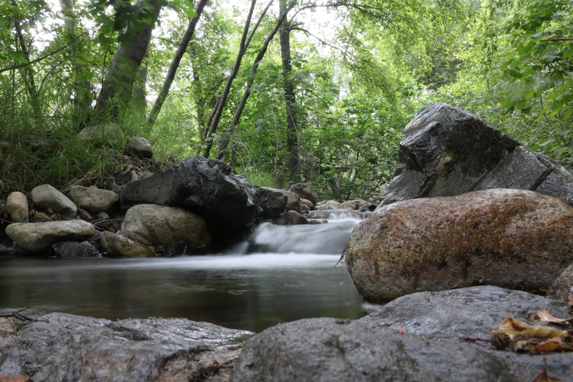
The Sanhedrin Trail (4.5 miles, moderate) climbs to Sanhedrin Mountain in the southern part of the forest. The Mill Creek Trail (4.0 miles, easy) follows Mill Creek through a riparian corridor near the forest headquarters. The Eel River Trail (3.5 miles, easy) accesses the upper Eel River drainage with fishing and swimming holes. The Lake Pillsbury Loop (6.0 miles, easy-moderate) circles Lake Pillsbury, the largest lake in the forest. The Anthony Peak Lookout Trail (2.5 miles, moderate) climbs to a historic fire lookout in the northern forest.
Permits and Passes
A campfire permit is required for any open fire or camp stove use outside developed campground fire rings (as of 2026). Obtain the free permit at readyforwildfire.org. No hiking or dispersed camping permit is required anywhere in Mendocino National Forest. Developed campground fees are required at sites with services. The America the Beautiful pass covers day use fees. Veterans should review our veteran benefits guide.
Wildfire risk is significant in the inner Coast Range; check current restrictions at fs.usda.gov/mendocino and review our checking conditions guide.
Camping
Lake Pillsbury Campground (75 sites) is the most accessible developed camping in the forest, near the lake with boating and fishing access. Reservable through Recreation.gov in summer.
Plaskett Meadows Campground (32 sites) is in the high meadow area near the Snow Mountain Wilderness, the best base for wilderness hiking. First-come, first-served.
Hammerhorn Lake Campground (9 sites) is a tiny campground at a small mountain lake in the wilderness area. Very remote; for those who want genuine solitude.
Eel River Campground (15 sites) is in the lower-elevation river corridor, better for spring and fall visits when the high country is too cold or too dry.
When to Visit
April through June are the best months for wildflowers at lower elevations and for Snow Mountain access as snow recedes. Temperatures are mild and the forest is at its most colorful.
July and August are hot at lower elevations (100°F+ possible in the valley areas) but comfortable in the high country near Snow Mountain. Summer access is best in the early morning.
September through November is hunting season, with excellent wildlife activity and fall color in the oak woodlands. Wearing blaze orange during deer season is strongly recommended if hiking.
December through March: The forest roads can be muddy and some high roads are closed. Winter is the quiet season.
Getting There
From Sacramento: Take I-5 north to Williams, then State Route 20 west toward Clear Lake and Lake County roads north to the forest. About 2 hours to the southern entry points.
From the Bay Area: US-101 north through Ukiah, then east on State Route 20 or forest roads. About 2.5 to 3 hours to the forest interior.
From Red Bluff: State Route 36 west to Covelo, then forest roads south. About 90 minutes to the northern forest areas.
Practical Tips
Road conditions are critical. Internal forest roads are unpaved and conditions change dramatically with weather. A high-clearance vehicle is strongly recommended for most trailhead access. Check with the Mendocino National Forest office in Willows before any visit.
Wildfire is a constant risk in the dry Coast Range summers. The forest has burned extensively in recent years. Check InciWeb and USFS closure orders before traveling. Air quality from regional fires can be unhealthy.
Hunting overlaps with fall hiking. Blaze orange is strongly recommended from August through December when deer and turkey seasons are open.
Leave no trace principles matter especially in the little-visited wilderness areas, where foot traffic is sparse enough that impact can persist for years. Follow the Leave No Trace seven principles and review bear canister requirements for backcountry trips.