Steamboat Springs' Mountain Backyard
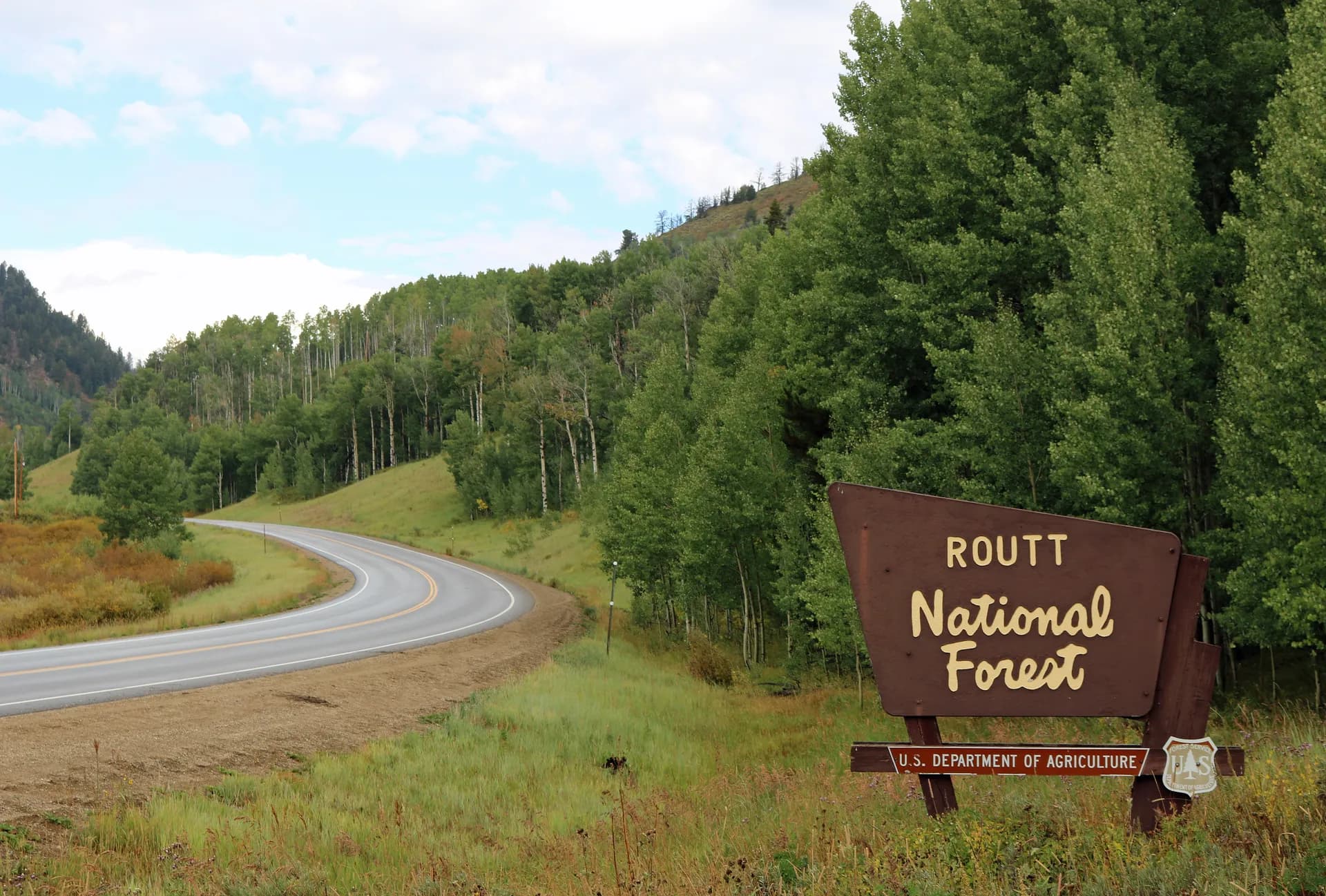
Routt National Forest wraps around the historic skiing and ranching community of Steamboat Springs in northwest Colorado, covering approximately 1,127,000 acres that extend from the Yampa River valley north to the Wyoming border and west across the high plateau above the Flat Tops. It forms the southern portion of the combined Medicine Bow-Routt National Forests administrative unit, sharing a supervisor's office in Steamboat Springs with the Medicine Bow section to the north.
Steamboat Springs (population around 13,000 at elevation 6,695 feet) is defined by its ski resort and the "champagne powder" snowpack that has made it one of Colorado's premier winter destinations. That same snowpack feeds an extraordinary summer landscape: lush meadows, abundant wildflowers, and alpine lake basins in the Mount Zirkel Wilderness that benefit from the area's higher-than-average precipitation. The Routt section receives more snow and rain than most Colorado forests of comparable elevation, producing a noticeably greener and more lush character than the drier ranges to the south and east.
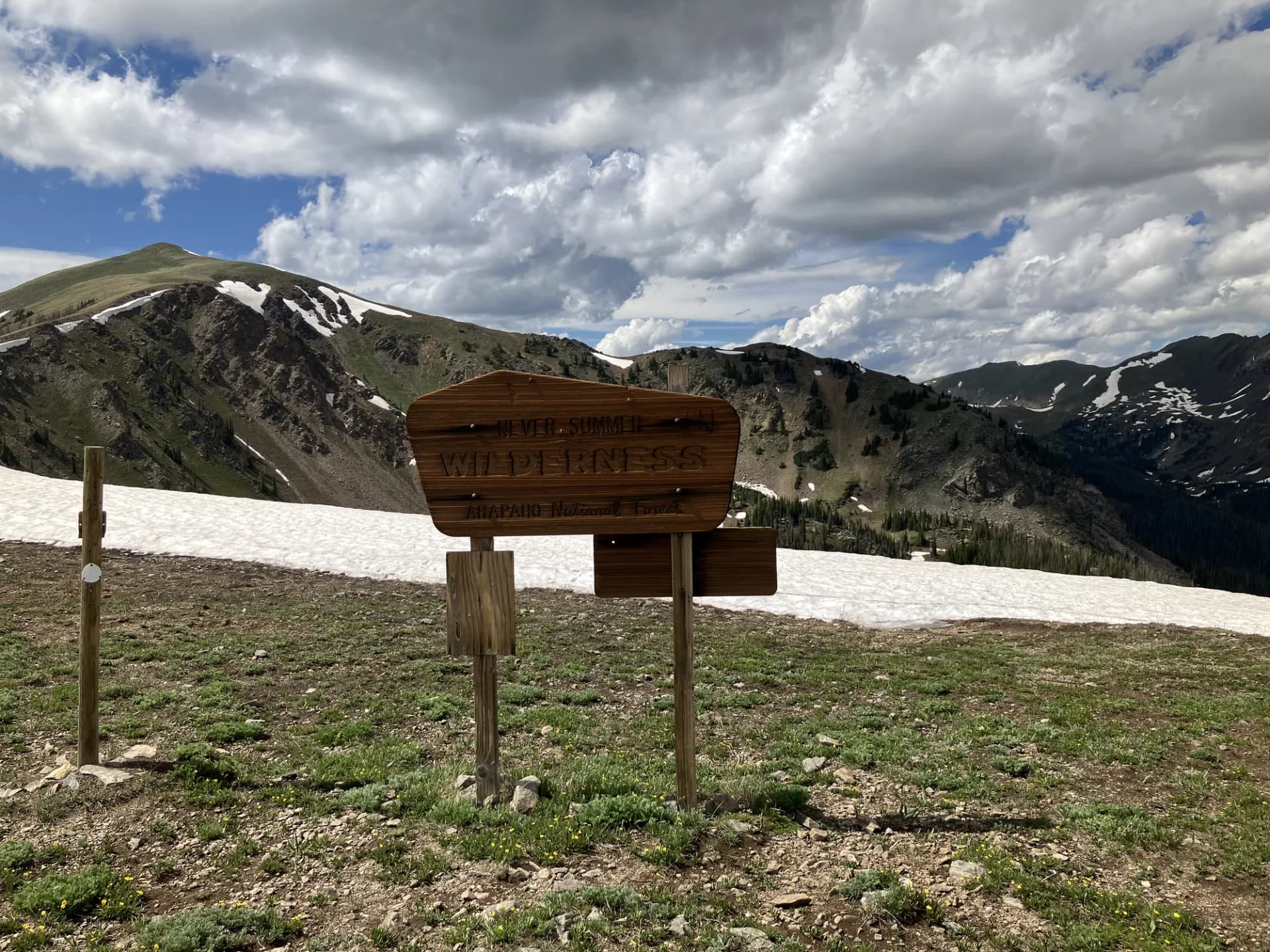
Mount Zirkel Wilderness
The Mount Zirkel Wilderness covers approximately 160,000 acres of the Park Range north of Steamboat Springs, with the crest forming the Continental Divide and the Wyoming border at the northern end. The wilderness takes its name from Mount Zirkel (12,180 feet), named for a 19th-century German geologist. The terrain is glacially carved granite, with dozens of alpine lakes, high tundra, and the Slavonia and Seedhouse trailheads providing the primary access points.
The Encampment River originates in the Zirkel Wilderness and flows north into Wyoming, while the Elk River drains west back toward Steamboat. The trail network connecting lake basins and ridge crossings makes the Zirkel an excellent multi-day backpacking destination, with enough routes to sustain interest over a week of travel.
Fish Creek Falls
Fish Creek Falls, 280 feet of dramatic plunge just east of Steamboat Springs, is the most visited single destination in the Routt section. The short paved trail from the parking area reaches the lower viewpoint in about 10 minutes. A longer unpaved trail continues past the falls and climbs into the Mount Zirkel Wilderness via Long Lake. The falls see their highest flow in late May and June, and the fee-parking area fills on summer weekends. Arrive before 10 AM to reliably find parking.
Flat Tops Wilderness
The southern tip of the Routt section touches the Flat Tops Wilderness, a high plateau shared primarily with the White River National Forest to the south. The Devils Causeway, where the trail traverses a knife-edge basalt ridge above the Yampa drainage, is the most photographed feature of the Flat Tops. The surrounding plateau holds dozens of lakes, excellent fishing, and a landscape that feels more like elevated Colorado plateau than the classic Rocky Mountain peaks terrain.
Best Trails
Mount Zirkel Trail (10 miles, out-and-back) is the primary route to the Zirkel Wilderness summit, visiting the Park Range high country with Continental Divide views. A full-day strenuous hike suited to acclimatized hikers.
Slavonia Trail (10.0 miles, out-and-back) is one of the primary entry routes into the Mount Zirkel Wilderness from the north, passing through timber and meadow terrain to high lake basins.
Seven Lakes Trail (12 miles, out-and-back) reaches a chain of alpine lakes in the heart of the Zirkel Wilderness, one of the best overnight destinations in the forest.
Gilpin Lake Trail (8.6 miles, out-and-back) accesses a beautiful high-country lake in the Zirkel Wilderness with good wildflower displays in late July.
Hahns Peak Trail (5.5 miles, out-and-back) climbs the prominent extinct volcano north of Steamboat to a fire lookout tower with 360-degree views across northwest Colorado and southern Wyoming.
Gold Creek Lake Trail (9 miles, out-and-back) reaches a high lake in the upper Elk River drainage, a less-visited alternative to the main Zirkel trailheads.
Seedhouse Trail (6 miles, out-and-back) provides a gentler introduction to the lower Zirkel Wilderness through spruce and fir forest near the Seedhouse Campground.
Permits and Passes
No permit is required for day hiking or dispersed camping in Routt National Forest (as of 2026). Fish Creek Falls trailhead parking requires a day-use fee ($5/vehicle as of 2026, covered by America the Beautiful pass). Developed campground fees apply.
Veterans and permanently disabled individuals may qualify for federal discount passes. Bear canisters are strongly recommended for overnight Zirkel Wilderness trips; review bear canister requirements before any multi-day outing.
Camping
Steamboat Lake State Park Campground (174 sites, reservable) is the largest facility in the region, though it's managed by Colorado State Parks. Hahns Peak Lake and Dumont Lake campgrounds are the primary USFS reservable options. Seedhouse Campground near the Zirkel Wilderness trailheads is a good first-come base for wilderness access.
When to Visit
July through September is the hiking season. Fish Creek Falls is accessible year-round. The Mount Zirkel high country is typically snow-free by mid-July. September is often the most rewarding month: crowds thin, aspens in the Yampa Valley turn gold, and the weather is generally stable before October closes the high routes.
Check conditions at checking conditions before you go and practice Leave No Trace principles. The best hikes near Denver guide covers additional Front Range options if you're exploring Colorado more broadly.
Getting There
Steamboat Springs sits on US-40, approximately 160 miles northwest of Denver via I-70 west and US-40 north through the Eisenhower Tunnel and Kremmling. Fish Creek Falls trailhead is east of downtown on Fish Creek Falls Road. For Zirkel Wilderness trailheads, take CR-129 (Elk River Road) north from Steamboat toward Clark and Seedhouse Road.