Colorado's Fourteener Capital
San Isabel National Forest covers approximately 1,106,885 acres of Colorado's Sawatch and Sangre de Cristo Ranges, anchored by the Arkansas Valley communities of Leadville and Salida. It forms the southern portion of the combined Pike and San Isabel National Forests administrative unit, sharing a supervisor's office in Pueblo, Colorado. Where the Pike section serves the Colorado Springs and Denver areas with Front Range terrain, the San Isabel section serves serious mountain hikers, backpackers, and the fourteener-bagging community with the highest collection of major peaks in the Rocky Mountains.
Leadville, at 10,152 feet the highest incorporated city in the United States, sits at the forest's northern core. The Sawatch Range rises immediately west of town, with Mount Elbert (14,440 feet) and Mount Massive (14,421 feet), Colorado's two highest peaks, accessible from Halfmoon Creek Road just 10 miles from downtown. This concentration of massive terrain in an easily accessible package has made the San Isabel section one of the most visited high-country forests in Colorado.
The Sangre de Cristo Range forms the forest's southern extent, rising dramatically from the San Luis Valley floor to peaks above 13,000 feet. The Sangre de Cristo Wilderness here is less visited than the Sawatch fourteener zones, offering more solitude with comparable or greater scenic rewards on routes like the Comanche-Venable Loop.
Mount Elbert and the Sawatch Fourteeners
Mount Elbert is the highest point in the Rocky Mountains and the most-climbed fourteener in Colorado (along with Mount Bierstadt near Denver). The North Elbert Trail from Halfmoon Creek is the standard route: 4.5 miles one-way with 4,700 feet of gain. The trail is well-marked and does not require technical skills, but the altitude, distance, and elevation gain are substantial. Plan for a full day of 8 to 12 hours round trip. Many hikers camp at Halfmoon Campground the night before to facilitate an early start.
Mount Massive, the second-highest peak in the Rockies, is also accessible from the Halfmoon Creek area and sees significantly less traffic than Elbert despite being taller than all other mountains in the lower 48 except Elbert itself. The Massive standard route is longer and less-defined than Elbert's, requiring more navigation on the upper mountain.
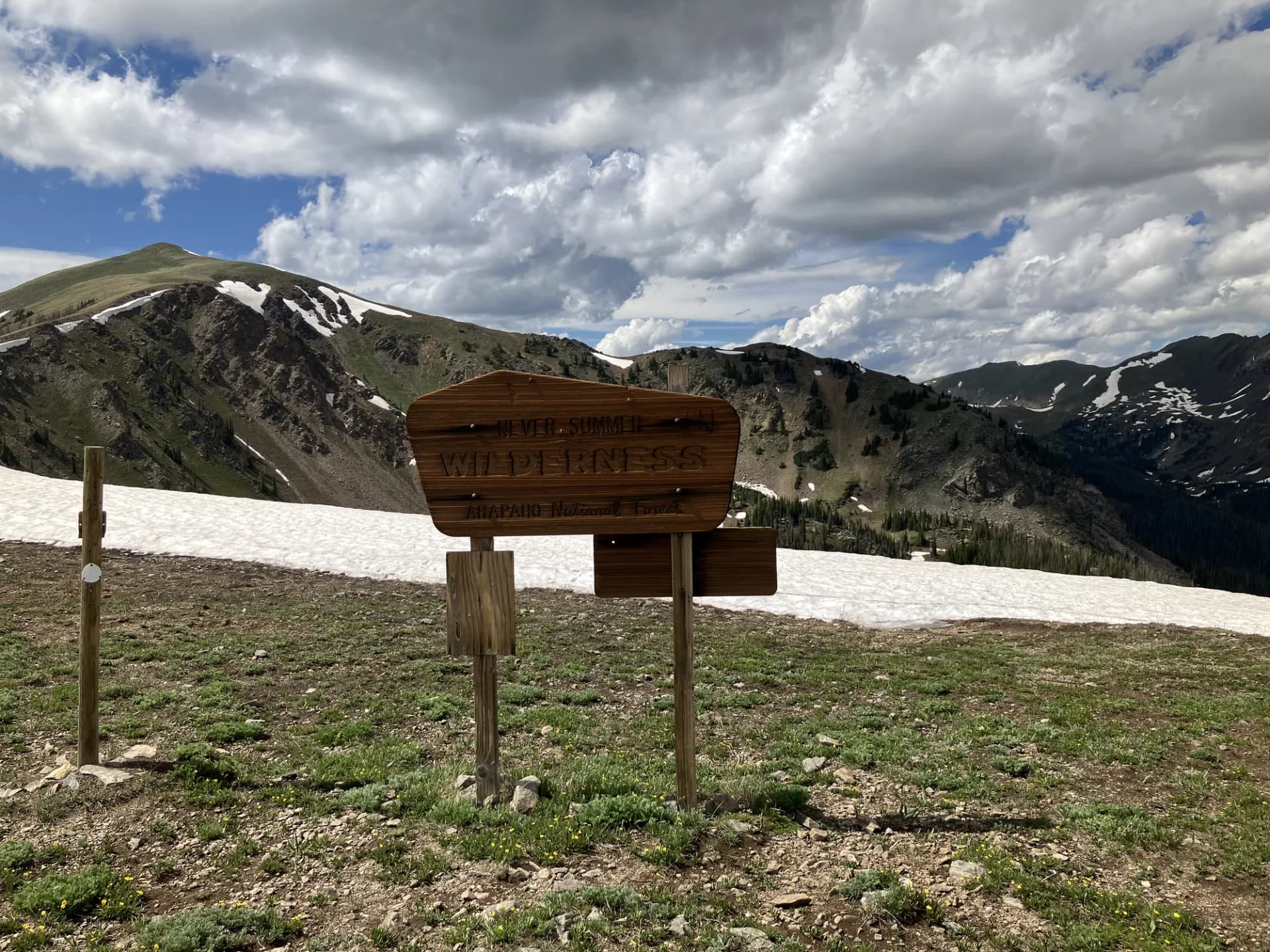
Sangre de Cristo Range
The Sangre de Cristo section of the San Isabel Forest, south of Salida, has a different character entirely from the Sawatch. These peaks rise from semiarid valleys on both the east (Great Plains) and west (San Luis Valley) sides, creating stark visual contrasts. The range name means "Blood of Christ" in Spanish, reportedly from the red color of the sunsets seen from the valley.
The Comanche-Venable Loop traverses the high crest above Westcliffe, crossing Comanche Pass (13,300 feet) and Venable Pass (13,330 feet) in a single day circuit that most strong hikers complete in 6 to 9 hours. The views across the San Luis Valley to the San Juan Mountains to the west and the Great Plains to the east are exceptional on clear days.
Adjacent to the forest's southern Sangre de Cristo section, Great Sand Dunes National Park and Preserve protects the tallest sand dunes in North America, formed from sand blown from the valley floor and trapped against the mountain front.
Best Trails
Mount Elbert Trail (9.5 miles, out-and-back) is the standard route to Colorado's and the Rockies' highest summit. The trail is well-marked and well-traveled, but the altitude demands proper acclimatization and an early start.
North Elbert Trail (9 miles, out-and-back) is an alternative approach to Elbert's summit via the north ridge, joining the standard trail near the top.
Mount Massive Trail (13.5 miles, out-and-back) is a longer and more complex route to the Rockies' second-highest peak, with more route-finding on the upper mountain than Elbert's trail.
Comanche Lake Trail (9.0 miles, out-and-back) in the Sangre de Cristo Wilderness reaches a beautiful alpine lake below Buchanan Pass on the Continental Divide.
Venable Falls Trail (6 miles, out-and-back) is an accessible Sangre de Cristo route reaching a waterfall and the lower approach to the Comanche-Venable high country.
Permits and Passes
No permit is required for day hiking or dispersed camping in San Isabel National Forest (as of 2026). Some high-use trailheads have parking fees and limitations. America the Beautiful passes cover most developed recreation area fees.
Lightning is the primary safety hazard throughout the San Isabel high country. The Sawatch and Sangre de Cristo ranges generate intense afternoon thunderstorms in July and August. Plan to be off summits and exposed ridges by early afternoon. Check current mountain weather forecasts before any summit attempt. See checking conditions before you go.
Veterans and permanently disabled individuals may qualify for federal discount passes and America the Beautiful pass for veterans.
Camping
Halfmoon Campground is the essential base for Elbert and Massive climbs. Twin Peaks Campground near Twin Lakes provides lake scenery and access to the Sawatch approaches. Alvarado Campground near Westcliffe is the best base for Sangre de Cristo Wilderness hiking. All reservable campgrounds fill on summer weekends; book through Recreation.gov well in advance.
Getting There
Leadville is on US-24, approximately 100 miles southwest of Denver via I-70 west and US-24 south. Salida is on US-50 south of Poncha Pass, roughly 150 miles from Denver. Westcliffe in the Sangre de Cristos is accessed via CO-96 east from US-50 near Salida. The best hikes near Denver guide covers additional options if you're exploring Colorado's Front Range more broadly.