Shoshone National Forest holds a distinction that shapes how you think about every other national forest in America: it is the first. On July 1, 1891, President Benjamin Harrison signed the proclamation establishing the Yellowstone Timberland Reserve, the area that would eventually become Shoshone National Forest. Every subsequent national forest in the system descends from that legal precedent. Standing on any trail in the Shoshone, you are walking on the ground that made all the others possible.
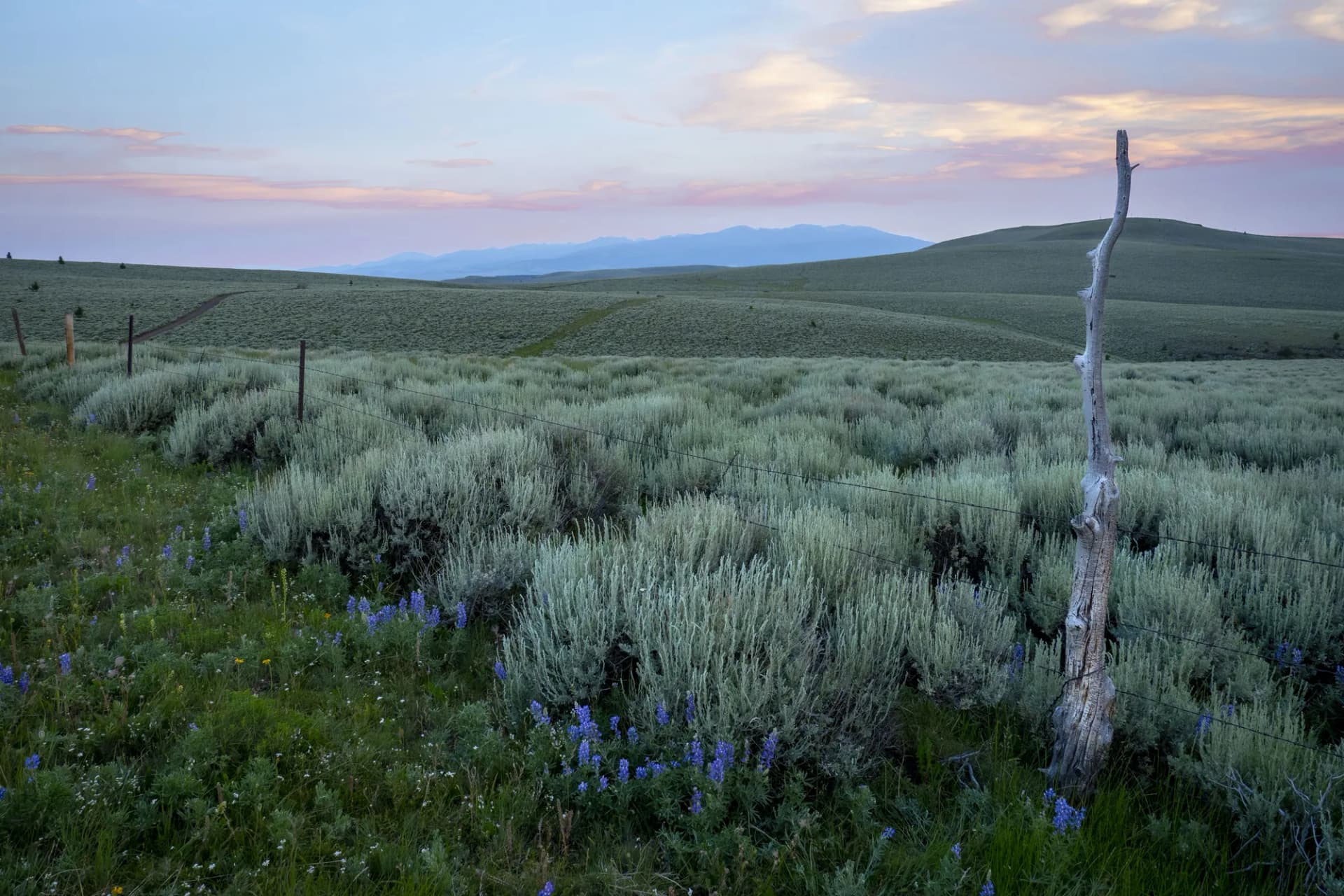
The forest covers 2.47 million acres in northwest Wyoming, bordering Yellowstone National Park to the west and the Bighorn National Forest to the east. It encompasses the Absaroka Range from the Clark's Fork canyon in the north to the Wind River Range's northern end in the south, and the terrain ranges from desert badlands at 4,500 feet in the Wapiti Valley to glaciated peaks above 13,000 feet in the Fitzpatrick Wilderness. Six designated wilderness areas preserve the core of this terrain, the largest being the 704,000-acre Washakie Wilderness the largest wilderness in Wyoming.
Cody, Wyoming, is the primary gateway. Buffalo Bill built a resort and promoted the Wapiti Valley and Yellowstone entrance in the early 1900s, and the town still serves as the eastern base for the park. But the Shoshone itself, outside the Yellowstone corridor, receives a fraction of the attention of the park it neighbors. The wilderness areas to the south, in the Washakie and Fitzpatrick, go days between parties. This is one of the less-crowded large wilderness complexes in the northern Rockies.
Why Shoshone Stands Out
America's First National Forest
The historical weight is real but the landscape carries it independently. The Shoshone looks like what a national forest is supposed to look like: vast, varied, largely untrailed, and governed by the expectation that people who enter will manage themselves. The six wilderness areas account for nearly half the forest's total acreage, and wilderness rules apply throughout them.
The Beartooth Highline
The Beartooth Highline Trail traverses the Wyoming side of the Beartooth Plateau at elevations above 9,000 feet, connecting to the Montana sections accessible from the Custer Gallatin. The Wyoming approach via the Shoshone sees less traffic than the Montana side and offers a distinctly different perspective on the same high-country plateau.
The Washakie Wilderness
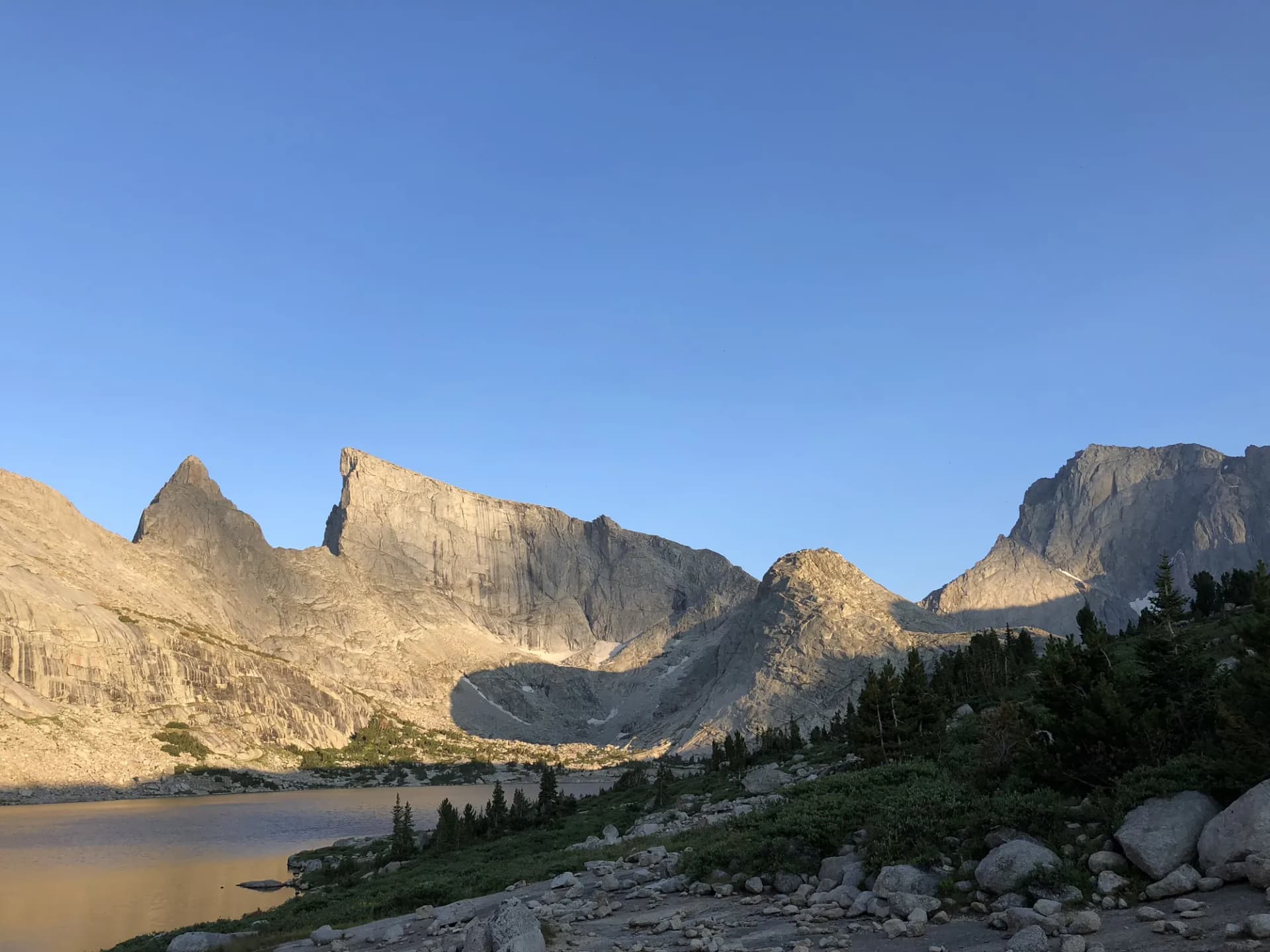
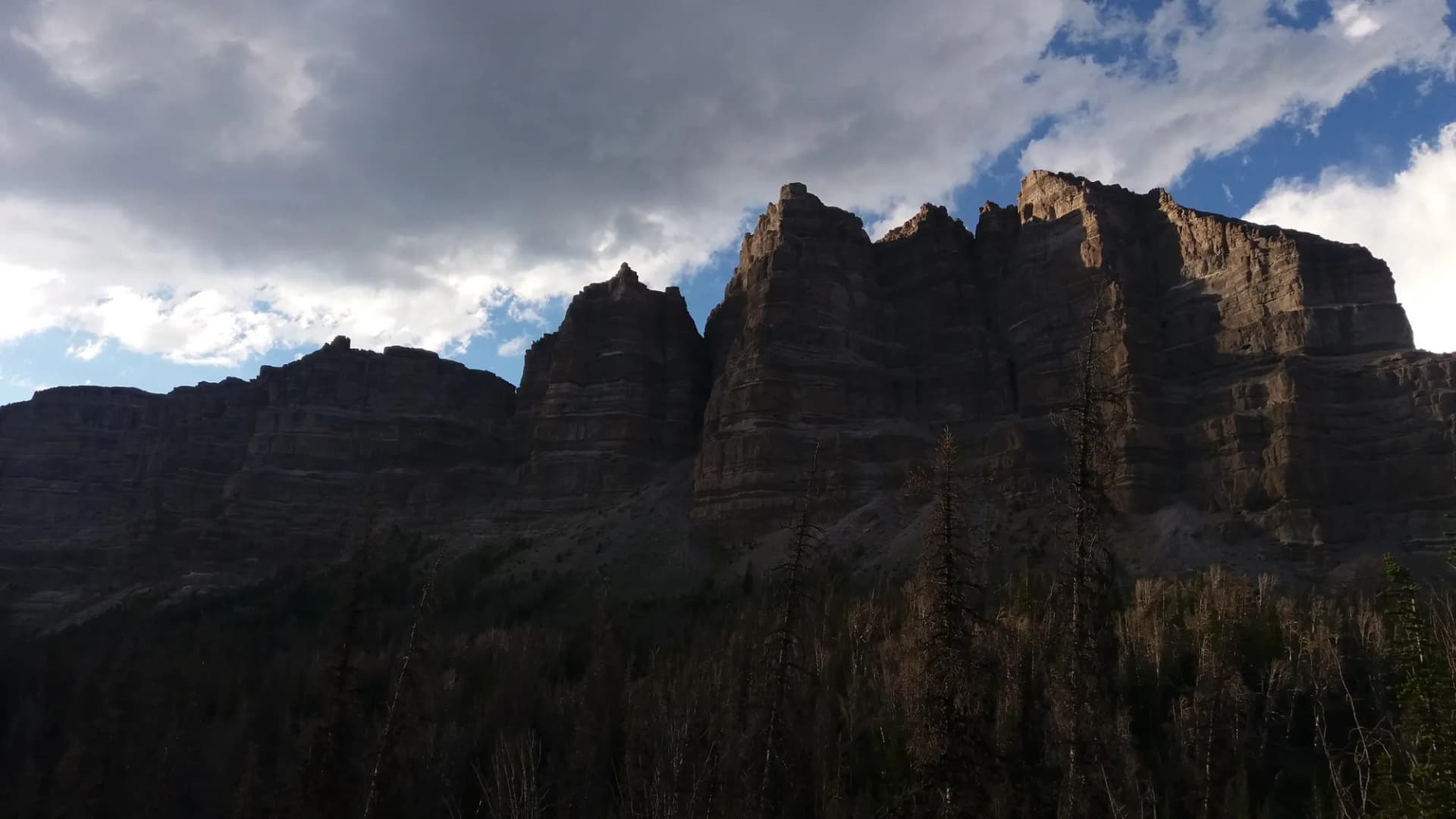
The Washakie Wilderness via Wiggins Fork introduces a 704,000-acre landscape that is genuinely remote. The Absaroka Range in the Washakie is characterized by volcanic rock formations, deep canyons, and an absence of established trail networks in much of the interior. For parties comfortable with cross-country travel, this is among the most rewarding wilderness areas in Wyoming.
Best Trails in Shoshone National Forest
The South Fork Loop covers 9 miles with 2,000 feet of gain through the Clarks Fork drainage, one of the most scenic river corridors in the forest. The Beartooth Highline Trail makes a 12-mile point-to-point through plateau terrain with shuttle logistics.
For longer routes into the Absaroka backcountry, Washakie Wilderness via Wiggins Fork and Upper Wind River Trail both cover serious terrain with multi-day potential. Lower-elevation options include the Elk Fork Trail and Clarks Fork Trail, both accessible from the Wapiti Valley corridor.
Permits and Passes
No permit is required for most day hiking as of 2026. Developed campgrounds may require reservations. The America the Beautiful pass and its veteran variants cover day-use fees. See the veteran benefits guide for details on fee programs.
Verify current requirements with the Wapiti, North Fork, or South Fork ranger districts, depending on which area of the forest you plan to visit.
Camping
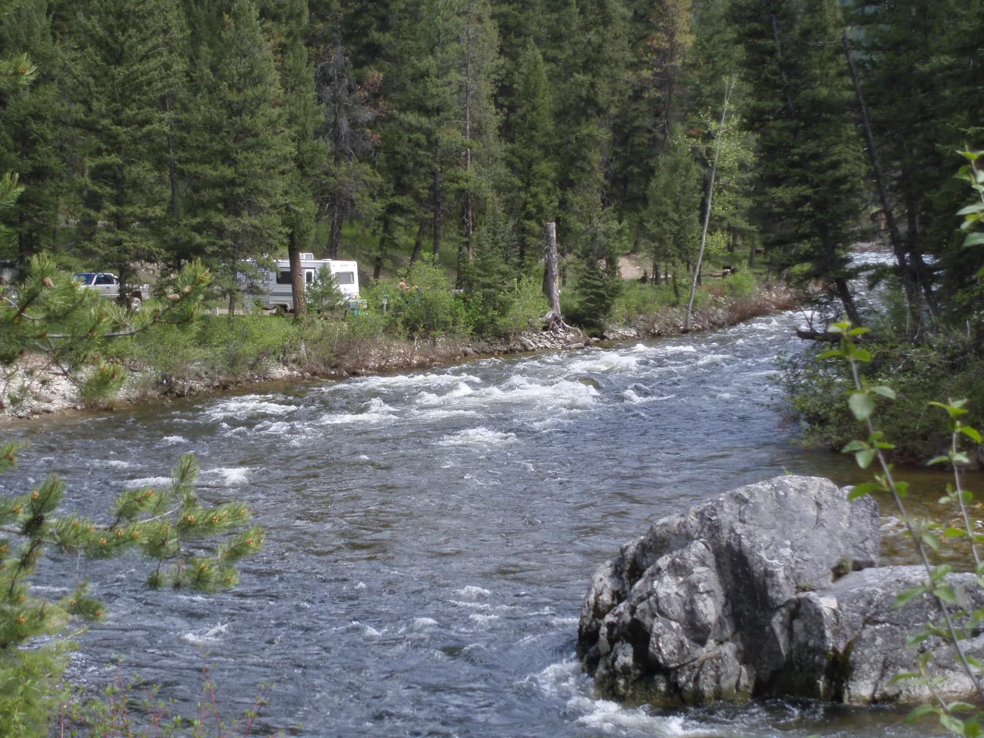
Developed campgrounds in the Shoshone range from the large Buffalo Bill State Park adjacent to the forest to small National Forest Service sites in the Wapiti Valley and South Fork corridors. Dispersed camping is permitted throughout most of the forest outside developed areas. See the camping permit guide for the practical mechanics of national forest camping reservations and dispersed use.
Fires may be restricted during dry conditions check current restrictions before any trip.
When to Visit
July through September is the prime hiking season for most of the forest. The Beartooth Plateau is accessible from the highway by mid-June most years. Lower-elevation Wapiti Valley trails open by late May. The Washakie backcountry at high elevation typically becomes reliable by mid-July.
Before any visit, review the conditions-checking guide for current fire, weather, and trail status in the specific area you plan to visit.
Getting There
Cody, Wyoming, is the primary gateway, located on US-14/16/20 at the eastern edge of the Wapiti Valley. From Billings, Montana, take I-90 west to Laurel, then US-212 south to Cody approximately 90 miles. From Casper, take US-26 west to Riverton, then US-26 north to Dubois, then US-26 west over Togwotee Pass to the Wind River country entrance.
The Beartooth Highway (US-212) provides access to the northern section from Red Lodge, Montana, over Beartooth Pass.
Practical Tips
Grizzly bears are active throughout the Shoshone. Bear spray is strongly recommended for all backcountry activities. The USFS recommends traveling in groups of three or more in grizzly-active areas. See our bear canister requirements guide for overnight food storage rules.
Afternoon thunderstorms are routine on the high terrain in July and August. Plan accordingly.
Planning Your Trip
First-time visitors often base in Cody and explore the Wapiti Valley corridor before committing to more remote destinations. The Buffalo Bill Center of the West in Cody is worth an afternoon before or after time in the forest, and the town has good gear shops and restaurants.