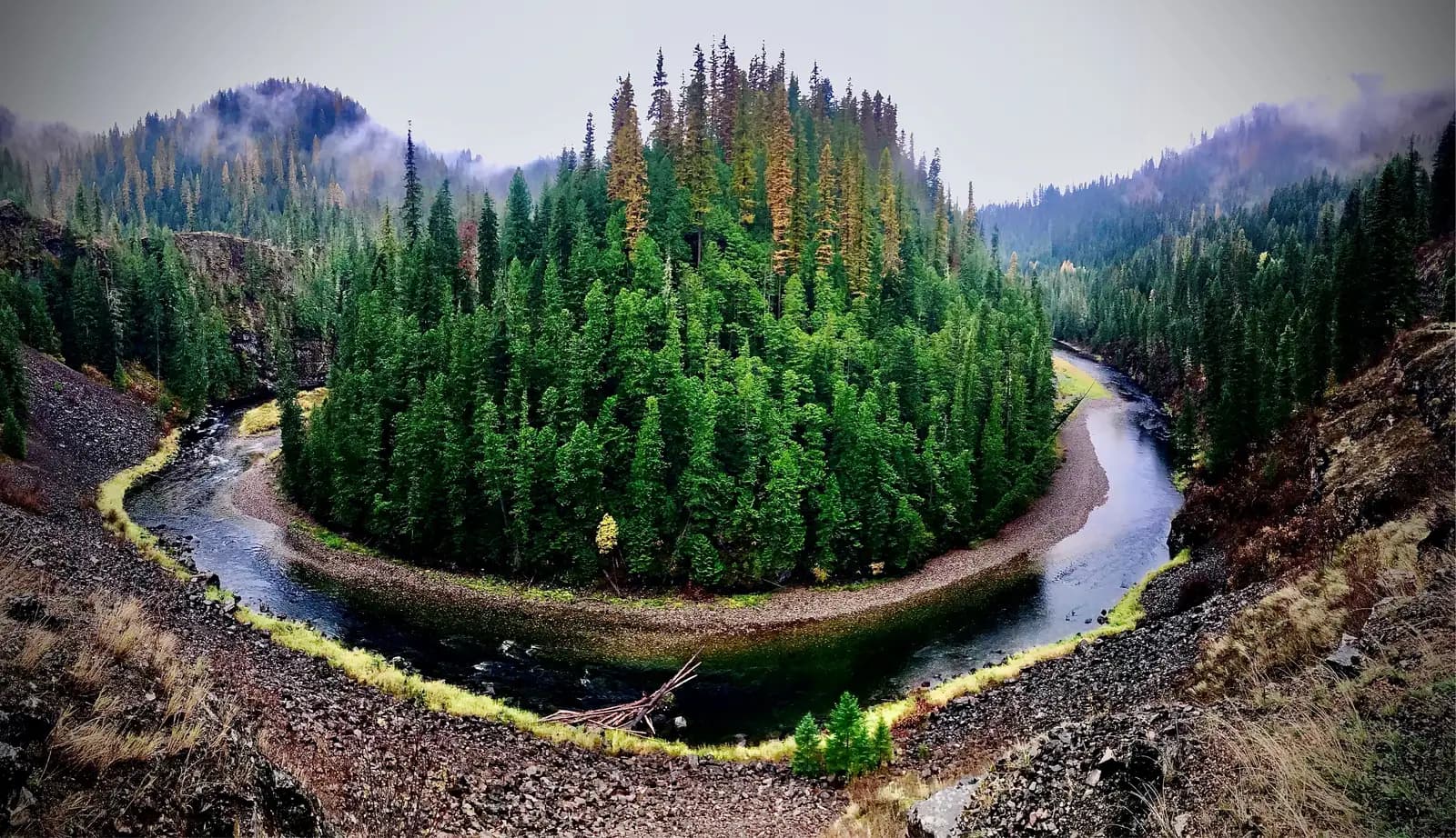
St. Joe National Forest protects approximately 866,000 acres of the St. Joe River watershed in the southern Idaho Panhandle, one of the more remote corners of the northern Rocky Mountain national forest system. The forest is administered as part of the Idaho Panhandle National Forests combined unit, sharing management with the Coeur d'Alene and Kaniksu sections. What distinguishes the St. Joe section is its eponymous river: the Wild and Scenic St. Joe, locally known as the "Shadowy St. Joe" for the dense forest canopy that shades its upper canyon, and celebrated as the highest navigable river in the world.
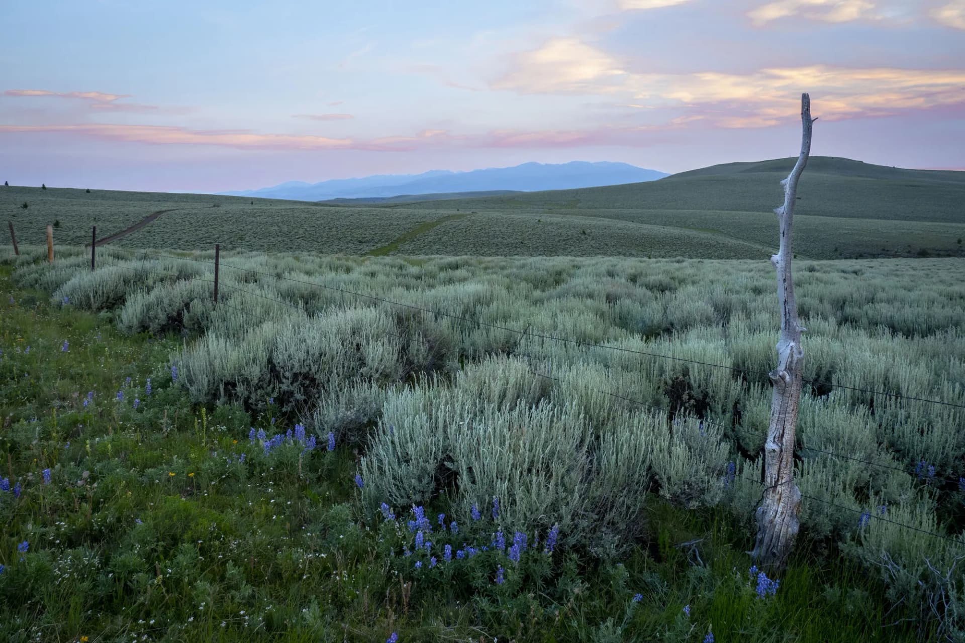
The forest spans a substantial elevation range, from the river bottoms at around 2,000 feet through the Huckleberry Mountains and ridge terrain above 6,000 feet. This range produces diverse habitat and a range of recreation opportunities across the calendar.
Trails
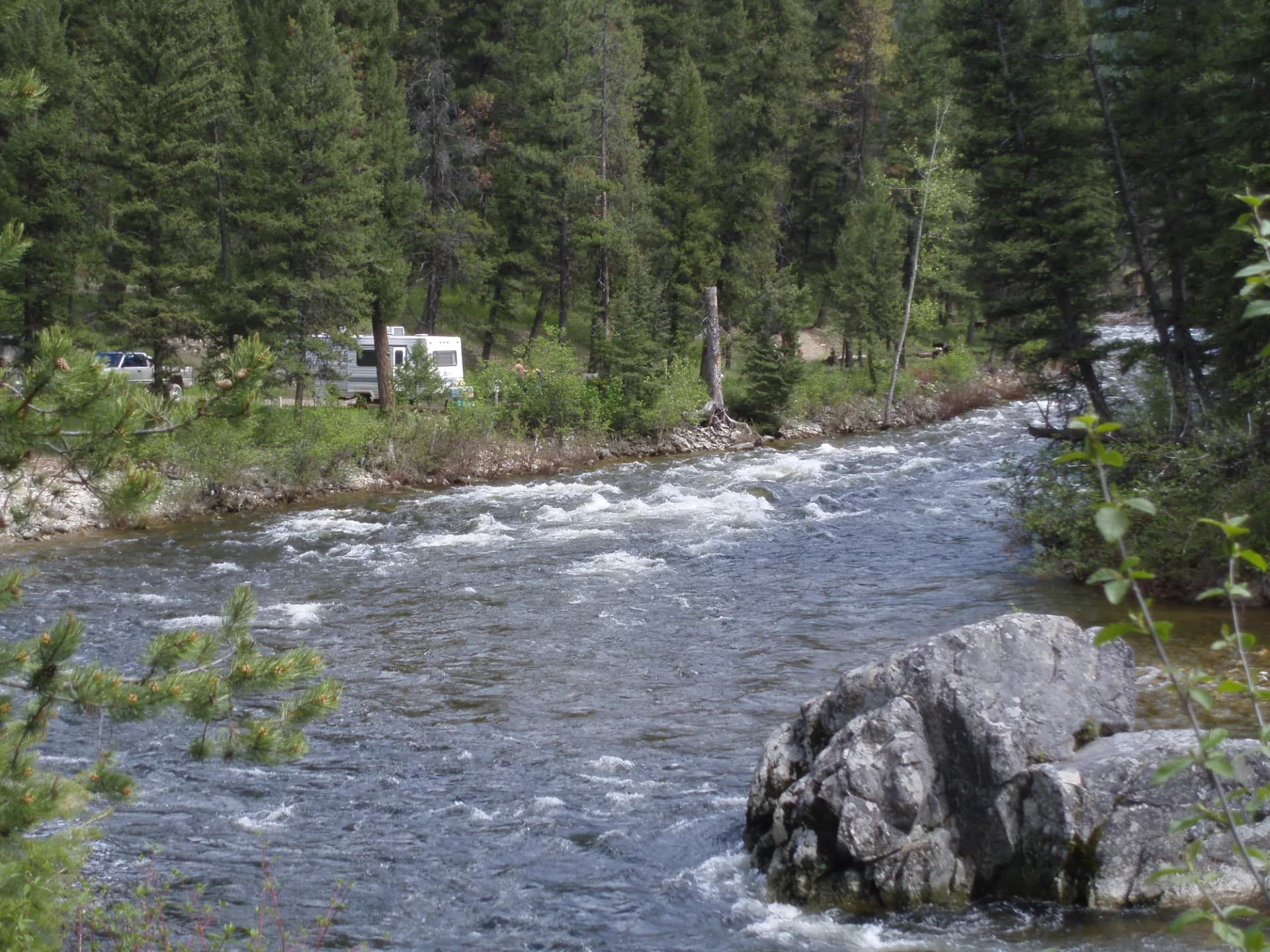
The St. Joe River Trail follows the Wild and Scenic reach of the river through forest and canyon terrain, covering 12 miles of riverside travel accessible from multiple trailheads. The river corridor provides outstanding fishing access and scenery through old-growth cedar and white pine forest that survived the 1910 wildfire that burned much of the surrounding region.
The Huckleberry Trail climbs through the Huckleberry Mountains to ridge-top terrain with views across the Idaho Panhandle, passing through the berry fields that give the range its name. Late July and August hiking here often includes the bonus of ripe huckleberries along the trail.
Marble Mountain offers a strenuous 9-mile round-trip to a summit with panoramic views across the St. Joe drainage and into the Bitterroot Range to the east. Gold Center Lakes is a longer route reaching alpine lake terrain in the upper watershed, a good multi-day backpacking destination in the St. Joe Wilderness.
The Emerald Creek Trail provides access to the garnet area and continues upstream through cedar and hemlock forest, a pleasant 4-mile walk accessible to most visitors.
Wildlife
The St. Joe watershed supports a healthy population of Rocky Mountain elk, with the Huckleberry Mountains area holding significant numbers. Black bears are common throughout the forest, particularly in the huckleberry areas in August. White-tailed deer and mule deer both occur, with white-tails more common in the lower river corridor. Steelhead salmon return to the St. Joe River from the ocean via the Columbia and Snake Rivers, with runs in fall and spring supporting both sport fishing and the wider ecosystem food chain. Gray wolves were reintroduced to the Northern Rockies in the 1990s and have been documented in the Idaho Panhandle forests; follow current USFS guidance regarding wolf encounters. Osprey and bald eagles nest along the St. Joe River corridor.
Getting There
From Coeur d'Alene, take I-90 east to the St. Maries exit and head south on US-3 approximately 25 miles to St. Maries. For the upper St. Joe River corridor, continue east from St. Maries on the St. Joe River Road (Forest Route 50) along the river, approximately 50 miles to Avery. From Moscow, take US-95 north to St. Maries Road or connect via US-8 east and US-3 north. Roads are paved to St. Maries and primarily gravel and dirt beyond, with some requiring high-clearance vehicles. Check road conditions with the St. Maries Ranger District before any extended forest road driving.
Seasons
Summer (June through September): The primary hiking and camping season. Huckleberry picking peaks in late July and August at higher elevations. The river corridor is accessible and fishable throughout the summer.
Fall (October): Hunting season is the most active period for the forest. Elk hunting draws visitors from across the region in October. Fall color in the western larch, which turns gold and drops its needles in October, is a distinctive and beautiful feature of the Idaho Panhandle forests.
Winter: Snow at upper elevations from November through March. Some forest roads close seasonally. The lower river road remains accessible most winters.
Spring (April through May): Snowmelt creates high water conditions on the river. Lower-elevation trails are accessible by late April. Higher terrain remains snowbound into June.
Nearby
St. Maries (population around 2,500) is the primary gateway, with basic services including lodging, a grocery store, and restaurants. The town sits at the confluence of the St. Joe and St. Maries Rivers and has a small historic downtown. Coeur d'Alene, 50 miles to the north, is a resort city on the lake of the same name and provides full metropolitan services. The Silver Valley mining towns of Kellogg and Wallace are accessible from I-90 and offer additional dining and lodging. For fishing information, review checking conditions before you go and check with Idaho Fish and Game for current regulations and steelhead run status.
Planning and Resources
No permit is required for day hiking or dispersed camping in St. Joe National Forest (as of 2026). America the Beautiful passes cover applicable fee sites. Veterans and permanently disabled individuals may qualify for federal discount passes. The St. Maries Ranger District is the primary contact for trail conditions, road closures, and current fishing information in the lower St. Joe corridor. The Avery Ranger District handles the upper river and wilderness area. The Emerald Creek garnet area requires a small daily fee ($10/day as of 2026) and a shovel; garnets are red almandite gems found in the decomposed schist along the creek. Practice Leave No Trace principles throughout, and review the dispersed camping guide for backcountry camping rules applicable in this remote forest.