ForestMatters, LLC

Trinity National Forest

California · 5 min read

State: California
Acres: 1,069,000
Established: 1905
Best Season: June through October
Trail Miles: 900 mi
Wilderness Areas: 2
Google MapsApple Maps
hikingbackpackingcampingfishingswimmingkayakingwildlife-viewingphotography

At a Glance

  • Trinity Alps Wilderness, the largest designated wilderness in California
  • Trinity Lake (Clair Engle Lake), a reservoir popular for boating and camping
  • New River Wilderness protecting a remote roadless river canyon
  • Granite peaks and alpine lakes rivaling the Sierra Nevada in scenery
  • Trinity River and New River supporting salmon and steelhead runs
  • Cultural landscape of the Wintu and Hupa peoples

Permits & Passes

Day Hiking (Trinity Alps Wilderness)Optional

Free (as of 2026)

Campfire Permit (non-developed sites)Required

Free (as of 2026)

Details

Federal Discount Passes

  • Military Annual PassFree — active duty & veterans
  • Senior Pass$20 lifetime — ages 62+
  • Access PassFree lifetime — permanent disability
Learn more →

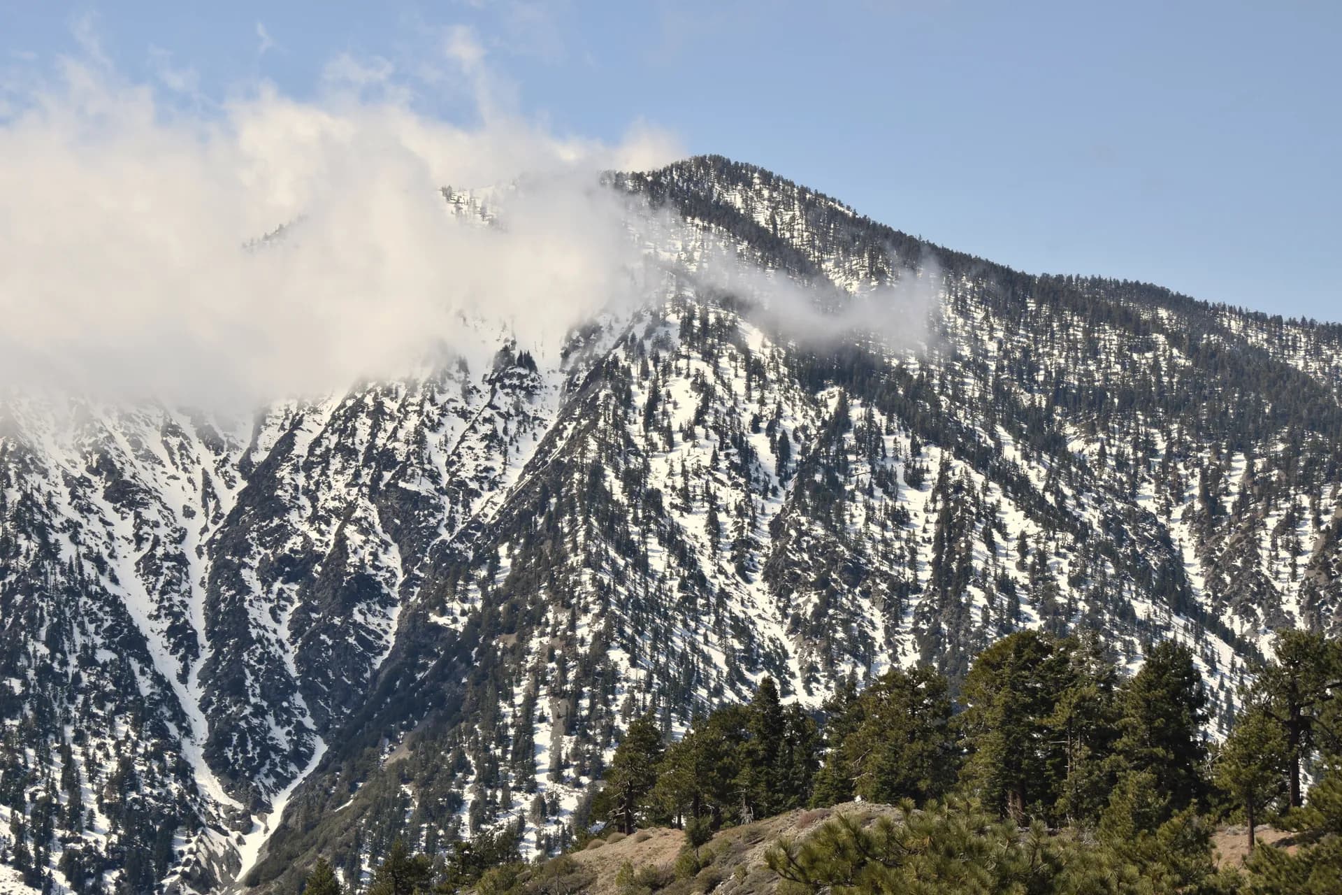
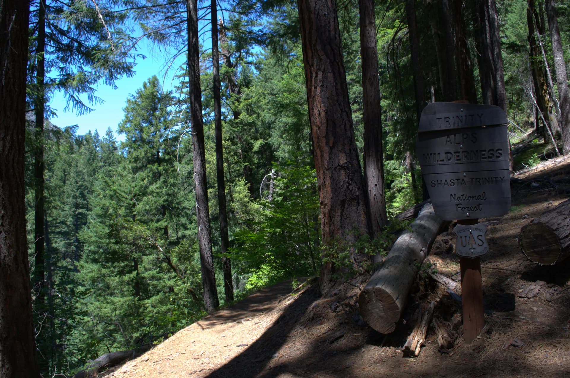
Trinity National Forest covers approximately 1.07 million acres of the Klamath Mountains in northern California, centered on Weaverville and the Trinity River drainage. It is administered as part of the combined Shasta-Trinity National Forest, sharing management with the Shasta section covering the volcanic terrain to the east. The Trinity section's defining feature is the Trinity Alps Wilderness, the largest designated wilderness area in California by area, a landscape of granite peaks, glacially carved lakes, and pristine river canyons that most Californians have never visited.

The Klamath Mountains, which include the Trinity Alps, Marble Mountains, and Siskiyou ranges, represent some of the most geologically complex terrain in North America. The region has accumulated oceanic terranes, volcanic arcs, and granitic intrusions over hundreds of millions of years, producing extraordinary rock diversity and, in combination with diverse climate and topography, exceptional plant and animal diversity.

Trails

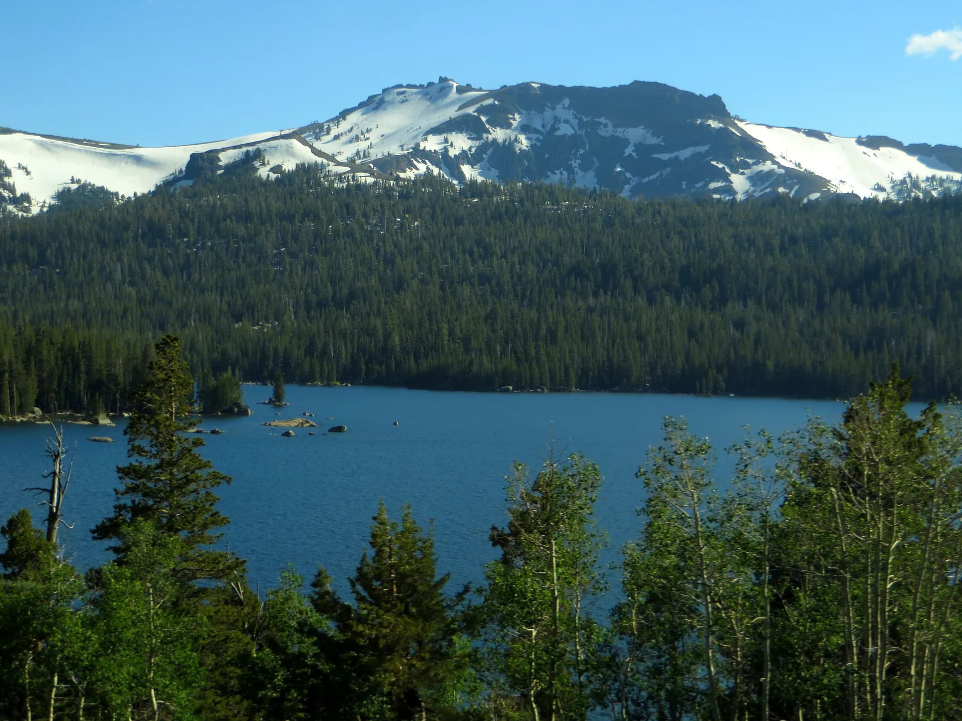
The Trinity Alps Loop is the premier multi-day circuit in the wilderness, connecting lake basins and ridge crossings over approximately 35 miles in a route that requires three to five days. The loop passes through the heart of the Alps, with granite peaks rising above 8,000 feet and lakes reflecting the rocky ridges above. This is one of the finest wilderness backpacking routes in California outside the Sierra Nevada.

For day hikes, Canyon Creek Trail is the most popular route in the Trinity Alps, climbing 10 miles to the Canyon Creek Lakes basin beneath a dramatic granite wall. The trail combines excellent fishing access with lake scenery and is the best introduction to the Alps' character. Swift Creek Trail follows a forested creek corridor for 12 miles into a quieter section of the wilderness.

Granite Peak is the forest's most demanding summit hike at 10 miles round-trip, reaching a high point with views across the full Trinity Alps. The Stuart Fork Trail penetrates the wilderness core over 16 miles to the Emerald and Sapphire Lakes area, one of the most-photographed destinations in the forest.

Wildlife

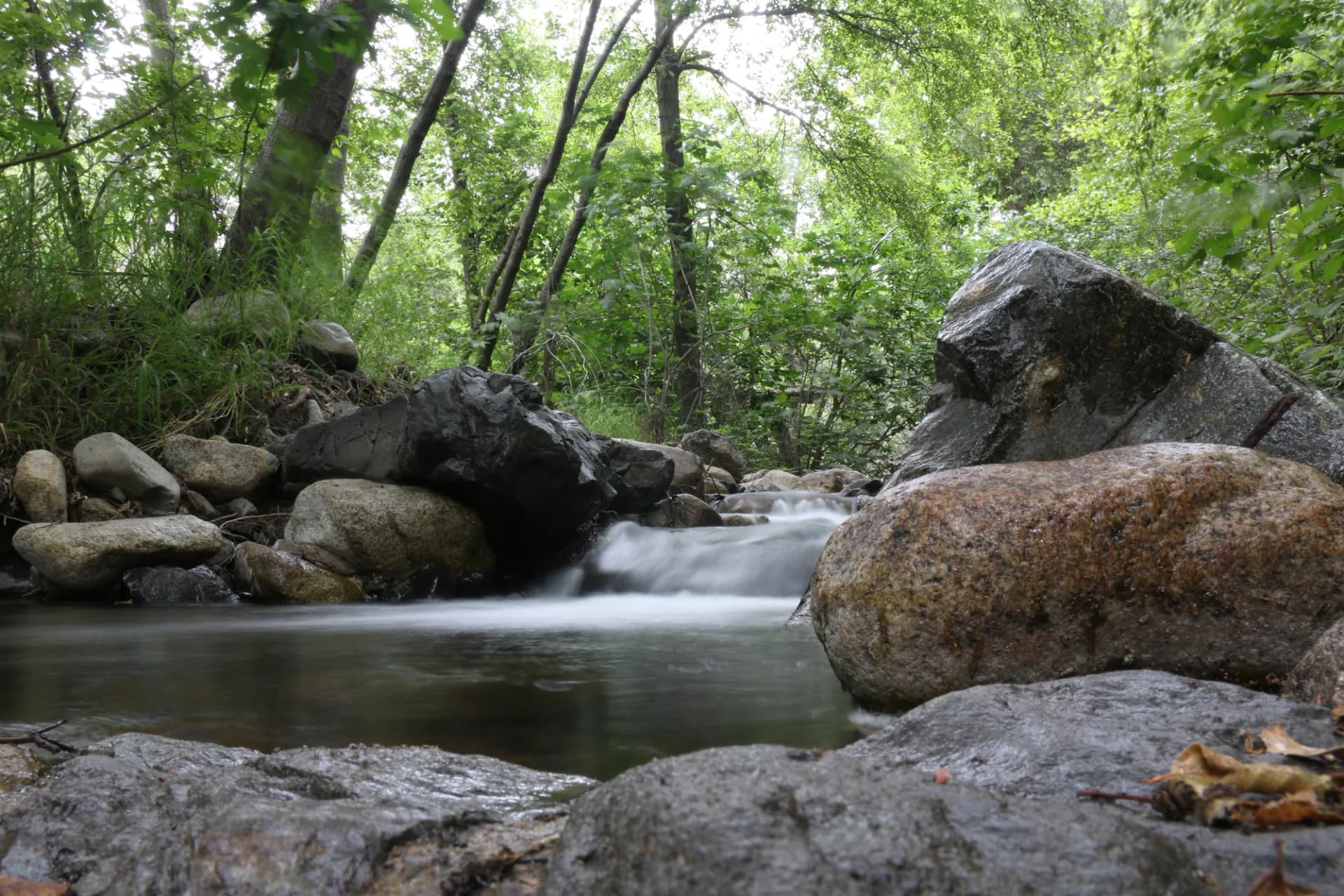
The Trinity section of the combined Shasta-Trinity forest lies within the Klamath-Siskiyou region, which is recognized by conservation biologists as one of the most biodiverse temperate regions in North America. Black bears are common throughout the forest and should be expected in all backcountry settings; proper food storage is essential. Pacific Fisher and Ringtail Cat inhabit old-growth forest zones. The Trinity and New Rivers support wild chinook salmon, coho salmon, and steelhead populations, and these fish runs are ecologically important to the entire watershed. Spotted owls inhabit old-growth stands throughout the forest. Follow current USFS guidance for wildlife encounters and store food in bear canisters on overnight trips.

Getting There

From Redding, take CA-299 west approximately 45 miles to Weaverville, the main gateway community. The Trinity Alps trailheads branch off north and south from CA-299 and the Trinity River Road (County Road 151). For the Canyon Creek trailhead, turn north at Junction City onto Canyon Creek Road. For the Stuart Fork and Swift Creek trailheads, continue west on CA-299 past Weaverville to Trinity Center Road. From Eureka on the North Coast, take US-101 to CA-36 east to CA-3 north to Weaverville, approximately 90 miles and 1.75 hours.

Seasons

Summer (June through October): The primary hiking season. High-country trails are accessible from late June in most years. Trinity Lake fills with boaters from June through August. Fire restrictions are typically in effect from June through September; check current restrictions before building any fire or using a stove in the backcountry.

Fall: Outstanding conditions from September through October. The wilderness sees far fewer visitors after Labor Day. The changing color of the black oaks and bigleaf maples in canyon bottoms begins in October.

Winter: The Trinity River valley is accessible year-round, but forest roads and high-country trails are snowbound from November through May. Some years see significant precipitation and road closures on lower roads.

Spring: Rivers run high and cold through June. Wildflowers in the lower elevations peak in April and May. High-country snow persists through mid-June.

Nearby

Weaverville (population around 3,500) is the county seat of Trinity County and the primary service hub for the forest. It has lodging, restaurants, a grocery store, and a small historical museum focused on the Chinese mining history of the area. Trinity County is one of California's least populous counties, and the forested character of the surrounding landscape reflects that low development pressure. Redding, 45 miles to the east, is a full-service city with an airport and complete services. For information on wilderness camping, see our national forest camping permit guide. Review Leave No Trace principles before any wilderness trip, and check conditions before you go given the active fire history of this region.

Planning and Resources

No permit is required for day hiking or overnight camping in the Trinity Alps Wilderness (as of 2026). A free campfire permit from the California Department of Forestry and Fire Protection is required for any open flame outside developed campgrounds; these can be obtained online. America the Beautiful passes cover fee sites in the combined Shasta-Trinity unit. Veterans and permanently disabled individuals may qualify for federal discount passes. The Weaverville and Hayfork Ranger Districts are the primary contacts for trail conditions and current fire restriction status. Fire restrictions in the Trinity Alps are typically in effect from June through September or October, varying by season severity. Bear encounters are common throughout the wilderness; review bear canister requirements and use a hard-sided canister or hang system on all overnight trips.

Trail Guides

moderate-hardout-and-back

Canyon Creek Trail

14 mi2,800 ft gain
June through October

Hike Canyon Creek Trail in Trinity National Forest, California. This moderate-hard 14.0-mile out-and-back follows a stunning creek canyon to twin alpine lakes beneath the granite walls of the Trinity Alps.

3 min read

moderateout-and-back

East Fork New River Trail

9.2 mi1,800 ft gain
June through October

Guide to the East Fork New River Trail in Trinity National Forest, California. A remote 9.2-mile out-and-back through old-growth forest and canyon wilderness.

4 min read

moderateout-and-back

Echo Lake Trail

6.8 mi1,600 ft gain
July through October

Hike to Echo Lake in Trinity National Forest, California. This moderate 6.8-mile out-and-back climbs through the eastern Trinity Alps to a quiet granite lake with views of the surrounding Klamath Mountains.

3 min read

strenuousout-and-back

Granite Peak Trail

10.2 mi3,100 ft gain
July through October

Summit Granite Peak in Trinity National Forest, California. This strenuous 10.2-mile out-and-back climbs to one of the Trinity Alps' rocky summits with sweeping views over the Klamath Mountains.

3 min read

moderateout-and-back

New River Trail

8.6 mi1,200 ft gain
April through October

Hike the New River Trail in Trinity National Forest, California. This moderate 8.6-mile out-and-back follows a wild and scenic river through a deep canyon with historic mining sites and old-growth forest.

3 min read

strenuousout-and-back

Stuart Fork Trail

18 mi3,800 ft gain
July through September

Backpack the Stuart Fork Trail to Emerald and Sapphire Lakes in Trinity National Forest, California. This strenuous 18.0-mile out-and-back reaches two of the Trinity Alps' most beautiful alpine lakes.

3 min read

moderate-hardout-and-back

Swift Creek Trail

11 mi2,400 ft gain
June through October

Hike the Swift Creek Trail in Trinity National Forest, California. This moderate-hard 11.0-mile out-and-back follows a mountain creek into the Trinity Alps Wilderness, reaching a scenic alpine lake beneath granite peaks.

3 min read

strenuousloop

Trinity Alps Wilderness Loop

32 mi7,200 ft gain
July through September

Backpack the Trinity Alps Wilderness Loop in Trinity National Forest, California. This strenuous 32.0-mile multi-day loop visits granite peaks, glacial lakes, and wildflower meadows in one of California's premier wilderness areas.

3 min read

Campgrounds

Tannery Gulch Campground

82 sitesReservable$22/night (as of 2026)

Hayward Flat Campground

100 sitesReservable$22/night (as of 2026)

Big Flat Campground

10 sitesFirst-comeFree (as of 2026)

Getting There

Weaverville
15 miles25 minutes
Redding
45 miles55 minutes
Eureka
90 miles1 hour 45 minutes

More in the Pacific Southwest

Frequently Asked Questions

Is Trinity National Forest the same as Shasta-Trinity National Forest?
Trinity National Forest is one of two proclaimed units forming the combined Shasta-Trinity National Forest administrative unit. The Trinity section covers the Klamath Mountains west of Redding, including the Trinity Alps Wilderness and Trinity Lake, while the Shasta section covers the volcanic terrain around Mount Shasta to the east. Both sections are administered from the supervisor's office in Redding.
How does the Trinity Alps Wilderness compare to the Sierra Nevada?
The Trinity Alps is often called California's 'other' alpine wilderness and delivers granite peaks, clear lakes, and high-alpine terrain comparable to the Sierra Nevada but with significantly fewer visitors. The wilderness contains over 55 lakes and numerous streams. The granite here is part of the Klamath Mountain complex, which is geologically older and more complex than the Sierra. The major trails in the Trinity Alps see a fraction of the use of comparable Sierra routes.
When does Trinity Lake reach capacity for boating?
Trinity Lake (officially Clair Engle Lake) is a reservoir on the Trinity River and is one of the largest lakes in California by surface area at full pool. Summer weekends draw houseboats, ski boats, and personal watercraft. The campgrounds on the lake fill well in advance for summer holiday weekends. Off-season visits (May and October) offer the same scenery with far less noise and crowding. Water levels vary significantly by water year.
Are permits required for Trinity Alps Wilderness?
No wilderness permit is required for day hiking or overnight camping in the Trinity Alps Wilderness as of 2026. A free campfire permit is required for any open flame outside a developed campground; these are available online through the California Department of Forestry and Fire Protection. Verify current requirements with the Weaverville Ranger District before your trip, as regulations can change, particularly regarding fire restrictions in summer.
Federal Discount Passes

Free and Discounted Entry for Qualified Visitors

Military Annual Pass

Active duty & veterans (any discharge except dishonorable)

Free · Annual

Senior Pass

U.S. citizens or permanent residents age 62+

$20 · Lifetime

Access Pass

Permanent disability (includes 50% off many camping fees)

Free · Lifetime
Get passes at any ranger station or store.usgs.gov/passLearn more →