Overview
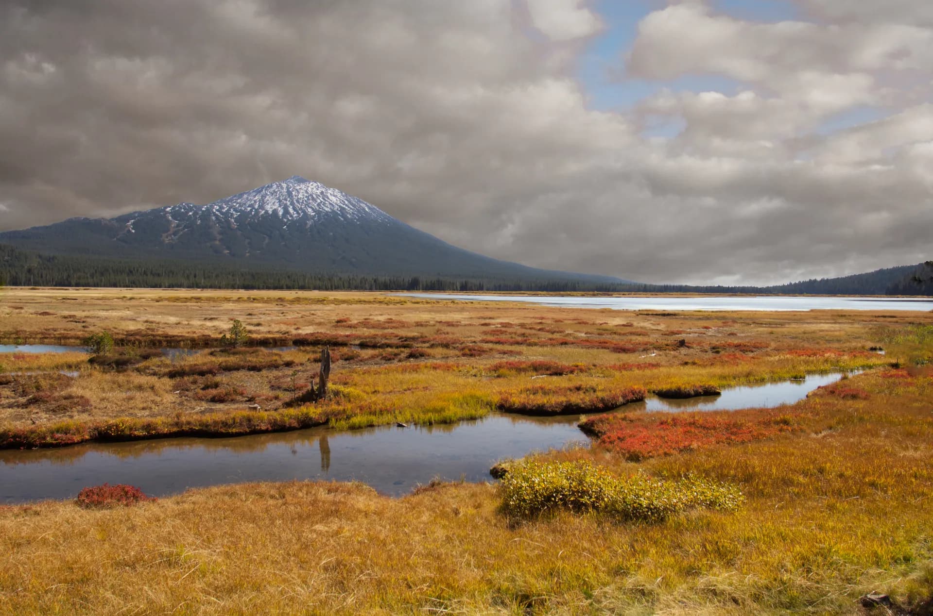
Wallowa-Whitman National Forest encompasses 2.3 million acres of the most rugged terrain in northeastern Oregon, from the glacier-carved granite peaks of the Wallowa Mountains to the extreme canyon depths of Hells Canyon. Few forests in the Pacific Northwest offer this range of extremes: alpine cirque lakes at 8,000 feet and a snake-river canyon bottom 4,000 feet below the surrounding plateau.
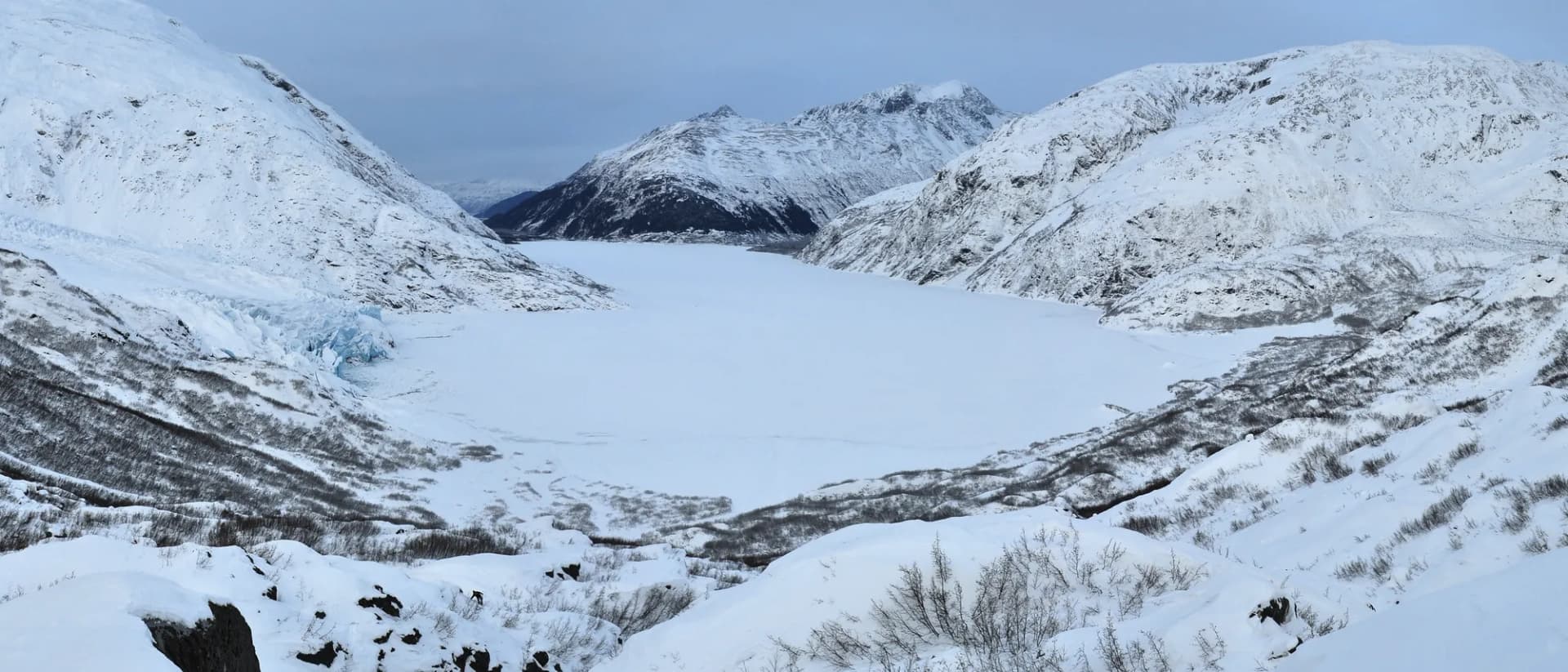
The Wallowa Mountains, often called the Oregon Alps, are geologically distinct from the volcanic Cascades: granite batholith terrain more similar to the Sierra Nevada, with sharp ridges, glacial lakes, and summits approaching 10,000 feet. The Eagle Cap Wilderness, at 350,000 acres, is Oregon's largest wilderness and provides world-class backpacking.
Why Wallowa-Whitman National Forest Stands Out
Eagle Cap Wilderness
The Eagle Cap Wilderness is the crown of the Wallowa Mountains, covering granite peaks, more than 50 named lakes, and over 500 miles of trails. The Lakes Basin in the wilderness interior is one of the Pacific Northwest's premier backpacking destinations: a compact area of high-country lakes including Moccasin, Frazier, and Horseshoe Lakes, all accessible on a loop route that most backpackers complete in 3 to 5 days. The summit of Eagle Cap (9,572 ft) commands views across northeastern Oregon into Idaho and Washington.
Hells Canyon
Hells Canyon cuts deeper than the Grand Canyon, dropping 7,913 feet from the Idaho side's Seven Devils Mountains to the Snake River's surface. The canyon is remote and extreme: summer temperatures in the inner canyon reach 110°F, rattlesnakes are present, and water sources are unreliable. The Bench Trail along the Oregon rim provides access without descending into the worst heat. Jet boat tours from Hells Canyon Dam are the most common visitor experience.
Imnaha River Country
The Imnaha River drains south through a remote canyon system before joining the Snake River in Hells Canyon. The small town of Imnaha is the most remote incorporated community in Oregon, and the road to it passes through landscape that genuinely feels like another era. The upper Imnaha drainages provide outstanding trail access for elk hunting and fishing.
Best Trails
The Wallowa Lake Tramway to Summit is a 2-mile descent from the tramway summit at 8,150 feet to Mount Howard's summit viewpoints, with panoramic views across the Wallowa Valley and into Idaho.
The Lakes Basin Loop is a 20.4-mile multi-day backpacking circuit through the heart of the Eagle Cap Wilderness, visiting Moccasin, Frazier, Horseshoe, and Lee Lakes in the most scenic high-country basin in Oregon.
The Hells Canyon Bench Trail covers 6.8 miles along the Oregon rim of Hells Canyon through wildflower-rich grasslands with views into the deepest gorge in North America.
The Mirror Lake Trail is an 8.2-mile out-and-back to Mirror Lake in the Eagle Cap Wilderness from the Wallowa Lake Trailhead, passing through classic alpine terrain.
The Hurricane Creek Trail is a 10.4-mile out-and-back up a dramatic canyon to Slick Rock Creek and the base of the Matterhorn, one of the most impressive peak approaches in Oregon.
The Imnaha River Trail is a 12.0-mile out-and-back through the remote Imnaha River canyon to a wilderness camp in the lower Eagle Cap.
The Eagle Cap Summit Trail is a 10.8-mile strenuous route to the 9,572-foot namesake summit of the wilderness, the high point of the Wallowa Mountains.
The Snake River National Recreation Trail is a 7.2-mile out-and-back along the Snake River corridor in Hells Canyon, one of the most remote river hiking experiences in the Northwest.
Permits and Passes
Day hiking in Wallowa-Whitman National Forest requires no permit. Overnight camping in the Eagle Cap Wilderness requires a free self-issue permit available at trailheads (as of 2026). Wallowa Lake Campground and other developed sites reserve through recreation.gov, with fees from $15-24/night (as of 2026).
The Hells Canyon National Recreation Area has specific regulations; check with the Hells Canyon NRA office in Clarkston, Washington, or Enterprise, Oregon, for current requirements.
Veterans and military families receive benefits through the America the Beautiful Pass. See America the Beautiful Pass for Veterans and Veteran Benefits at National Forests.
Camping
Wallowa Lake Campground is the primary developed campground, with 211 sites adjacent to Wallowa Lake at the foot of the Wallowa Mountains. Flush restrooms, showers, and boat launch access. Heavily used in summer; reserve months in advance at recreation.gov. Fee is approximately $24/night (as of 2026).
Buckhorn Campground in the Imnaha River drainage offers 6 primitive sites with vault toilets, first-come-first-served at approximately $8/night (as of 2026).
Hurricane Creek Campground is a free 5-site primitive facility at the Hurricane Creek Trailhead, open June through September. First-come-first-served.
Dispersed camping is allowed throughout the forest and in the wilderness, free of charge (as of 2026). Camps must be 100 feet from water and 200 feet from trails in wilderness areas.
When to Visit
July through August is peak season for the Eagle Cap Wilderness. Most high-elevation routes are snow-free by early July in average years. Wildflowers peak in late July at the lakes basins.
September is the best month for uncrowded wilderness travel with reliable weather and exceptional photography conditions. Nights are cold; bring adequate sleeping gear.
Late June opens access to lower routes including Hurricane Creek and the Wallowa Lake area, while upper lakes often hold late snow.
May through June, the Wallowa Valley itself is beautiful for driving and lower-elevation hiking, but most wilderness trails remain snow-covered.
Getting There
From Enterprise (8 miles, 15 minutes): Enterprise is the gateway town with full services including a ranger station, grocery, and lodging. Highway 82 east from Enterprise leads to Wallowa Lake and the main wilderness trailheads in minutes.
From La Grande (65 miles, 1 hour): I-84 to Highway 82 provides the most direct route from the population center of northeastern Oregon. La Grande has full commercial services.
From Boise (185 miles, 3 hours): Interstate 84 north to Baker City, then north on Highway 86 to the forest's southern districts including Hells Canyon. Baker City is the service hub for the southern forest.
Practical Tips
The Eagle Cap Wilderness is a serious mountain environment. July thunderstorms develop rapidly over the summits; check forecasts and be off exposed ridges by early afternoon. See Checking Conditions Before You Go for a full checklist.
Black bears are present throughout the forest. Bear canisters are recommended for wilderness overnight trips. Review Bear Canister Requirements.
Hells Canyon is genuinely hazardous in summer heat. If visiting the canyon in July or August, carry at least 4 liters of water per person for any canyon hike, start at dawn, and turn back before midday temperatures peak. Rattlesnakes are present in the canyon grasslands.
Practice Leave No Trace 7 Principles throughout the wilderness, particularly around the fragile alpine lake margins in the Lakes Basin.