Exploring Hiawatha National Forest
Hiawatha National Forest covers 880,000 acres across the central and eastern Upper Peninsula of Michigan, making it one of the largest national forests in the Great Lakes region. The forest's northern boundary runs along Lake Superior and the southern edge of Pictured Rocks National Lakeshore, while its eastern and southern arms reach Lake Huron and Lake Michigan respectively. This triple-shoreline geography is rare: no other national forest in the contiguous United States borders three of the Great Lakes.
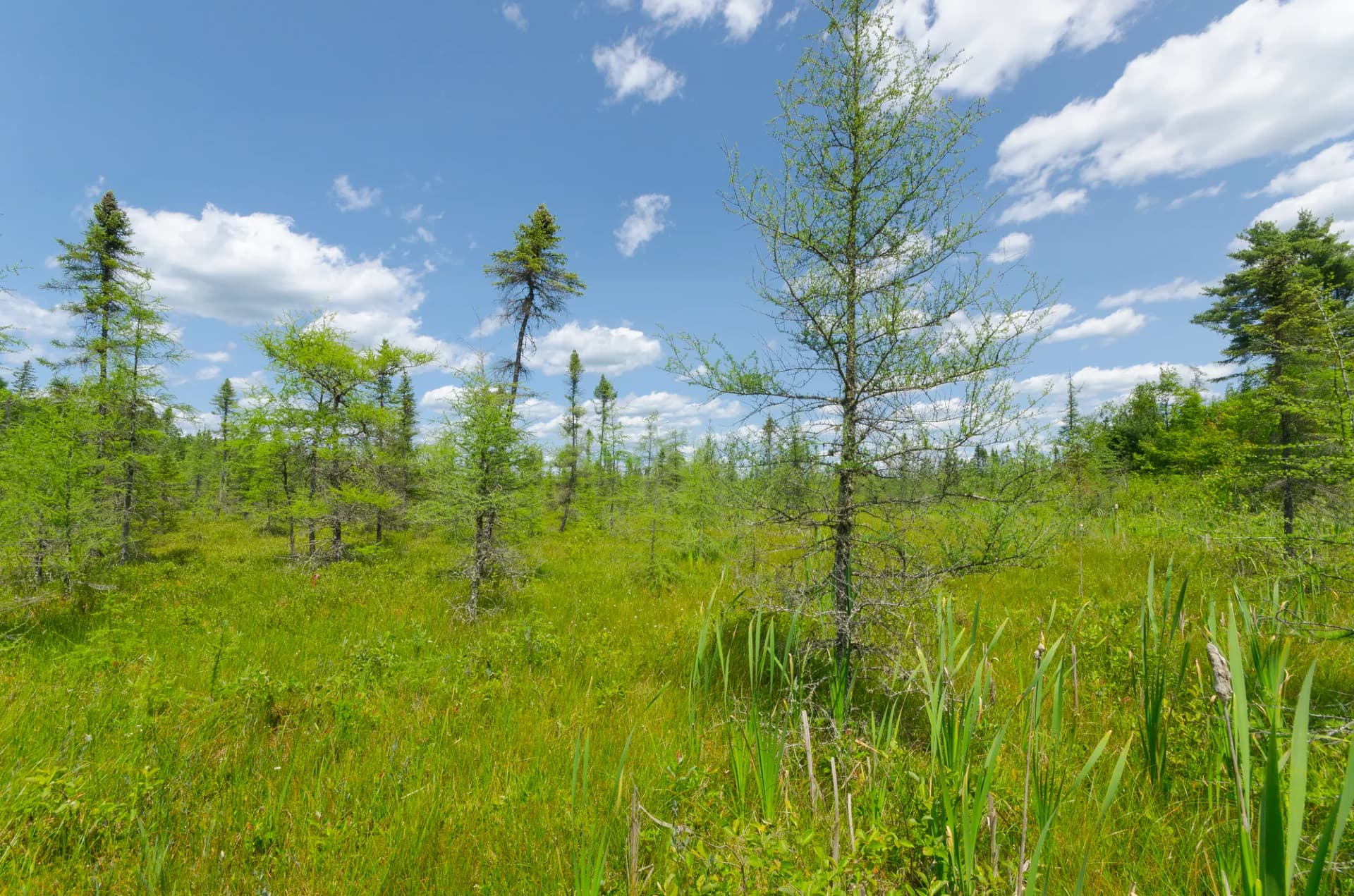
The forest encompasses a mosaic of northern hardwoods, boreal spruce-fir stands, cedar swamps, and inland lake chains left by glacial retreat. Birch and maple dominate the uplands, putting on a spectacular color show in late September. The interior holds more than 700 lakes and 4,000 miles of streams, supporting cold-water fisheries prized across the Midwest. The city of Munising sits practically inside the forest boundary and serves as the primary gateway, with outfitters, lodging, and access to Pictured Rocks boat tours all within a few minutes' drive.
Why Hiawatha National Forest Stands Out
Three Great Lakes Shorelines
Most hikers know Pictured Rocks National Lakeshore for its painted sandstone cliffs above Lake Superior, but Hiawatha wraps around the park's western edge and continues along the shoreline in both directions. The forest's Lake Superior shoreline includes Miners Beach and the Au Train River mouth, offering sand beaches and cobble shores without the heavy Pictured Rocks crowds. The Lake Michigan and Lake Huron shorelines in the southern units bring warmer water temperatures and excellent swimming beaches in summer.
Rich Wildlife and Birding
Hiawatha supports one of the Upper Peninsula's healthiest black bear populations, along with wolves, moose, white-tailed deer, river otters, bald eagles, and osprey. The forest is a documented stopover for migratory songbirds during spring and fall migrations, and the Seney National Wildlife Refuge sits immediately to the east, extending the contiguous wild habitat. Kirtland's warbler, a federally recovered species, breeds in jack pine stands near the forest's southern units: making this one of the few places in the world where birders can reliably spot this once-rare bird.
Winter Recreation Network
Hiawatha maintains more than 300 miles of groomed snowmobile trails and roughly 40 miles of dedicated cross-country ski trails. The Rapid River, Munising, and St. Ignace ranger districts each run interconnected groomed networks from December through March in most years. The forest's inland lake chains also provide ice fishing opportunities for walleye, perch, and northern pike throughout winter.
Best Trails
Hiawatha's trail system spans 650 miles, ranging from short lakeside walks to multi-day backpacking routes along the North Country Trail corridor.
The Chapel Loop is the showpiece hike of the Munising district, linking Chapel Falls, Chapel Rock, and Chapel Beach in a 9-mile circuit through old-growth hemlock forest above Lake Superior. The loop includes some of the most dramatic cliff-top views in the Upper Peninsula.
The North Country Trail Munising Segment follows a 7.5-mile corridor through mixed forest south of Munising, connecting trailheads with views of small inland lakes and cedar lowlands. It's part of the continuous North Country Trail that runs from North Dakota to Vermont.
Miners Beach Trail is an accessible 3.2-mile out-and-back route from Miners Castle to the wide sand beach at Miners Beach on Lake Superior: ideal for families and those wanting a shorter outing close to Munising.
The Au Train Lake Trail circles Au Train Lake on an 8.4-mile loop through mixed hardwood forest, passing the Au Train River outlet and several sandy beach points. The campground at the south end makes it a natural overnight option.
The Eben Ice Caves Trail leads 1.8 miles out-and-back to a sandstone canyon that fills with dramatic ice formations from December through March. In summer the canyon is a cool, mossy slot with interesting geology.
Lake Superior Beach Walk is a casual shoreline route covering 4.0 miles of cobble and sand beach near the Bay Furnace Campground. The walk passes the ruins of a 19th-century charcoal iron furnace, giving it historical interest alongside the scenery.
The Rock River Canyon Wilderness Trail drops into the Rock River Canyon Wilderness for a 5.2-mile round trip, following the river through a sandstone gorge with a 50-foot waterfall at the turnaround point. This is one of the forest's designated wilderness areas.
The Kitch-iti-kipi Spring Walk accesses the largest natural freshwater spring in Michigan at 40 feet deep and 300 feet across. The 0.8-mile walk from the trailhead uses a self-operated observation raft to view the spring from above: a genuinely unusual experience popular with all ability levels.
Permits and Passes
Day hiking and dispersed camping on Hiawatha National Forest require no permits and no fees (as of 2026). Dispersed camping is permitted throughout most of the forest at least 200 feet from water, trails, and roads, following Leave No Trace principles.
Developed campground stays require reservation and nightly fees ranging from $14 to $24 (as of 2026), bookable through Recreation.gov. Some sites fill weeks in advance during peak summer weekends, particularly at Bay Furnace and Au Train Lake.
The America the Beautiful Annual Pass covers day-use fees at developed recreation sites. Veterans and active-duty military qualify for free passes under the Interagency Access and Military programs: see our veteran benefits guide for complete details.
Camping
Bay Furnace Campground sits on the Lake Superior shore near Christmas, Michigan, with 50 sites directly above the waterline. Many sites have lake views, and the beach is a short walk. The restored iron furnace ruins are visible from the campground road. Open May through October (as of 2026).
Au Train Lake Campground offers 37 sites on the southern shore of Au Train Lake, a clear glacial lake with a sandy beach and good walleye fishing. The campground connects directly to the Au Train Lake Trail. Open May through October (as of 2026).
Colwell Lake Campground provides 35 sites in a mature hardwood setting with lake access for swimming and canoeing. Colwell Lake is small and quiet, making it a good choice for families and first-time campers. Open May through October (as of 2026).
Straits Area Campground near St. Ignace faces the Straits of Mackinac, with views toward the Mackinac Bridge. It's the most convenient campground for travelers coming from the Lower Peninsula via I-75. Open May through September (as of 2026).
When to Visit
June through August brings the warmest weather, wildflower blooms, and full campground and trail access. Lake Superior water temperatures remain cold even in summer: rarely above 60 degrees: so beach swimmers should be prepared. Bugs peak in June and early July, particularly near wetland areas.
September and October are prime for fall color, which typically peaks the last week of September. Crowds drop significantly after Labor Day, campground fees are lower, and the forest is at its most photogenic. Black flies and mosquitoes are largely gone by mid-September.
November through March brings significant snow accumulation across the Upper Peninsula. Forest roads often become impassable without a plow or four-wheel drive. Snowmobile trails open when conditions allow, typically December through March. Cross-country skiing is excellent on the groomed trail networks.
April and May are mud season in the UP. Many trails are soft and forest roads can be rutted. Ice-out on inland lakes varies; walleye and northern pike anglers often time their spring trips to coincide with ice-out in May.
Getting There
From Munising: Munising is the primary gateway to the Munising Ranger District and the north shore trails near Pictured Rocks. The town is on M-28, roughly 50 miles east of Marquette. Most trailheads near Chapel Falls and Miners Beach are within 10-15 miles of downtown Munising.
From Escanaba: Escanaba serves the Rapid River and Manistique Ranger Districts on the southern side of the forest. Drive north on US-2 or US-41 from Escanaba to reach campgrounds and trailheads in the forest interior. The drive is approximately 1 hour from Escanaba.
From Marquette: Marquette is about 55 miles west of Munising on M-28 and offers the largest airport in the Upper Peninsula (MQT). Travelers flying into Marquette can reach most Hiawatha trailheads within 1 to 1.5 hours.
Practical Tips
Black bears are common throughout Hiawatha. Store all food, coolers, and scented items in a bear box or vehicle trunk. Camp kitchen waste should go into sealed bags in bear-resistant receptacles. See our guide on bear canister requirements for food storage recommendations.
Cell service is sparse across the Upper Peninsula, particularly in the forest interior. Download offline maps before leaving cell range, and let someone know your itinerary. Forest roads may have sections of deep sand, mud, or washboard depending on season and recent maintenance: a high-clearance vehicle is helpful on secondary roads.
Always check current conditions before heading out, particularly for road closures in spring and storm damage after severe weather. The USFS Hiawatha district offices post current alerts on the forest's official website. Our guide to checking conditions before you go covers the key resources.
Practice Leave No Trace principles across all your trips in the forest. Hiawatha's remote lakes and rivers are unusually pristine: pack out all waste and use established fire rings. Full principles are covered in our Leave No Trace guide.