Southern New Mexico's Mountain Island
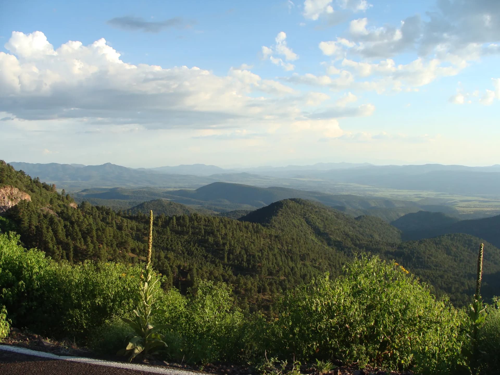
Lincoln National Forest is a collection of forested mountain ranges rising above the Chihuahuan Desert of southern New Mexico. Established in 1902, the forest covers 1.1 million acres across three separate units: the Sacramento Mountains near Ruidoso, the Guadalupe Mountains near Carlsbad, and the Capitan Mountains between them. Each unit has a distinct character, ranging from the alpine terrain of Sierra Blanca to the low limestone canyons of the Guadalupe unit.
The Sacramento Mountains unit, centered on Ruidoso and Sierra Blanca, is the most visited. Sierra Blanca Peak rises to 11,981 feet, the highest point in southern New Mexico, and the surrounding White Mountain Wilderness contains nearly 49,000 acres of roadless land accessible only on foot or horseback. For visitors arriving from the desert valleys below, the forest provides a dramatic elevation change and a genuine escape from summer heat.
Why Lincoln National Forest Stands Out
Sierra Blanca and the White Mountain Wilderness The centerpiece of the Sacramento Mountains unit is Sierra Blanca, a dramatic peak visible from much of southern New Mexico. The White Mountain Wilderness covers the high terrain around and below the peak with nearly 49,000 roadless acres. Trail options range from the demanding Sierra Blanca summit route to gentler ridge walks that traverse the wilderness boundary. The wilderness designation means no motorized vehicles, no chainsaws, and genuine backcountry quiet.
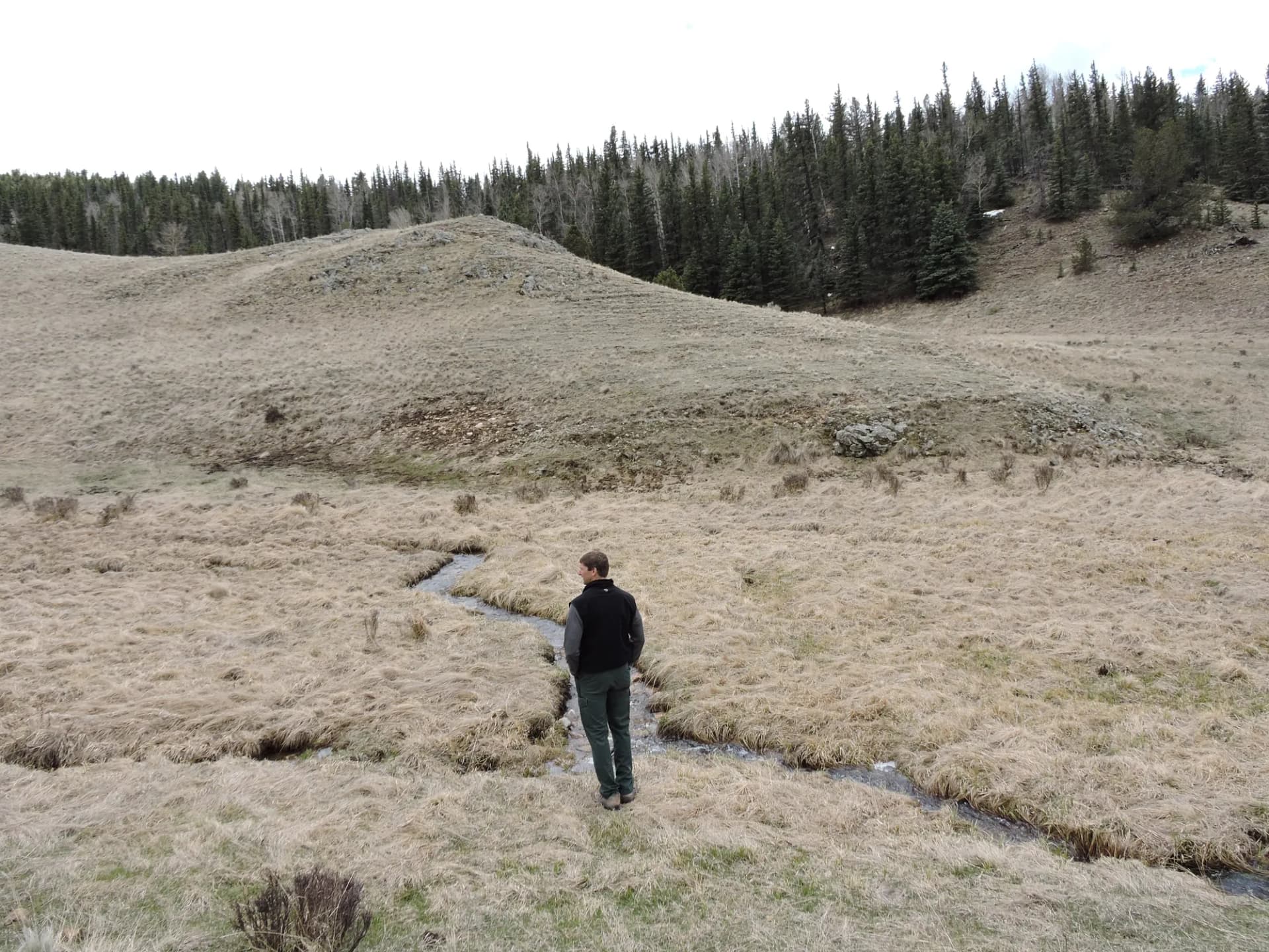
The Capitan Mountains and Smokey Bear Country The Capitan Mountains unit is distinct from the rest of the forest in both ecology and history. This small range runs east to west, unlike most New Mexico mountains, and receives precipitation from both Gulf of Mexico and Pacific storm tracks. The result is a diverse forest of ponderosa pine, Douglas fir, and aspen on a relatively small landmass. The unit is also where the living Smokey Bear was rescued from a 1950 wildfire, making it a touchstone in the history of American fire awareness.
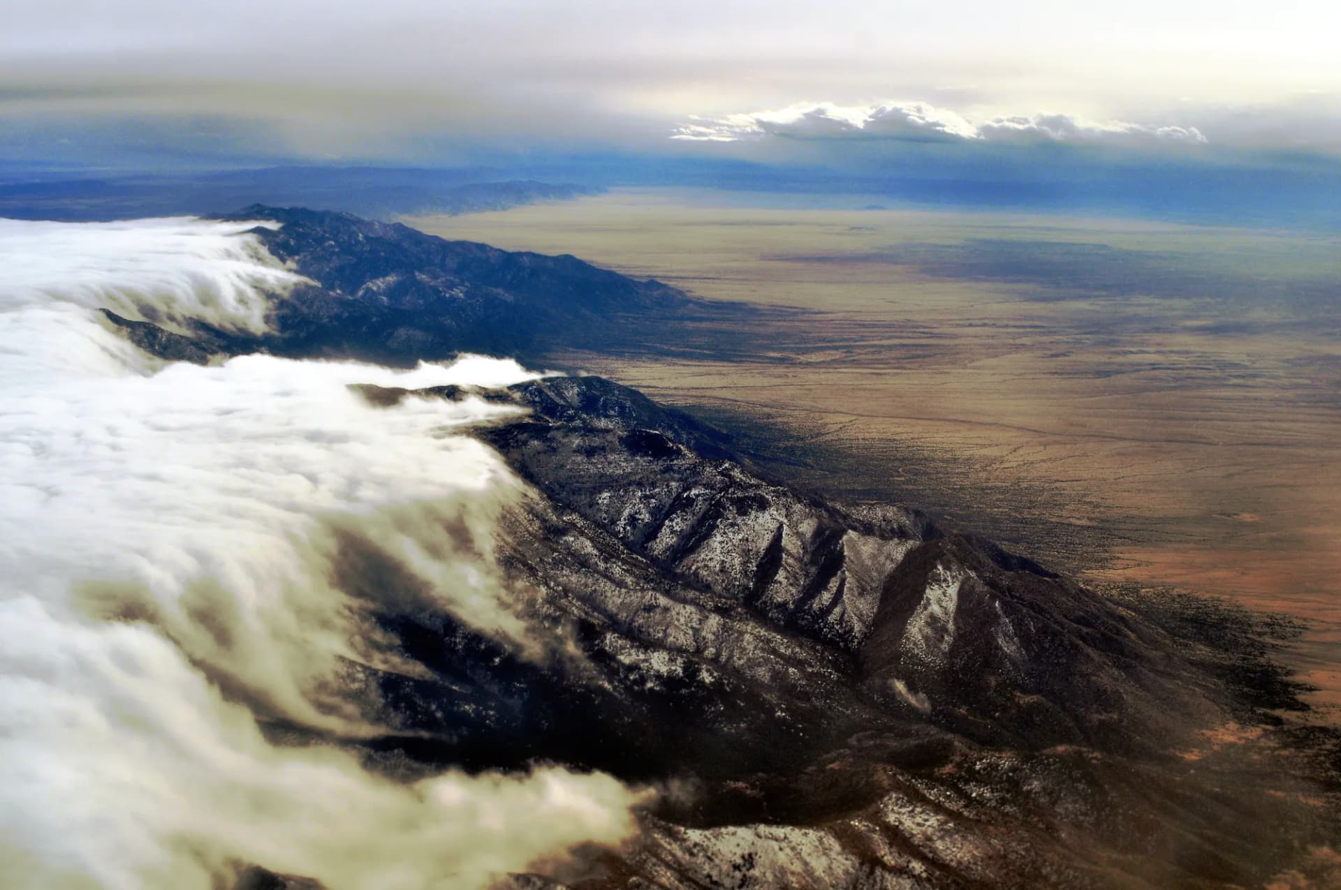
Southern Access to Rocky Mountain Ecosystems Lincoln National Forest sits far enough south that its high-elevation forests represent some of the southernmost examples of Rocky Mountain spruce-fir forest in the United States. The forest also sits between Carlsbad Caverns National Park to the southeast and White Sands National Park to the west. Visitors combining all three areas experience one of the most geologically varied short itineraries in the Southwest. For background on what makes national forests different from national parks, see /learn/national-forest-vs-national-park.
Best Trails
Lincoln National Forest's 330 miles of trail span all three units and a wide range of terrains and difficulties.
The Sierra Blanca Peak Trail (7.0 miles, strenuous) climbs to the highest point in southern New Mexico at 11,981 feet, crossing through spruce-fir forest and alpine tundra with wide desert views on clear days.
The White Mountain Trail (10.6 miles, moderate) traverses the crest of the White Mountain Wilderness on a long ridge route through ponderosa and mixed conifer with views of the Sacramento Mountains.
The Sitting Bull Falls Trail (2.4 miles, easy) visits a striking desert waterfall in the Guadalupe unit where a spring-fed creek drops 150 feet over a limestone cliff into a clear pool.
The Trestle Recreation Area Loop (4.2 miles, moderate) follows an old railroad grade through the Sacramento Mountains, passing the ruins of a historic logging trestle in a ponderosa forest setting.
The South Fork Trail (6.8 miles, moderate) follows the South Fork of the Rio Ruidoso through one of the most scenic creek drainages in the Sacramento Mountains.
The Rim Trail Cloudcroft (5.0 miles, easy-moderate) offers high-altitude forest walking near Cloudcroft with views into the White Sands basin below.
The Capitan Mountains Sunset Trail (4.0 miles, moderate) climbs the south face of the Capitan Mountains to a ridgeline with panoramic views across Lincoln County.
The Bluff Springs Loop (5.4 miles, moderate) explores the mid-elevation ponderosa zone near Ruidoso, passing a historic spring and through diverse forest vegetation.
Permits and Passes
Day hiking and dispersed camping in Lincoln National Forest require no permit and no fee as of 2026. The White Mountain Wilderness requires no permit for day use or overnight camping as of 2026. Developed campground sites require reservation and fee payment through Recreation.gov.
America the Beautiful Annual Passes cover developed campground fees. Veterans and active-duty service members benefit from federal recreation discounts. Details at /learn/america-the-beautiful-pass-veterans and /learn/veteran-benefits-national-forests.
Camping
Oak Grove Campground (30 sites) is the most popular developed campground in the Sacramento Mountains unit, sitting at 6,800 feet in ponderosa pine near Cloudcroft. Reservations recommended for summer weekends at $18/night (as of 2026).
Pine Springs Campground (20 sites) near Cloudcroft operates year-round and sits at higher elevation with spruce-fir canopy. Available at $22/night (as of 2026).
Sitting Bull Falls Campground (28 sites) serves the Guadalupe unit adjacent to the Sitting Bull Falls Recreation Area. Open March through November at $15/night (as of 2026). Reservations recommended.
Skyline Campground (12 sites) is a small, first-come, first-served facility at higher elevation in the Sacramento Mountains unit at $12/night (as of 2026).
When to Visit
April and May open the lower-elevation trails in the Guadalupe unit and the Capitan Mountains. The Sitting Bull Falls area is at its best with spring flow.
June is the transition month in the Sacramento Mountains: high-elevation trails clear of snow, and temperatures are comfortable before the July monsoon begins.
July through August brings the North American Monsoon, delivering afternoon thunderstorms daily to the mountains. Morning hikes are reliably good; afternoon exposure on ridges is a serious lightning concern.
September and October are the prime months: dry stable weather, excellent visibility, and fall color in the aspen zones above 9,000 feet.
November through March the Sacramento Mountains unit receives significant snowfall, and Ski Apache operates on Sierra Blanca. Many campgrounds close, but the forest sees a different kind of visitor: snowshoers and backcountry skiers.
Getting There
From Ruidoso (5 miles, 10 minutes, Sacramento unit): Ruidoso sits within the forest boundary. US-70 and NM-48 provide access throughout the Sacramento Mountains. Ruidoso has full visitor services.
From Alamogordo (50 miles, 1 hour, Sacramento/Cloudcroft): US-82 climbs from Alamogordo to Cloudcroft, one of the most scenic highway approaches in New Mexico, gaining more than 4,000 feet in elevation. Cloudcroft is the gateway for the Rim Trail and nearby campgrounds.
From Roswell (75 miles, 1 hour 30 minutes): US-380 west to NM-48 north into Ruidoso provides access to the Sacramento Mountains unit from the east.
Practical Tips
Black bears are common in the Sacramento Mountains, particularly in late summer and fall when bears are feeding heavily before winter. Store food securely and review /learn/bear-canister-requirements for guidance.
The North American Monsoon runs from early July through mid-September. Afternoon thunderstorms build rapidly and deliver intense lightning on exposed ridgelines. Plan all high-elevation hikes to be at or below treeline before noon.
The Guadalupe unit near Sitting Bull Falls is rattlesnake country from spring through fall. Watch where you step and where you place your hands on rocks. Check current conditions before any outing at /learn/checking-conditions-before-you-go.
Practice Leave No Trace throughout the forest: /learn/leave-no-trace-7-principles.