ForestMatters, LLC

Manistee National Forest

Michigan · 5 min read

State: Michigan
Acres: 542,000
Established: 1938
Best Season: May through October
Trail Miles: 400 mi
Wilderness Areas: 0
Google MapsApple Maps
HikingCampingFishingKayakingCanoeingBird WatchingWildlife ViewingPhotographyMountain Biking

At a Glance

  • North Country National Scenic Trail traversing the forest's full length
  • Little Manistee River, a premier fly-fishing stream for steelhead and trout
  • Lake Michigan shoreline access and coastal dune country
  • Loda Lake National Wildflower Sanctuary, one of 23 in the country
  • Sand Lakes Quiet Area for non-motorized recreation
  • Extensive river canoeing and kayaking on the Manistee, Pine, and White rivers

Permits & Passes

Day Hiking and Dispersed CampingOptional

Free (as of 2026)

Developed Campground FeesRequired

$16-25/night (as of 2026)

Details

Federal Discount Passes

  • Military Annual PassFree — active duty & veterans
  • Senior Pass$20 lifetime — ages 62+
  • Access PassFree lifetime — permanent disability
Learn more →

Michigan's Western Forest and River Country

Manistee National Forest covers approximately 542,000 acres of Michigan's Lower Peninsula, spreading across several counties between the Lake Michigan shoreline and the interior of the western Lower Peninsula. It forms the western portion of the combined Huron-Manistee National Forest administrative unit, with the Huron section located on the northeastern Lower Peninsula near Lake Huron.

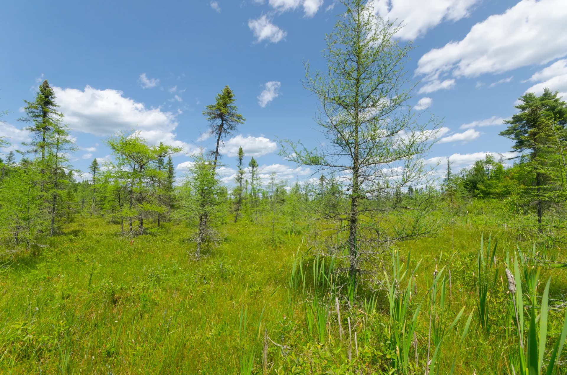
The Manistee section is defined by rivers, lakes, and sandy terrain shaped by the retreating glaciers of the last ice age. Five major rivers flow through the forest: the Manistee, Pine, White, Little Manistee, and Pere Marquette rivers (the latter partially through adjacent private lands). These rivers are the primary recreational draw for the region, attracting paddlers, anglers, and camping families who return year after year to the same river corridor campgrounds. Trout fishing on the Little Manistee River is particularly well-regarded, and the river is one of the key natural steelhead production streams in Michigan.

The terrain is flat to gently rolling, with maximum elevations barely exceeding 1,000 feet. The forest floor transitions between sandy outwash plains with jack pine and open-grown ponderosa, transitional mixed hardwood stands, and wet lowlands along the river corridors. This is not dramatic mountain scenery, but it has a quiet, distinctive beauty that draws strong regional loyalty.

North Country National Scenic Trail

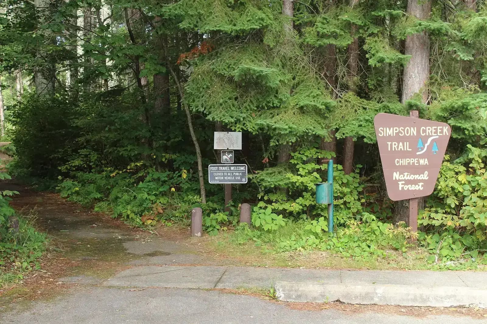
The North Country Trail, a designated national scenic trail running from New York to North Dakota, traverses the Manistee section for approximately 60 miles. The Manistee River Loop portion of the NCT is one of the most popular multi-day hiking circuits in the Midwest, combining the North Country Trail with the Manistee River Trail to create a 22-mile loop along the river and high ridge above. This route is accessible to hikers of moderate ability and offers excellent camping along the river.

River Paddling and Fishing

The Manistee River is Michigan's second-longest river and a legendary trout and salmon fishery. The section of the river within the national forest offers numerous put-in and take-out points for day or multi-day paddling. Steelhead runs in spring and fall attract anglers from across the Midwest. The Pine River is also a popular intermediate-level canoe run with faster current and some light whitewater. River conditions vary significantly by season; spring and early summer typically provide the best flows.

Best Trails

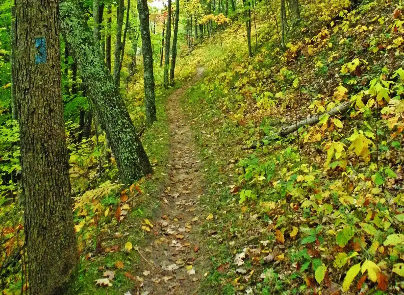
North Country Trail - Manistee Section (14.0 miles, selected section) traverses high ridges above the Manistee River before descending to the river corridor, offering the best views and most varied terrain on the NCT through the forest. Can be combined with the river trail for a multi-day loop.

Lake Michigan Recreation Area (5.0 miles, loop) explores the coastal dune and beach terrain at the western edge of the forest, with views across Lake Michigan and access to the shoreline.

Little Manistee River Trail (8.0 miles, out-and-back) follows the river through excellent trout habitat, passing streamside vegetation and offering multiple fishing access points.

Loda Lake Wildflower Sanctuary (2.5 miles, loop) circles the lake through the National Wildflower Sanctuary, ideal for wildflower viewing in May and June, with native orchids and forest wildflowers along the entire route.

Sand Lakes Quiet Area (8.0 miles, interconnected trails) is a network of non-motorized trails connecting several small lakes in the interior forest, popular for quiet hiking, swimming, and exploring the glacial lake landscape.

Udell Hills Trail (5.5 miles, loop) climbs the highest terrain in the Manistee section, with views across the forest interior and Lake Michigan in the distance.

Permits and Passes

No permit is required for day hiking or dispersed camping in Manistee National Forest (as of 2026). Developed campground fees apply. The how to get a national forest camping permit guide covers general reservation procedures.

America the Beautiful passes are accepted at fee sites. Veterans and permanently disabled individuals may qualify for federal discount passes.

Camping

Lake Michigan Recreation Area Campground (99 sites, reservable) is the most popular and largest facility, with beach access and excellent location. Sand Lake Campground and Loda Lake Campground are good interior options. Bowman Bridge Campground on the Manistee River is a favorite for river-camping travelers.

Dispersed camping is available throughout the forest away from developed areas and rivers. Review dispersed camping guide for applicable rules.

When to Visit

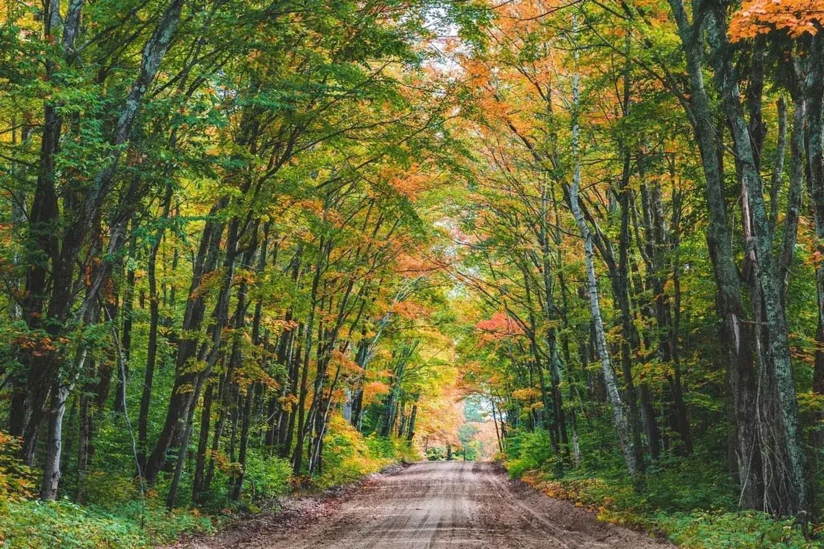
May through October is the primary season. River flows are best in spring. Summer is the peak season for lake and beach recreation. Fall color in the mixed hardwood forests peaks in mid-October and is excellent throughout the forest. Winter brings snowshoeing and cross-country skiing on trail corridors.

Check conditions at checking conditions before you go and practice Leave No Trace principles throughout, particularly around the river corridors where camping impact is cumulative.

Getting There

From Grand Rapids, take US-131 north to Big Rapids, then continue north on US-131 or take M-20 west toward Newaygo to access the southern forest. For Manistee city and the western forest, take US-31 north along the Lake Michigan coast. The forest is distributed across a large area of the Lower Peninsula without a single central gateway.

Trail Guides

easyloop

Bear Track Lakes Trail

4 mi200 ft gain
April through November

Hike the Bear Track Lakes Trail in Manistee National Forest, Michigan. This easy 4-mile loop visits several quiet forest lakes through classic northern Michigan hardwood and pine terrain.

2 min read

easyloop

Bowman Bridge Campground Trail

2.5 mi100 ft gain
April through November

Walk the Bowman Bridge Campground Trail in Manistee National Forest, Michigan. This easy 2.5-mile loop explores the Manistee River corridor through riverside hardwood forest with good wildlife habitat.

3 min read

easyloop

Lake Michigan Recreation Area Trail

3 mi100 ft gain
May through October

Walk the Lake Michigan Recreation Area Trail in Manistee National Forest, Michigan. This easy 3-mile loop crosses forested sand dunes along a pristine Lake Michigan shoreline with wildlife and beach access.

3 min read

moderateout-and-back

Little Manistee River Trail

6 mi300 ft gain
April through November

Walk the Little Manistee River Trail in Manistee National Forest, Michigan. This moderate 6-mile out-and-back follows a scenic trout stream through lowland hardwood forest with excellent wildlife habitat.

3 min read

easyloop

Loda Lake Wildflower Sanctuary

1.5 mi100 ft gain
April through October

Explore the Loda Lake Wildflower Sanctuary in Manistee National Forest, Michigan. This easy 1.5-mile loop circles a quiet lake through the only USFS wildflower sanctuary in the National Forest system.

3 min read

moderatepoint-to-point

North Country Trail Manistee Segment

10 mi400 ft gain
April through November

Hike the North Country Trail through the Manistee National Forest in Michigan. This moderate 10-mile point-to-point follows the Manistee River through old-growth forest on one of the NCT's finest segments.

3 min read

moderateloop

Sand Lakes Quiet Area

5.5 mi300 ft gain
April through November

Explore the Sand Lakes Quiet Area in Manistee National Forest, Michigan. This moderate 5.5-mile loop circles several small lakes through classic Michigan hardwood forest with excellent wildlife habitat.

3 min read

moderateloop

Udell Hills Pathway

7.5 mi400 ft gain
April through November

Hike the Udell Hills Pathway in Manistee National Forest, Michigan. This moderate 7.5-mile loop rolls through the highest terrain in the Manistee with wildflower meadows and diverse wildlife habitat.

3 min read

Campgrounds

Lake Michigan Recreation Area Campground

99 sitesReservable$25/night (as of 2026)May through October

Sand Lake Campground

45 sitesReservable$18/night (as of 2026)May through September

Bowman Bridge Campground

20 sitesFirst-come$16/night (as of 2026)April through October

Loda Lake Campground

35 sitesReservable$18/night (as of 2026)May through October

Getting There

Manistee
5 miles10 minutes
Big Rapids
30 miles40 minutes
Grand Rapids
80 miles1 hour 20 minutes

More in the Midwest

Frequently Asked Questions

Is Manistee National Forest the same as Huron-Manistee National Forest?
Manistee National Forest is one of two proclaimed units that form the combined Huron-Manistee National Forest administrative unit. The Manistee section covers the western portion of Michigan's Lower Peninsula near the Lake Michigan coast and contains the Manistee, Pine, and White River corridors.
Can I canoe or kayak in Manistee National Forest?
River paddling is one of the main draws of the Manistee section. The Manistee River, Little Manistee River, Pine River, and White River all flow through the forest and offer multi-day paddling routes with developed and dispersed camping along the banks. Spring and early summer typically offer the best water levels. Local outfitters in towns like Mesick and Baldwin offer canoe and kayak rentals and shuttle services.
What is the Loda Lake National Wildflower Sanctuary?
Loda Lake is one of 23 National Wildflower Sanctuaries designated by the USFS across the country. The sanctuary protects a diverse plant community including native orchids, wildflowers, and forest herbs in a setting of mixed hardwood and conifer forest. A 2.5-mile trail loop circles the lake and passes through the primary sanctuary area. The best wildflower viewing is in May and June.
Are there sand dunes in Manistee National Forest?
The Lake Michigan Recreation Area near the western boundary of the forest includes access to the coastal dune country along Lake Michigan. While the most dramatic dunes in the area are within Sleeping Bear Dunes National Lakeshore (managed by the National Park Service), the Manistee forest's coastal areas offer beach access, dune walking, and lake views.
Federal Discount Passes

Free and Discounted Entry for Qualified Visitors

Military Annual Pass

Active duty & veterans (any discharge except dishonorable)

Free · Annual

Senior Pass

U.S. citizens or permanent residents age 62+

$20 · Lifetime

Access Pass

Permanent disability (includes 50% off many camping fees)

Free · Lifetime
Get passes at any ranger station or store.usgs.gov/passLearn more →